Ticker for February 16, 2016
MESONET TICKER ... MESONET TICKER ... MESONET TICKER ... MESONET TICKER ...
February 16, 2016 February 16, 2016 February 16, 2016 February 16, 2016
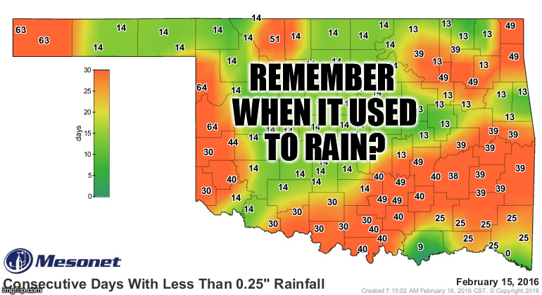
Remember when it used to rain?
Ahhh, Thanksgiving and Christmas, the Holidays where you get to spend time with
family, eat good food, and worry about ice storms and flooding. Yes, for some
folks in Oklahoma, it has been more than two months since they've received at
least a quarter-inch of rain in a single day. For almost all of the rest of us,
it's been a good two weeks. And things look only slightly better when we look at
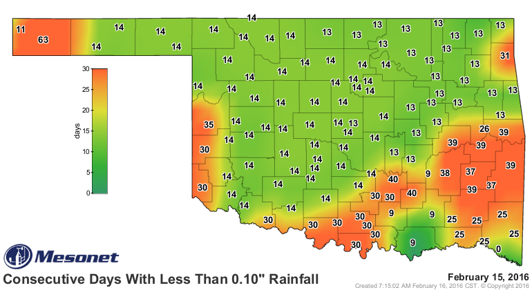
the same map for days since at least a tenth of an inch of moisture.
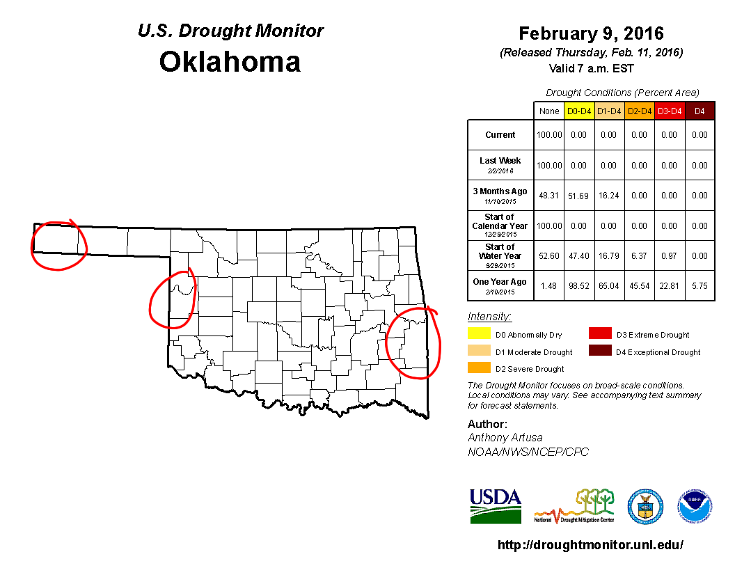
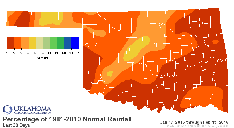
This current dry spell has left Oklahoma teetering on the edge of drought (or at
least abnormally dry conditions), with the Drought Monitor beating down our door
to add some yeller to our lovely white map. Here is that map from last week, but
I've added a few red circles of my own that are under what I'd call a "drought
watch" for the moment. And take those circles as fuzzy lines (they're drawn pretty
fuzzily anyway, since I don't have the best crayon skills).
And for crying out loud, if you're concerned about your area, send me your
impact reports post haste! But as you can see, we are particularly concerned
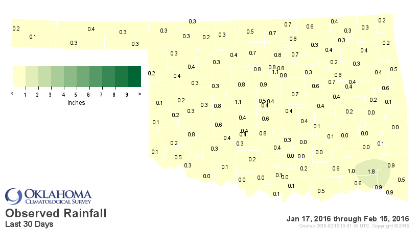
with what's going on in the last 30 days as we've dried out, the winds have
picked up, the RH has been pretty steady in the "ow, my lips are chapped"
territory, and the temperatures have started to climb.

We've managed to avoid a widespread return to drought thus far, both thanks
to the time of the year (it's winter, after all, so no plants demanding water,
evaporation if relatively negligible, etc.) and just how wet it was right up
until the end of 2015. But, things are not looking good for the near future.
We have spring...to heck with that, SUMMER! slated to return this week and very
little moisture in the offing.
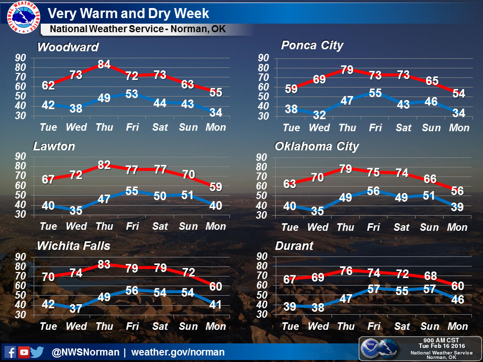
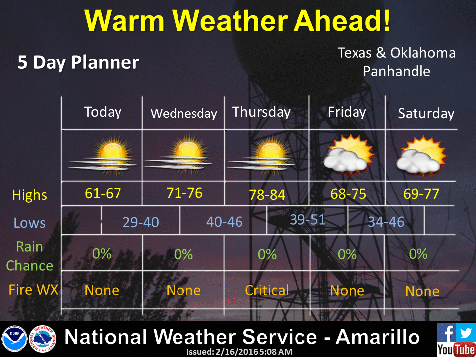
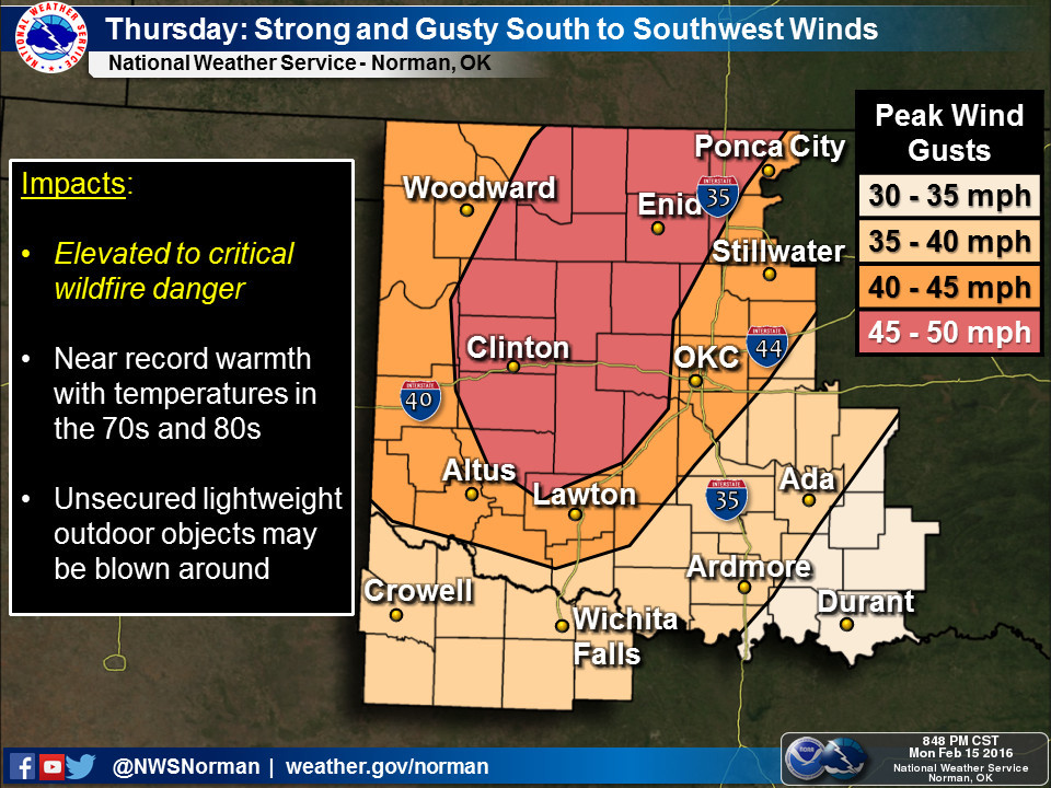
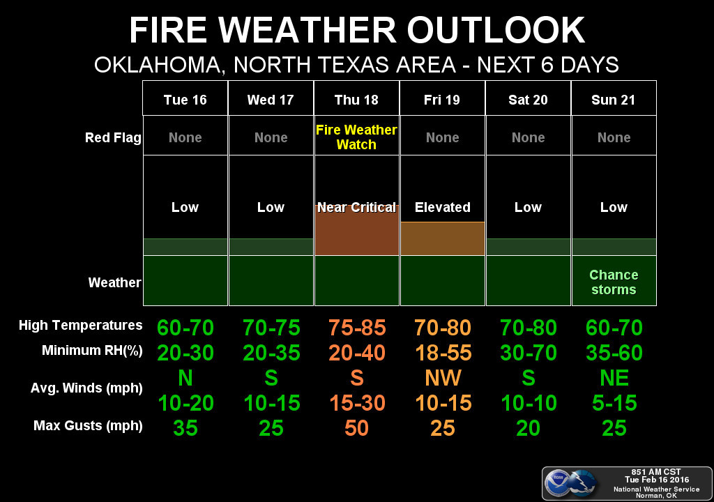
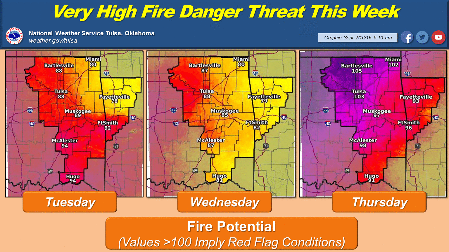
80s for Thursday, are you kidding me Private Pyle? That's wonderful! I mean
horrible!! Add winds in the 30-50 mph range and you have a potential wildfire
disaster on your hands.
Oh yeah, about that bleak moisture outlook:

Hey, at least there's SOME color on there. Almost a tenth of an inch out west.
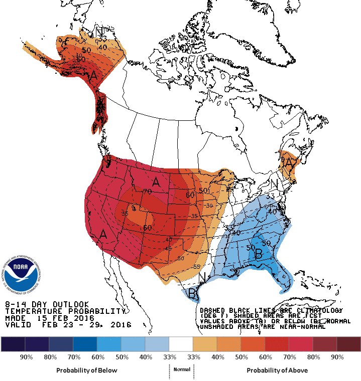
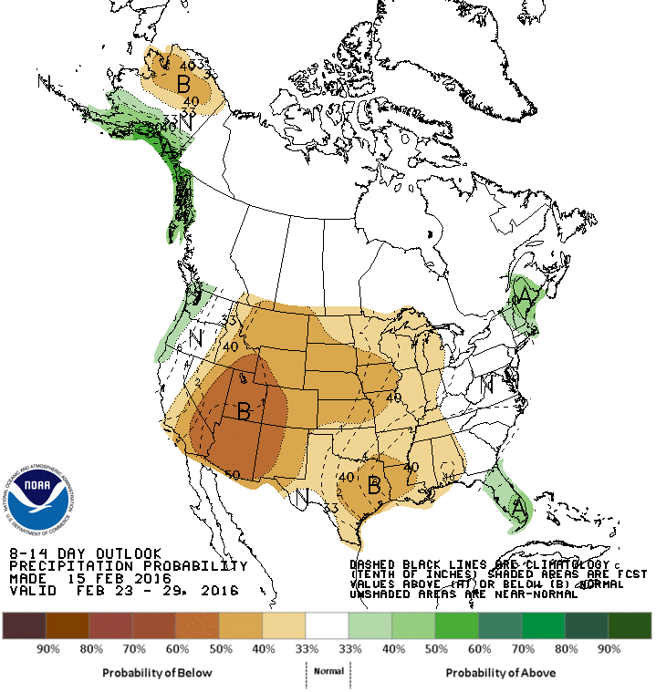
WHOO-HOO! The 8-14 day outlooks from CPC, which extend out to the end of the
month, are pretty much calling winter over for February with our area covered
in the increased odds of above normal temps and below normal precip.
I'm just going to go ahead and say it, if it doesn't rain -- and I mean a good
rain -- between now and the end of the month, look for drought to creep back
into Oklahoma in some of those areas I indicated. Certainly not good news for
crops and fire danger concerns as we head into spring a month early and a
raindrop short.
Gary McManus
State Climatologist
Oklahoma Mesonet
Oklahoma Climatological Survey
(405) 325-2253
gmcmanus@mesonet.org
February 16 in Mesonet History
| Record | Value | Station | Year |
|---|---|---|---|
| Maximum Temperature | 85°F | HOLL | 2011 |
| Minimum Temperature | -22°F | NOWA | 2021 |
| Maximum Rainfall | 3.37 inches | TALI | 2008 |
Mesonet records begin in 1994.
Search by Date
If you're a bit off, don't worry, because just like horseshoes, “almost” counts on the Ticker website!