Ticker for February 8, 2016
MESONET TICKER ... MESONET TICKER ... MESONET TICKER ... MESONET TICKER ...
February 8, 2016 February 8, 2016 February 8, 2016 February 8, 2016
Something windy this way comes
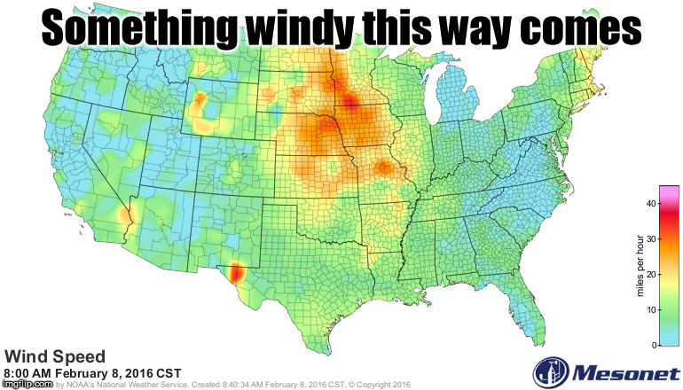
And those are just the wind speeds, not counting the gusts! It's not quite too bad
here in Oklahoma just yet, but it is starting to blow out there after last night's
cold front.
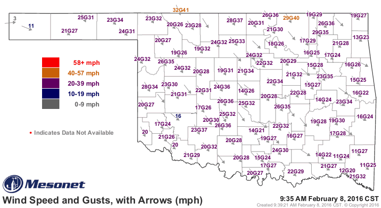
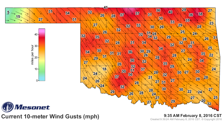
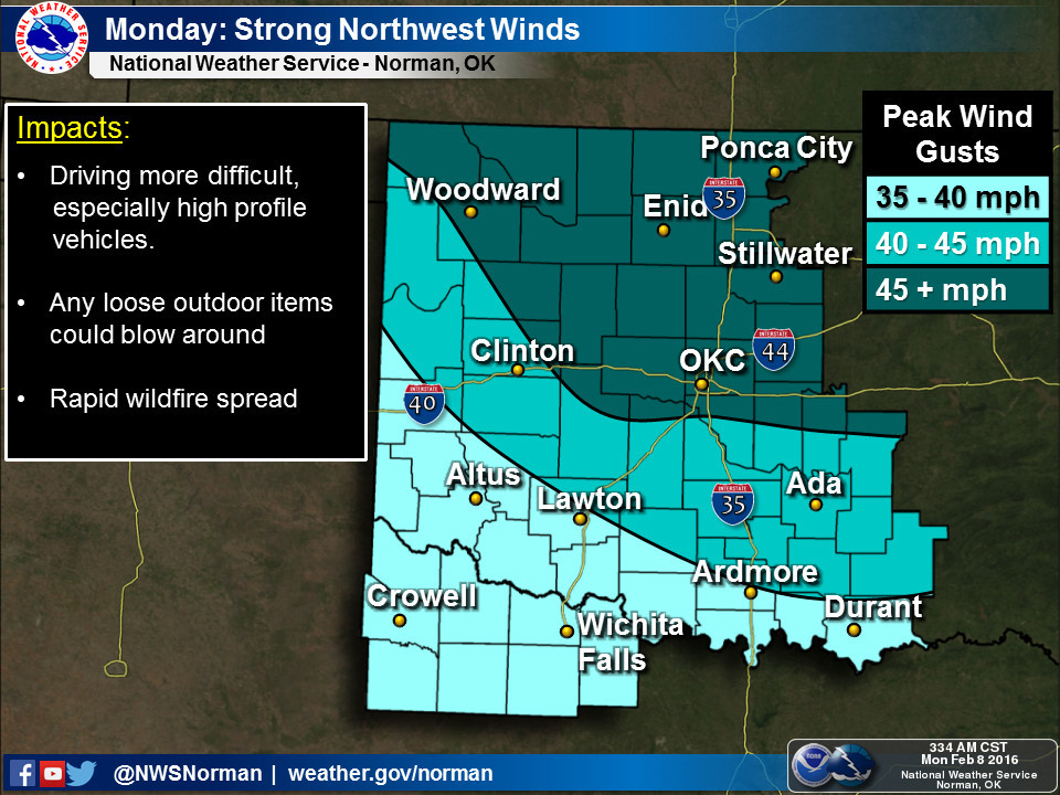
That's also not quite as bad as it can get as we are going to see gusts start to
reach that good old February 40-50 mph range as the surface heats up and we start
to get some vertical mixing of the atmosphere. Those stronger winds above the
surface will get dragged down to where we live and breathe, setting us up for
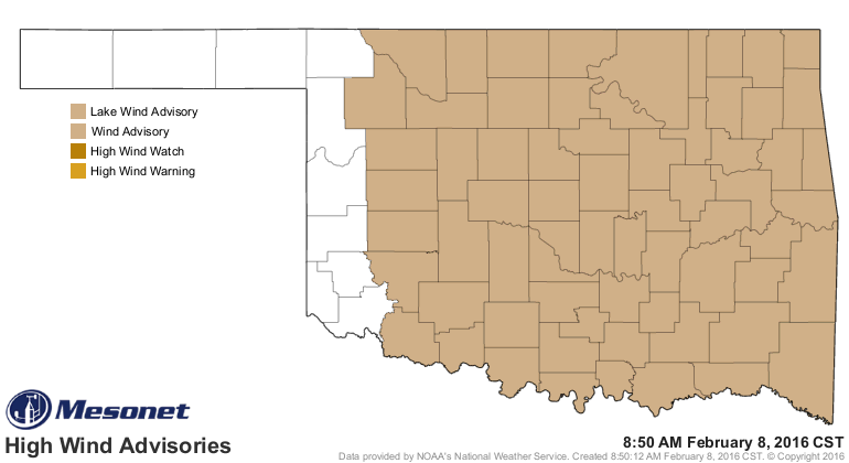
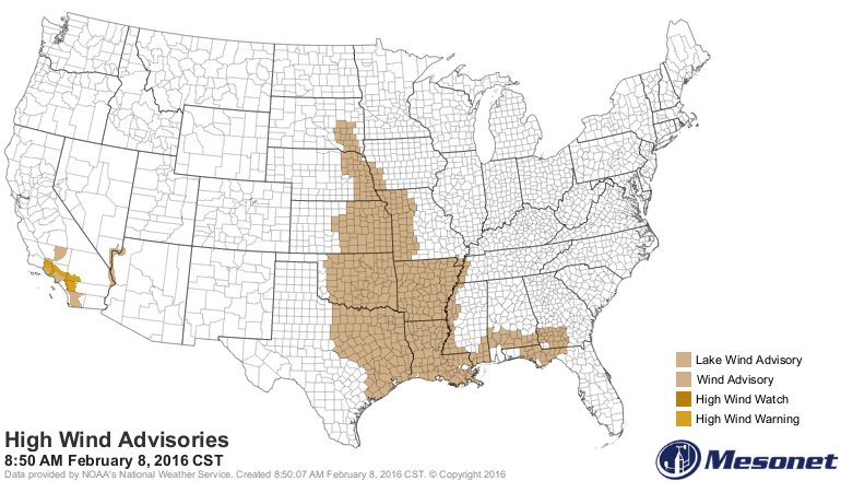
yet another lovely day across the state. The NWS has already put us in a wind
advisory for today through tomorrow, although things should really start to calm
down tonight as we lose some of that daytime heating.
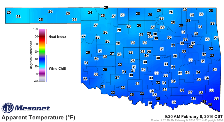
Combined with the cold front, wind chills should be sufficiently low enough to
cause lots of uncomfortable trips between cars and buildings. They're certainly
not as bad as we've seen, but given that this winter has been mostly above
normal-ish, I'd deem them "uncomfortable" as described above.
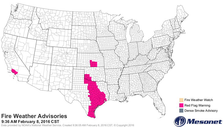
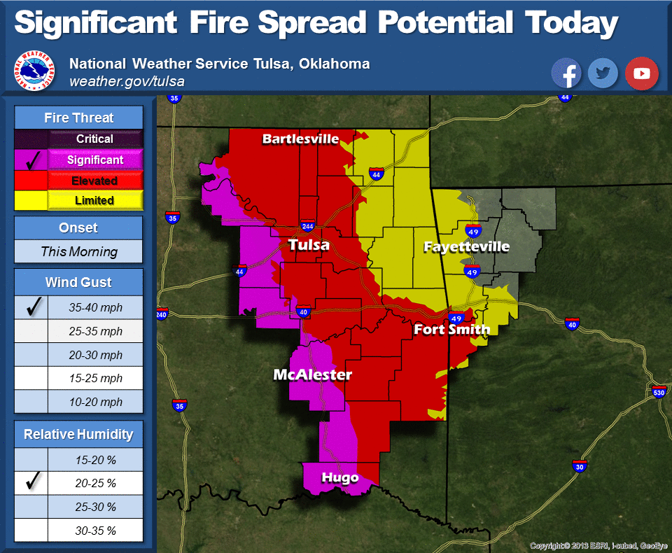
Now the big problem today will be fire. FIRE! I'm not typing from a crowded
theater, so I have the go ahead to shout that. Given that we will have those
strong winds and low relative humidity values, the fire danger will be elevated
to really, really dangerous, depending on who you talk to. Southwestern OK has
been put in a Red Flag fire advisory, and that also extends to the south.
Southern KS is also in a Red Flag fire warning, so before we get too complacent,
we should probably just go ahead and consider that area in between to be in
the Red Flag advisory just to be safe.
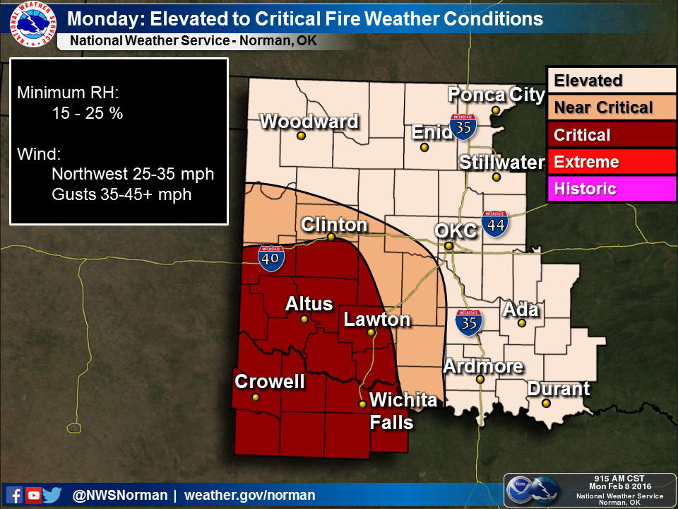
OK Forestry gives us a good description of the perils today:
"Statewide Discussion: High to Very High fire danger across Oklahoma
today. Dry fuels, low relative humidity and strong, gusty northwest
winds will promote active fire behavior. Any fire that becomes
established will exhibit rapid rates of fire spread. Relative humidity
values 17-20% in both southwest and southeast counties, and 20-30%
elsewhere will result in very dry, highly receptive fine fuels this
afternoon. Northwest winds 20-28 mph will be accompanied with gusts
to near 40 mph. Extreme rates of fire spread in grass dominated fuels
potentially near (or exceeding) 300 ft./min. should be expected."
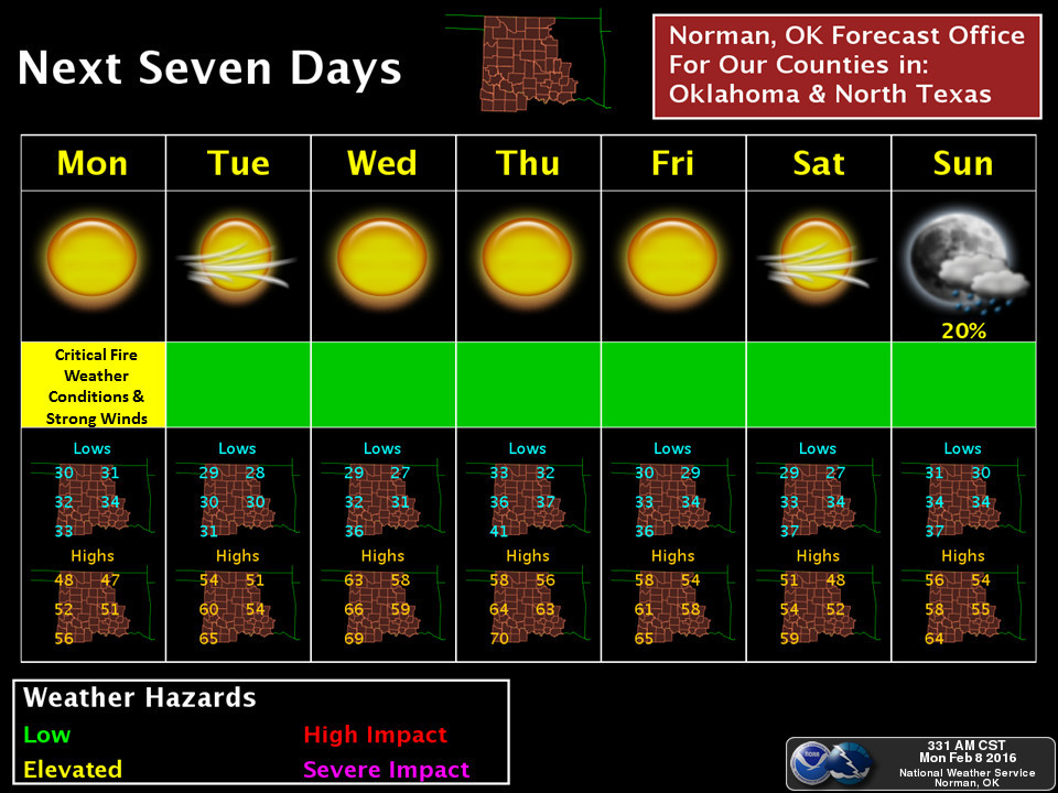
Following today's possibly crisp-and-crispy fun, we should see a rapid warm up
before the next dry cold front passes through later in the week. There will
be a chance of rain as we get into next week. Right now it doesn't look too
impressive, but perhaps things will get a bit more exciting as we get closer.
Doubtful, but one can hope. We certainly need some moisture.

Despite El Nino going strong, we've apparently gone back into the same old
late winter pattern of the past few years here in the U.S. that saw cold, stormy
weather in the eastern half of the country and dry, warm weather across the west.
Oklahoma is once again torn between that ridge of high pressure in the west
and trough of low pressure in the east, setting us up for these fast-moving cold
fronts that never get enough moisture to do anything. It's deja polar vortex all
over again.
Gary McManus
State Climatologist
Oklahoma Mesonet
Oklahoma Climatological Survey
(405) 325-2253
gmcmanus@mesonet.org
February 8 in Mesonet History
| Record | Value | Station | Year |
|---|---|---|---|
| Maximum Temperature | 83°F | BROK | 2025 |
| Minimum Temperature | -5°F | BOIS | 2011 |
| Maximum Rainfall | 4.35 inches | BROK | 2023 |
Mesonet records begin in 1994.
Search by Date
If you're a bit off, don't worry, because just like horseshoes, “almost” counts on the Ticker website!