Ticker for January 28, 2016
MESONET TICKER ... MESONET TICKER ... MESONET TICKER ... MESONET TICKER ...
January 28, 2016 January 28, 2016 January 28, 2016 January 28, 2016
The warm before the storm
It's not against the law to yell "FIRE!" in a crowded Ticker...we got a waiver.
So while we're exuberantly, wonderfully happy for the warm weather beginning today
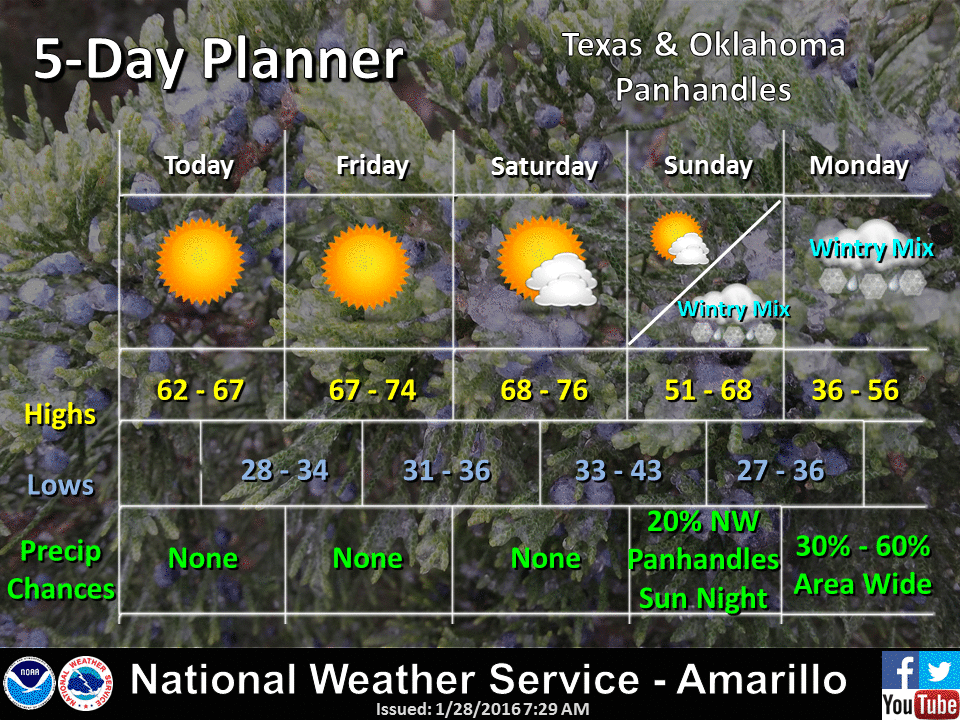
through the weekend (for some)
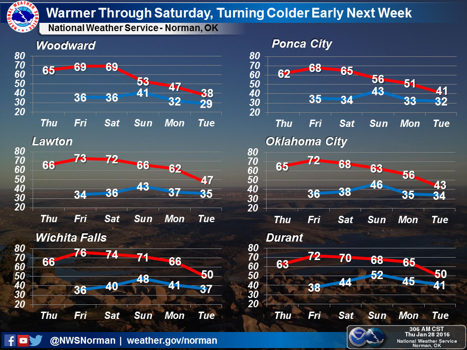
http://www.mesonet.org/index.php/forecast/air_temperature/
the type of conditions that come with that warmth will create a high fire danger
through much of that period as well. So the heat, low RH and windy conditions,
combined with the dramatic vegetative overgrowth created by 2015's abundant
moisture, now turns around and bites us in the rear end.
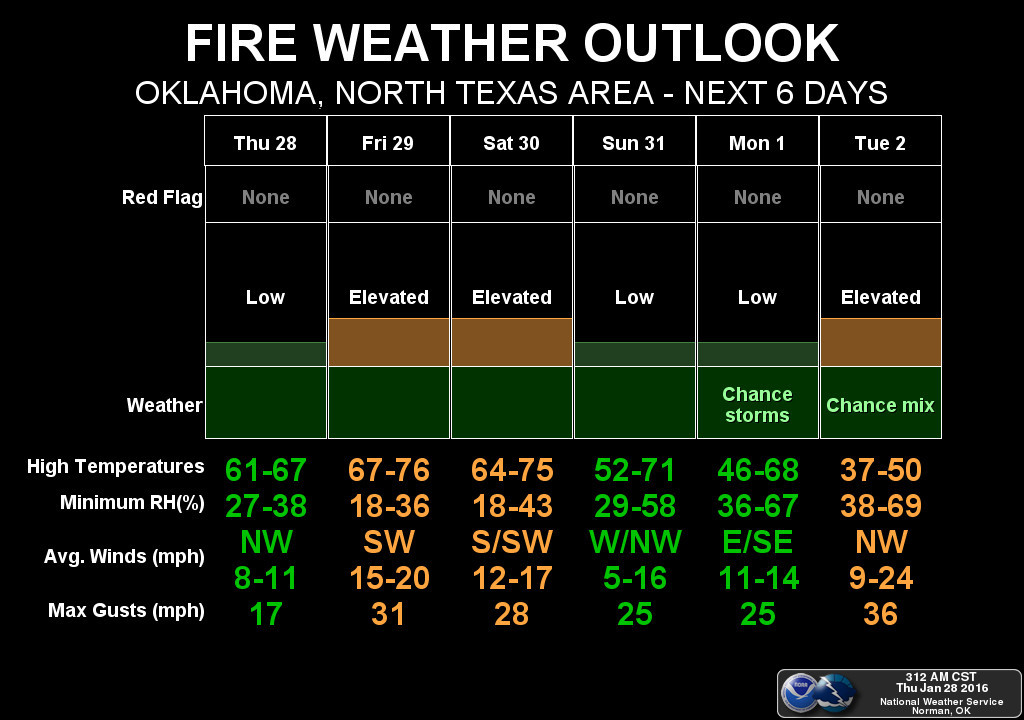
Nothing TOO drastic looking, at least at this point, but we do need to be
careful with our outdoor burning activities. Take this advice from the OK Forestry
Services:
"County Wildland Task Forces should be prepared for possible
mobilization tomorrow. Short windows of elevated fire danger
will exist each afternoon thru Saturday. Expect any wildfire
that starts to burn with zeal during the burning period. Fortunately,
weather conditions will moderate in the late afternoon hours and
early evening which will cause fire behavior to rapidly diminish.
SPECIAL NOTE TO THE PUBLIC: Outdoor burning today and thru
Saturday is discouraged due to the current and expected fire
weather forecast. Wildland fuels will be very dry for the next few
days which will allow any wildfire that starts to quickly grow in
size and be difficult for the average person to control.
Please put off any outdoor burning until fire weather conditions
moderate."
That last bit says it will be difficult to the average person to control any
fires, so for us below average people, we need to be especially careful.
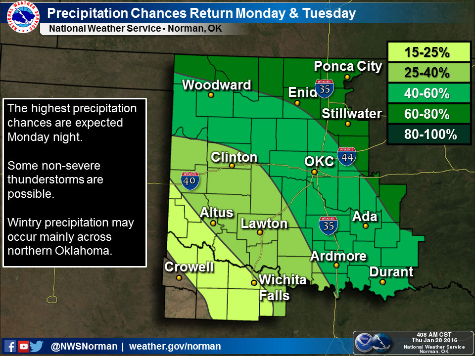
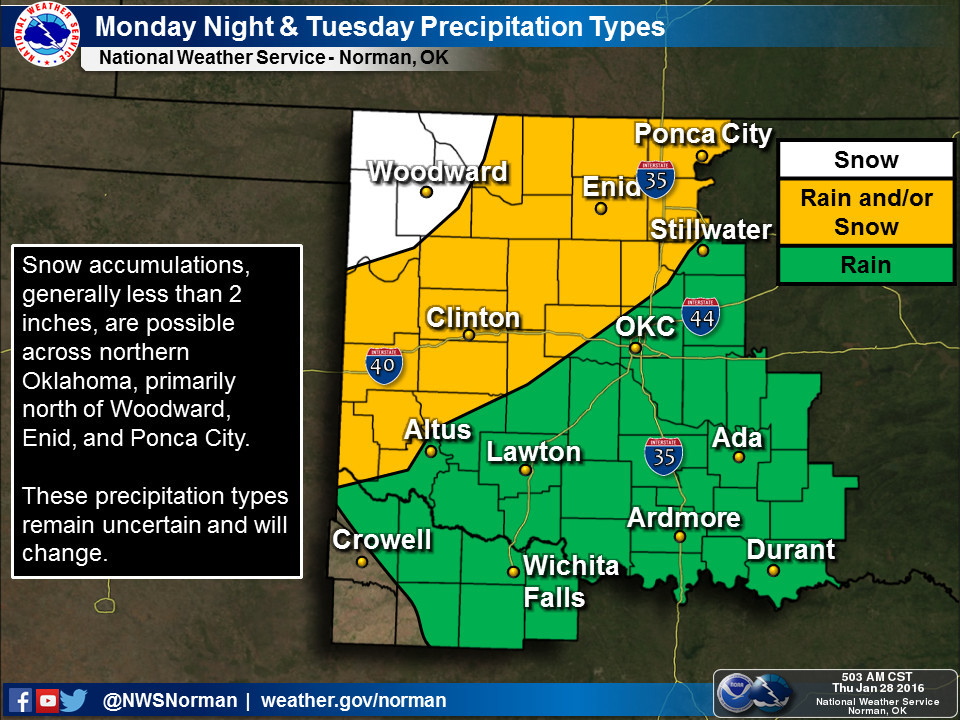
Now after that, we're gonna see another dastardly and unprovoked attack by cold
air on the state, with a chance of moisture tagging along. We're still not
seeing a bullish November-December style event, but it could bring some snow to
northern OK, a few storms to SE OK, and a bit of rain elsewhere.

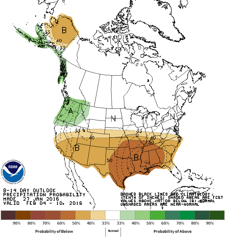
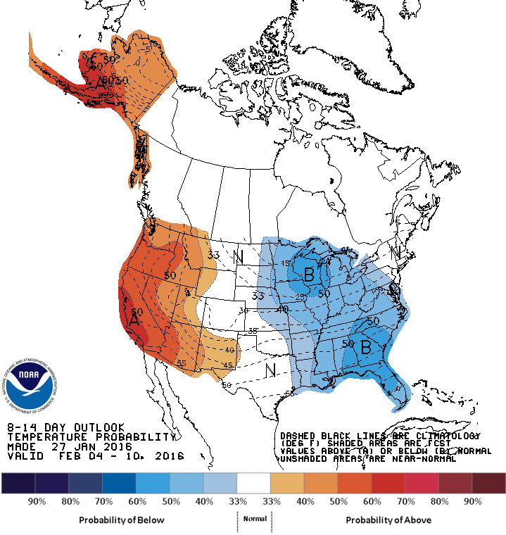
Following that, the weather looks very "blah-ish" into early February. Very low
energy.
This is the Ticker, and we do NOT approve of cold air.
Gary McManus
State Climatologist
Oklahoma Mesonet
Oklahoma Climatological Survey
(405) 325-2253
gmcmanus@mesonet.org
January 28 in Mesonet History
| Record | Value | Station | Year |
|---|---|---|---|
| Maximum Temperature | 83°F | MANG | 2015 |
| Minimum Temperature | -1°F | BUFF | 2009 |
| Maximum Rainfall | 2.87 inches | TIPT | 2010 |
Mesonet records begin in 1994.
Search by Date
If you're a bit off, don't worry, because just like horseshoes, “almost” counts on the Ticker website!