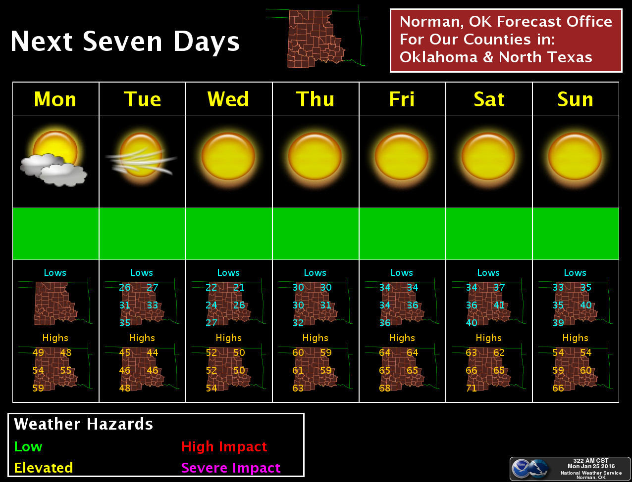
Ticker for January 25, 2016
MESONET TICKER ... MESONET TICKER ... MESONET TICKER ... MESONET TICKER ...
January 25, 2016 January 25, 2016 January 25, 2016 January 25, 2016
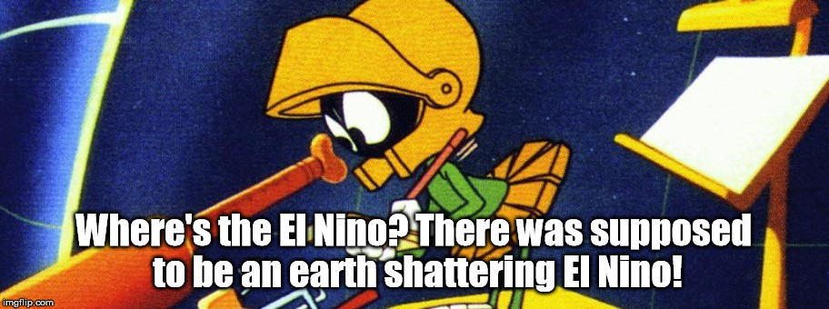
What happened to the kaboom?
With attention focused on some minor snowstorm along the East Coast this past
weekend (seen here from a visible satellite image yesterday...a few clouds are
present to mess up the pic, but basically, if you see white you see snow)
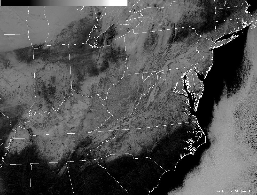
folks tend to forget that storm crossed our paths first. The trouble (or LACK
of trouble) is that it didn't have its act together, nor enough moisture to work
with, so it became just another in a string of mostly dry January cold fronts for
us to enjoy. This has become quite extraordinary in that this was *probably* yet
another El Nino fueled storm, but it El Nino'd in an area where it normally
wouldn't. It's vastly different than the air flow regime we say during November
and December with the abundance of warm, moist air and southerly diving storm
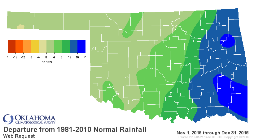
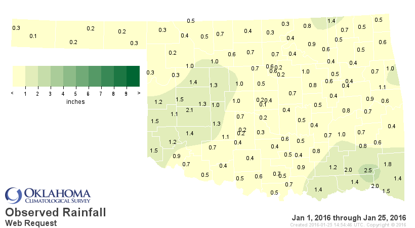
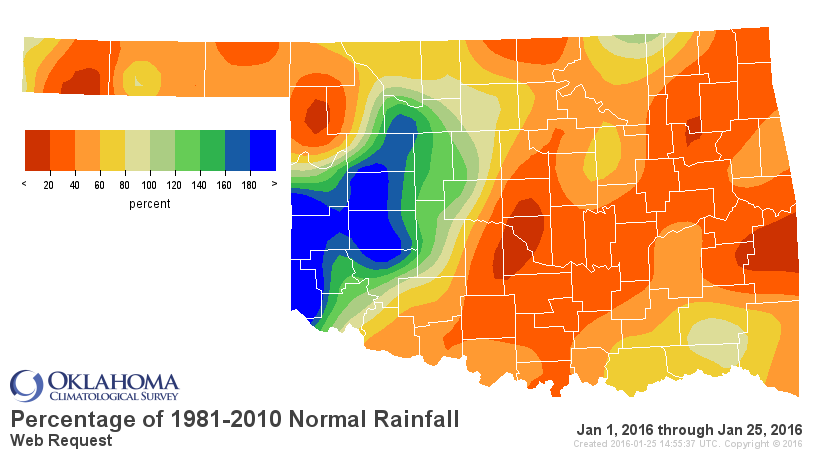
systems. Check out the rainfall maps for the Nov-Dec period, and then the
January-thus-far maps after Mother Nature opened the door to the arctic soon after
Christmas and shut the El Nino spigot off.
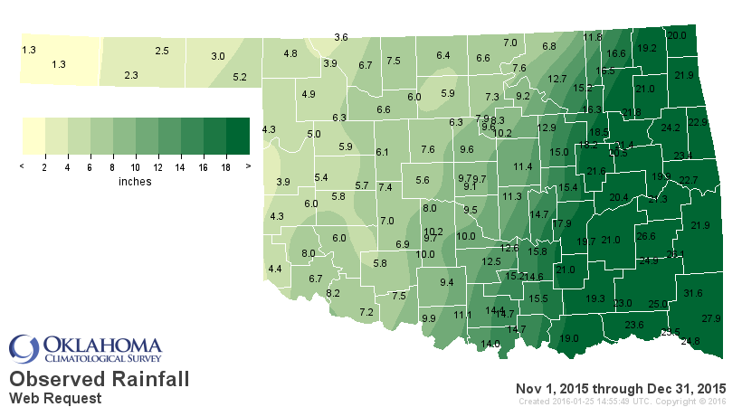
Remember, that Nov-Dec two-month period was EASILY the wettest in state history
with a statewide average of 10.85 inches, 7 inches above normal far ahead of
second place finisher Nov-Dec 1992 (9.4 inches). Then we get to January and the
preliminary estimates from the Mesonet give us an average of 0.71 inches, at
least a half inch below normal. January will probably end in the top third driest
on record because prospects for the rest of the month look bleak at best.
And, even though we're seeing a cold front pass through the state as I type,
the warmth appears to be returning as well (and not the "normal" warming as we
get later into winter, but a rapid "back to November-December" type of above
normal regime).
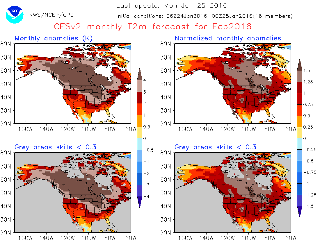
And don't look now, but the February temperature forecasts from the CFSv2 via
the CPC once again shows us headed to that warmer than normal weather pattern
for February (concentrate on the upper left for simplicity).
Will that translate into November-December style deluges? It all depends on the
storm track and the characteristics of each storm system as it passes. Just for
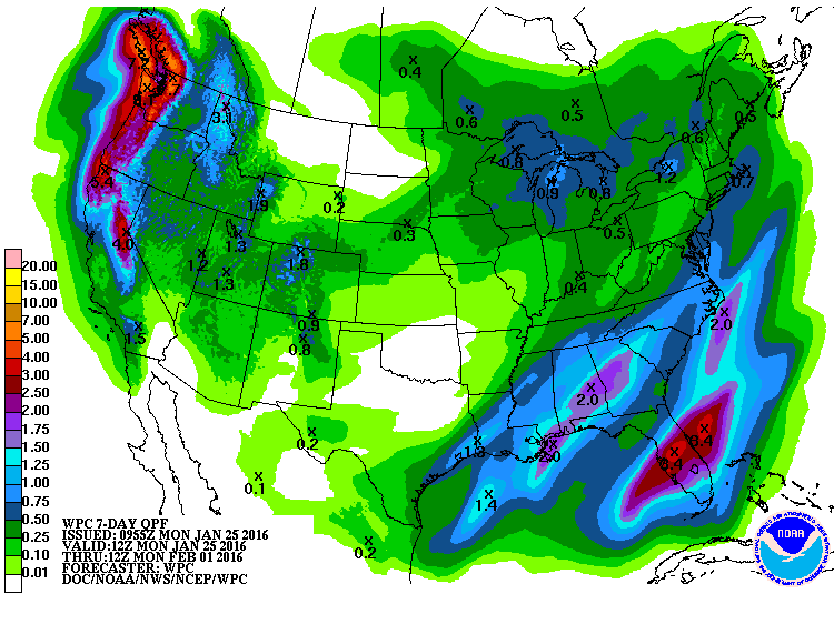
kicks, here is the same February forecast as above, except for precipitation.

Hmmmmmm...perhaps there's some Kaboom left in this El Nino after all??
Gary McManus
State Climatologist
Oklahoma Mesonet
Oklahoma Climatological Survey
(405) 325-2253
gmcmanus@mesonet.org
January 25 in Mesonet History
| Record | Value | Station | Year |
|---|---|---|---|
| Maximum Temperature | 77°F | MADI | 2005 |
| Minimum Temperature | 7°F | VINI | 2019 |
| Maximum Rainfall | 3.32 inches | MTHE | 2012 |
Mesonet records begin in 1994.
Search by Date
If you're a bit off, don't worry, because just like horseshoes, “almost” counts on the Ticker website!