Ticker for December 3, 2015
MESONET TICKER ... MESONET TICKER ... MESONET TICKER ... MESONET TICKER ...
December 3, 2015 December 3, 2015 December 3, 2015 December 3, 2015
When will it snow/ice/sleet again?
How would I know?? Who am I, Kreskin (look it up)? That's impossible to say. What
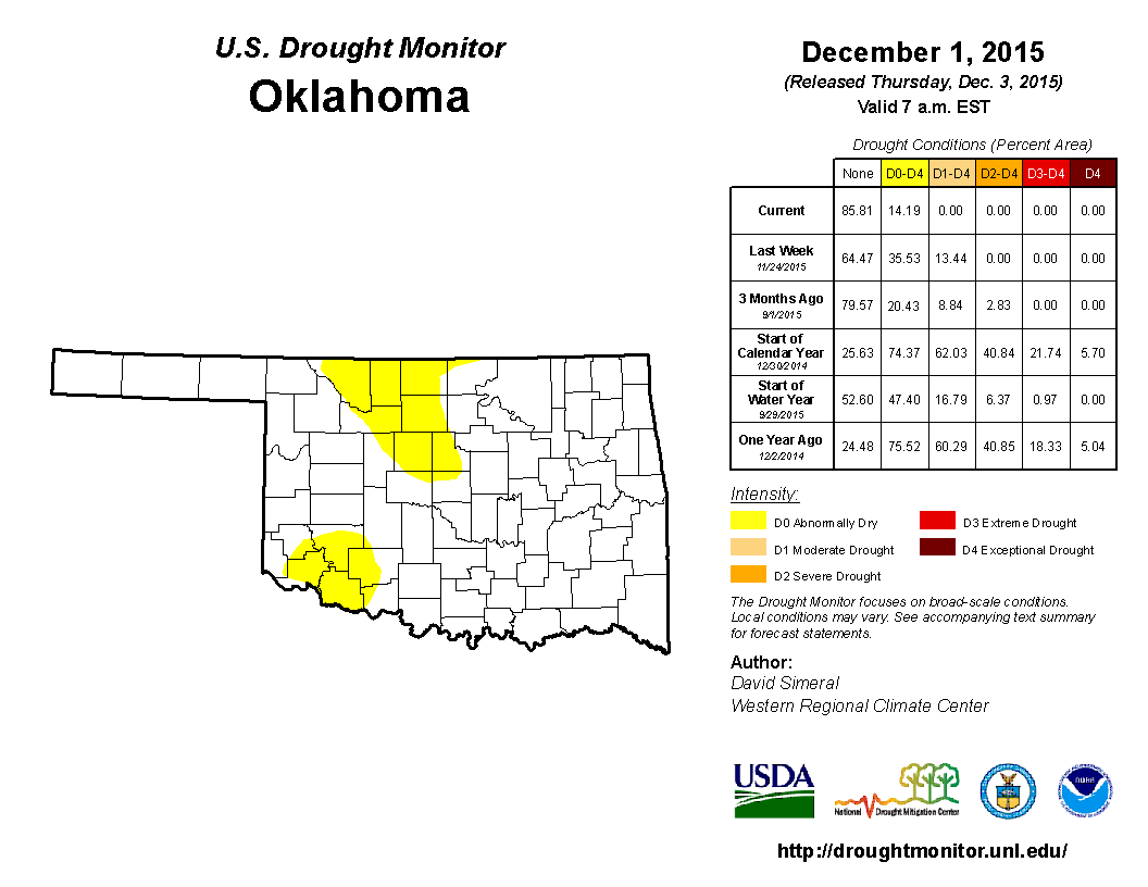
I do know (because I asked for it) is that Oklahoma is free of drought once again,
at least according to the U.S. Drought Monitor.
After some good meltage of ice into our rain gauges, November ended up with 5.99
inches of rain according to the Oklahoma Mesonet, making it the wettest November
on record, dating back to 1895, UNOFFICIALLY. NCEI (formerly NCDC) keeps the
official records with a combination of Mesonet and NWS COOP data, and they'll
release those numbers in a few days. But the Mesonet is generally close. November
2015 tops 2004's previous record mark of 5.96. That being said and whatnot, we're
now left with just 14.19% of the state in D0 or Abnormally Dry conditions. As I've
explained many times, that is not a drought intensity but a designation of an area
either entering or leaving drought. In this case, leaving. We hope to have the
yeller gone next week. There is a tiny chance of rain in the forecast for this
weekend, but it's looking fairly paltry at the moment. In fact, WPC had taken
any accumulation completely out of the state.
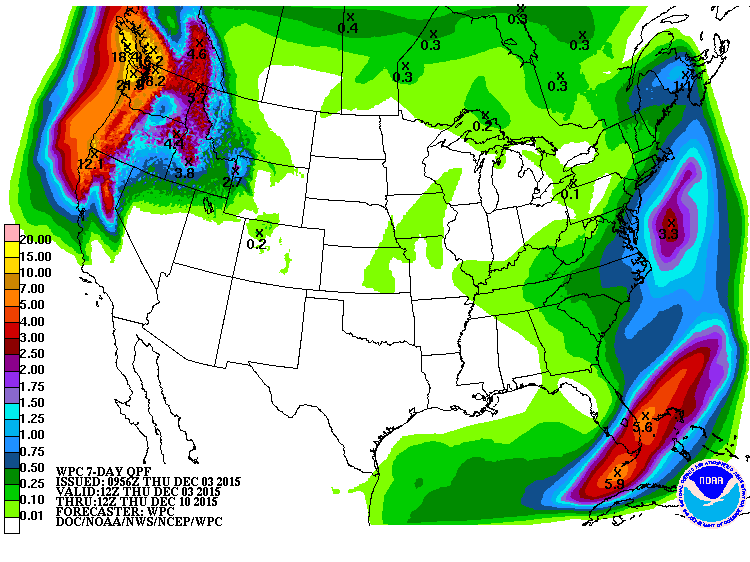
Later next week looks wet. Maybe. And warm. Maybe.
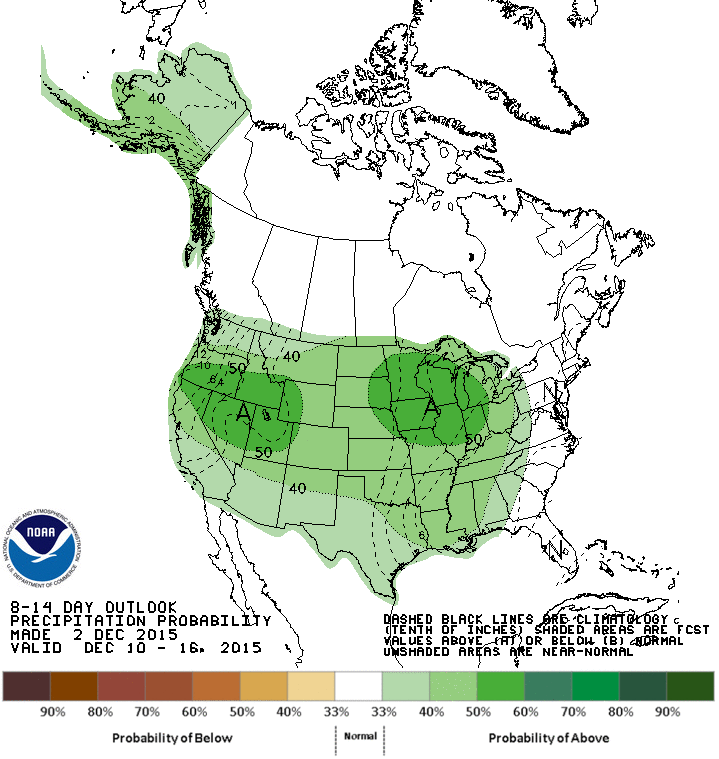
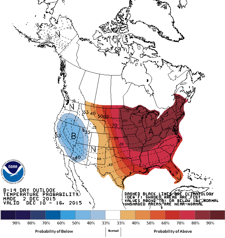
Back to the snow, there is a really good swath of snow across the northern
tier of the U.S.
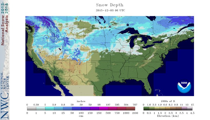
but I'm not real confident that snow is going to stick around for very long.
I'm going to show you a series of long-range forecasts using the CFSv2 (NCEP
Coupled Forecast System model, version 2) for a week all the way out to
May-June-July. What you're gonna see is that the northern tier (heck, all the way
to the arctic circle) of the U.S. expecting warmer than normal conditions
throughout the next 4-6 months. Sort of a classic El Nino signature, but
apparently on steroids. You might see some blue, meaning cooler than normal
conditions for our area, but again, this is not indicative of lots and lots of
arctic air intrusions. More of a case of just lots of clouds and expected wet
weather, which keeps those daytime highs down. It's not a strong signal because
those clouds and wetness also keep the nighttime temps up, so it's a bit of a
trade off. Now these anomalies are in kelvins, but it's okay to just think of
them as in Celsius.
Away we go!
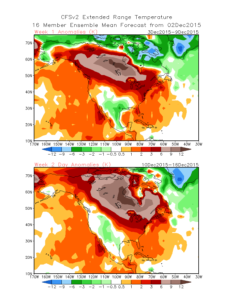
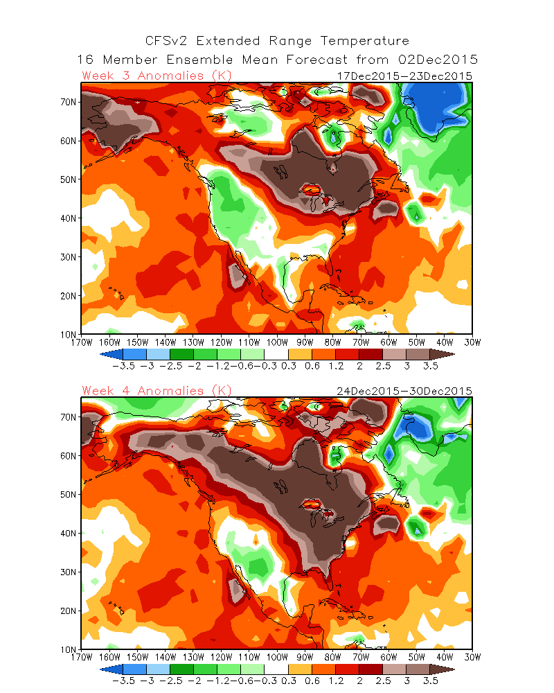
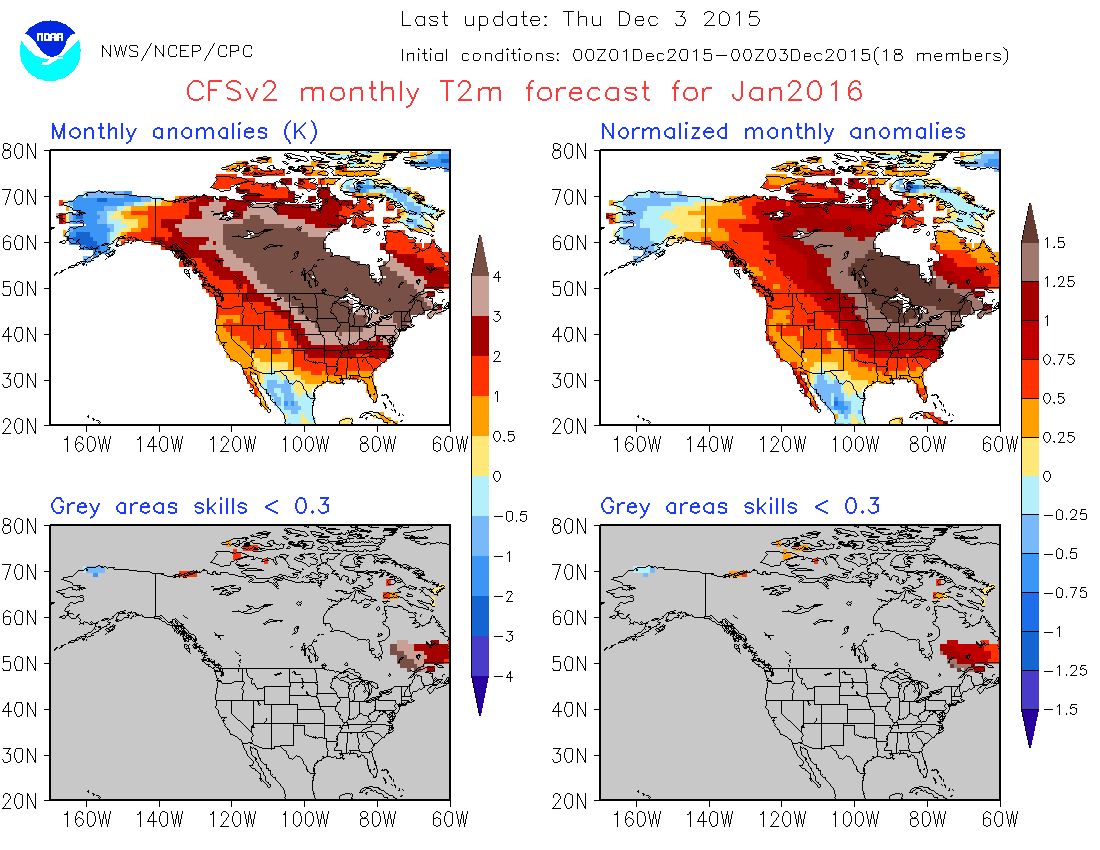
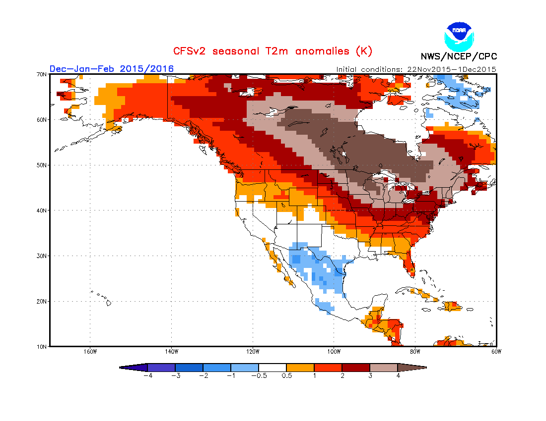
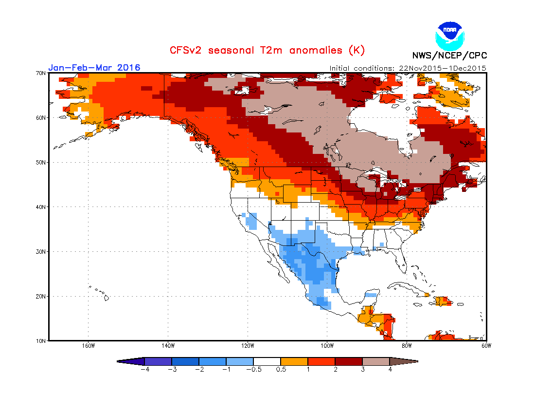
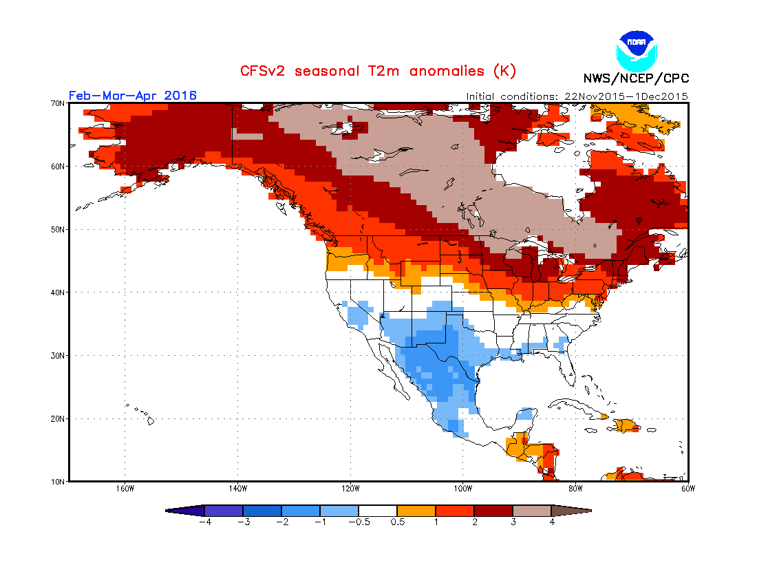
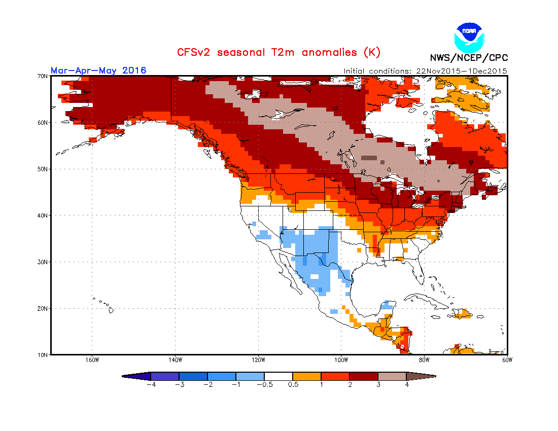
So you see lots of oranges/reds/browns from OK all the way up to Santa Claus.
But here are a few things to think about before we kill the snow season up that
way.
A) 1-2-3-4 degrees Celsius above normal up that way might still be cold enough
to produce snow.
B) All it takes is one good arctic blast (or 2 or 3) timed correctly with some
good moisture (we call that a "storm system") to lay down a nice thick blanket
of snow (also see November in OK...1.6 degrees above normal but the worst ice
storm in the state since 2009, probably).
C) These predictions are made from the same model based off the same initial
conditions fed into that model, so any change in the large scale atmospheric
patterns could change them all in a hurry.
D) That large scale pattern dominating this model output is El Nino, and it is
one of the strongest on record, so there is SOME added confidence to what these
models are showing.
So to sum it up, when's it going to snow again in Oklahoma? Don't know.
When's it going to rain again? Don't know.
Will we have a white Christmas? Don't know.
Is Kylo Ren actually Luke Skywalker? Unrelated to weather, but don't know.
What we do know is that El Nino is going strong, we are seeing its influence,
and so far, it's been a doozy. So count nothing out yet.
Or, in Yoda speak, "Counted out nothing is."
Gary McManus
State Climatologist
Oklahoma Mesonet
Oklahoma Climatological Survey
(405) 325-2253
gmcmanus@mesonet.org
December 3 in Mesonet History
| Record | Value | Station | Year |
|---|---|---|---|
| Maximum Temperature | 84°F | DURA | 2005 |
| Minimum Temperature | 0°F | NOWA | 2006 |
| Maximum Rainfall | 1.97 inches | KETC | 2002 |
Mesonet records begin in 1994.
Search by Date
If you're a bit off, don't worry, because just like horseshoes, “almost” counts on the Ticker website!