Ticker for November 12, 2015
MESONET TICKER ... MESONET TICKER ... MESONET TICKER ... MESONET TICKER ...
November 12, 2015 November 12, 2015 November 12, 2015 November 12, 2015
You have something in your teeth
You know how the old saying goes..."If you don't like the weather in Oklahoma,
move." And yesterday there wasn't a lot to like, unless you love gale-force winds,
blowing dirt, uncontrollable wildfires, rapid temperature drops, and cake.
I threw that last one in there for contrast.
Check out the maximum wind gusts from yesterday. Just as forecast, the strongest
gusts were up along the KS border with a maximum of 59 mph at Newkirk.
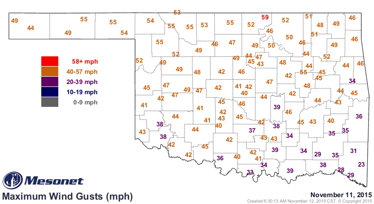
That map looks pretty bad, but you also have to realize that the wind didn't go
from 20 mph and then suddenly gust to 59 mph. These were winds yesterday
*sustained* at 40-45 mph, gusting into the upper 50s all across that area. Check
out the 24-hour meteogram for Newkirk. The second graph down is the 5-minut average
windspeed (dark blue) with the maximum gust for each 5 minute interval (light blue)
on top of that.
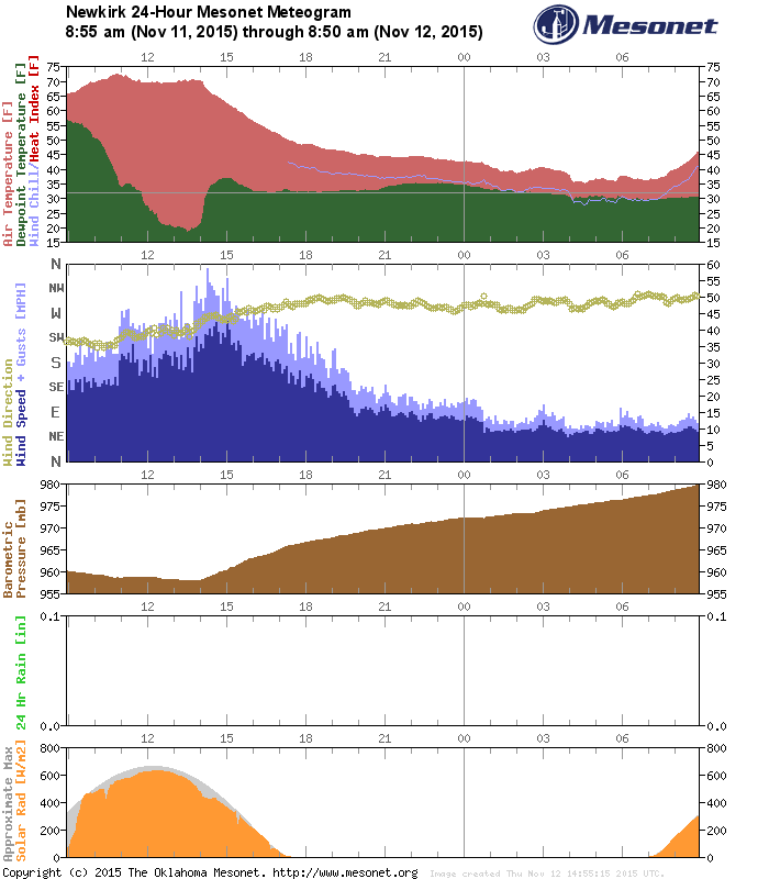
Some other interesting things on that meteogram, on the top graph with the
temperature (red) and dewpoint (green), you can see the dryline pass through as
the dewpoint dropped from about 55 degrees to 20 degrees in a few hours, then
the dewpoint rise another 10 degrees about the same time that the temperature
started dropping with the cold front's passage. AND you can also see by
comparing the first two graphs that the maximum winds were associated with the
cold front, not the dryline (but there wasn't too much difference between the
two). And then on the third graph down, you can see the pressure slowly rise
as the surface high associated with all that cold air behind the front took
over. Verrrrrrrry interesting!
I'm scared to find out what that did to any wheat sprouted in that important
production area across NC Oklahoma as it endured hours and hours of that
desiccating wind. If it was anything like what happened to my lips, it tweren't
good. There were the expected wildfires as well, including a really bad one
up in Washington and Nowata counties that burned multiple structures.
As noted earlier, the wind gusts were out of control. In the last 24 hours, the
Mesonet stations measured thousands of wind gusts of at least 35 mph. Here's a
tally of the wind gusts over the last 24 hours.
35 mph: 5142 wind gusts
40 mph: 2250 wind gusts
45 mph: 621 wind gusts
50 mph: 103 wind gusts
55 mph: 10 wind gusts
Again, topped by the 59 mph gust at Newkirk at 12:15pm.
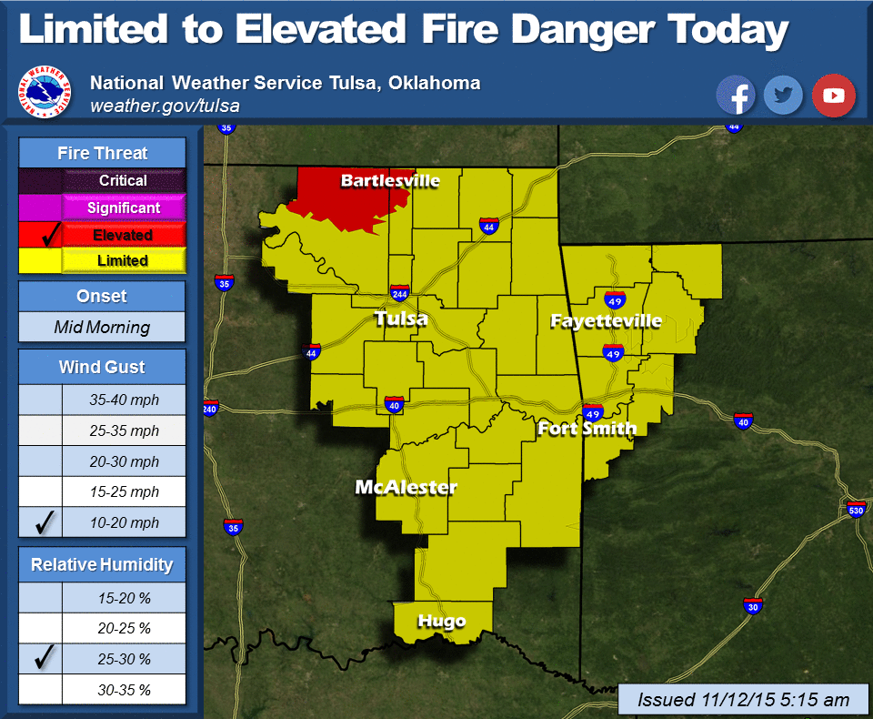
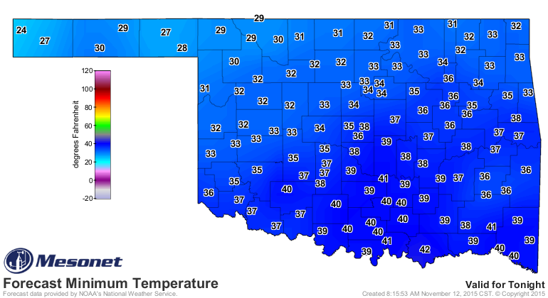
We now get to endure some seasonable-but-dry weather for a few days (beware of
some frost and/or freezing weather tonight!).
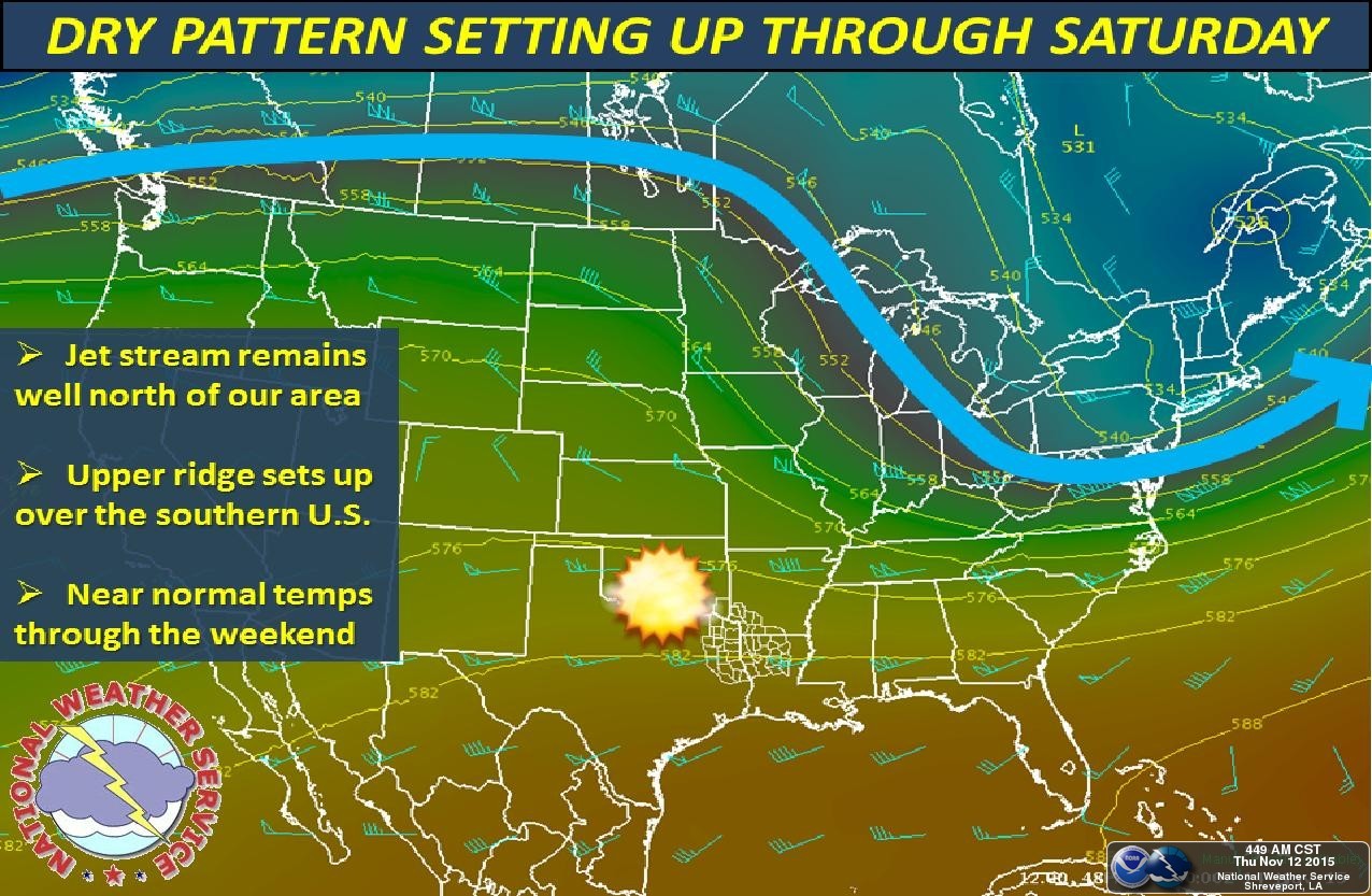
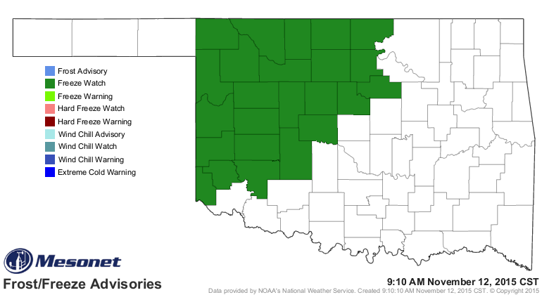
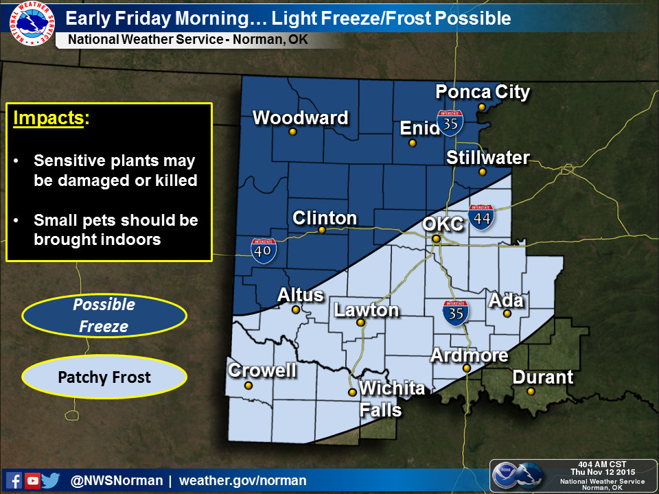
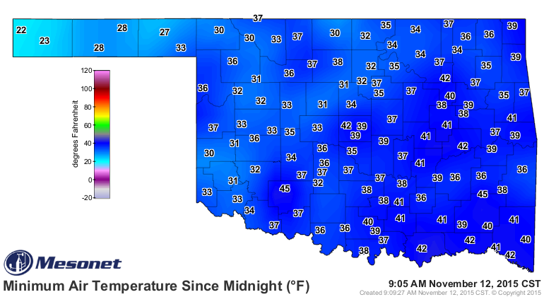
This morning was the coldest morning of the season thus far, and tomorrow
morning looks chilly as well.
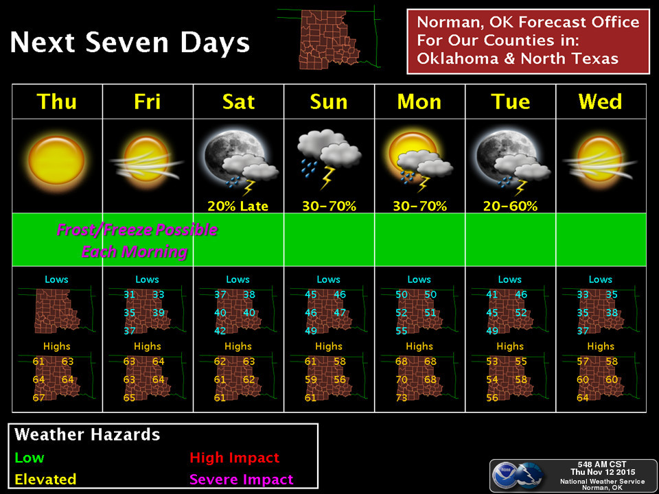
And then all eyes turn to early next week as another couple of storm systems
currently sitting off the Alaskan coast plunge to the south and move across
our area (we hope), bringing better chances for rain and also another strong
cold front.
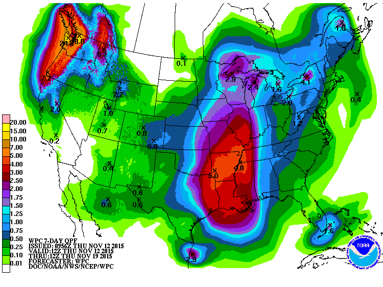
Amounts look to be heaviest in the east as of now, with 3-4 inches being
forecast. Lessening amounts to the west, but quite nice as we approach the
driest part of our calendar year.
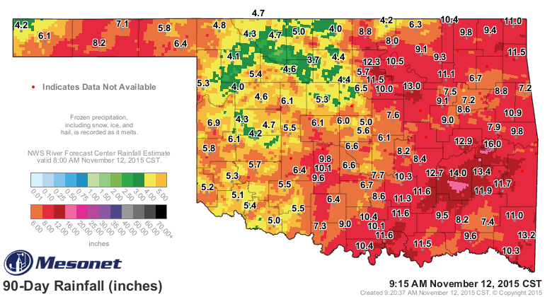
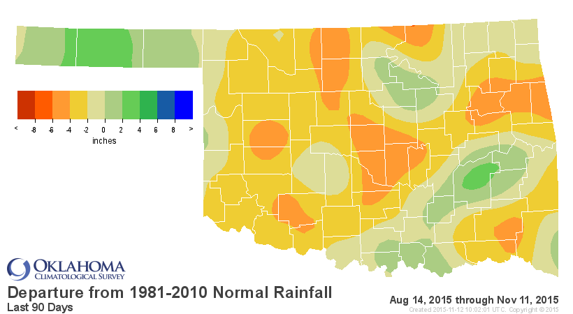
And we do need the rain, especially across northern and SW OK where the rainfall
totals are looking especially pathetic after our wet April-July. Barely 5 inches
across much of western Oklahoma, which is 2-6 inches below normal for that
time frame.
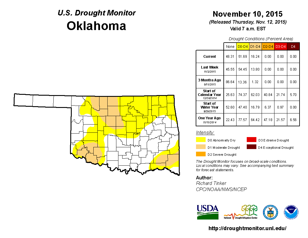
Today's U.S. Drought Monitor report showed an increase in drought across NC
OK, with moderate drought concentrated in that area as well as SW and SE OK.
Gary McManus
State Climatologist
Oklahoma Mesonet
Oklahoma Climatological Survey
(405) 325-2253
gmcmanus@mesonet.org
November 12 in Mesonet History
| Record | Value | Station | Year |
|---|---|---|---|
| Maximum Temperature | 86°F | BURN | 2005 |
| Minimum Temperature | -4°F | EVAX | 2019 |
| Maximum Rainfall | 2.72″ | SEIL | 2010 |
Mesonet records begin in 1994.
Search by Date
If you're a bit off, don't worry, because just like horseshoes, “almost” counts on the Ticker website!