Ticker for November 16, 2015
MESONET TICKER ... MESONET TICKER ... MESONET TICKER ... MESONET TICKER ...
November 16, 2015 November 16, 2015 November 16, 2015 November 16, 2015
All severe weather modes in play for today!
The Storm Prediction Center has given notice that folks in the Southern Plains
should stay very much weather aware today into early tomorrow. Their Day-1
Severe Weather Outlook shows much of the western half of Oklahoma to be in an
"Enhanced" risk category, with surrounding areas in the "Slight" risk category.
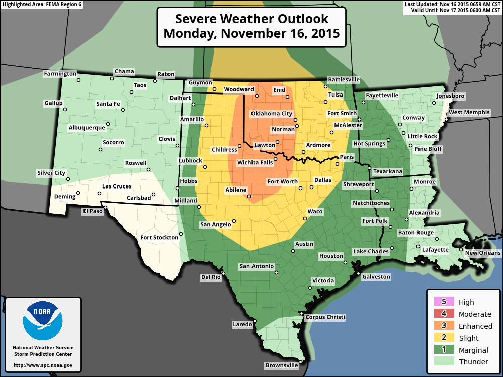
The beginning of their forecast summary says it all:
"SEVERE STORMS ARE EXPECTED TO DEVELOP INITIALLY OVER THE CENTRAL AND
SOUTHERN HIGH PLAINS DURING THE LATE AFTERNOON AND EVENING. AN
EXTENSIVE SQUALL LINE SHOULD FORM TONIGHT AND PUSH EASTWARD ACROSS
PARTS OF OKLAHOMA AND TEXAS. TORNADOES...DAMAGING WINDS...AND LARGE
HAIL ARE ANTICIPATED."
Yes, the old "T" word. No, not "to."
"Tornadoes."
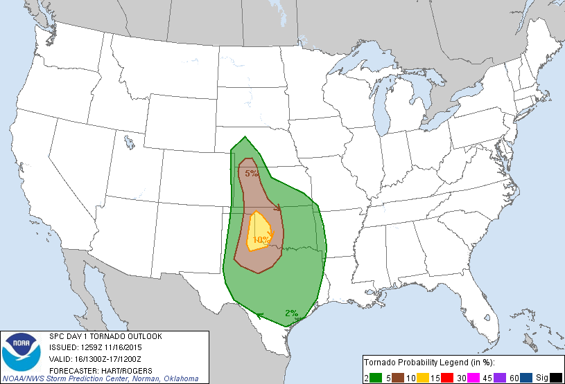
The threat is not high for most of the area, but out along the western edge of the
state, it's a bit more pronounced. This graphic from SPC doesn't give you any
indication of the power of number of any tornadoes that might pop up, but merely
indicates the probability of a tornado within 25 miles of any point on the map.
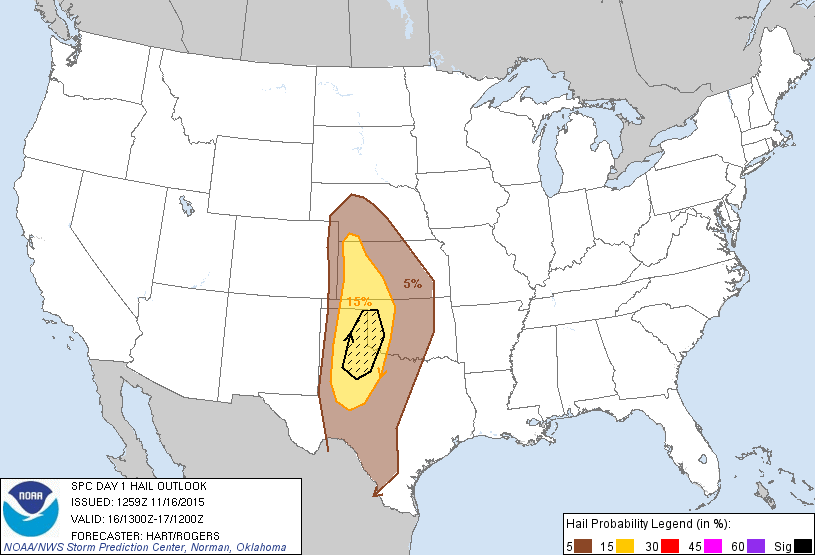
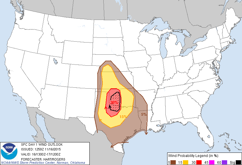
The wind and hail categories are also more pronounced out to the west, but the
wind threat is spread a bit farther to the east, intended to be associated with
the expected squall line that could move across the state later tonight. These
are again probability maps, with the probability of damaging t-storm winds of
50 knots or greater within 25 miles of a point (the hatched area is a 10%
greater probability of wind gusts of 65 knots or greater), and the possibility
of 1-inch diameter hail (hatched area 10% greater probability of 2-inch
diameter hail).
In a nutshell, look for storm development out to the west with the possibility of
"discrete" storms, separated from other storms (not to be confused with discreet
storms, which you can tell all your secrets to and they'll keep it to themselves).
It's at that point that the tornado risk will be higher. Then the storms are
expected to form into a line and march across the state throughout the evening
hours. Again, the tornado risk will not be zero at that point either.
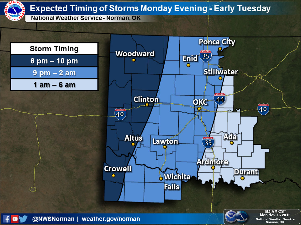
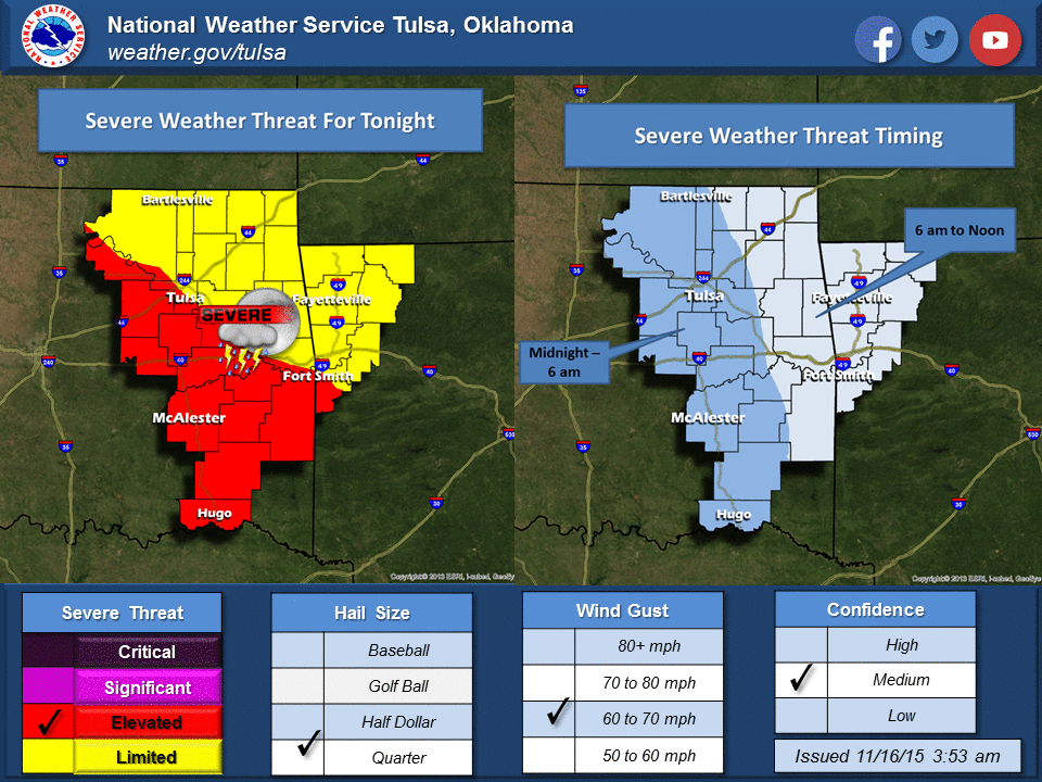
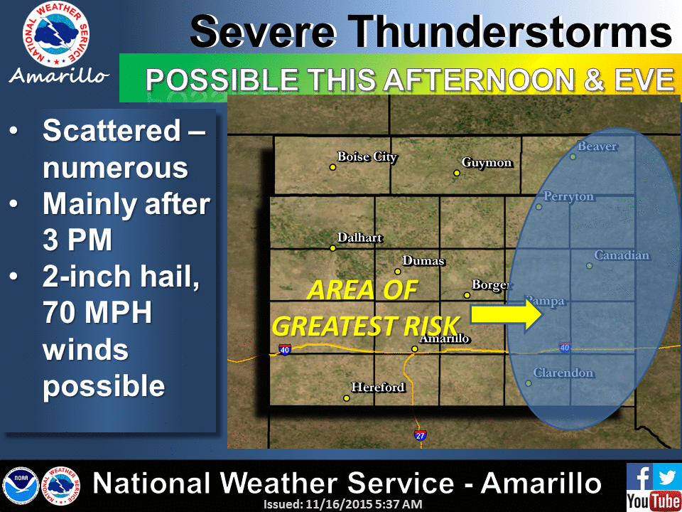
Here are some graphics from the local NWS offices detailing the timing of today's
event and other factors.
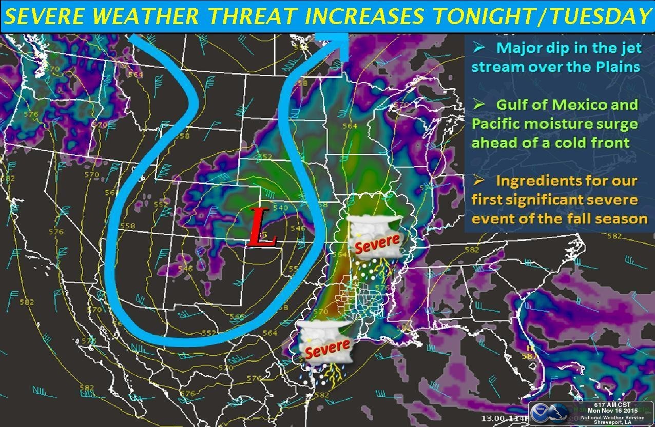
The moisture is surging north from the Gulf
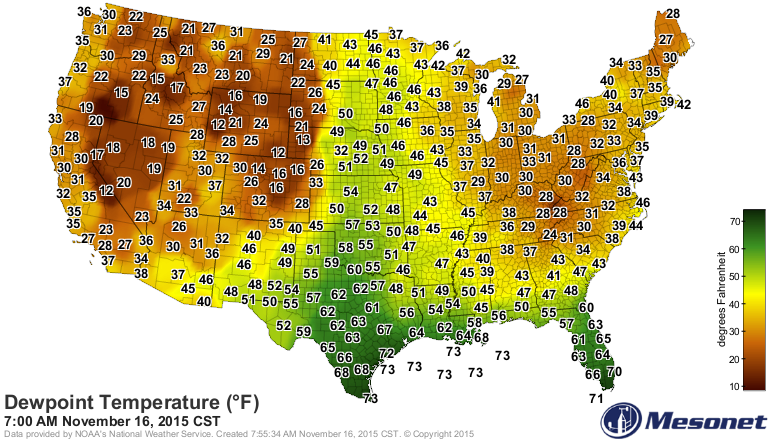
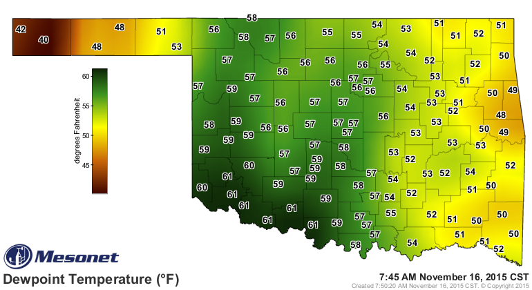
which means that there will be plenty of water to work with as this system
moves on by.
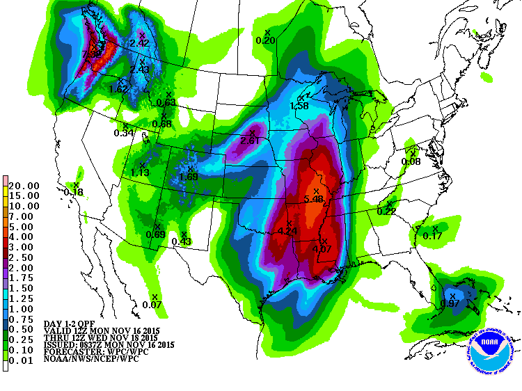
Rainfall amounts will be very difficult to determine, since we're dealing with
convective rain here (thunderstorms), but a good 1-4 inches looks possible with
highest amounts to the east, of course.
There have been 94 November tornadoes confirmed in Oklahoma since 1950. Yes,
that total *might* go up today, but it might not. Regardless of the threat of
the T-Rex of severe events, Oklahomans should be weather aware for any and all
types of severe weather. The best way to do that is to stay tuned to your
favorite media channel and follow your local NWS office to stay weather aware.
Final point, and this is a big one...the timing/locations/outlooks could and
probably will change as storm initiation draws near, so there will be lots of
fine tuning as we go throughout the day. In other words, STAY WEATHER AWARE!
Gary McManus
State Climatologist
Oklahoma Mesonet
Oklahoma Climatological Survey
(405) 325-2253
gmcmanus@mesonet.org
November 16 in Mesonet History
| Record | Value | Station | Year |
|---|---|---|---|
| Maximum Temperature | 90°F | BUFF | 2016 |
| Minimum Temperature | 7°F | KENT | 1997 |
| Maximum Rainfall | 3.72″ | PAWN | 1996 |
Mesonet records begin in 1994.
Search by Date
If you're a bit off, don't worry, because just like horseshoes, “almost” counts on the Ticker website!