Ticker for November 11, 2015
MESONET TICKER ... MESONET TICKER ... MESONET TICKER ... MESONET TICKER ...
November 11, 2015 November 11, 2015 November 11, 2015 November 11, 2015
Don't. Just don't.

You've heard the story of today's fire danger EXCLUSIVELY on the Ticker all week,
stolen from about 50 other sources also talking EXCLUSIVELY about today's fire
danger. So if you take one thing from today's Ticker, that would be:
1. We are thieves, and
3. DON'T DO ANYTHING TO SPARK FIRES TODAY!
And why wouldn't we expect some sort of crazy weather today, on the anniversary
of Oklahoma's most famous palindrome (11/11/11)?
http://ticker.mesonet.org/select.php?mo=11&da=11&yr=2010
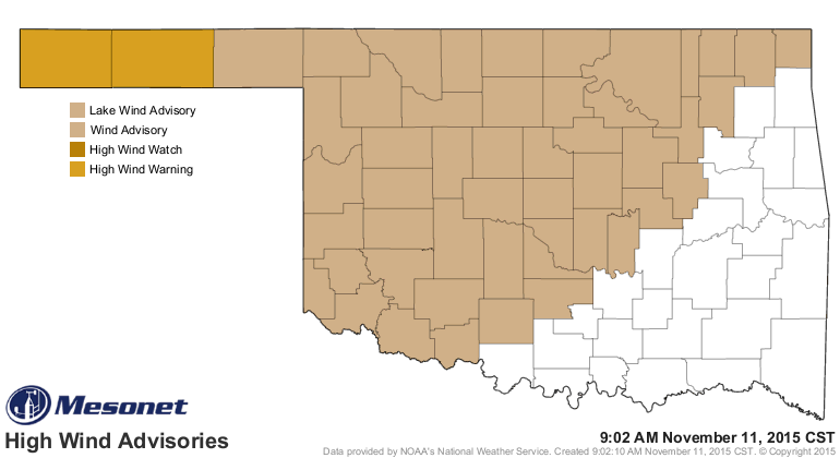
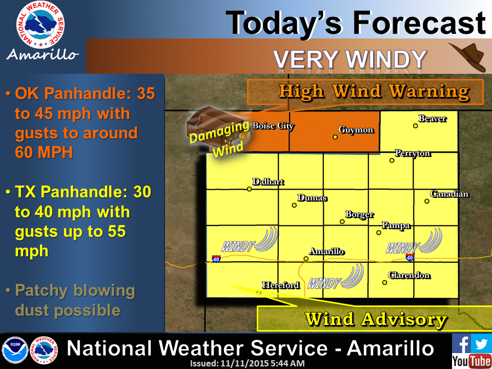
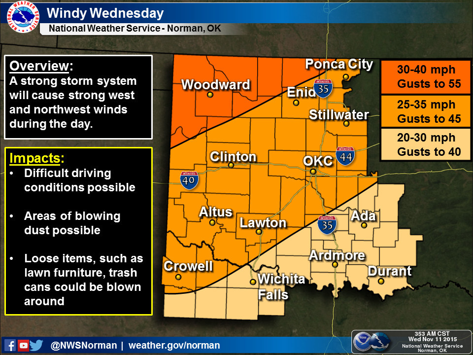
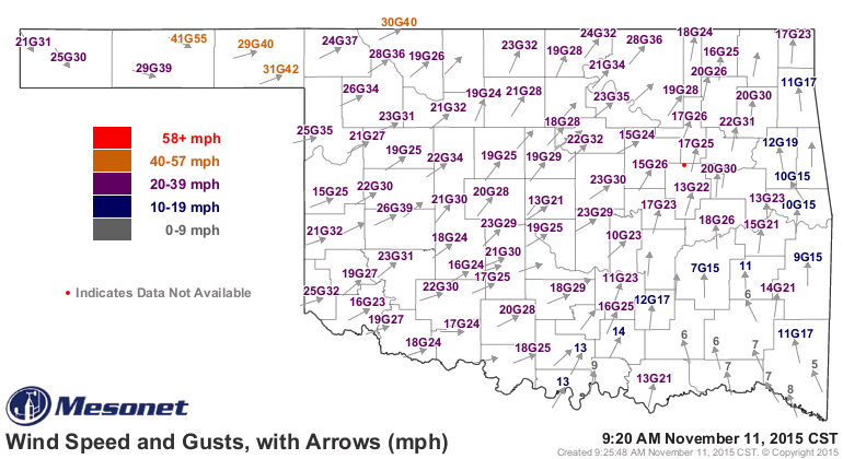
Here's the setup. We have high wind warnings and watches for most of the NW 2/3rds
of the state today, as we could see winds gusting close to 60 mph in the far NW,
diminished a bit but not a lot as you go southeast.
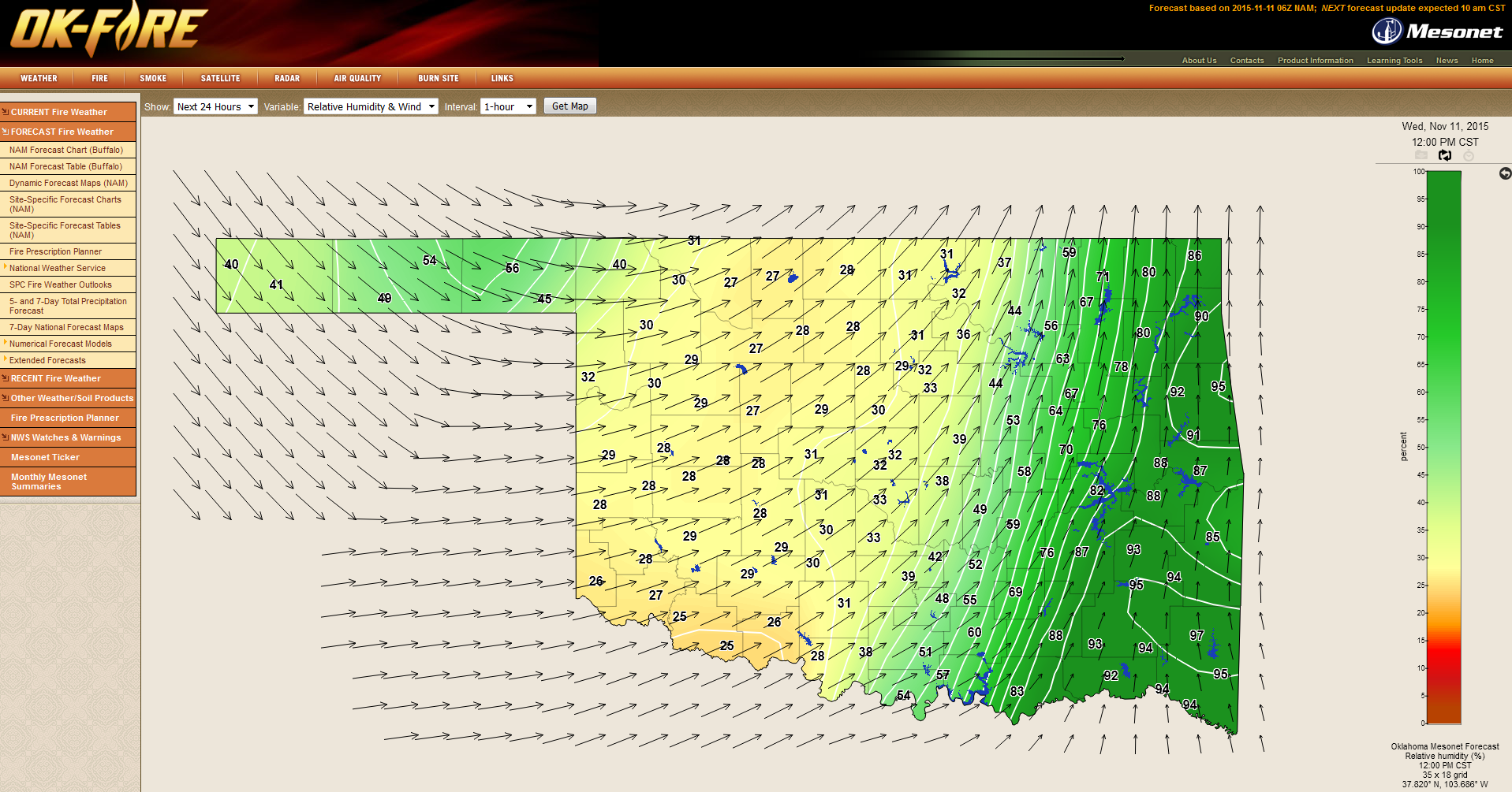
That goes along with relative humidity values dropping into the 20s as that
dryline passes through later today. Check out this RH forecast map from the
Mesonet's OK-FIRE program for noon.
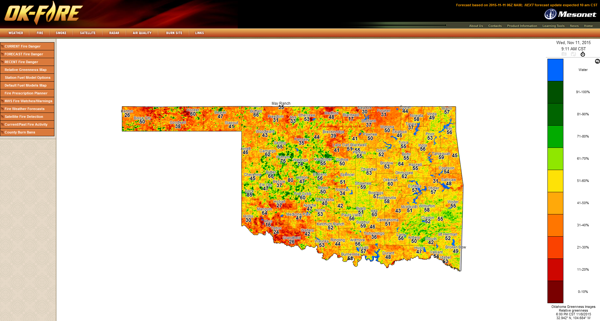
All that combined with vegetation just going into dormancy (or in some cases,
stressed by drought). Here's the relative greenness map from OK-FIRE. Intuitively,
the orange and reds are bad, greens are good.
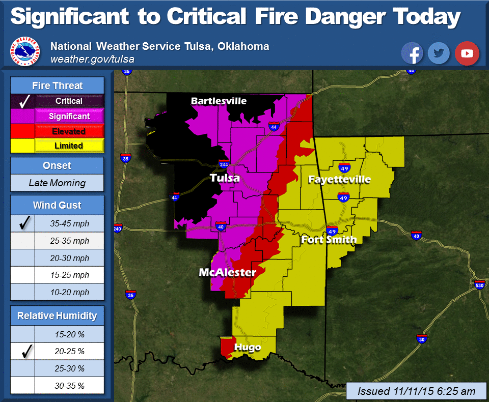
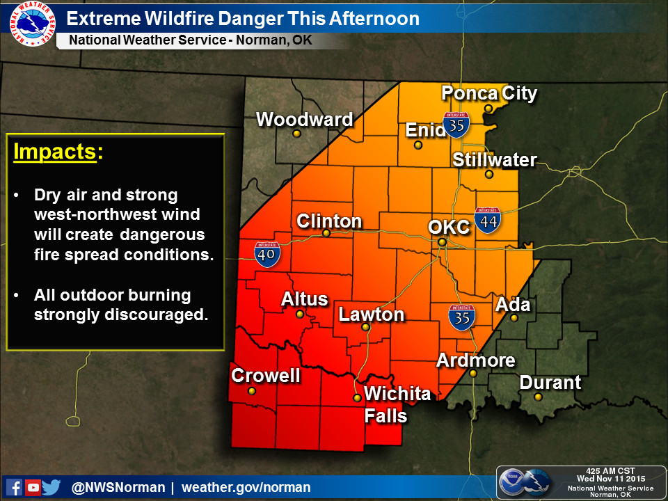
Together, all those ingredients make for extremely high fire danger, albeit in
a moving window as that dryline moves through. Once that passes and the cold
front comes in, RH values will increase (colder air and a bit more moisture lead
to higher RH) and the fire danger will drop dramatically. The big problem there
is that if a fire is already started, the changeover in winds from the west
behind the dryline will become northerly behind the cold front, causing a
shift in wildfire burn direction. Definitely something to watch out for today.
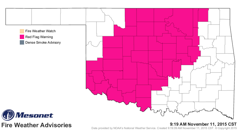
So a large part of the state is now under a Red Flag Fire warning, a stern
reminder to delay any outdoor burning that might need to be done today.
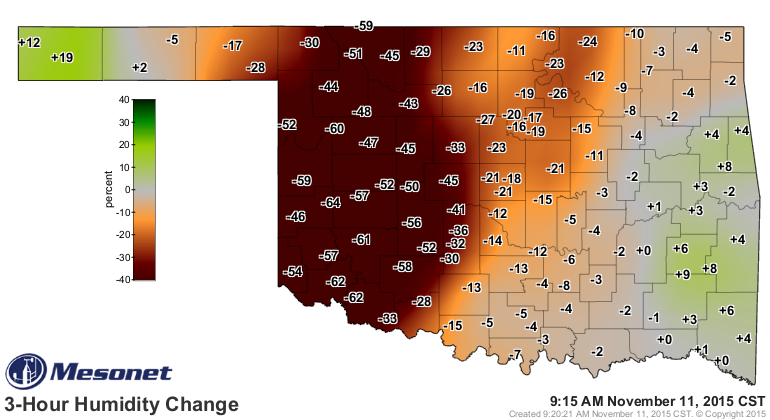
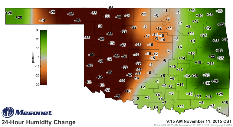
The humidity has really plunged in the last 3 hours behind that dryline, which
is already approaching central OK. Quite a difference from yesterday at this
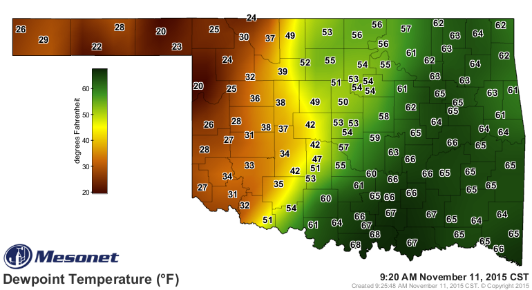
time as well. You can see the dryline quite nicely in the dewpoint map.
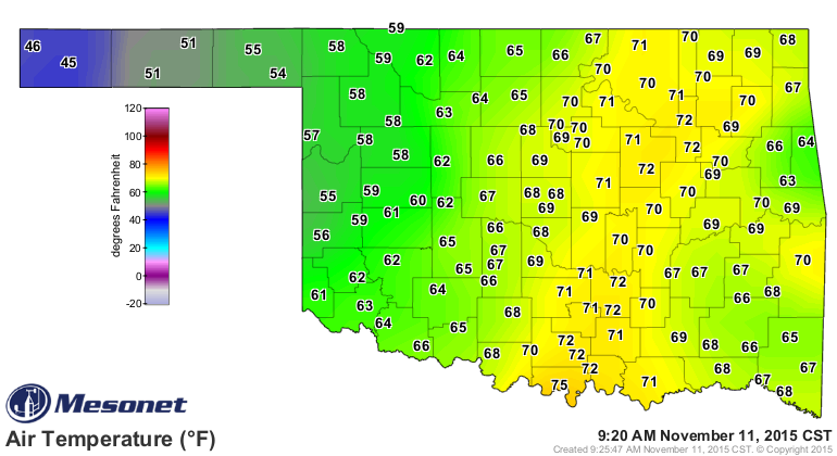
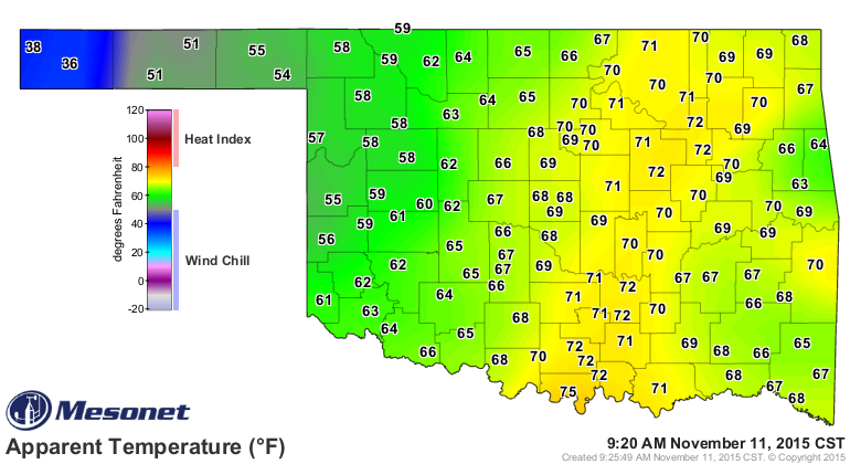
And the front shows up in the Panhandle where the winds shift to the NW and the
temperatures are in the 40s. That also drops the Panhandle into winter territory
with wind chills in the 30s.
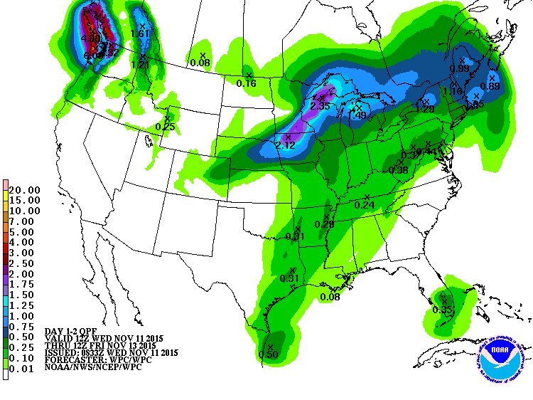
The chance of moisture, with that dry air already upon the western half of the
state, is now entirely shifted to the eastern third of the state, and not much
to work with at that.
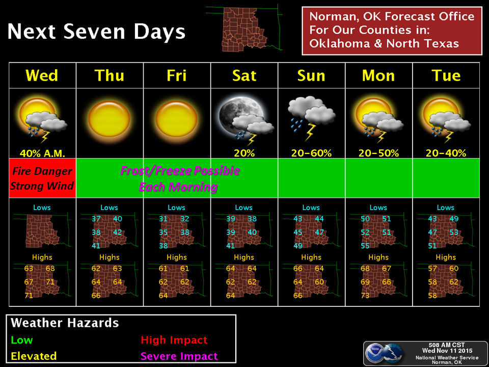
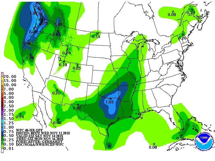
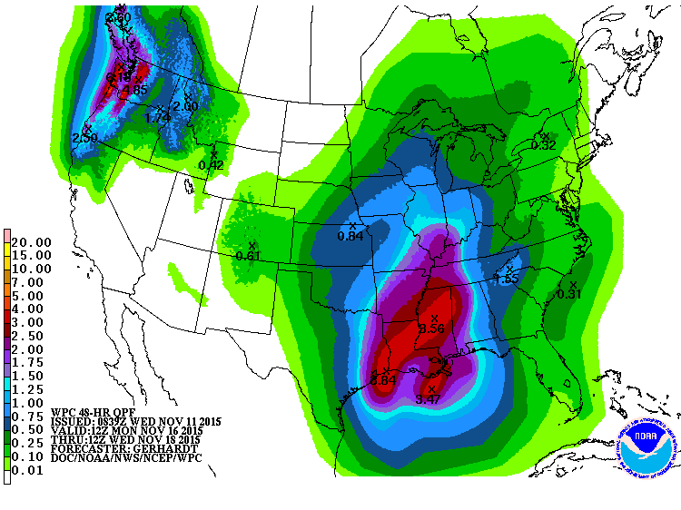
The next chance comes later in the weekend and early next week, with more
substantial moisture to work with.
We'll leave you with these advisories from the "Fire Situation Report" of the
OK Forestry Service:
"Special Note to Firefighters: County Wildland Task Force resources should
be prepared for mobilization today. Incident Commanders on any going fire
will need to monitor wind speed and direction as well as location of fire
in relation to the cold front passage.
Special Note to Law Enforcement: Given the fire weather conditions today,
any fire that becomes established will have potential to spread rapidly
to the east-northeast early in the day. As the cold front passes expect
direction of spread to move to the southwest or south. Any established
wildfire will most likely require evacuation of non-incident personnel.
Special Note to Public: Outdoor burning is strongly discouraged today
due to today?s forecast extreme fire weather. Report any suspected
wildfire by calling 911."
Let me paraphrase all of that: DON'T BURN ANYTHING TODAY.
Gary McManus
State Climatologist
Oklahoma Mesonet
Oklahoma Climatological Survey
(405) 325-2253
gmcmanus@mesonet.org
November 11 in Mesonet History
| Record | Value | Station | Year |
|---|---|---|---|
| Maximum Temperature | 86°F | SLAP | 2005 |
| Minimum Temperature | 1°F | EVAX | 2019 |
| Maximum Rainfall | 1.24″ | COPA | 2012 |
Mesonet records begin in 1994.
Search by Date
If you're a bit off, don't worry, because just like horseshoes, “almost” counts on the Ticker website!