Ticker for November 10, 2015
MESONET TICKER ... MESONET TICKER ... MESONET TICKER ... MESONET TICKER ...
November 10, 2015 November 10, 2015 November 10, 2015 November 10, 2015
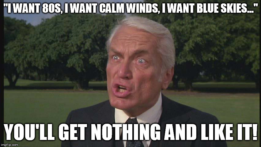
I'm no doorknob, either!
The big weather story remains that big system roaring through tonight and
tomorrow, complete with a dryline, cold front and lots of unpleasantness to go
with it. This time, however, it's unpleasantness of the dry variety for the most
part. Not much moisture in the offing.
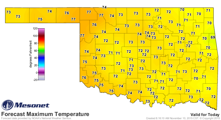
We start with today, which will be warm, but windy.
After that, we get a front entering the state moving fast enough that the moisture
return will be too little too late for most of the western two-thirds. So we're
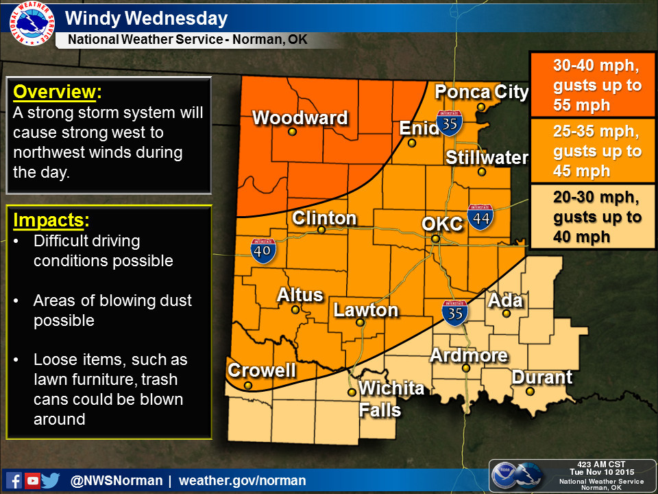
going to still have those strong winds gusting to over 55 mph, low humidity and
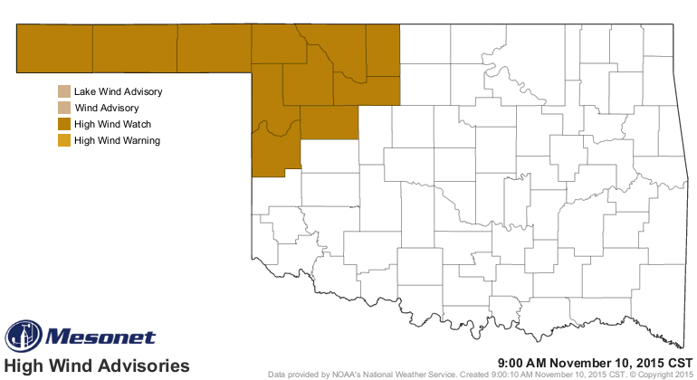
so lots of wildfire concerns. There is currently a high wind advisory for the
NW quarter as well.
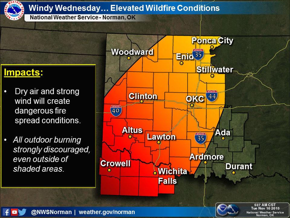
Today's "Fire Situation Report" from the OK Forestry Services sums it up nicely:
"Veteran?s Day has greater potential for elevated fire danger statewide
with relative humidity values falling to or below 30% driving fine fuel
moisture down. Winds are expected to be pretty stiff out of the west
with northwestern Oklahoma seeing winds in the 30-40 mph range and
potential for gusts near 55 mph. The bulk of the state will experience
winds 20-30 mph with gusts near 40 mph. Fires that occur in grass fuels
will have the potential to exhibit rates of fire spread in excess of
300 feet per minute."
300 feet per minute. Let's see, 60 seconds is just about my 100 yard dash (I'm
old school, as well as just plain old) time, so I'd be in trouble. But today is
concerning as well.
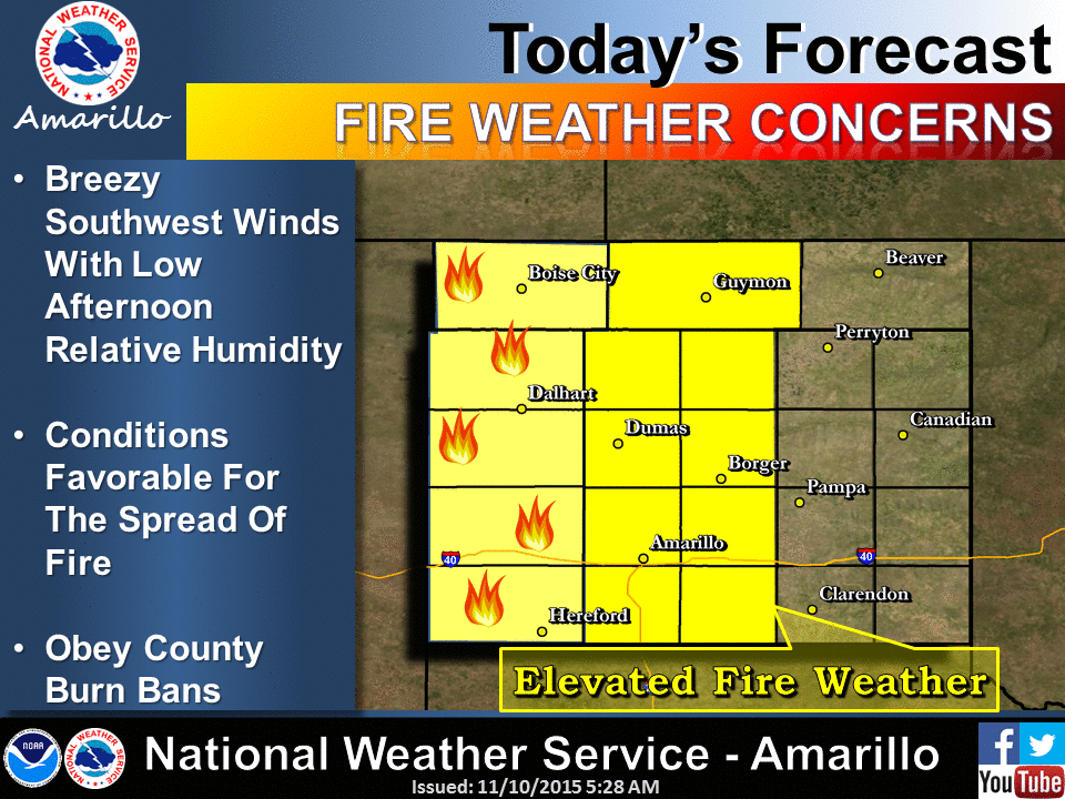
"The highest fire danger today will be in the Panhandle Counties and
northwestern Oklahoma where winds will be SSW 15-20 mph
gusting to 25 mph combined with temperatures in the mid- to upper-
70?s and relative humidity values near 20% driving dormant, fine fuels
into the 5% fuel moisture range. Fires that become established will have
the potential to exhibit rapid rates of fire spread."
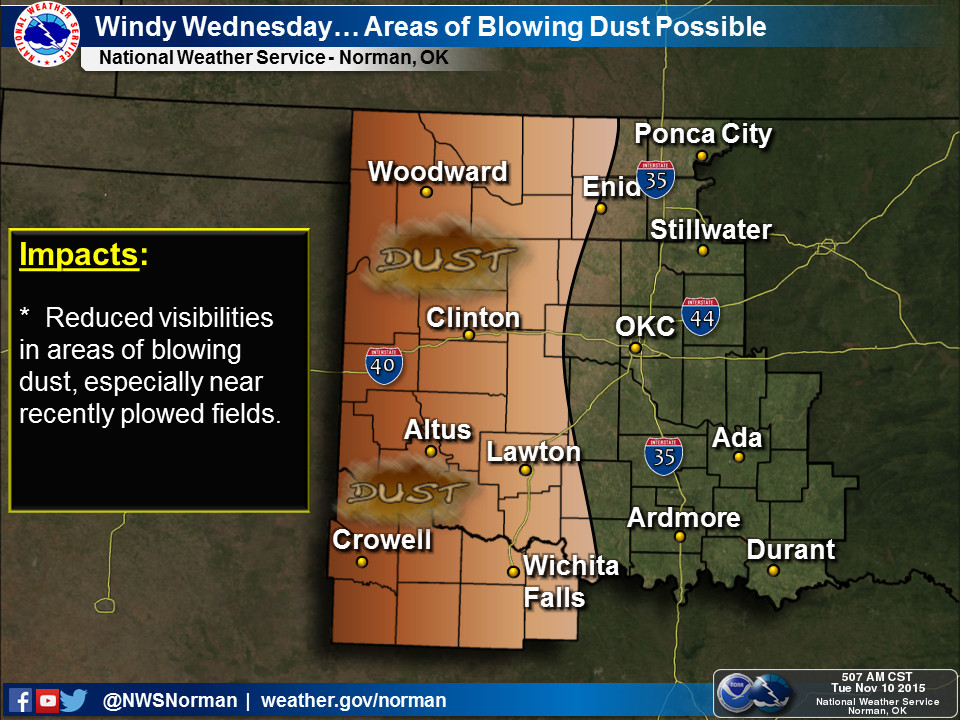
Oh, and while you're running from wildfires, be sure to keep your mouth closed
or you'll end up with your teeth full of dust.
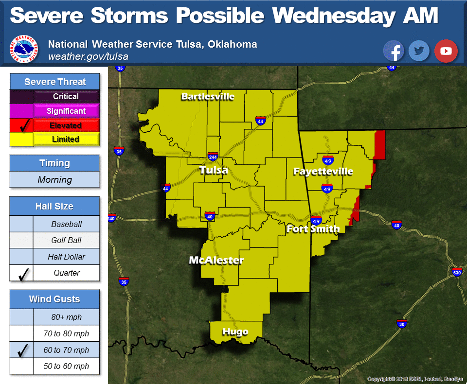
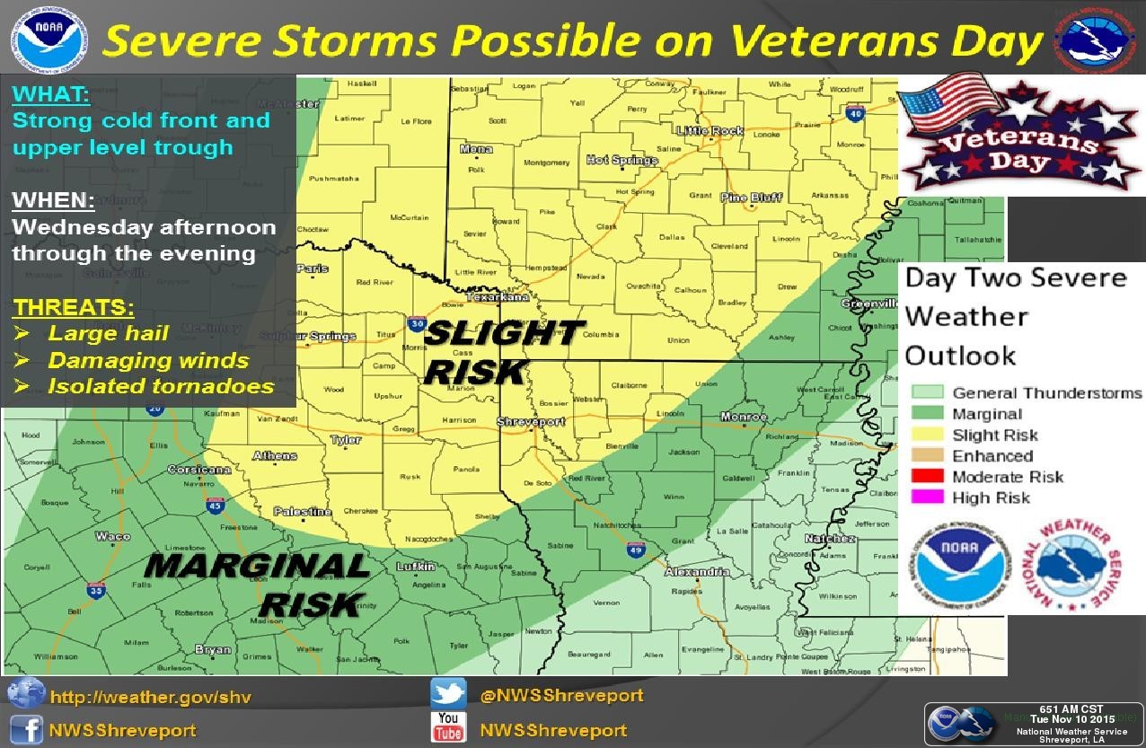
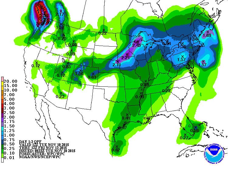
There IS a chance of rain and severe weather, still, in eastern Oklahoma. Amounts
will not be excessive, and any severe weather will be moving quickly out of
state. Main threats will be winds and some large-ish hail.
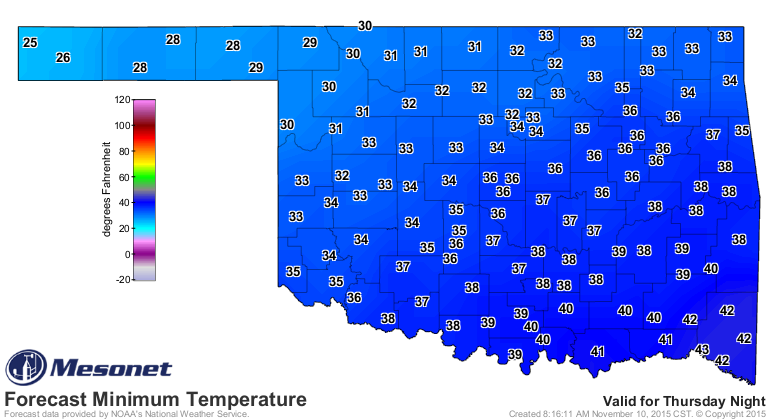
It is a cold front, so expect a much larger area with frost/freeze advisories
on Thursday and Friday.
It was just reported yesterday by the Ag Statistics Service that Oklahoma's
wheat crop was taking a turn for the better, but the type of weather we're to
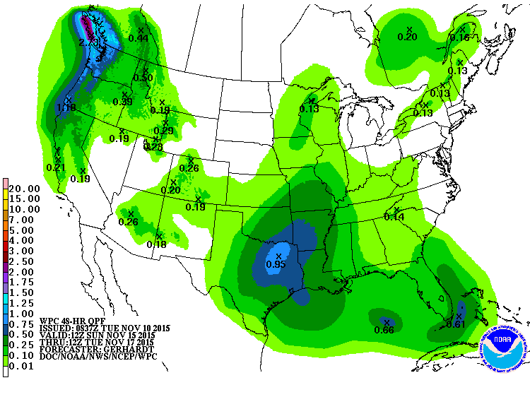
see over the next couple of days might reverse that. The next chance of rain
comes in 5 or 6 days. Not looking like a drencher just yet, but moisture
nonetheless.
Gary McManus
State Climatologist
Oklahoma Mesonet
Oklahoma Climatological Survey
(405) 325-2253
gmcmanus@mesonet.org
November 10 in Mesonet History
| Record | Value | Station | Year |
|---|---|---|---|
| Maximum Temperature | 88°F | MANG | 2014 |
| Minimum Temperature | 13°F | VINI | 2018 |
| Maximum Rainfall | 2.98″ | WIST | 2008 |
Mesonet records begin in 1994.
Search by Date
If you're a bit off, don't worry, because just like horseshoes, “almost” counts on the Ticker website!