Ticker for November 9, 2015
MESONET TICKER ... MESONET TICKER ... MESONET TICKER ... MESONET TICKER ...
November 9, 2015 November 9, 2015 November 9, 2015 November 9, 2015
WHOOSH!
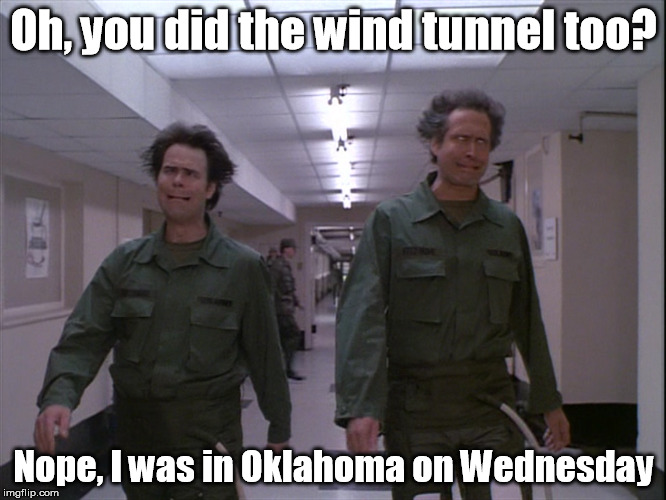
Here we go again. Another week, another strong storm system approaching from the
west bringing us a grab-bag of weather wonders. Once again we'll have a dryline/
cold front type situation setting up for Tuesday evening and Wednesday, a chance
of rain (again, east over west probably), a chance of high wildfire danger, and
a chance for severe weather.
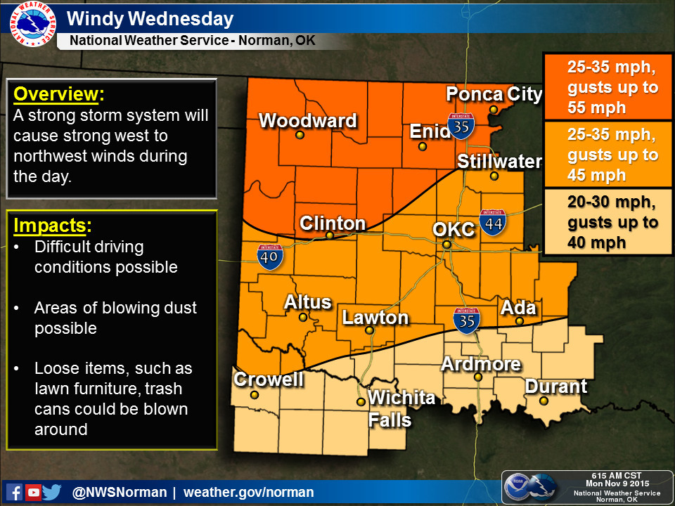
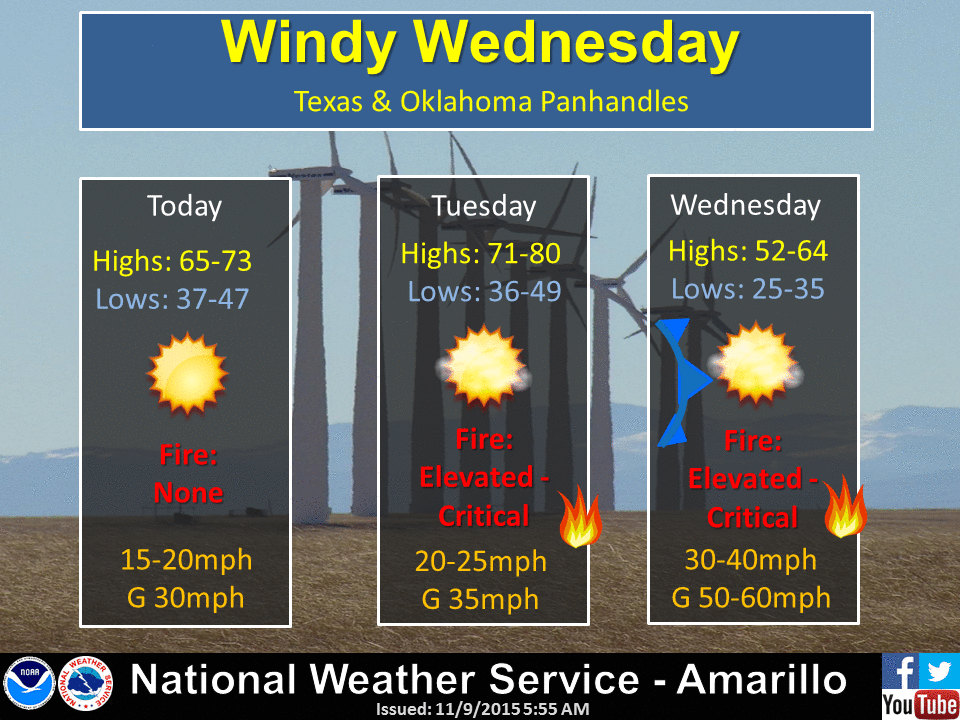
First the winds are going to be fierce following this front, howling from the
northwest (both from and especially IN the northwest) at about 40-55 mph on
Wednesday. Combine that with low humidity values in the front's wake and
vegetation that's beginning to go dormant thanks to the loss of sunlight and the
frosty temperatures and there will be a short window in there for some fairly
significant fire danger. One of the biggest dangers is the rate at which those
fires could spread. As OSU fire expert and Mesonet OK-FIRST head Dr. J.D. Carlson
put it, fire spread rates could exceed 100feet/minute in some locations.
Here are some graphics from the NWS offices detailing the coming week's exciting
weather.
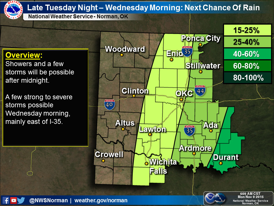
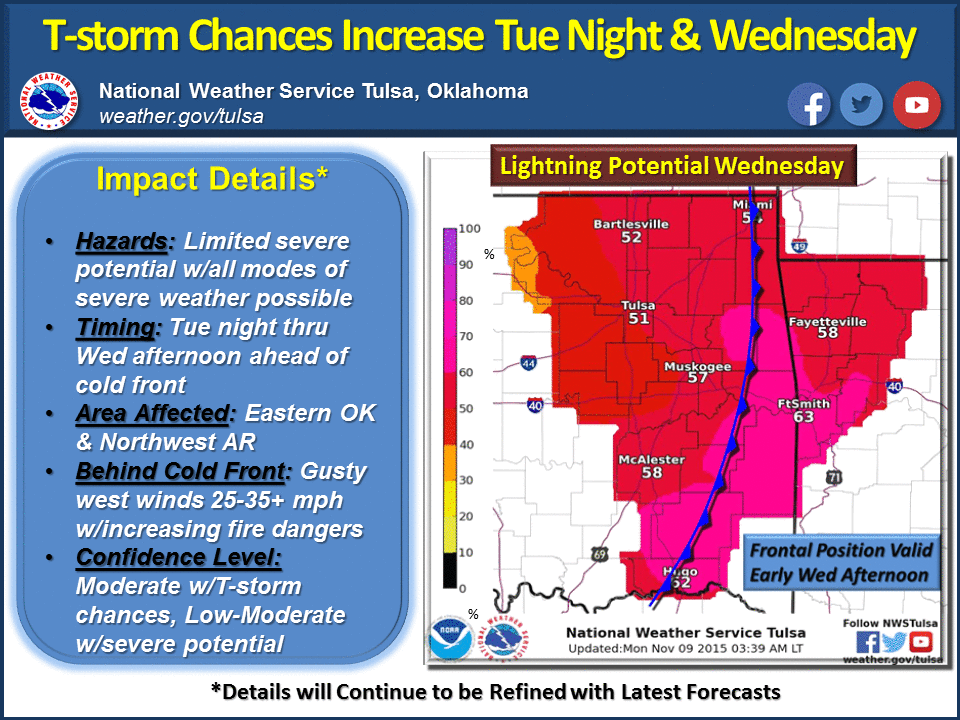
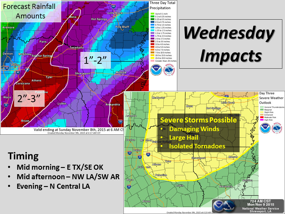
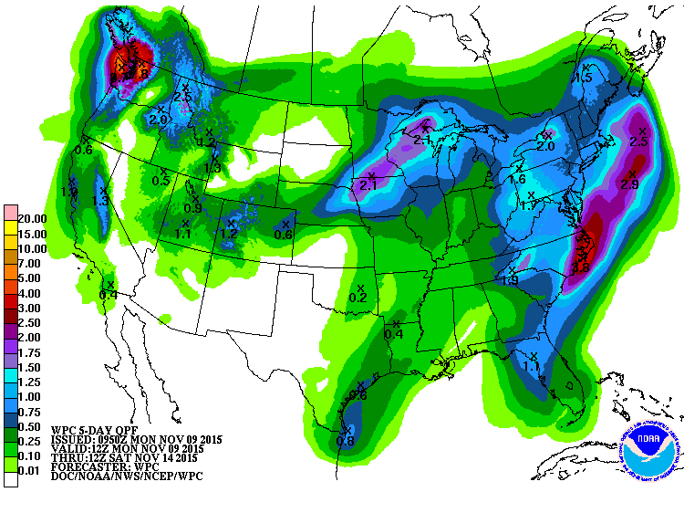
As you saw in that last graphic, the chances for significant rain decrease
rapidly as you go to the northwest, as you can also see in the 5-day rainfall
forecast. In fact, it looks like the totals have dropped dramatically since that
graphic's issuance.
As we saw last week, stay tuned for changes to the weather forecast because it
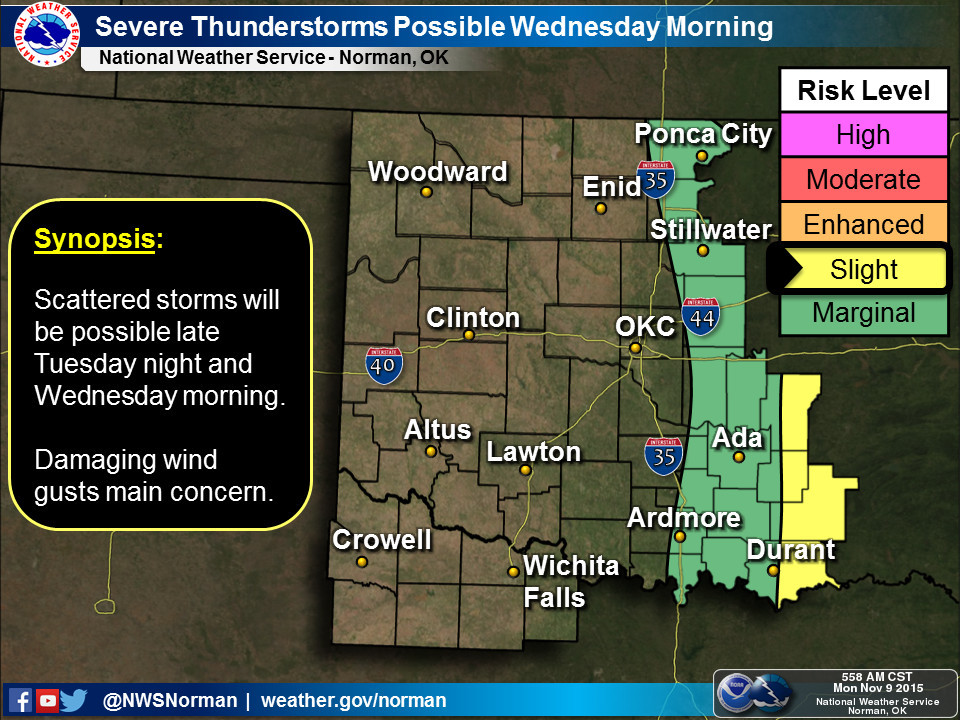
can change rather quickly (hello tornado watch!). You have probably heard by
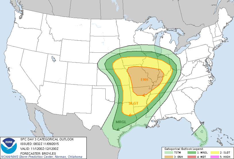
now that Wednesday is *expected* to be a significant severe weather day from
eastern Oklahoma to points farther east, as illustrated by this graphic from
the Storm Prediction Center. Hopefully that yellow area moves even farther
east as we get closer to Wednesday.
So as with last week, be prepared for just about anything. Batten down those
hatches, tie the kids to the clothesline and put the dogs in the closet because
Wednesday is going to be a doozy.
Gary McManus
State Climatologist
Oklahoma Mesonet
Oklahoma Climatological Survey
(405) 325-2253
gmcmanus@mesonet.org
November 9 in Mesonet History
| Record | Value | Station | Year |
|---|---|---|---|
| Maximum Temperature | 88°F | HOLL | 2012 |
| Minimum Temperature | 16°F | EVAX | 2018 |
| Maximum Rainfall | 2.04″ | TALI | 2023 |
Mesonet records begin in 1994.
Search by Date
If you're a bit off, don't worry, because just like horseshoes, “almost” counts on the Ticker website!