Ticker for November 5, 2015
MESONET TICKER ... MESONET TICKER ... MESONET TICKER ... MESONET TICKER ...
November 5, 2015 November 5, 2015 November 5, 2015 November 5, 2015
We call it a
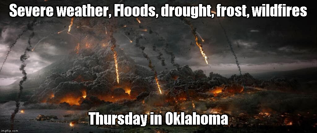
That title sounds a lot worse than what's REALLY going to happen, but we have to
hype something. It's in the DNA. In actuality, what we have is a front coming
through that MIGHT generate a bit of severe weather down south, MAYBE some
flooding way down southeast, POSSIBLY some frost in the far northwest, and
(insert word similar to MIGHT/MAYBE/POSSIBLY here) some fire danger following
the front's passage.
In other words, your typical spring/fall cold front passage in Oklahoma. No big
deal. The drought was a gift, Todd. I'm keeping that (guess the movie).
-------------------------------------------------------------------------------
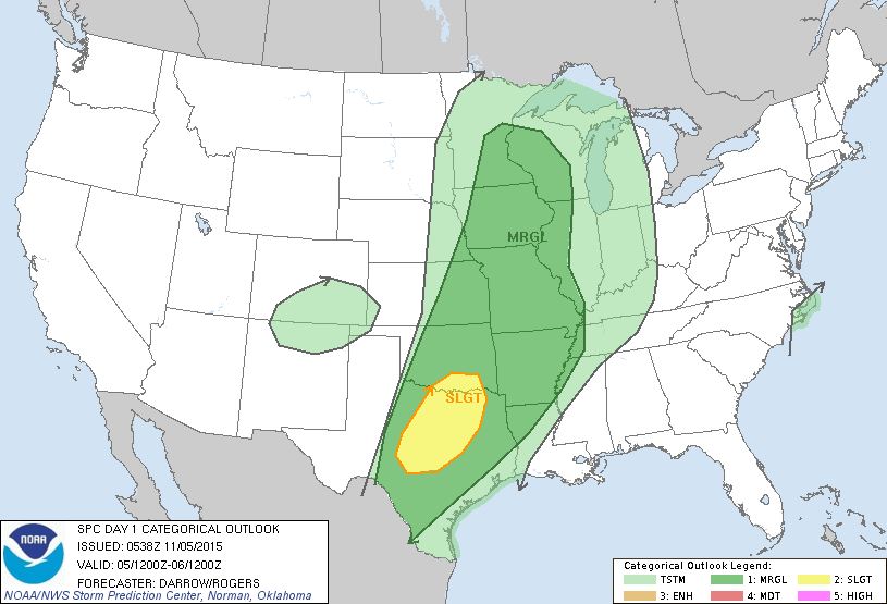
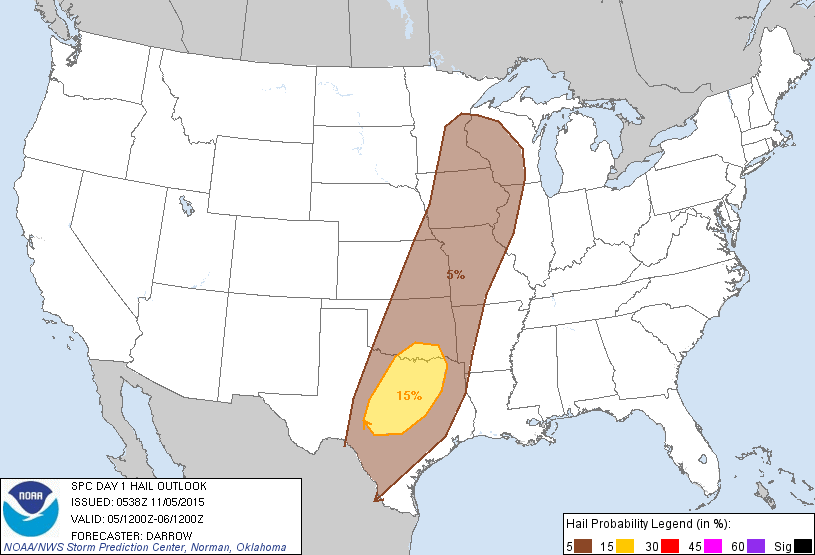
Okay, first with the severe weather, the Storm Prediction Center has shifted the
area of slight risk to south central OK down into Texas. Other areas of the state
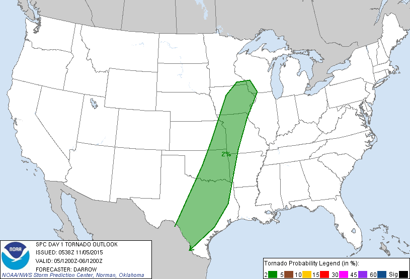
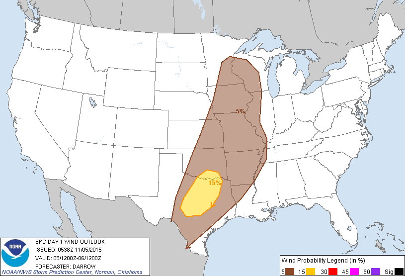
are in the "marginal" category. Here are their graphics, also with their
categorical risk maps for each type of hazard. When you see the 2% for tornadoes,
don't be alarmed. That's really REALLY low. About like my chance of needing a
comb today. The wind and hail risk goes up a bit down south.
-------------------------------------------------------------------------------
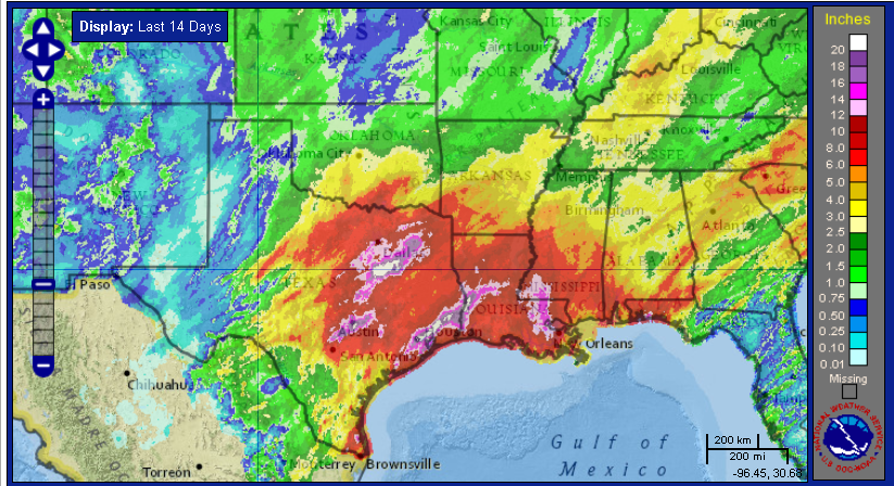
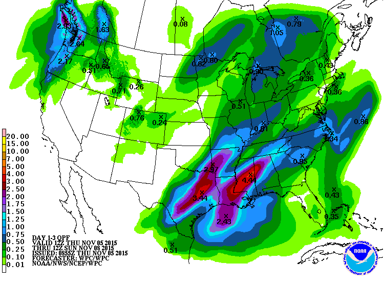
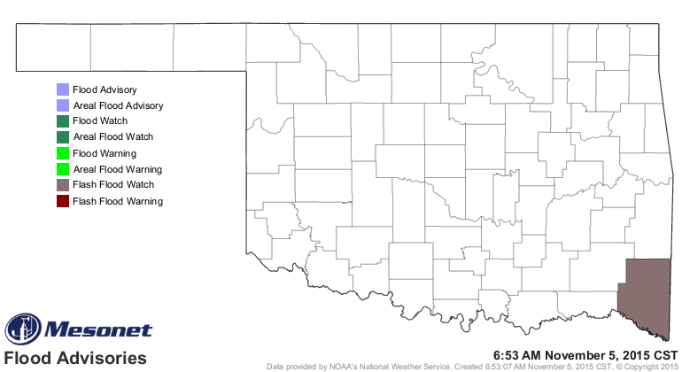
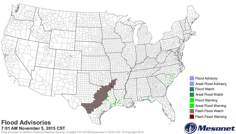
Now for the flooding...the timing of this event does look like it will trigger
the most rain after the front has moved through central Oklahoma into the SE,
and with the moist soils down that way and the possibility of 2-3 inches of
convective (t-storm) rains, McCurtain County has been placed in a flash flood
watch, as has much of that corridor of heavy rains the last 2 weeks from Texas
into Arkansas. NOW THAT WAS A SENTENCE!! Unfortunately, for the rest of the
state, it looks like like a dry front.
--------------------------------------------------------------------------------
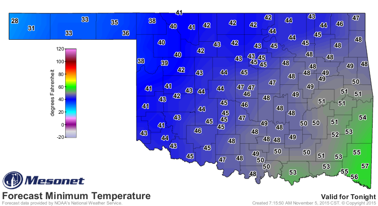
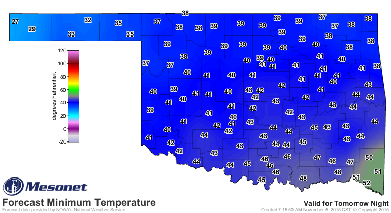
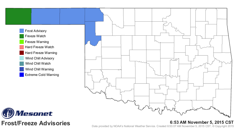
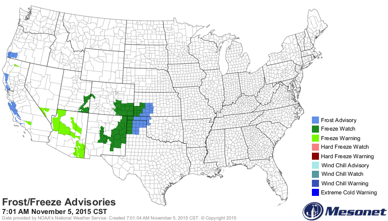
Okay, what are we up to now. Oh yes, frost (and a freeze). It is a cold front
after all, and this is November, so eventually we should expect some cold
weather. With temperatures in the dry air falling into the 20s and 30s in the
northwest, this will be the coolest air of the season.
-------------------------------------------------------------------------------
Following the front, it will be windy and the humidity is going to plummet.
That's a recipe for fire danger. While there are no red flag fire warnings or
anything yet, it is significant enough to be mentioned in the Norman NWS
forecast discussion this morning. Their screaming, not mine.
"THE NEXT ITEM OF CONCERN IS FIRE WEATHER. MINIMUM RH VALUES
WILL DROP TO NEAR 20 PERCENT BEHIND THE FRONT...AS WINDS APPROACH
20 MPH ACROSS WESTERN PORTIONS OF THE CWA...RESULTING IN ELEVATED
FIRE DANGER."
-------------------------------------------------------------------------------
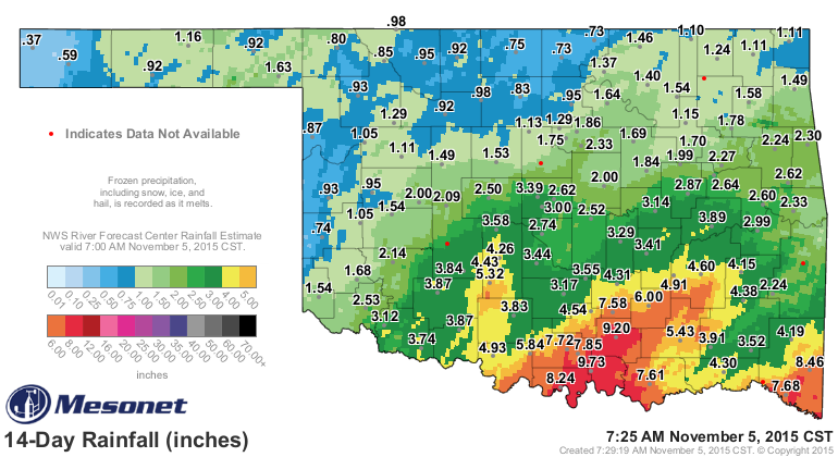
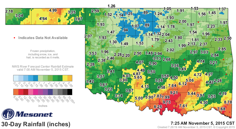
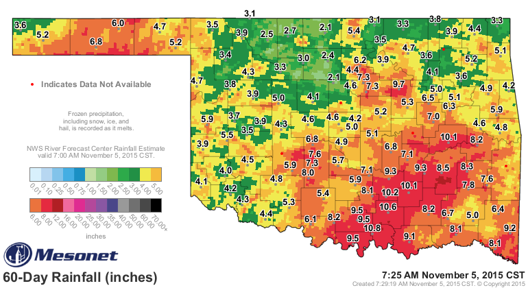
Finally, the drought. The rainfall map I showed you earlier gives the reason
for the dramatic reduction in drought over the last three drought monitor maps,
but the Mesonet rainfall maps over the last 14/30/60/90 days also give you the
reason some moderate drought remains across the SW, NW and far SE.
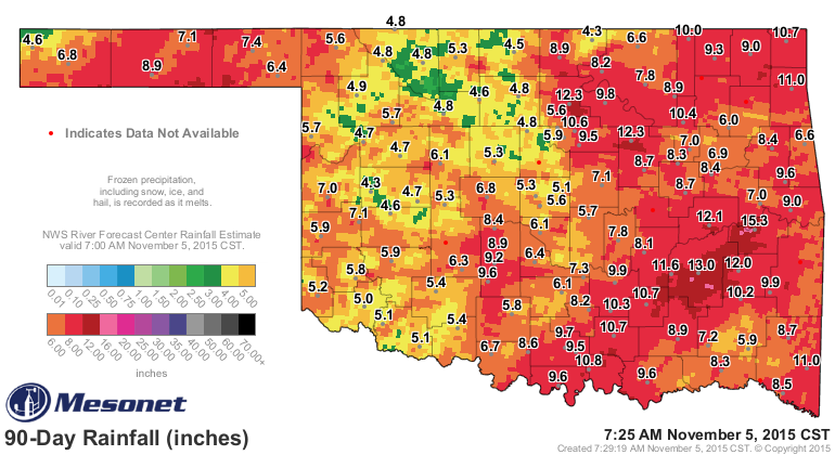
Less than 5 inches across the western half of the state over the last 90 days
is concerning when you look at the departure from normal rainfall map for the
same period.
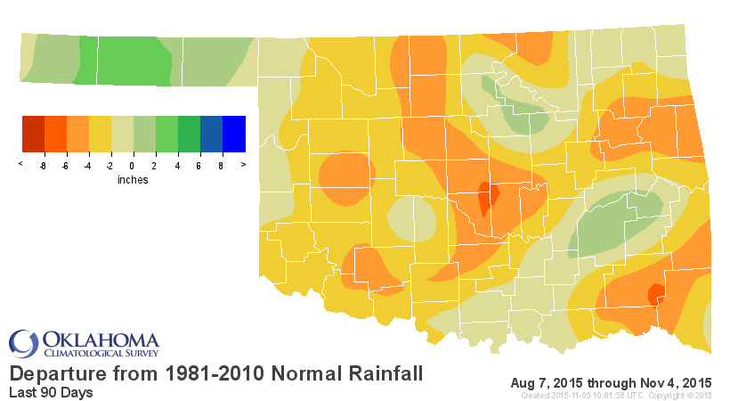
So we still have 13.8 percent of the state in moderate drought and 40.65 percent of
the state in abnormally dry conditions (AGAIN, ABNORMALLY DRY IS NOT A DROUGHT
DESIGNATION...IF YOU SAY 54 PERCENT OF THE STATE IS IN DROUGHT I'M GOING TO
COME TO YOUR HOUSE AND WATER YOUR LAWN...or something).
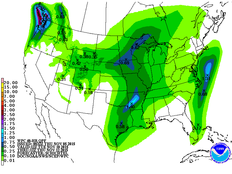
For those needing rain, we do see another trough and possible front early next
week. We'll have to wait and see just how much moisture return we get for it
to work with, but it's not looking like a drought-buster at this point. And it
does appear to be another southeast event.
Seacrest out!
Gary McManus
State Climatologist
Oklahoma Mesonet
Oklahoma Climatological survey
(405) 325-2253
gmcmanus@mesonet.org
November 5 in Mesonet History
| Record | Value | Station | Year |
|---|---|---|---|
| Maximum Temperature | 91°F | BURN | 2017 |
| Minimum Temperature | 20°F | BEAV | 2010 |
| Maximum Rainfall | 4.60″ | IDAB | 2000 |
Mesonet records begin in 1994.
Search by Date
If you're a bit off, don't worry, because just like horseshoes, “almost” counts on the Ticker website!