Ticker for November 3, 2015
MESONET TICKER ... MESONET TICKER ... MESONET TICKER ... MESONET TICKER ...
November 3, 2015 November 3, 2015 November 3, 2015 November 3, 2015
Severe weather chances on the rise!
Yet another upper-level low pressure system is set to move across the area
Wednesday night into Thursday, and therefore rain chances will yet again be
on the rise. But this time, the conditions might, (Foghorn Leghorn voice needed
here) MIGHT I SAY, be ripe for severe weather. So much so that the NWS' Storm
Prediction Center is showing a marginal-to-slight chance for severe weather from
north to south across OK on Thursday.
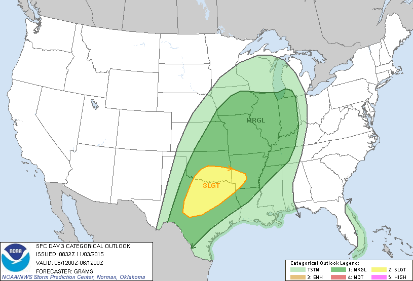
Now granted we are still 48-72 hours away, and the forecast will be fine tuned
much greater as that trough moves ashore on the West Coast and the weather models
get a better handle on it. But since it has been awhile since we've had a real
chance for nasty weather like this, always best to get prepared early. Here are
the takes from the NWS offices.
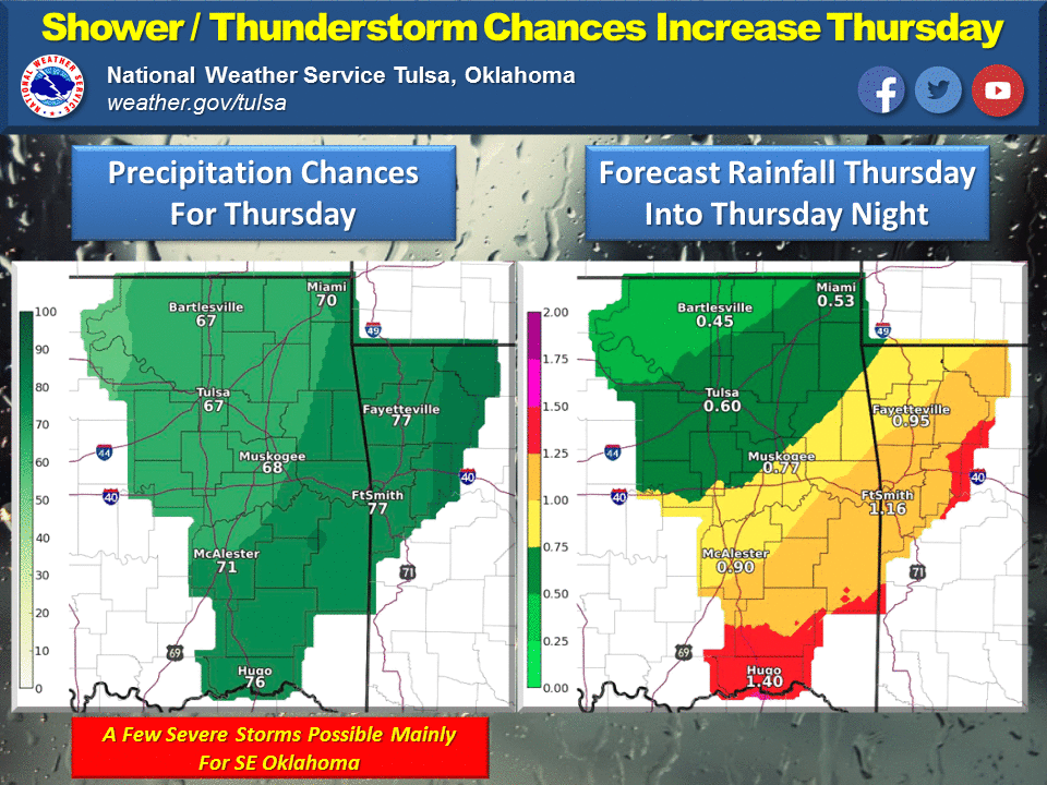
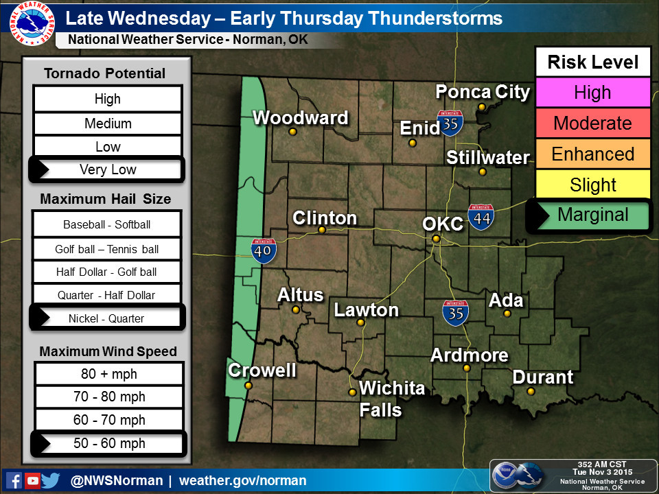
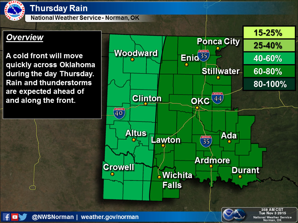
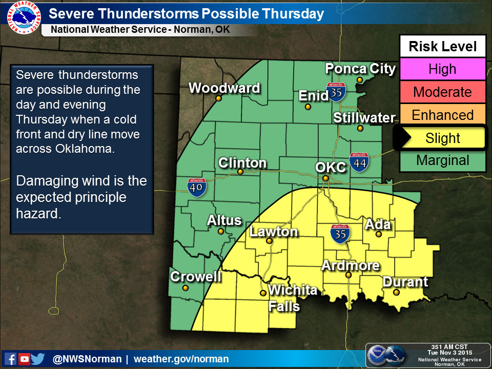
Looks like right now severe winds are the expected hazard, but again, that will
have to be fine tuned. Nobody has mentioned tornadoes (oops!), but any severe
hazard from hail to twisters can occur throughout the year in Oklahoma if
severe storms develop. The usual advice applies here, stay weather aware. Stay
tuned to your favorite (or non-favorite if that's your cup of tea) media or
governmental source for weather warnings, or combination thereof.
The timing of the front and the other ingredients does make it seem like this
will be another soaker for the southeast, with the rest of the state getting
a bit less.
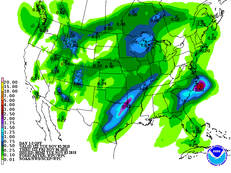
Following that, there will be another chance for some action early next week as
ANOTHER storm digs across the southern tier of the U.S. We won't go there yet
as that's still quite a ways away, but moisture chances should be less than
zero, at least.
--------------------------------------------------------------------------------
Prince Valliant
Yes, we do have a brand spanking new Oklahoma Mesonet station in Valliant, way
down yonder in the pawpaw patch, I mean McCurtain County. The site is actually
located at the Oklahoma State Agricultural Experiment Station down that way on
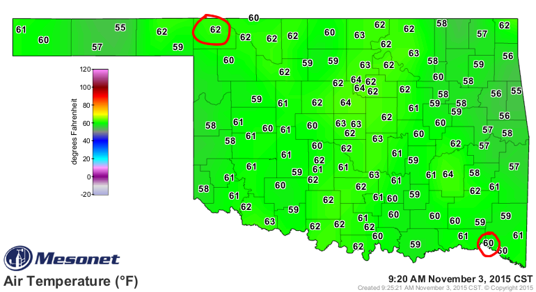
the Lindley Research and Demonstration Farm. You can see the site reports
observations right now on our Mesonet maps, seen here circled in far SE OK. I've
also circled Buffalo in far NW OK with an even bigger circle, just because.
Valliant (Mesonet site ID: VALL) is located 5 miles SSW of the actual town at
lat 33.938606 and long -95.114913, and was commissioned on October 14.
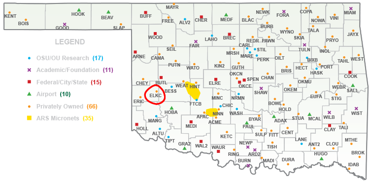
We've been remiss in announcing the new Elk City site as well, Christened back
on June 10. That site (ELKC) is located 5 miles S of Elk City in Beckham
County.
Congratulations to those two towns and welcome to the Mesonet!
Gary McManus
State Climatologist
Oklahoma Mesonet
Oklahoma Climatological Survey
(405) 325-2253
gmcmanus@mesonet.org
November 3 in Mesonet History
| Record | Value | Station | Year |
|---|---|---|---|
| Maximum Temperature | 93°F | MANG | 2005 |
| Minimum Temperature | 10°F | KENT | 2004 |
| Maximum Rainfall | 6.69″ | TISH | 2024 |
Mesonet records begin in 1994.
Search by Date
If you're a bit off, don't worry, because just like horseshoes, “almost” counts on the Ticker website!