Ticker for November 2, 2015
MESONET TICKER ... MESONET TICKER ... MESONET TICKER ... MESONET TICKER ...
November 2, 2015 November 2, 2015 November 2, 2015 November 2, 2015
It ain't done raining yet
Ignore the clouds on the ground this morning. They'll go away soon enough, then
you can see the other vehicles screaming your way at 70 mph, separated by a
couple of inches of yellow paint on the ground.
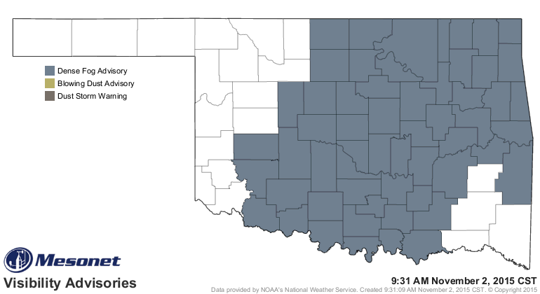
Oh, sorry, Halloween is over. I'll quit trying to scare you. After all, didn't it
rain pretty good across much of the state, just like I said others said it would?
(I'll take credit if it kills me)
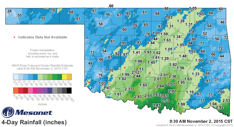
That's a mess of good moisture, and even more impressive when you look at the
last couple of weeks.
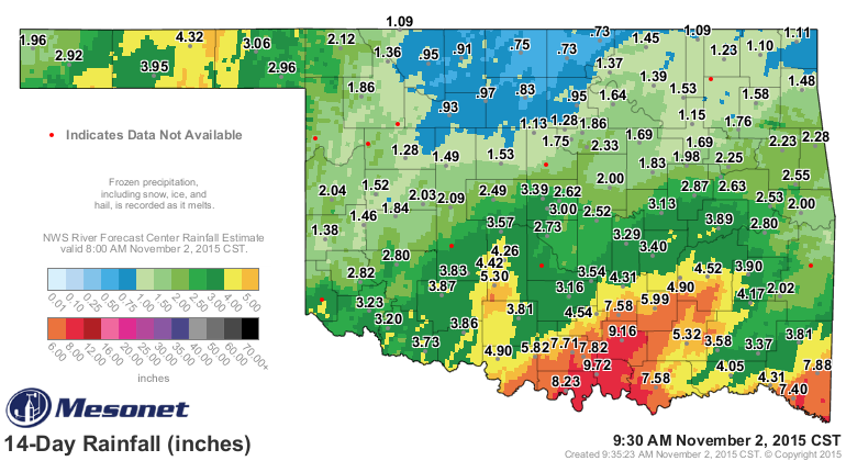
Still worried about that NC OK area where less than an inch has fallen through
both big storms, and then over to the east from there. But we do have a decent
chance for more rain coming up on Wednesday night and Thursday.
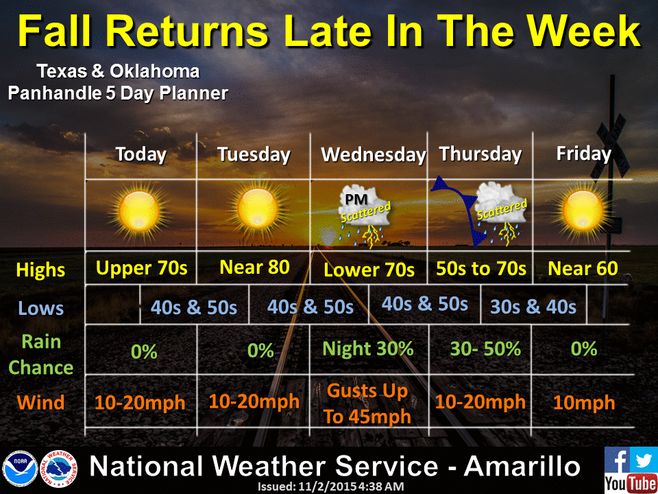
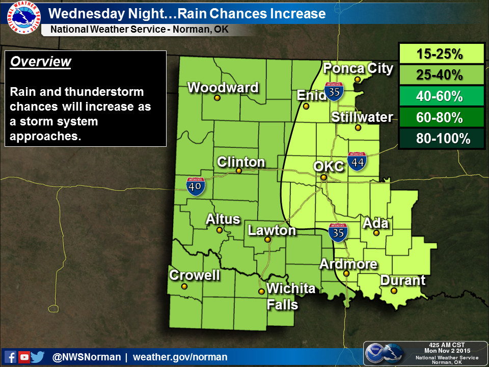
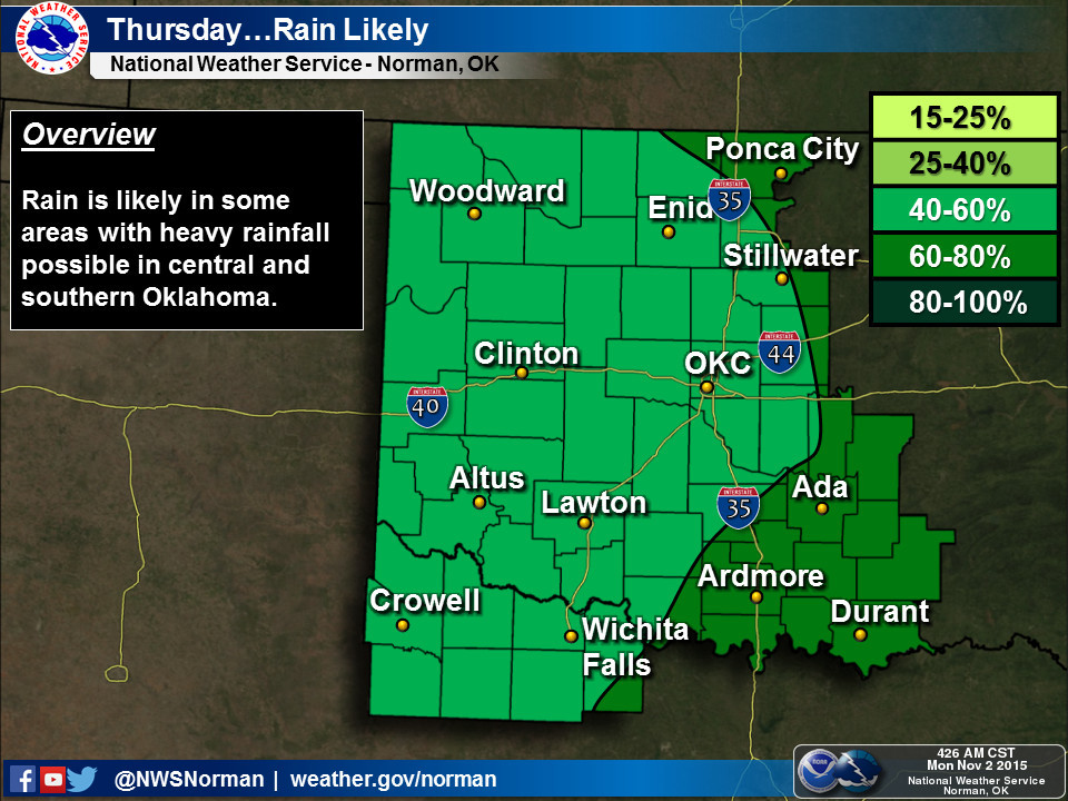
Doesn't look like too much for the northwestern 2/3rds of the state...more of
a SE OK event again.
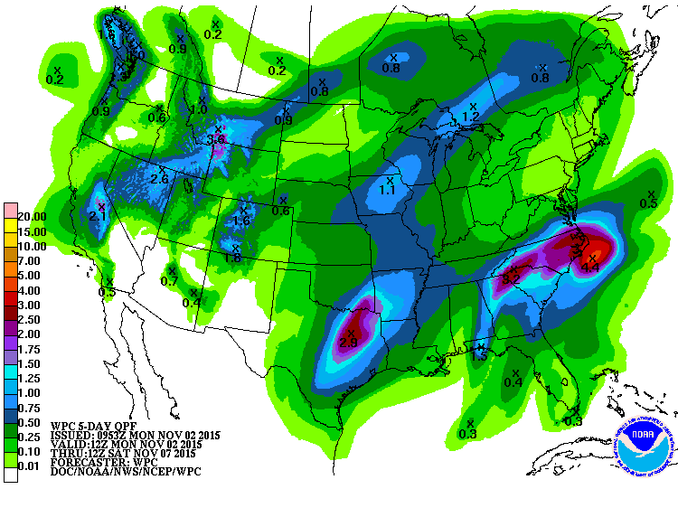
Fear not, more rain (or snow or whatever) could be in the offing for later in
the month, if not next week. The 3-4 week outlooks from the CPC show increased
odds of above normal precip but nothing too exciting for temperatures. We still
don't see any hints of a bit arctic high moving down and giving us a taste of
winter just yet. These patterns can change pretty quickly, but otherwise, these
maps are classic El Nino impact maps, just on a shorter time scale.
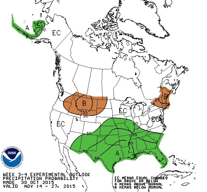
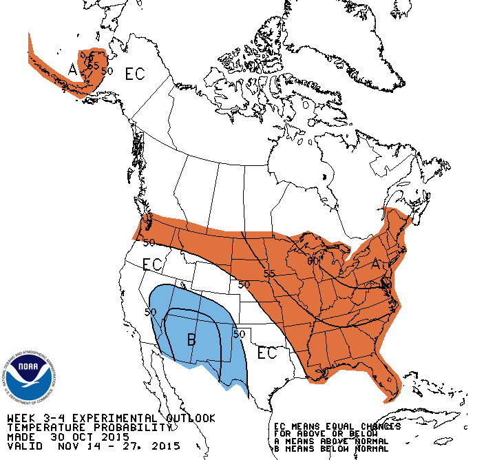
Oh, you wanting that snow? Or a big freeze? Enjoy fall first. It just got here!
Gary McManus
State Climatologist
Oklahoma Mesonet
Oklahoma Climatological Survey
(405) 325-2253
gmcmanus@mesonet.org
November 2 in Mesonet History
| Record | Value | Station | Year |
|---|---|---|---|
| Maximum Temperature | 93°F | BURN | 2017 |
| Minimum Temperature | 15°F | KENT | 2004 |
| Maximum Rainfall | 4.12″ | HOLL | 2024 |
Mesonet records begin in 1994.
Search by Date
If you're a bit off, don't worry, because just like horseshoes, “almost” counts on the Ticker website!