Ticker for October 22, 2015
MESONET TICKER ... MESONET TICKER ... MESONET TICKER ... MESONET TICKER ...
October 22, 2015 October 22, 2015 October 22, 2015 October 22, 2015
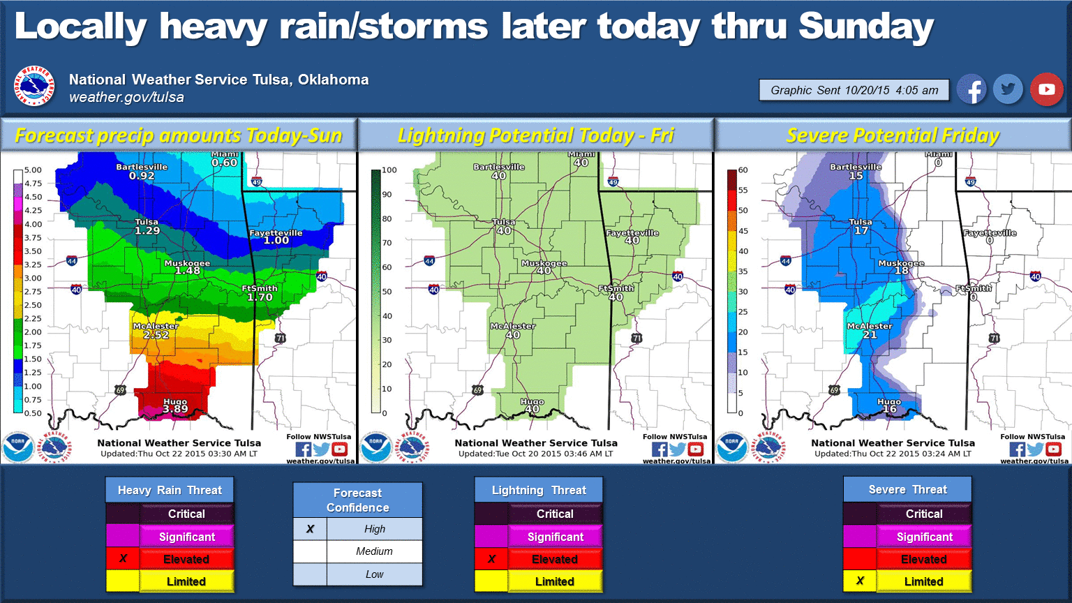
Well, the Panhandle is submerged...
How many times has that statement ever been uttered? Well, check out the rainfall
map and you'll see why I said it!
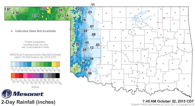
Wowwwwwwww! I'll bet even the Panhandle folks are throwing up the muddy, brown
flag right now. And it's all headed east. As some meteorologists like to say,
there's a "wall of water" about to pass through the state.
The forecast rainfall totals could exceed 5 inches in some areas across southern
Oklahoma, and maybe outside there as well.
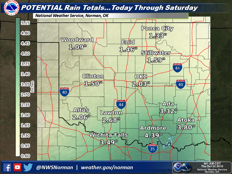
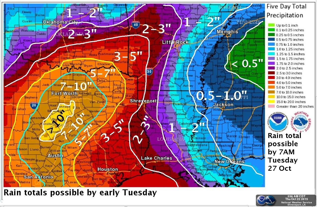
The WPC's totals appear to be a bit high (which we were hoping was the case for
S OK to limit flooding).
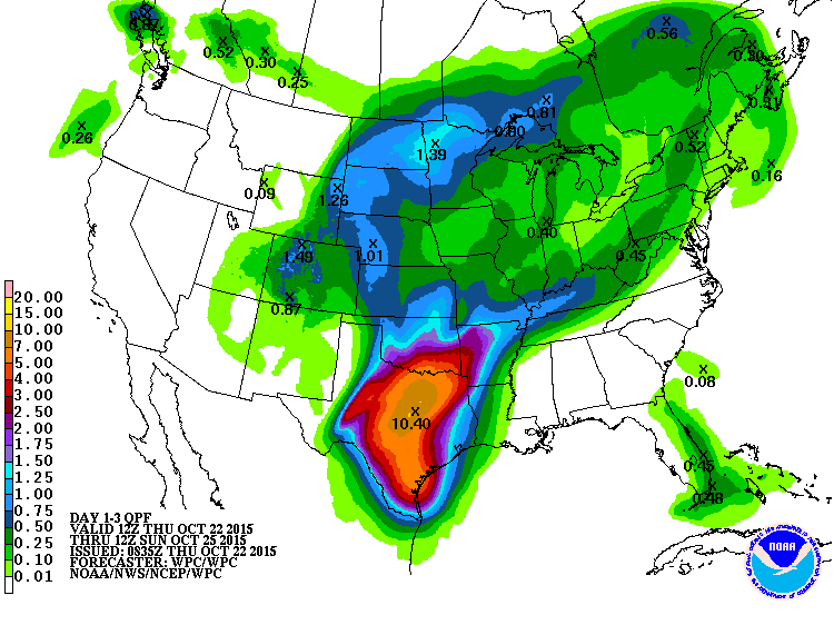
That forecast through Sunday morning shows as much as 7 inches of rain across
far southern Oklahoma, which would certainly be a drought eraser, but also a
flash flood producer. Those WPC forecasts should be taken with a grain of salt
when it shows it widespread like that, and the Dallas-Ft. Worth NWS office has
a nice graphic showing us why.
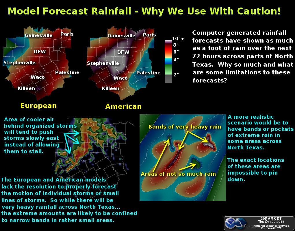
"One area that gets a lot of attention is forecast rainfall amounts
from the computer models. With the last few runs... the models
have shown as much as a foot of rain across the region. While some
areas may indeed receive extreme rainfall amounts...it is unlikely
that this much rain would fall over such a large area. Extreme rain
amounts are usually confined to narrow bands or pockets within an
overall larger area of rain. These bands are nearly impossible to
precisely forecast...even an hour out from developing. Models such
as the European and American are great for forecasting large weather
patterns...but they lack the resolution to properly forecast individual
storms or small lines of storms. Since extreme rains usually occur
in narrow bands...these are usually not well forecast by the computer
models. It also explains why some areas get dumped on and others...just
a few miles away miss out on the heavier rains."
The San Antonio NWS office also has a nice graphic explaining the setup of
this heavy rain event. You might have caught this on the Mesonet's Facebook
page (what, you haven't liked our page yet?? tsk tsk), but we thought it was
worth showing again. All sorts of players here, including remnants of a
Hurricane (Patricia), although that's more of an impact for their area.

Is this southerly track storm influenced by El Nino? Impossible to say (for me,
maybe not for smarter folks). Is it taking more of a southerly track due to El
Nino, and so we're missing out on the extreme rainfall (fingers crossed) amounts?
Again, tough to say. We do know that we're gobsmacked by moisture from the
Gulf, and there are tons of water waiting to fall from the sky.

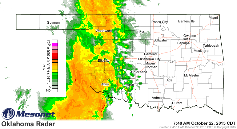
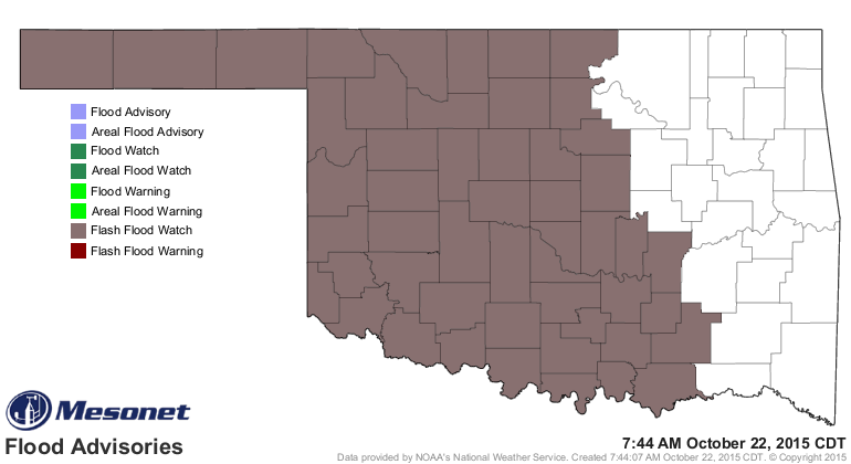
SO there is a flash flood watch for the western two-thirds of the state, but
it does appear that the heaviest rain amounts will be confined to Texas (but
that is not certain).
After this, a bit of a cool down and a slighter chance of rain early next week.
Cool and dry for awhile. After that...well, let's worry about this current
situation first.
Oh yeah, here's the new Drought Monitor map, surely a ghost of its former self
even as it was released.

Gary McManus
State Climatologist
Oklahoma Mesonet
Oklahoma Climatological Survey
(405) 325-2253
gmcmanus@mesonet.org
October 22 in Mesonet History
| Record | Value | Station | Year |
|---|---|---|---|
| Maximum Temperature | 96°F | GRA2 | 2022 |
| Minimum Temperature | 22°F | KENT | 2019 |
| Maximum Rainfall | 5.45 inches | TISH | 2015 |
Mesonet records begin in 1994.
Search by Date
If you're a bit off, don't worry, because just like horseshoes, “almost” counts on the Ticker website!