Ticker for September 17, 2015
MESONET TICKER ... MESONET TICKER ... MESONET TICKER ... MESONET TICKER ...
September 17, 2015 September 17, 2015 September 17, 2015 September 17, 2015
Drought, rain, fall, winter...it's all here!

Okay, we've been talking about this for almost 2 months now as the deficits have
mounted across southern up into western Oklahoma, and now is the time to pay the
piper. First, check out the rainfall (and lack thereof) since July 28. And keep
in mind that through this time, a large area of high pressure had continued to
keep pressure on the moisture resources of the state.
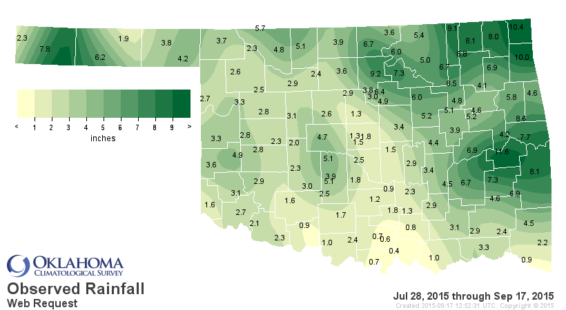
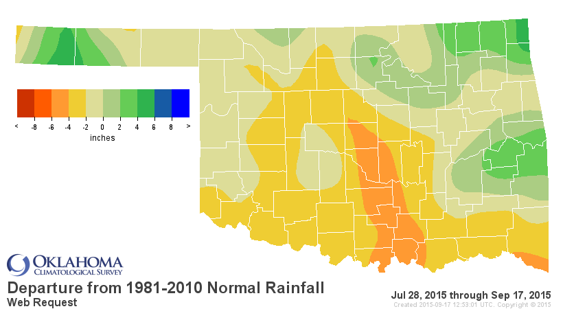
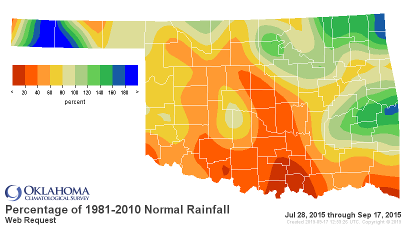
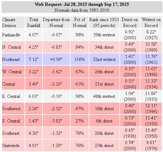
These deficits have taken their toll on the state's soil moisture, both up high
and down low, leaving many folks wanting to plant wheat and canola with scant
moisture to work with. Click on any map you want, but in general, just notice all
the browns across the SW half of the state, spreading all the way over to SE OK.
http://www.mesonet.org/index.php/weather/category/soil_moisture
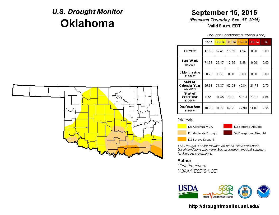
And that soil moisture condition (along with the growing deficits) is one of the
biggest reasons why we expanded the D0 (Abnormally Dry) condition across much
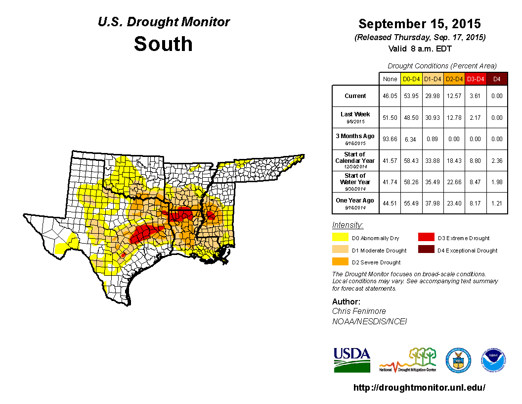
of central and north central Oklahoma. And that is all part of a larger flash
drought striking the ArkLaTex region and points farther south.
Now don't be too alarmed just yet, and here's why.
1. The D0 designation IS NOT DROUGHT! In this case, it is a precursor to drought.
So please don't go report that 52.41% of the state is in drought. In actuality,
15.55% of the state is indeed in drought (D1 or D2 at this point, Moderate to
Severe). Look for the light tan and orange colors (we see you down there, Harmon
and Jackson counties!).
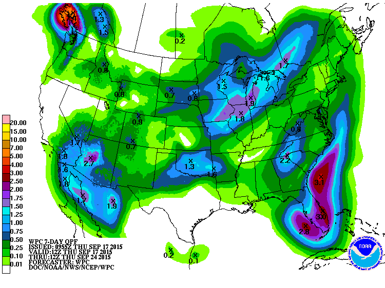
C. It's going to rain this weekend into early next week, starting tomorrow.
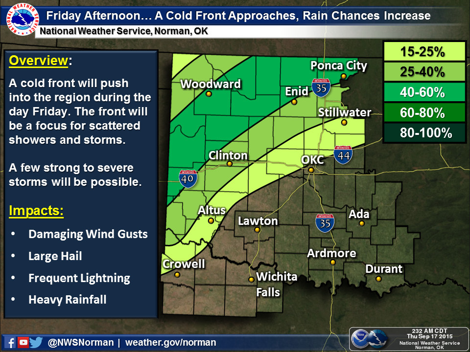
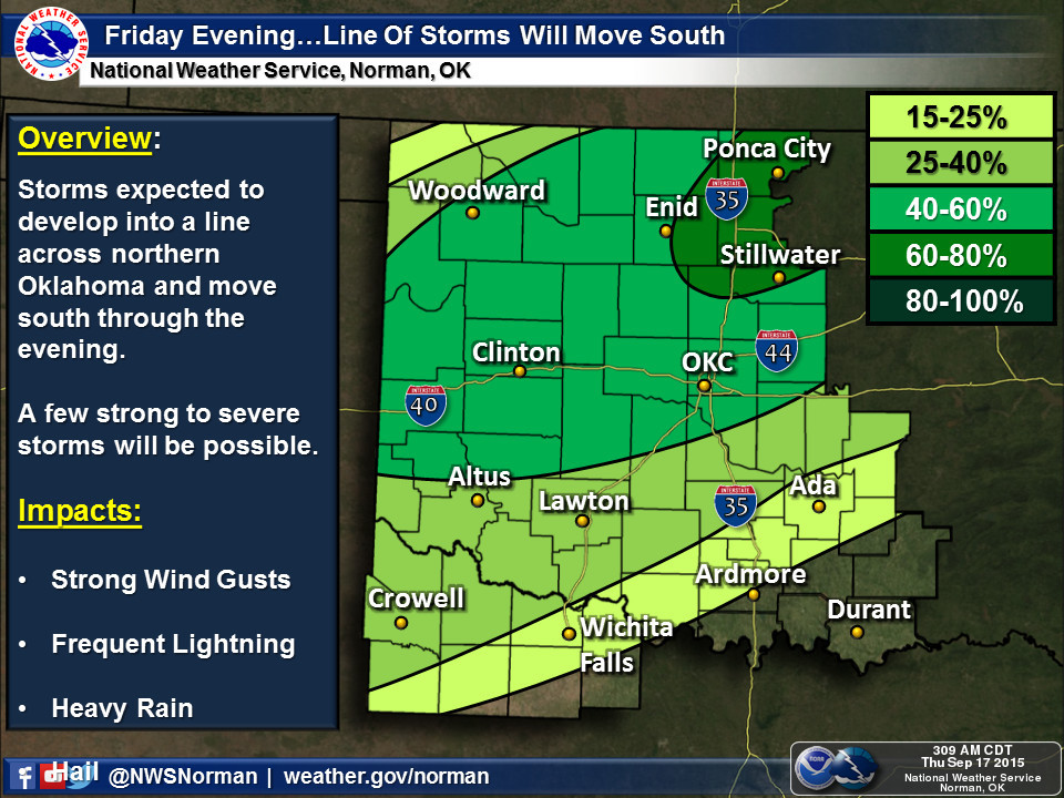
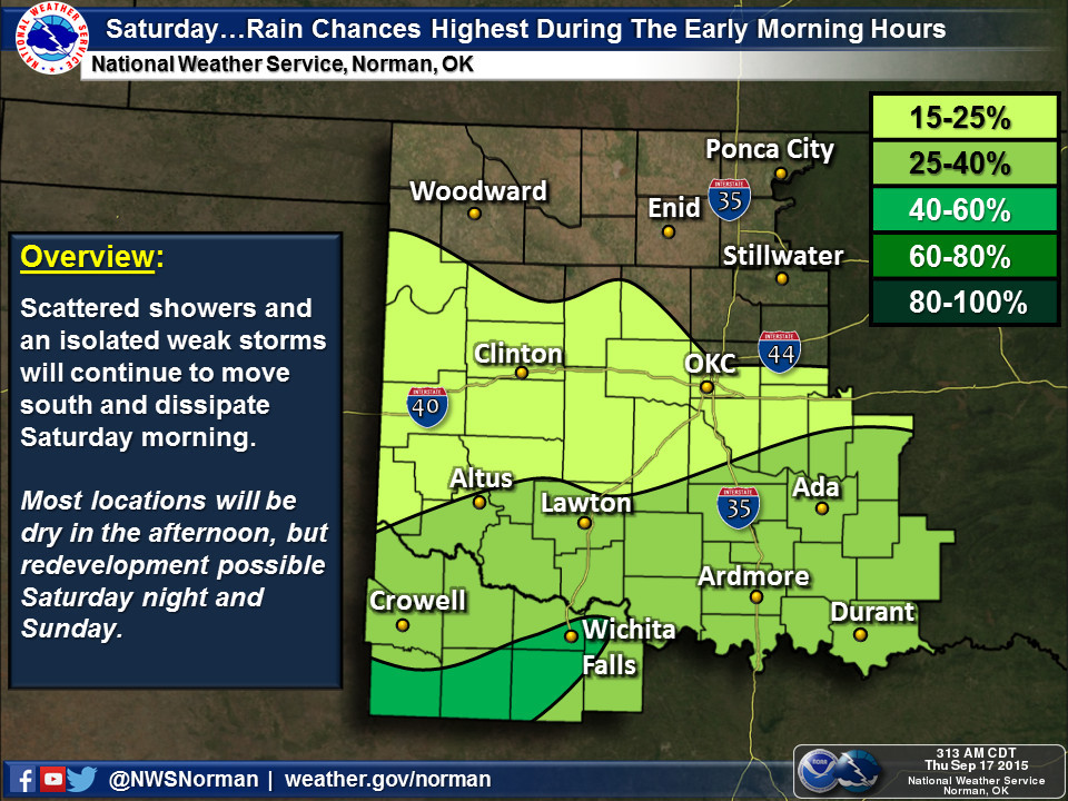
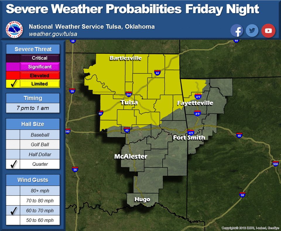
VI. It's going to cool down! The front that's coming in late tonight and marching
across the state tomorrow will bring some much needed relief on the thermometer.
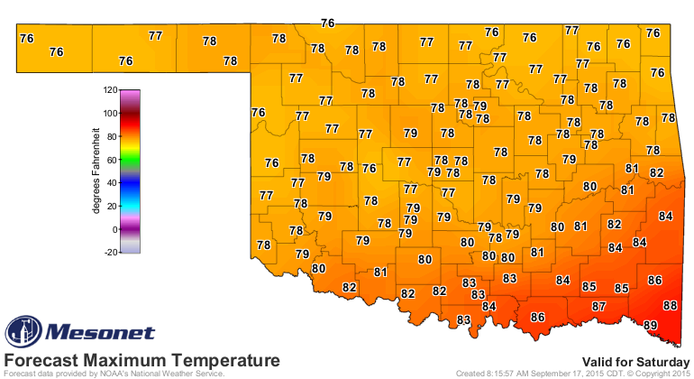
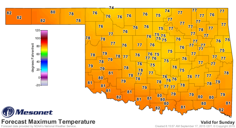
That should take some of the pressure off of our soil moisture and also lakes
and reservoirs (and farm ponds).
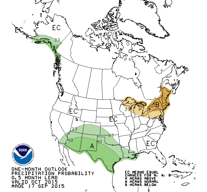
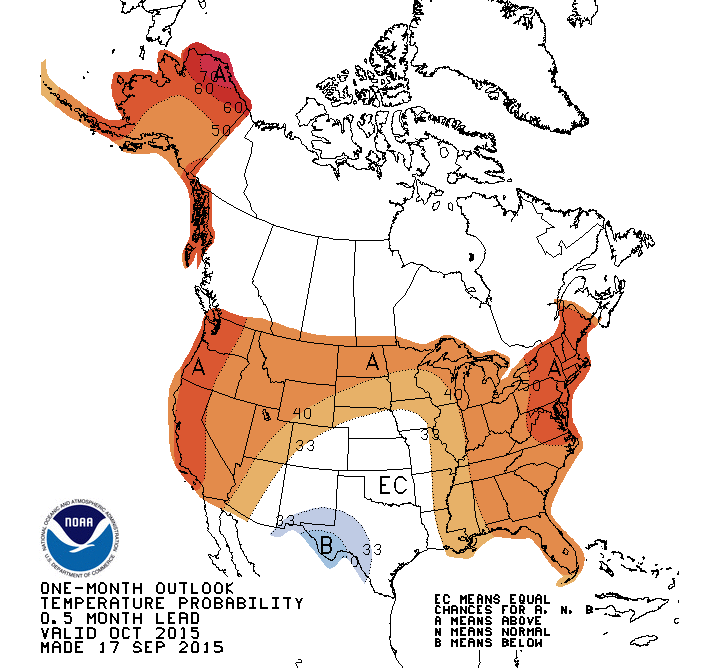
Now how about a look into the next few months? The latest CPC monthly and
seasonal outlooks are out and they continue to reflect that classic El Nino
weather pattern across the Southern Tier of the United States.
CPC October Outlooks
CPC October-December 3-month Outlooks
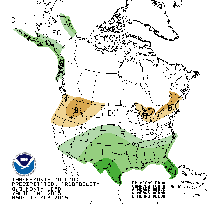
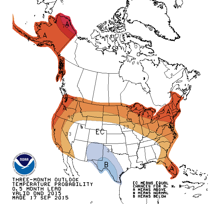
For the newcomers out there, let's remember what we're looking at there. These
are MAPS OF PROBABILITIES, not anomalies. So A darker shade of green means a
greater probability of above normal precipitation, not an amount much greater
than normal (darker green) vs. just a little above normal (lighter green). Same
for temps. And the "EC" white area that covers Oklahoma on the temperature
probability maps does not mean they expect normal conditions! It's means there
is an EQUAL CHANCE of above-, below- and near-normal conditions. In other words,
the lack of a signal to tilt the odds to any of those three categories.
We can keep going out there and check out the later months, which still reflect
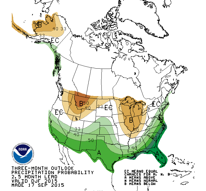
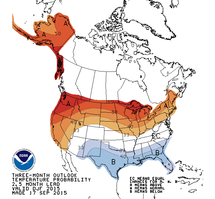
that classic El Nino signal. Take the winter period, for instance, where we
still see increased odds of above normal precip for Oklahoma, but especially for
the southern fringe of the U.S. where the El Nino teleconnection impacts are
usually more important.
CPC Winter Outlooks
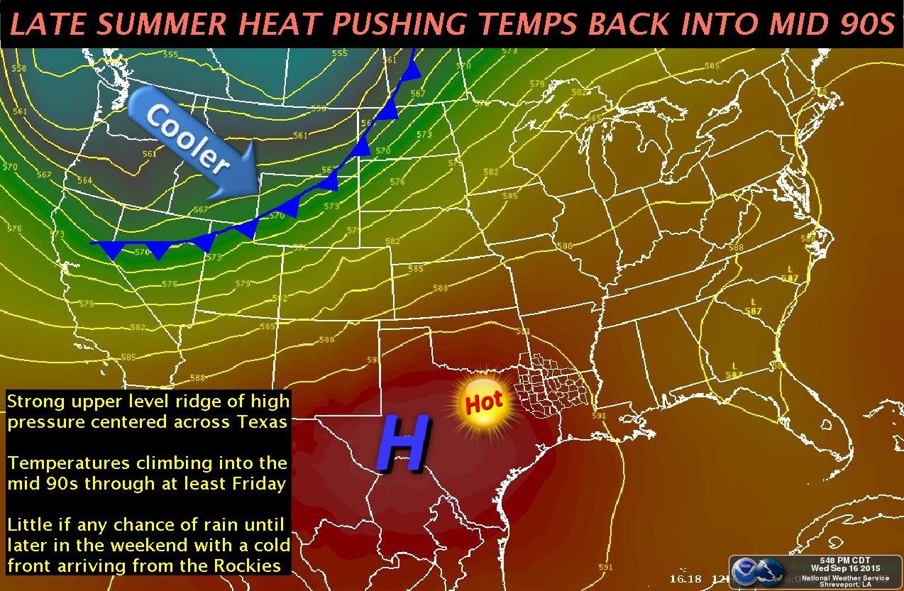
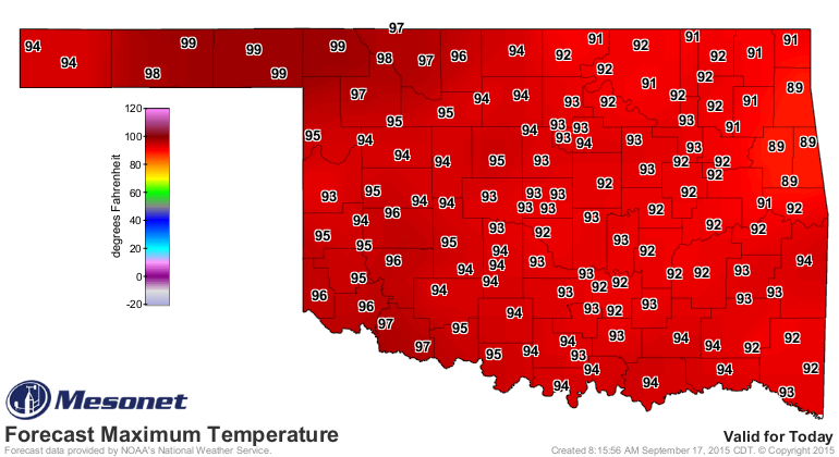
Before any of that, before the rain and the cool front and whatnot, it's still
going to be hot for a couple of days, as indicated by this graphic from the
Shreveport NWS office, which covers McCurtain County.
And the forecast highs.

And before you think fall has, uh, fallen, for good, check out the CPC
temperature outlooks for late next week and beyond.
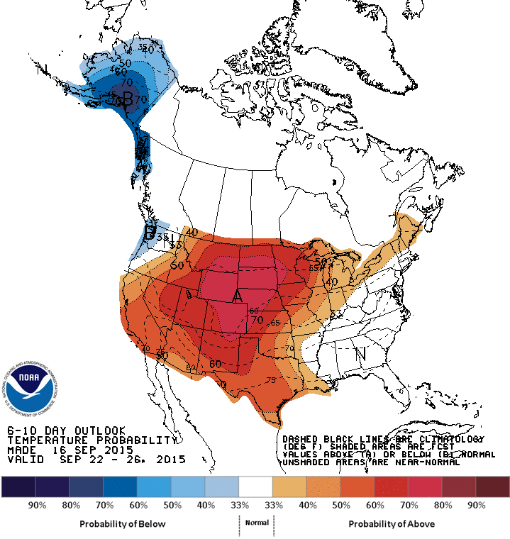
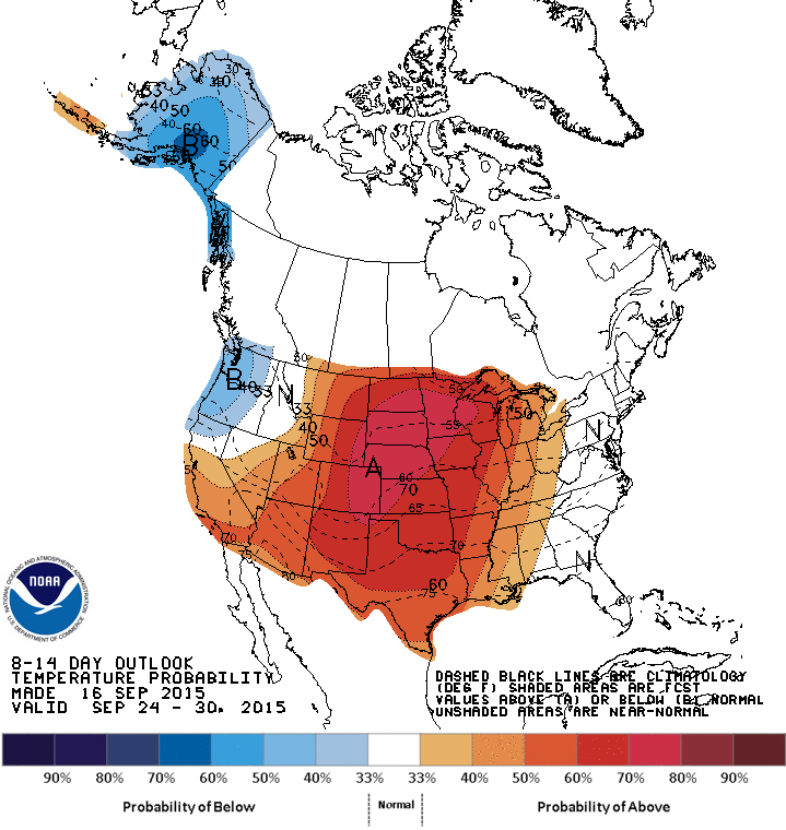
Summer ain't dead until Mother Nature says it's dead.
But, at least it's in critical condition. Fall is inevitable. Unfortunately,
so is winter.
Gary McManus
State Climatologist
Oklahoma Mesonet
Oklahoma Climatological Survey
(405) 325-2253
gmcmanus@mesonet.org
September 17 in Mesonet History
| Record | Value | Station | Year |
|---|---|---|---|
| Maximum Temperature | 105°F | GRAN | 1997 |
| Minimum Temperature | 37°F | BOIS | 2006 |
| Maximum Rainfall | 4.15″ | APAC | 2006 |
Mesonet records begin in 1994.
Search by Date
If you're a bit off, don't worry, because just like horseshoes, “almost” counts on the Ticker website!