Ticker for September 15, 2015
MESONET TICKER ... MESONET TICKER ... MESONET TICKER ... MESONET TICKER ...
September 15, 2015 September 15, 2015 September 15, 2015 September 15, 2015
Fire, FIRE!
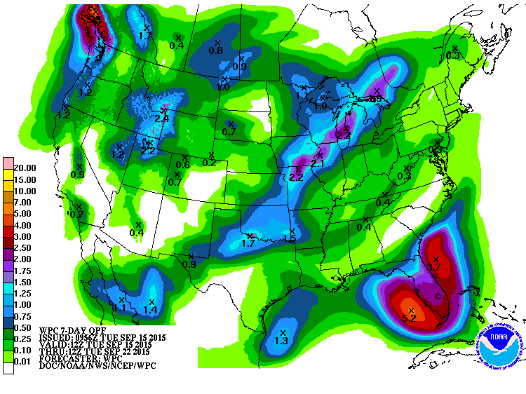
We're mere days from another good chance of rain, and the inevitability of another
fall-type cold front barreling through the state. The NWS offices are all a-Twitter
(sorry, you'll have to look up their Twitter accounts), so let's share in the
excitement, shall we?
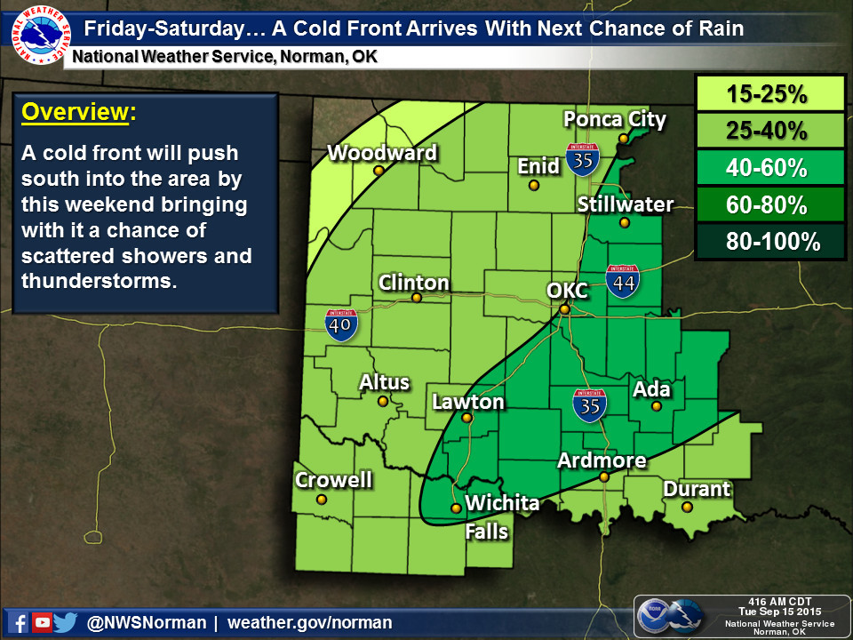
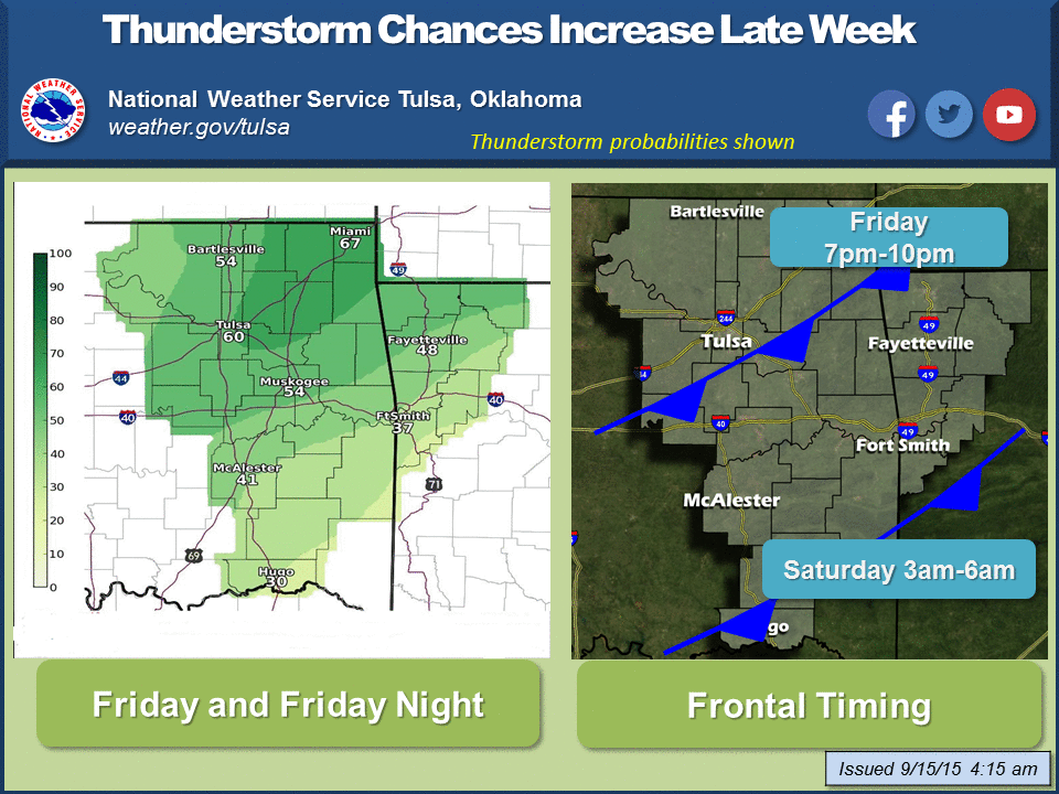
But until then (and depending on where the storms hit, after as well), we have
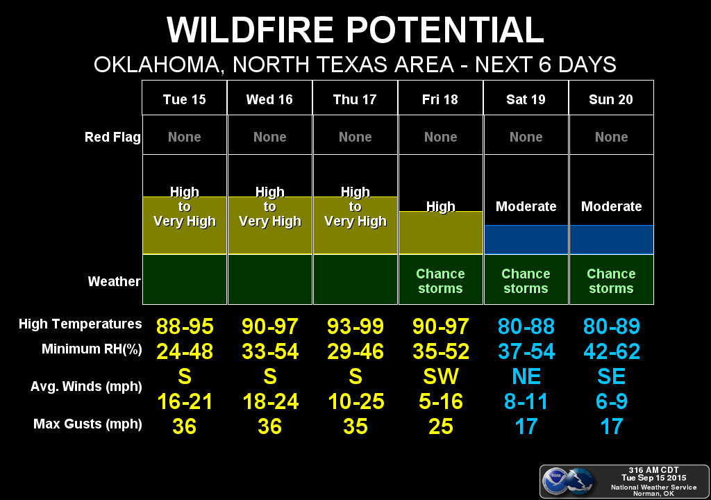
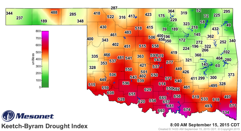
a few problems. One is fire danger. Yesterday saw a lot of small fires across
parts of central and western Oklahoma. Actually, from what I'm hearing, NW OK
has been having a bit of a fire problem for a while now. But anytime you have
this type of "drying out" along with wind and low RHs (and heat!), you're gonna
run into problems. And the Norman NWS office is showing high fire danger through
Friday. At least until the cooler weather and moisture arrives.
And the Mesonet's OK-FIRE KBDI (Keetch-Byram Drought Index) map gives us a good
indication of those higher fire danger conditions. The Oklahoma Keetch-Byram
Drought Index illustrates the probability of wildfires based on drought and
soil moisture conditions throughout Oklahoma for the current day. It ranges
from 0 (no drought) to 800 (extreme drought).
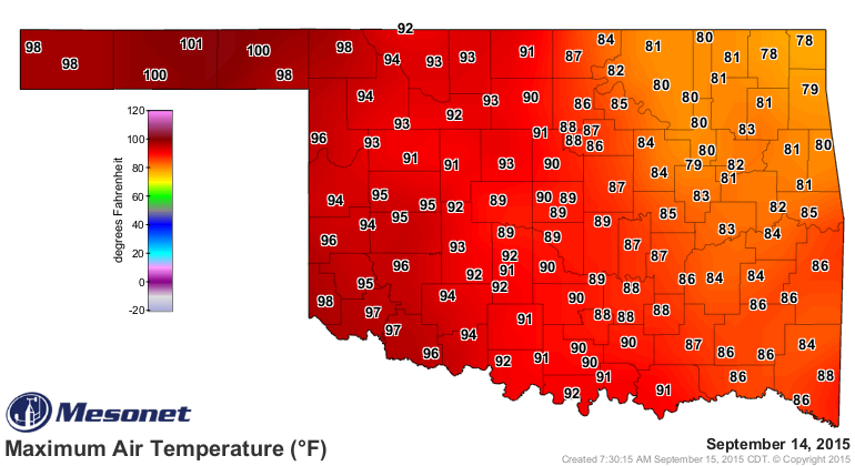
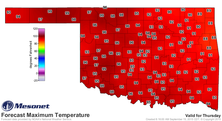
Now for the heat...yesterday saw the western half of the state bake. In fact,
we hit triple-digits in the Panhandle.
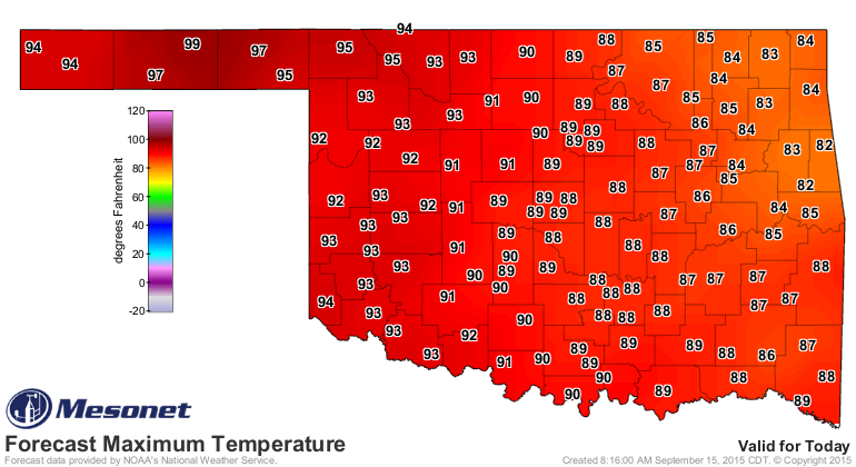
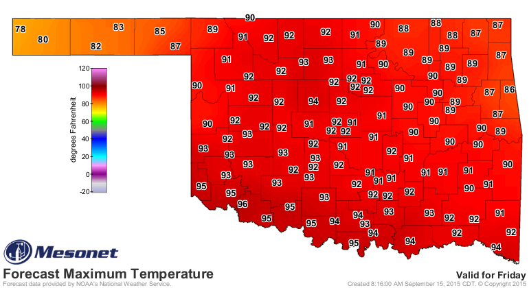
And the heat will remain with us through Friday (notice the front impacting
the NW on the Friday highs map).
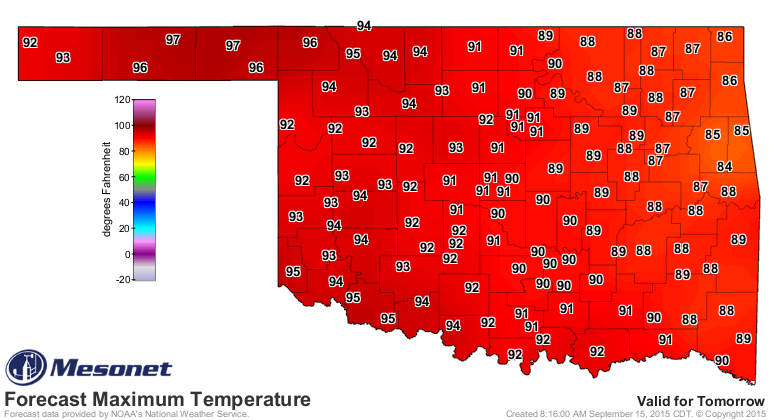
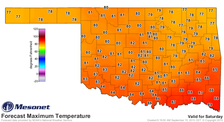
And then we get FROPA (FROntal PAssage) and a nice Saturday.
Oh yes, last but not least, the drying out! If you've received rain of any
significant over the last two weeks, consider yourself lucky. And even then,
you might still be drying out a bit. Check out the rainfall maps since the
rain went away (for many of you) way back on July 28th.
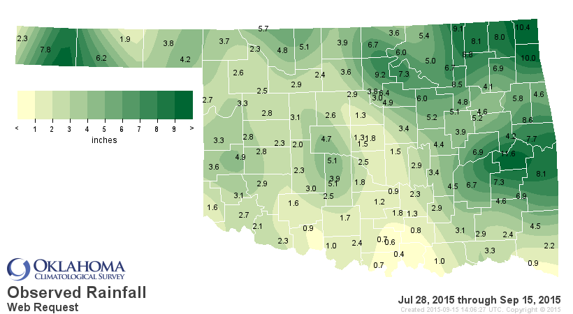
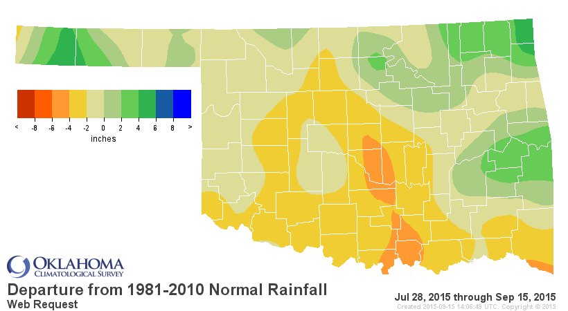
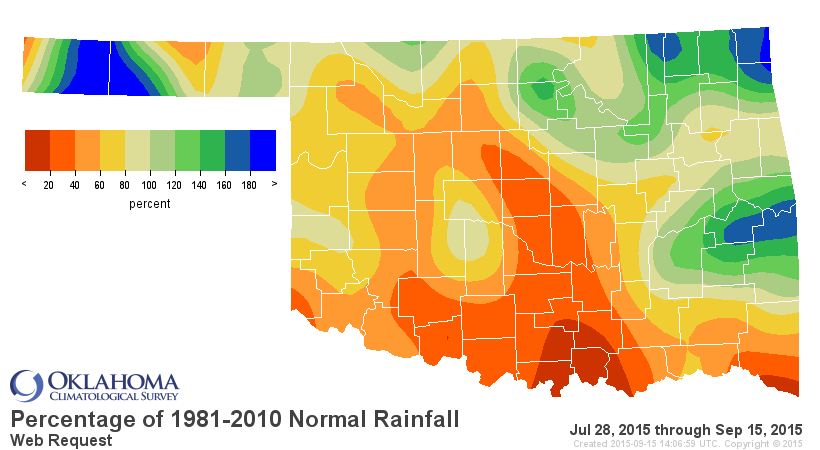
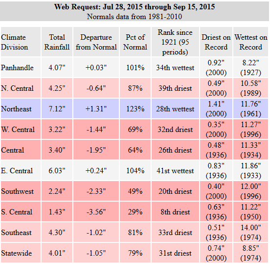
That's a big dry blob across south central into central Oklahoma.
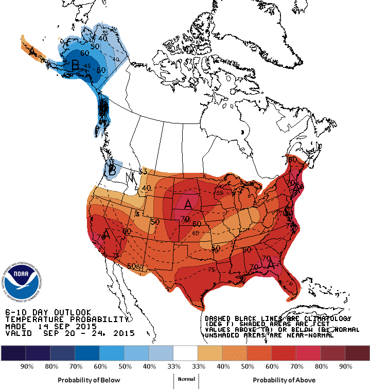
For now, we have the rain this weekend to look forward to, at least. As far
as summer being over with this next front? Don't count your 70s and 80s before
they're hatched.
Gary McManus
State Climatologist
Oklahoma Mesonet
Oklahoma Climatological Survey
(405) 325-2253
gmcmanus@mesonet.org
September 15 in Mesonet History
| Record | Value | Station | Year |
|---|---|---|---|
| Maximum Temperature | 103°F | FREE | 2010 |
| Minimum Temperature | 37°F | BOIS | 2012 |
| Maximum Rainfall | 5.53″ | SULP | 2001 |
Mesonet records begin in 1994.
Search by Date
If you're a bit off, don't worry, because just like horseshoes, “almost” counts on the Ticker website!