Ticker for September 21, 2015
MESONET TICKER ... MESONET TICKER ... MESONET TICKER ... MESONET TICKER ...
September 21, 2015 September 21, 2015 September 21, 2015 September 21, 2015
Rain rain glorious rain
Friday's rain was kind of a dud (unless you were up Creek County without a paddle,
where they saw over 4 inches of rain), so I was a bit worried about Sunday's
version living up to the hype that I supplied on Thursday. Well, how do you like
me now? Don't answer that. But I'm betting you do like this.
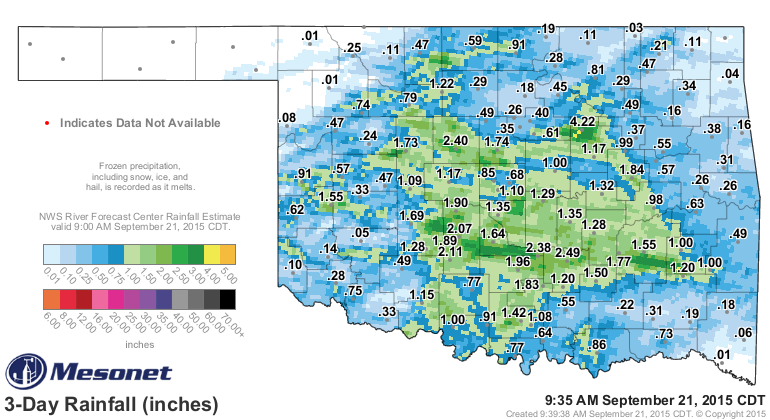
A goodly amount of rain across parts the middle of the state, and in areas that
saw dry conditions continuing to multiply over the last month or two, so maybe
some relief there.
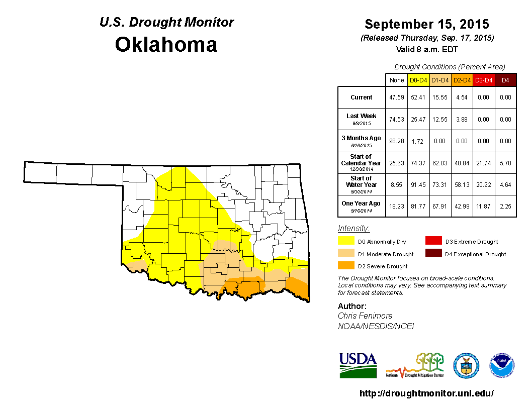
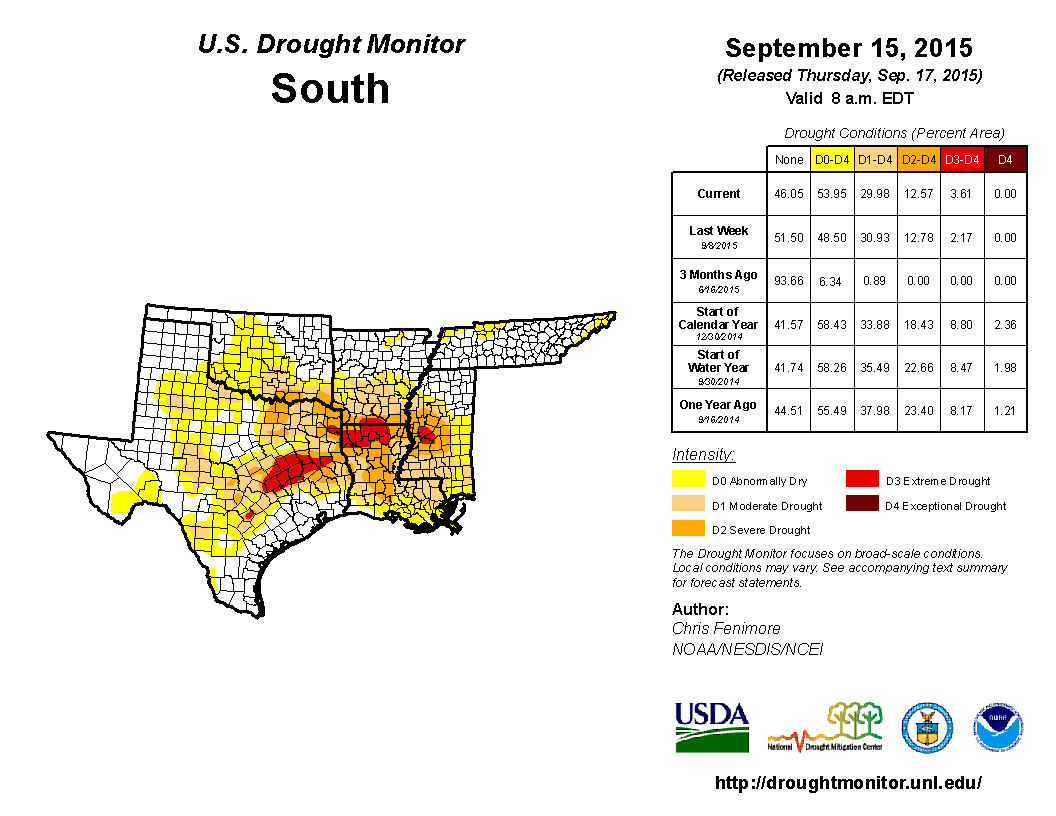
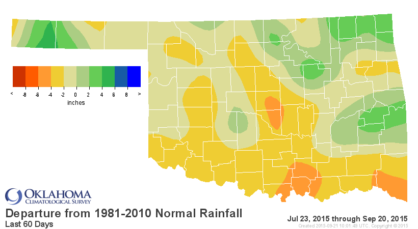
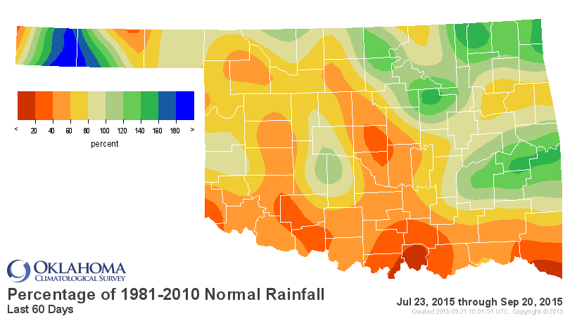
Unfortunately, not nearly enough down across far SC and SE OK, which are in full
flash drought mode, along with the rest of the ArkLaTex region.
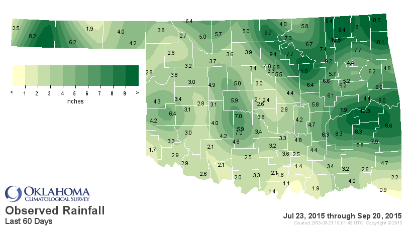
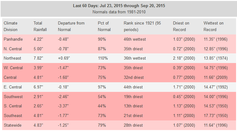
But we're still looking at deficits across that area as well as the western half
of the state over the last 30-60 days. We've just experienced the 28th driest
July 23-Sept. 20 (last 60 days) since at least 1921 statewide. Thirteenth
driest for SC OK.
Our friends from the Shreveport NWS office remind us that Idabel has received
1.82 inches of rain since June 27, about 20% of normal for that time frame. So
drought marches on in some areas, and possibly relieved in other areas. The
7-day moisture forecast does show a good system from the Desert Southwest up
through the Panhandle into the Northern Plains, but the main body of the state
going largely ignored by that system.
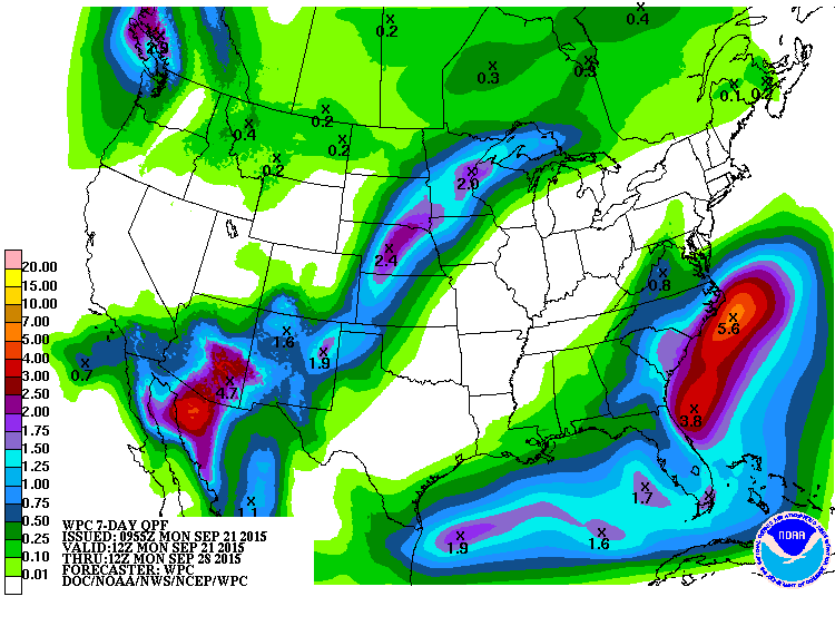
So a slight chance of storms coming up later this week for most of the state,
a good chance in the Panhandle, and summer tries to make its return.
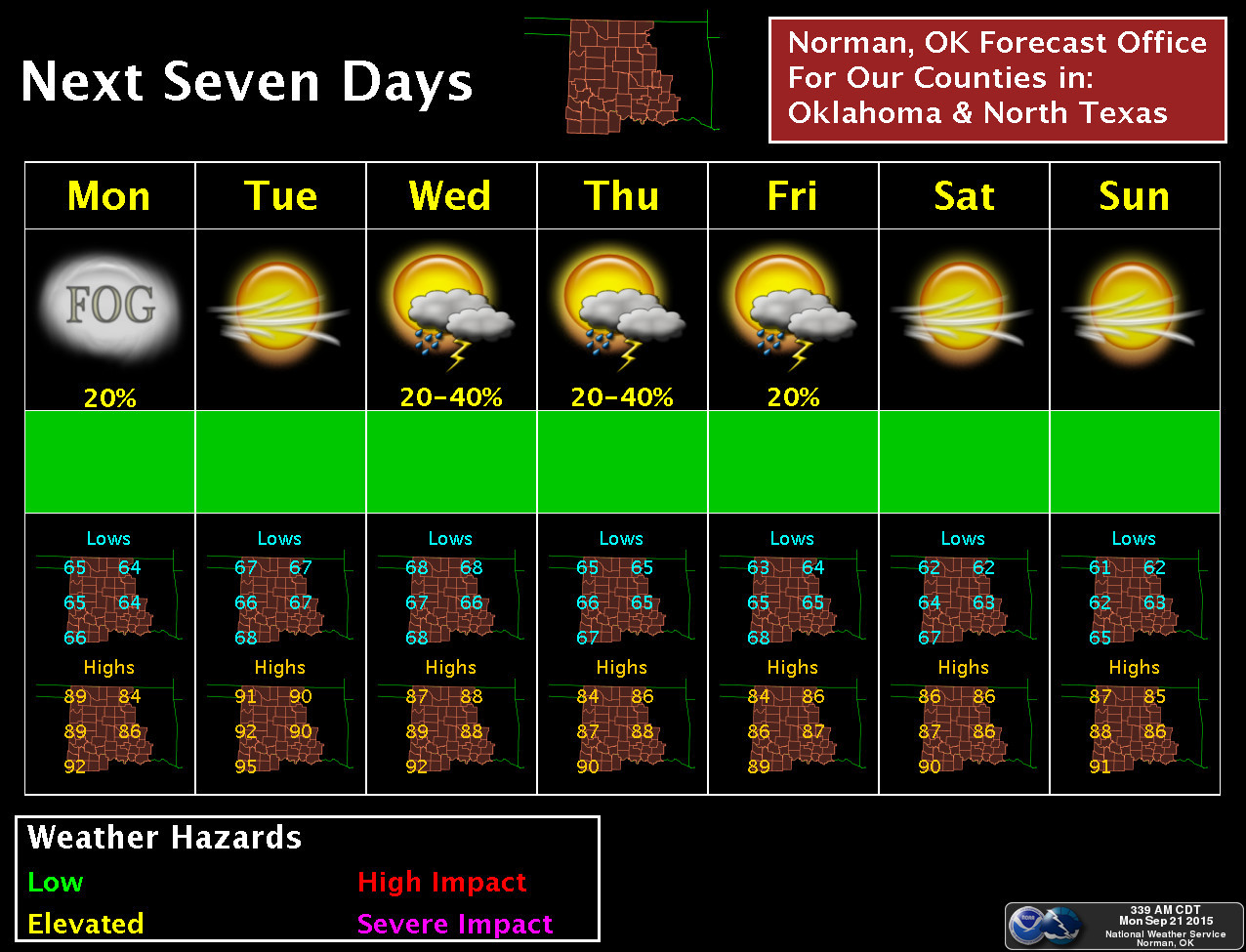
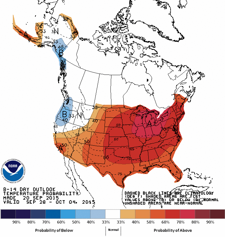
In doing so, flash drought will make a leap in some areas. But at least some
folks found relief. As for summer, I wouldn't read its obituary just yet.
Gary McManus
State Climatologist
Oklahoma Mesonet
Oklahoma Climatological Survey
(405) 325-2253
gmcmanus@mesonet.org
September 21 in Mesonet History
| Record | Value | Station | Year |
|---|---|---|---|
| Maximum Temperature | 103°F | WALT | 1998 |
| Minimum Temperature | 38°F | NOWA | 2000 |
| Maximum Rainfall | 14.20″ | FITT | 2018 |
Mesonet records begin in 1994.
Search by Date
If you're a bit off, don't worry, because just like horseshoes, “almost” counts on the Ticker website!