Ticker for September 10, 2015
MESONET TICKER ... MESONET TICKER ... MESONET TICKER ... MESONET TICKER ...
September 10, 2015 September 10, 2015 September 10, 2015 September 10, 2015
Drought is here to stay...for now
Well, we came close with our rains this week
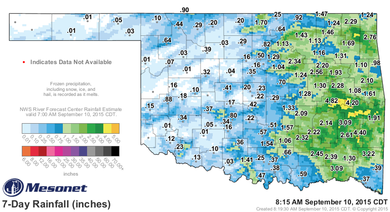
and some key areas received some decent moisture. Most of that water fell after
the 7am cutoff for consideration in the new Drought Monitor map. The changes from
this rain will show up next week. Until then, this is what we have for the latest
map.
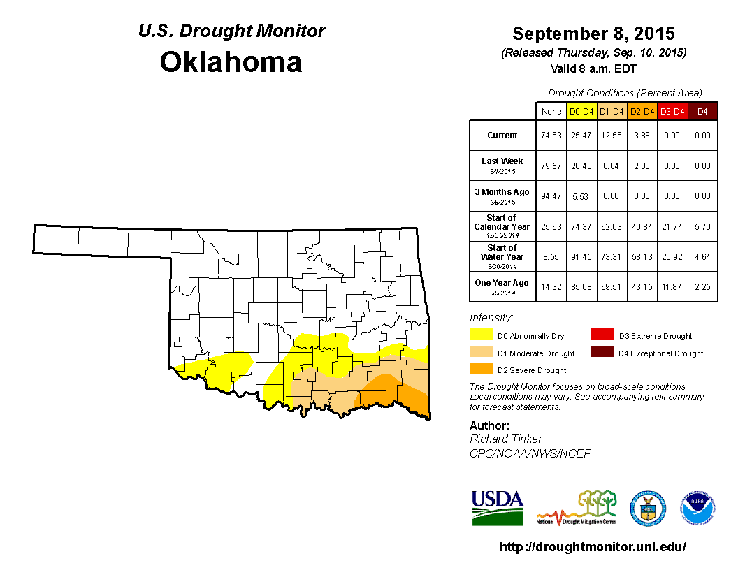
You can see the westward progression of the drought area as the deficits continue
to mount in that direction. And remember, this is mere months away from that
part of the state (SC Oklahoma) receiving 40+ inches of rain in little over
three months!
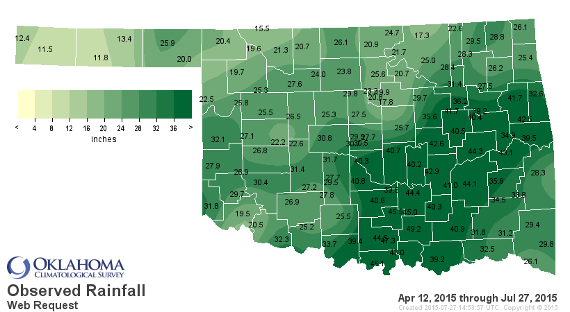
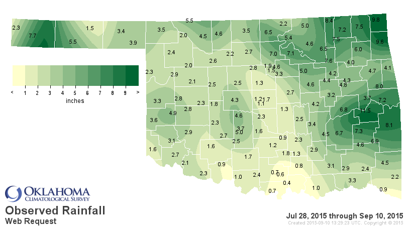
The deficits are real, however. Burneyville, for instance, had 46.1 inches from
April 12-July 27, but only 0.7 inches since then.
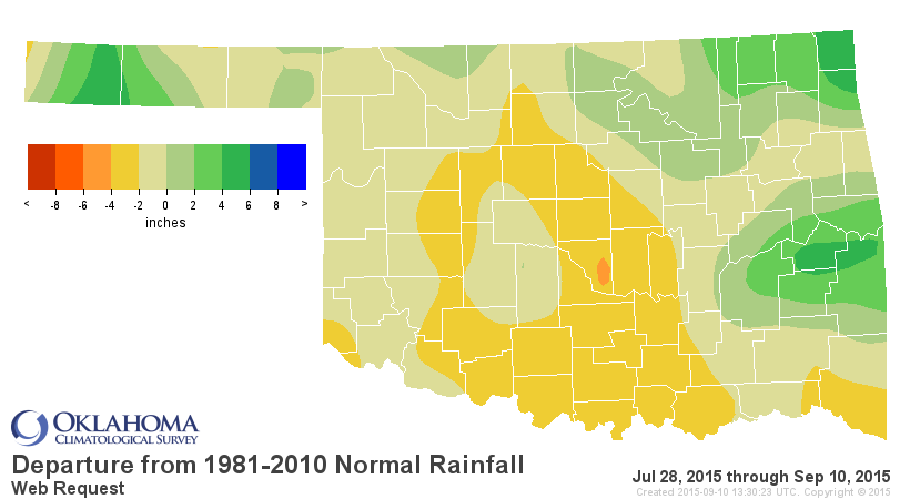
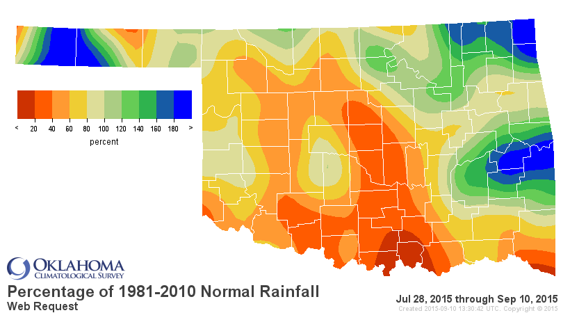
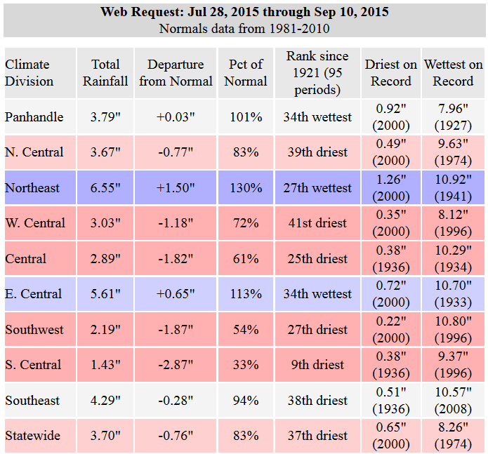
The impacts are real, and they're specta...I mean spreading (almost a Seinfeld
joke there). They show up in the soil moisture
http://www.mesonet.org/index.php/weather/category/soil_moisture
they show up in the vegetative health index satellite maps (in this image, the
reds and oranges signify poor vegetative health)
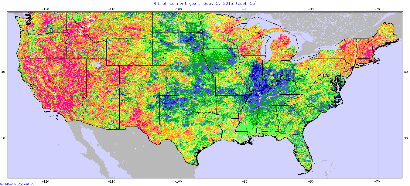
Zounds! Look at the western U.S.! But you can also see the poor VHI of SE OK, as
well as parts of SW OK and other scattered locales. It also shows up in the
various drought indices we use to track, uh, drought. Such as the Mesonet's
KBDI map (Madill at 666???).
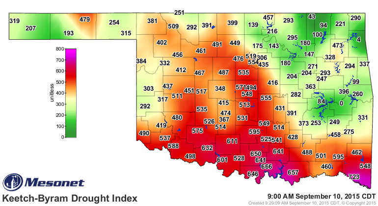
Here's an explanation of its scale: "The Oklahoma Keetch-Byram Drought Index
illustrates the probability of wildfires based on drought and soil moisture
conditions throughout Oklahoma for the current day. It ranges from 0 (no
drought) to 800 (extreme drought)."
And also the 60day Standardized Precipitation Drought Index (SPI)
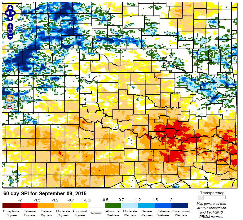
So you can see we're not just looking at rainfall surpluses and deficits. When
building our Drought Monitor map, we look at anything and everything we can.
We've heard a lot from folks in the field as well, telling us of the dryness
in their local areas.
As for the next week, expect a nice cold front tonight which will up the rain
chances a tad and then cool us down for the next few days. Other than that,
back to late summer weather. Don't expect a lot of rain from those storms, but
a bit of severe weather could occur as they move through tonight.
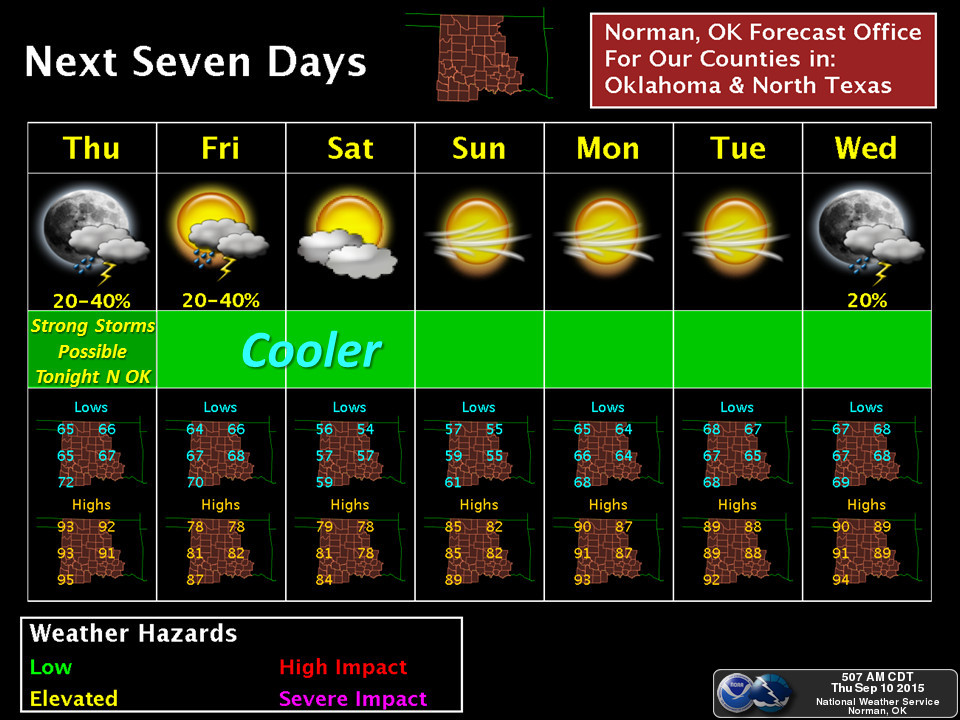
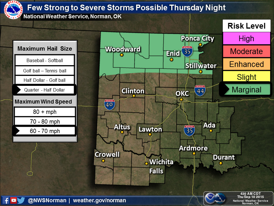
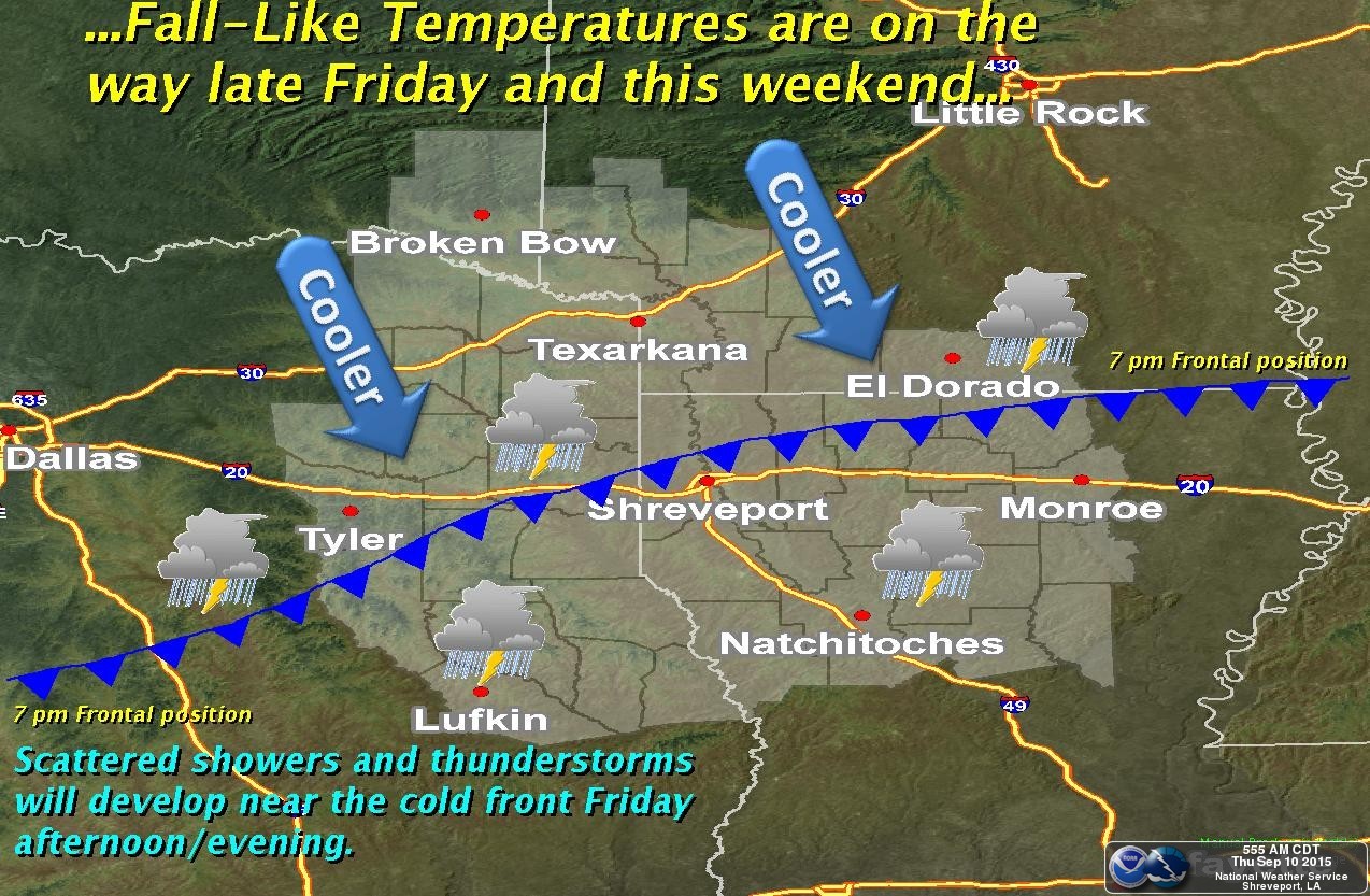
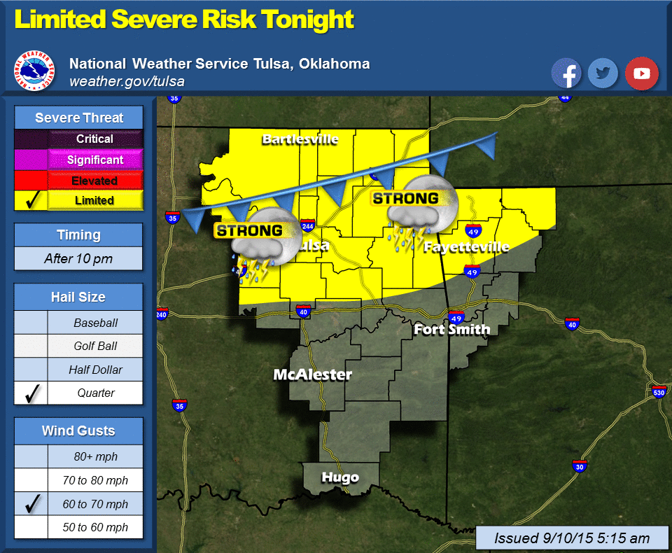
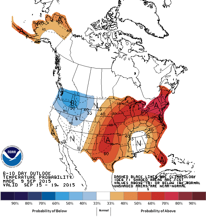
Don't expect a lot of rain from those storms, but a bit of severe weather could
occur as they move through tonight. And as we warned yesterday, summer ain't
dead just yet!
Gary McManus
State Climatologist
Oklahoma Mesonet
Oklahoma Climatological Survey
(405) 325-2253
gmcmanus@mesonet.org
September 10 in Mesonet History
| Record | Value | Station | Year |
|---|---|---|---|
| Maximum Temperature | 106°F | HOLL | 2000 |
| Minimum Temperature | 37°F | KENT | 2020 |
| Maximum Rainfall | 5.70″ | ERIC | 2003 |
Mesonet records begin in 1994.
Search by Date
If you're a bit off, don't worry, because just like horseshoes, “almost” counts on the Ticker website!