Ticker for September 9, 2015
MESONET TICKER ... MESONET TICKER ... MESONET TICKER ... MESONET TICKER ...
September 9, 2015 September 9, 2015 September 9, 2015 September 9, 2015
Big Gulp
As I was driving across western Oklahoma this weekend, a lot of folks were out
plowing preparing to plant wheat (I presume). Now all that worked ground seemed
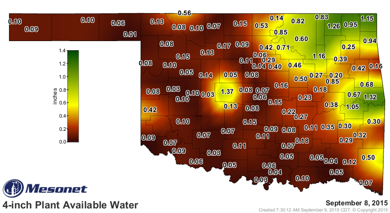
as dry as toast because the dirt was flying. The Mesonet's soil moisture map from
4 inches and above show the drying out of all that dirt pretty well.
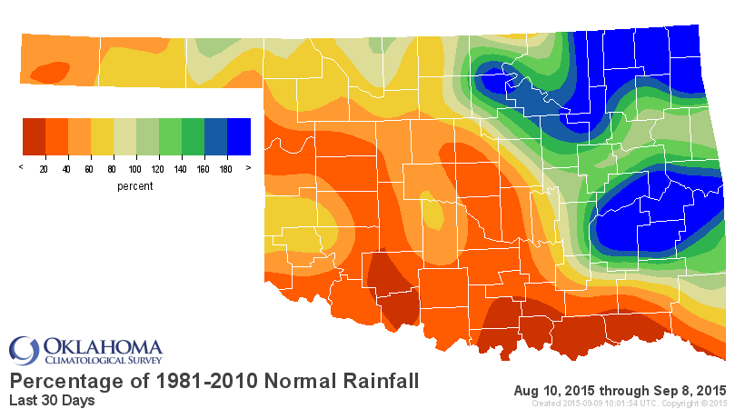
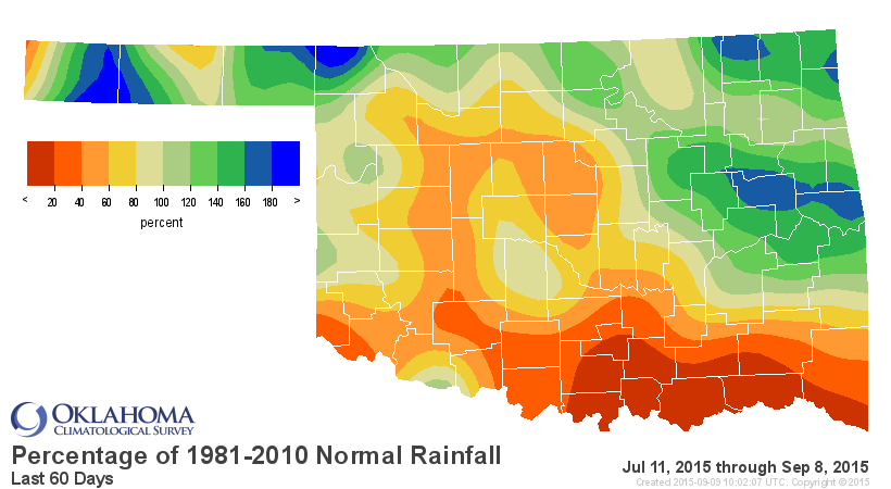
And we've also had that developing flash drought across southern Oklahoma, with
evil intent to spread farther north. The rainfall maps through yesterday show
that as well.
That's why the promised rain was so important. Unfortunately for the west, the
amounts were small. The expected heavier amounts across eastern OK did come
through, however.
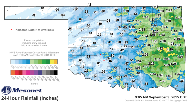
From 2-5 inches fell across a large part of SE through EC OK, which will either
tamp down or reduce those burgeoning drought conditions. Now we're left with
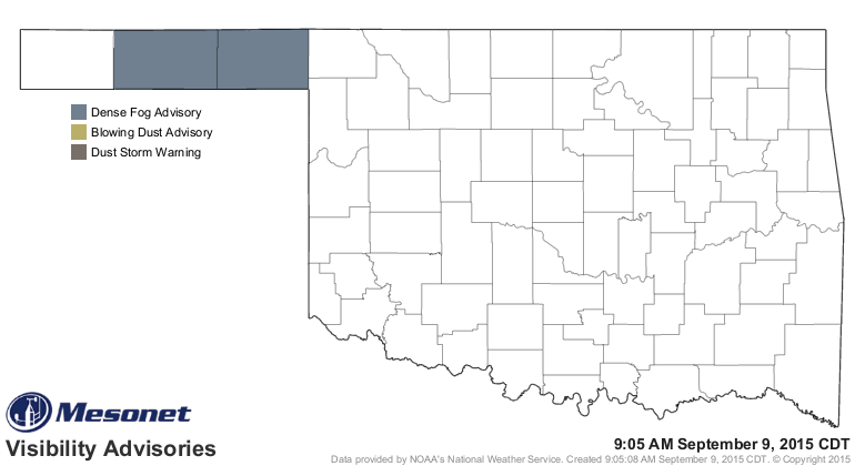
just a few scattered storms here and there, some drizzle there and here, and
even some heavy fog around some parts.
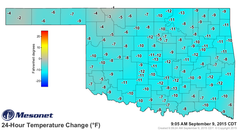
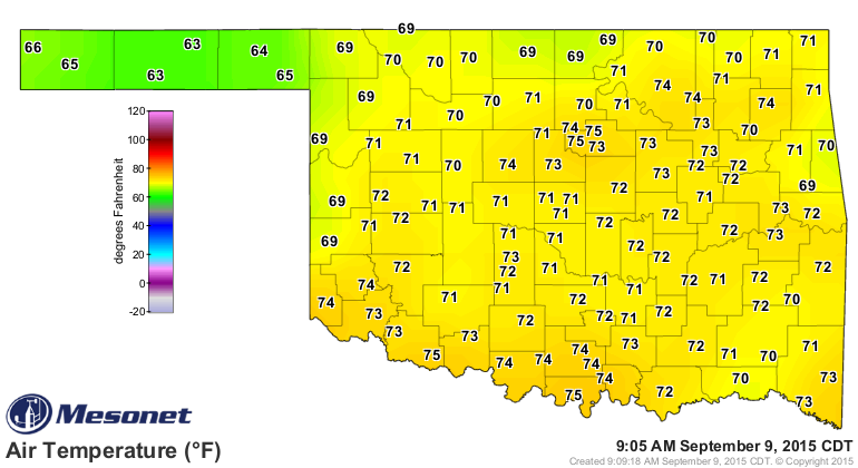
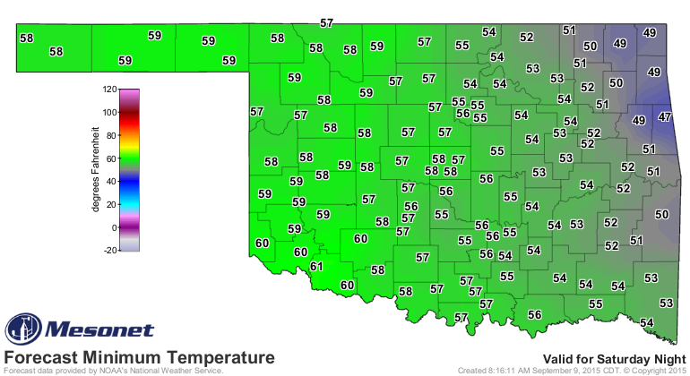
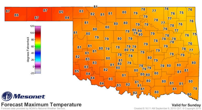
And last but not least (unless I want to write more), the air temps following
the front are a bit more manageable.
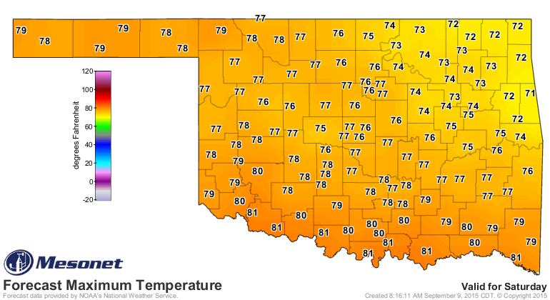
Saturday and Sunday are the days to shoot for if'n you're making that chili
mentioned yesterday. A few of you probably make that an event anyway with the
football games and the opening weekend of the NFL. This ought to work, then.
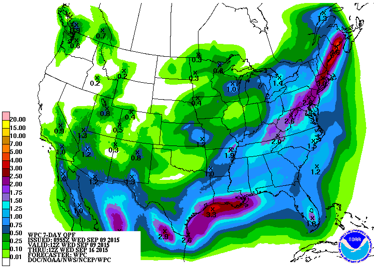
That's probably it for the big rains, at least for the next week or so.
And you'd be a bit premature to think summer is done with us just yet. We have
lots of September to go, and it can get hot right to the end. Just enjoy what
we have now. Soon fall will be here to stay for good, unless we go right to
winter.
Gary McManus
State Climatologist
Oklahoma Mesonet
Oklahoma Climatological Survey
(405) 325-2253
gmcmanus@mesonet.org
September 9 in Mesonet History
| Record | Value | Station | Year |
|---|---|---|---|
| Maximum Temperature | 100°F | TIPT | 2016 |
| Minimum Temperature | 33°F | KENT | 2020 |
| Maximum Rainfall | 8.09″ | SALL | 2010 |
Mesonet records begin in 1994.
Search by Date
If you're a bit off, don't worry, because just like horseshoes, “almost” counts on the Ticker website!