Ticker for September 8, 2015
MESONET TICKER ... MESONET TICKER ... MESONET TICKER ... MESONET TICKER ...
September 8, 2015 September 8, 2015 September 8, 2015 September 8, 2015
One burst of fall, coming up
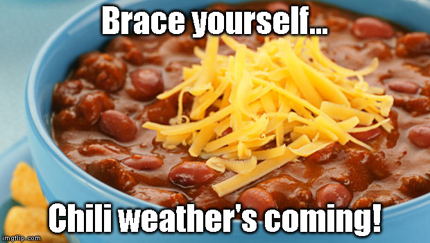
I hate roast. As a member of a true nuclear family, one of my Thanksgiving dinners
actually ended up being roast. Might as well have been May 8th. Why May 8th?
Exactly.
But roast is what we've had (or done, I guess) over the long holiday weekend,
and it would appear we have one more day to go before we start to see
temperatures actually drop BELOW normal for a spell. Yesterday was a scorcher
(see heat index map)
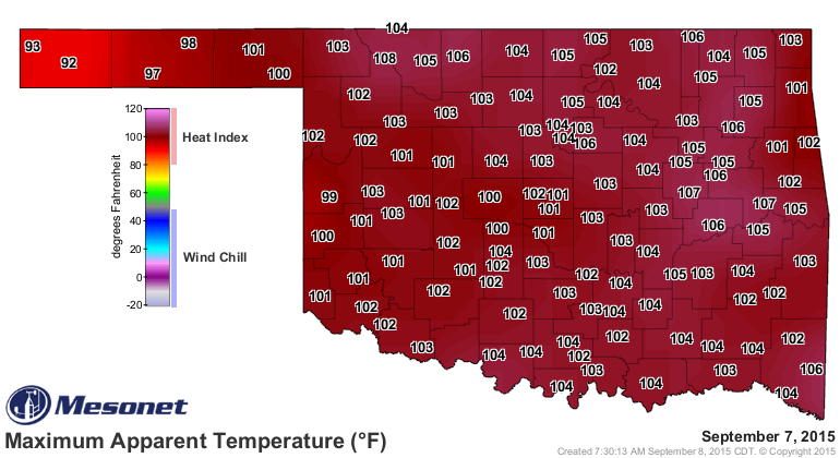
and most of Oklahoma is going to be hot again today.
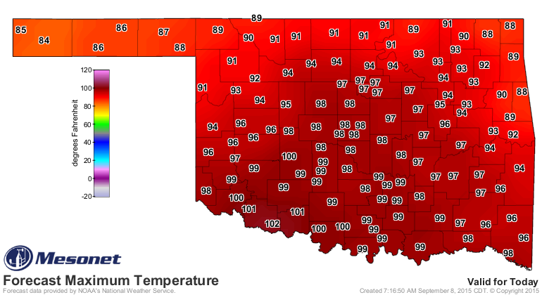
But a cold front tonight should bring some rain and cooler weather for the rest
of the week as we bask in lovely northwesterly flow. Saturday looks to be the
coolest day of the week.
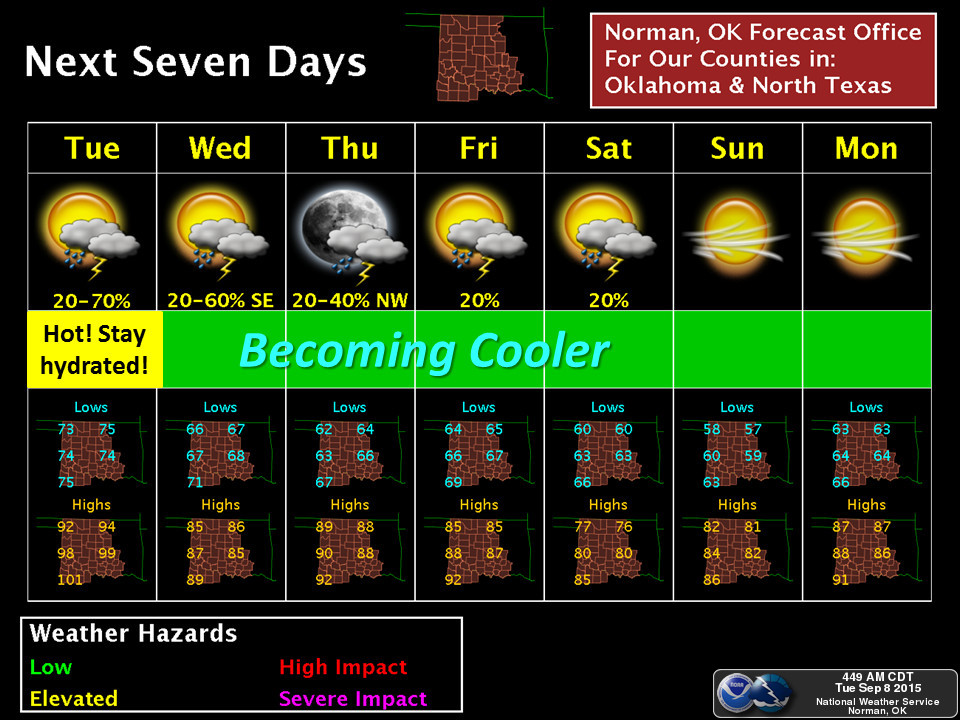
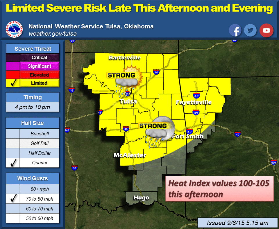
Oh yes, rain! Glad I mentioned it. Some rain has already fallen in the NW, but
expect more tonight into tomorrow, WITH a chance of some severe weather. Mostly
wind and hail, probably.

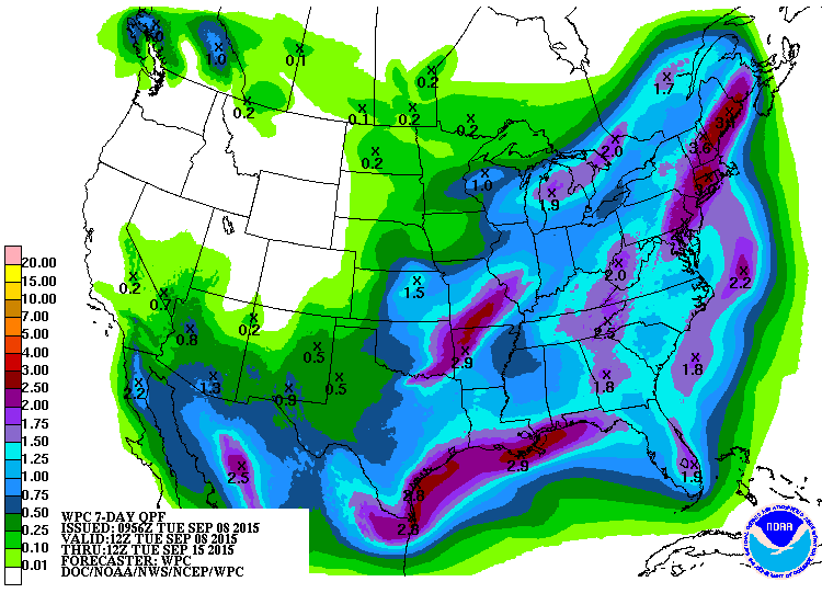
Rainfall amounts look to be highest in SE Oklahoma, but that's okay since that
is the area being hit hardest by the flash drought situation that has popped
up in the last 60 days.
So neighbor, how long has it been since you had a big, thick, steaming bowl of
Wolf Brand Chili? Oh, it was just a few weeks ago? August 19th?
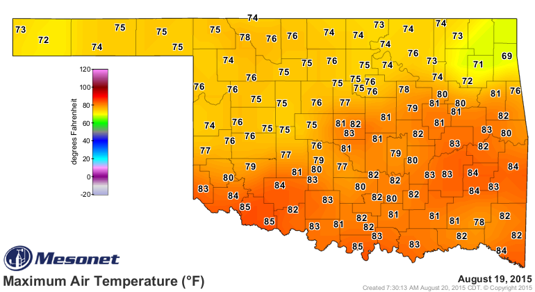
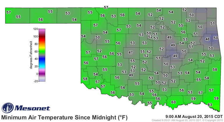
Well, never mind then. And yes, we do beans here. More fun for everybody.
Gary McManus
State Climatologist
Oklahoma Mesonet
Oklahoma Climatological Survey
(405) 325-2253
gmcmanus@mesonet.org
September 8 in Mesonet History
| Record | Value | Station | Year |
|---|---|---|---|
| Maximum Temperature | 111°F | GRA2 | 2023 |
| Minimum Temperature | 34°F | KENT | 2020 |
| Maximum Rainfall | 5.37″ | WILB | 2001 |
Mesonet records begin in 1994.
Search by Date
If you're a bit off, don't worry, because just like horseshoes, “almost” counts on the Ticker website!