Ticker for August 20, 2015
MESONET TICKER ... MESONET TICKER ... MESONET TICKER ... MESONET TICKER ...
August 20, 2015 August 20, 2015 August 20, 2015 August 20, 2015
Droughtus Interruptus
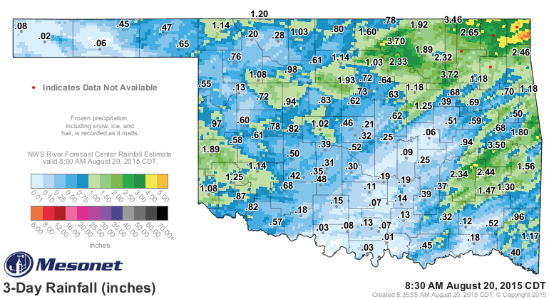
Remember when it started raining on Tuesday and into Wednesday? And we ended up
with some fairly hefty amounts across NE OK down close to SE OK? Okay, well,
here's a reminder then.
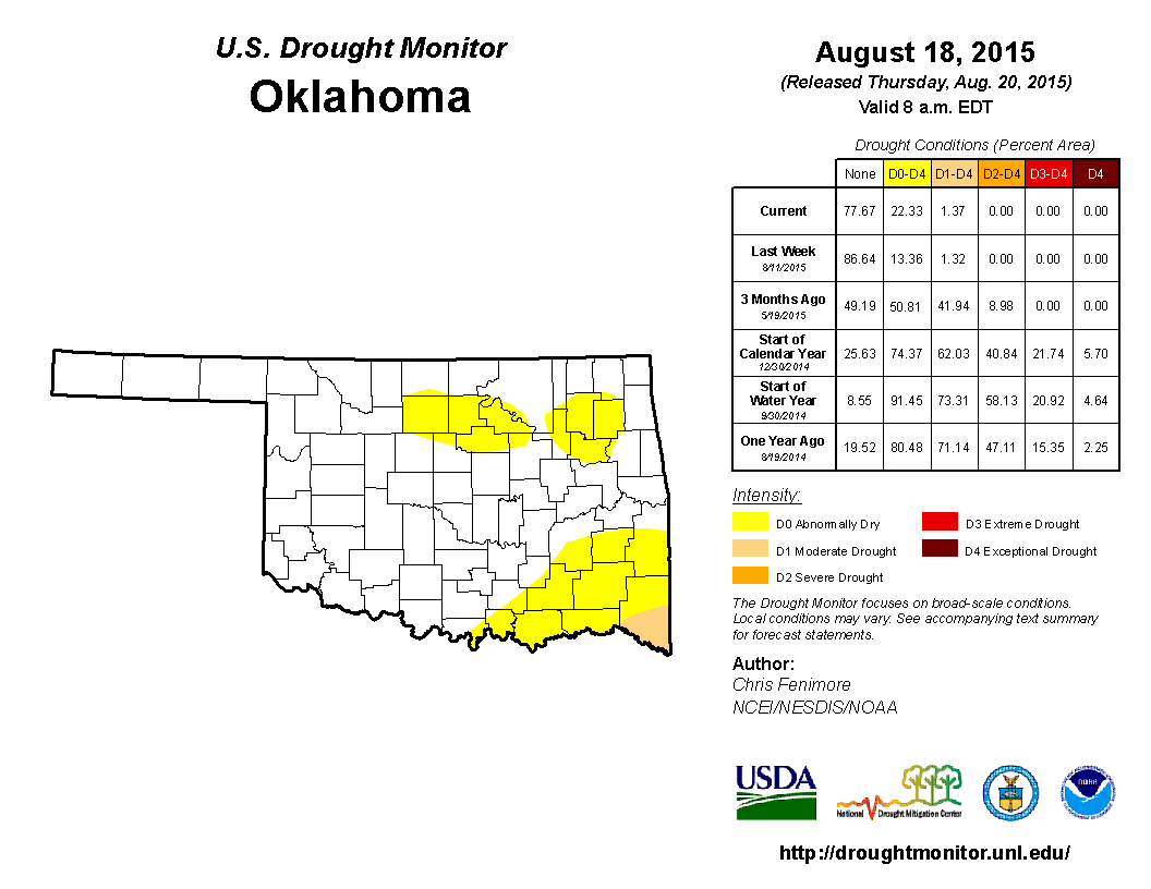
And remember when I've told you in the past that the cutoff for rain to be
considered in the Thursday release of the U.S. Drought Monitor map is Tuesday
morning at 6am? Well, let that be a reminder.
So sometimes unfortunate timing concludes with a rather inaccurate or inappropriate
DM map. As you gaze upon this map that appears to show drought beginning to
encompass NE OK, remember the first rainfall map I showed you and realize that a
lot of that D0 area is going to probably disappear on next week's map.
Also, due to a glitch, some of our recommended changes did not appear across the
SE Quarter of the state. This is what the map was supposed to look like:
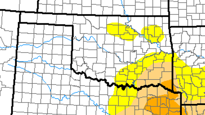
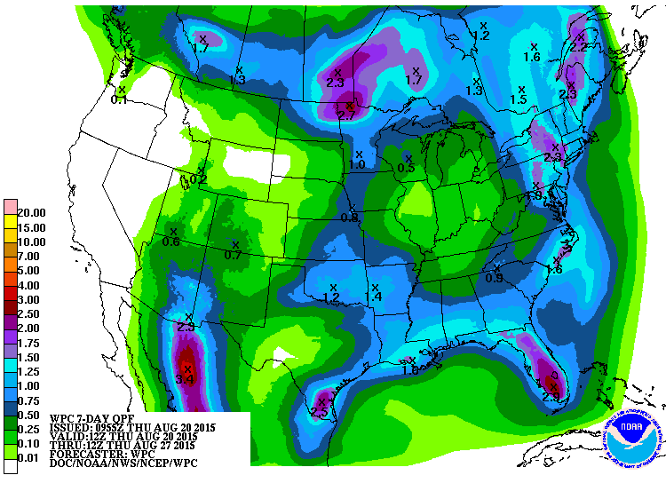
However, some of that area received an inch or so as well. I'm not sure if that
will be enough to change the map for next week, but we do have another shot at
rain coming up Friday and again over the weekend into next week. So maybe
that map glitch will take care of itself.
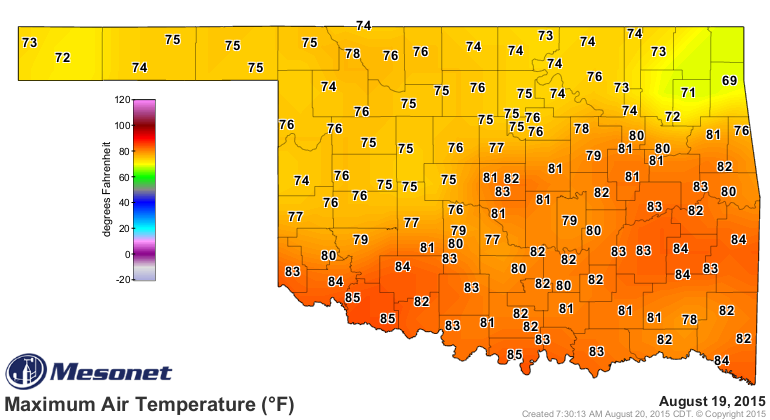
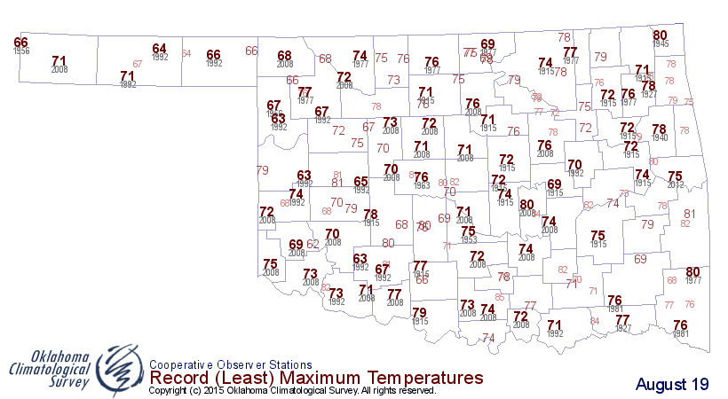
Now let's deal with the temperatures yesterday and this morning. First off, it
obviously didn't feel very Augusts-ish yesterday with highs scattered in the
70s and 80s. We even had a 69 reading up in Jay. Compare that with yesterday's
record low maximum temperatures and you can see some places across northern
Oklahoma probably broke those marks for lowest Tmaxs.
And then we come to this morning's low temperature map. Ridiculously cool for
this time of year. This is the type of low temperature map you'd see in mid-
October. Compare that to the record low map for today and you can see lots of
places probably fell below those historical marks.
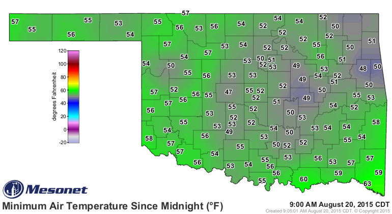
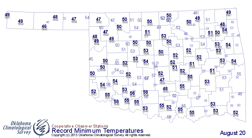
El Reno, a known cold-air pooler, came in with a chilly 47 degrees, beating
the previous record from the El Reno COOP site at 54 degrees on this date back
in 1953. Oklahoma City also broke it's minimum temperature record this morning
at 50 degrees, falling below the old mark of 56 set way back in 1950. The 47
at El Reno is tied for the fifth lowest reading ever on August 20th in Oklahoma,
dating back to the late 1800s, the lowest being a 45 at Reydon on this date
back in 1996.
Don't expect a big warm up anytime soon. Maybe some low-mid 90s a day here or
there in the next week. For now, however, enjoy our September weather, because
September might give us August.
Gary McManus
State Climatologist
Oklahoma Mesonet
Oklahoma Climatological Survey
(405) 325-2253
gmcmanus@mesonet.org
August 20 in Mesonet History
| Record | Value | Station | Year |
|---|---|---|---|
| Maximum Temperature | 111°F | WAUR | 2023 |
| Minimum Temperature | 47°F | ELRE | 2015 |
| Maximum Rainfall | 3.45″ | MAYR | 1996 |
Mesonet records begin in 1994.
Search by Date
If you're a bit off, don't worry, because just like horseshoes, “almost” counts on the Ticker website!