Ticker for August 18, 2015
MESONET TICKER ... MESONET TICKER ... MESONET TICKER ... MESONET TICKER ...
August 18, 2015 August 18, 2015 August 18, 2015 August 18, 2015
Thar she blows!
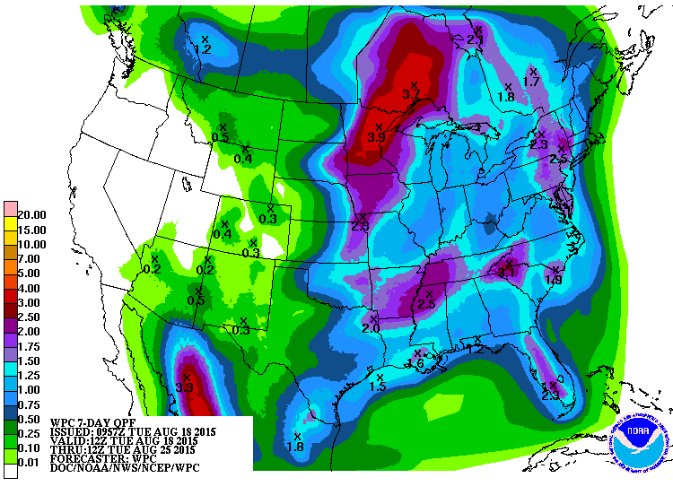
Boom! When Mother Nature gives you flash droughts, *I* will give you rain. Well,
maybe I can't *really* take credit for it, but somebody has to. The rain started
last night but the big show starts later today with an upper-level system
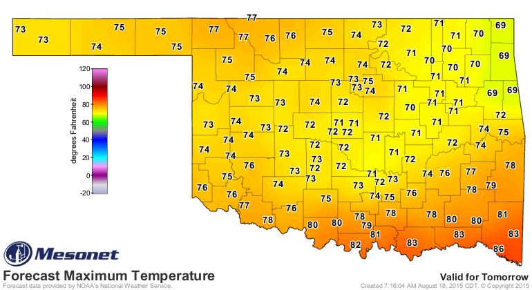
accompanied by a pretty darned strong cold front for this time of year. Check out
the forecast highs for tomorrow. Even more startling, check out the lows for
Thursday morning.
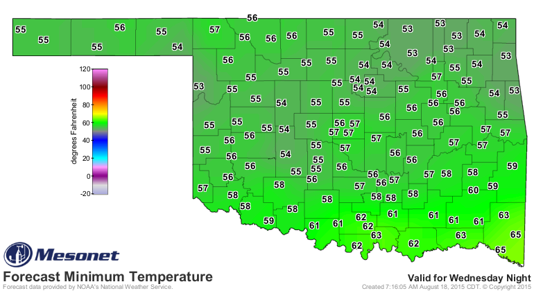
Break out the parkas! But first, we have to put up with the chances for a bit
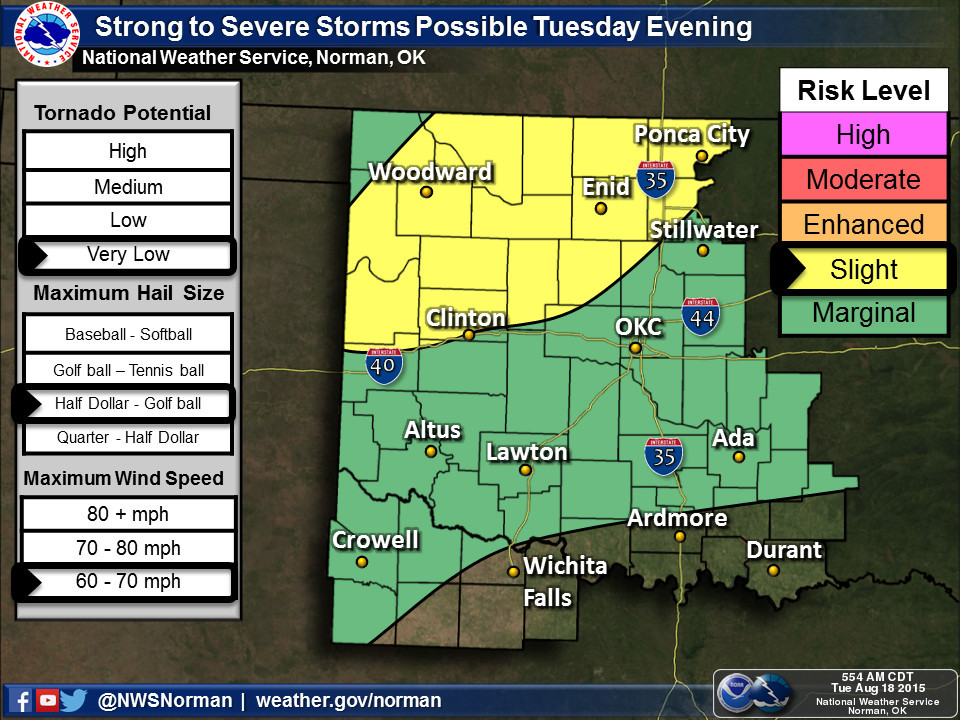
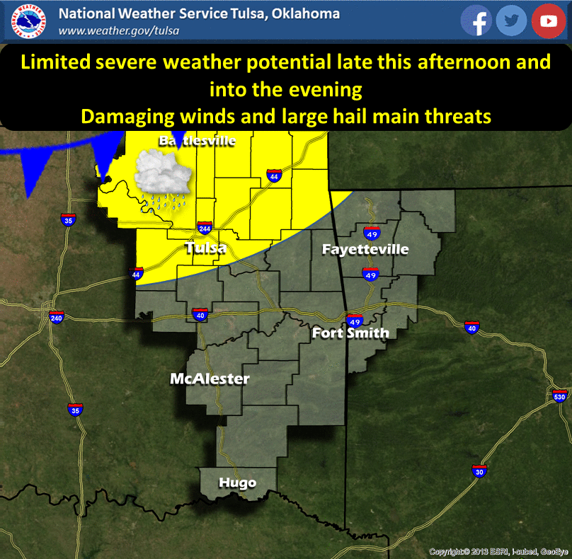
of severe weather also. There is a slight risk tonight, as put forth by SPC.
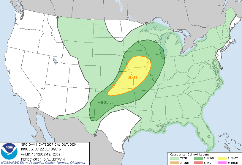
Our friends at the NWS offices say damaging winds and large hail are the biggest
threats.
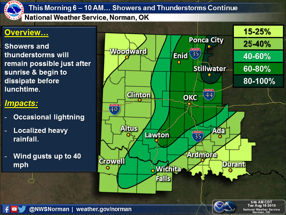
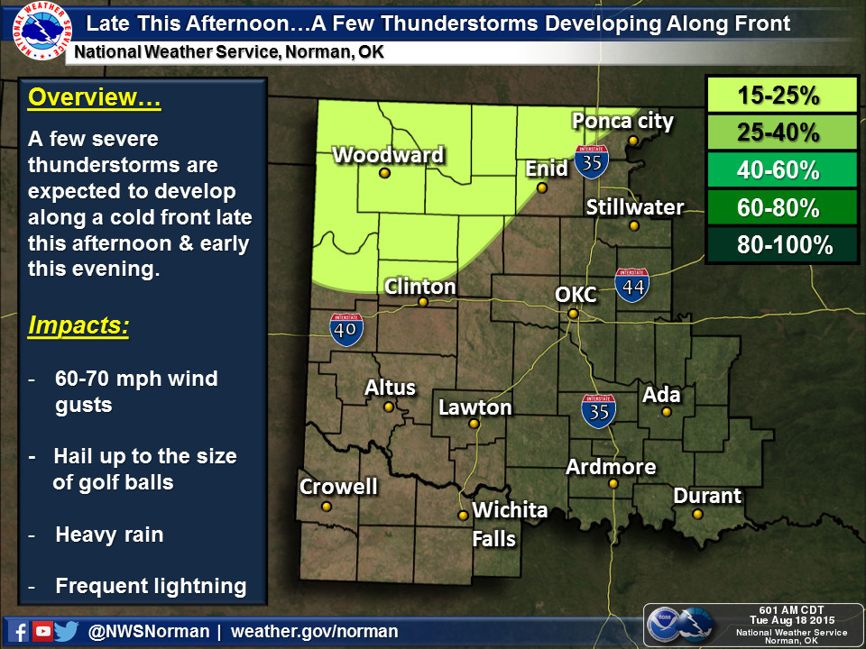
Here's the timing of the rains, at least from the Norman NWS office perspective.
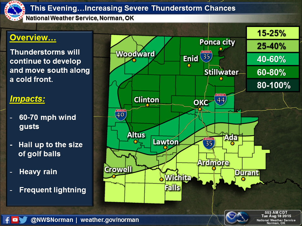
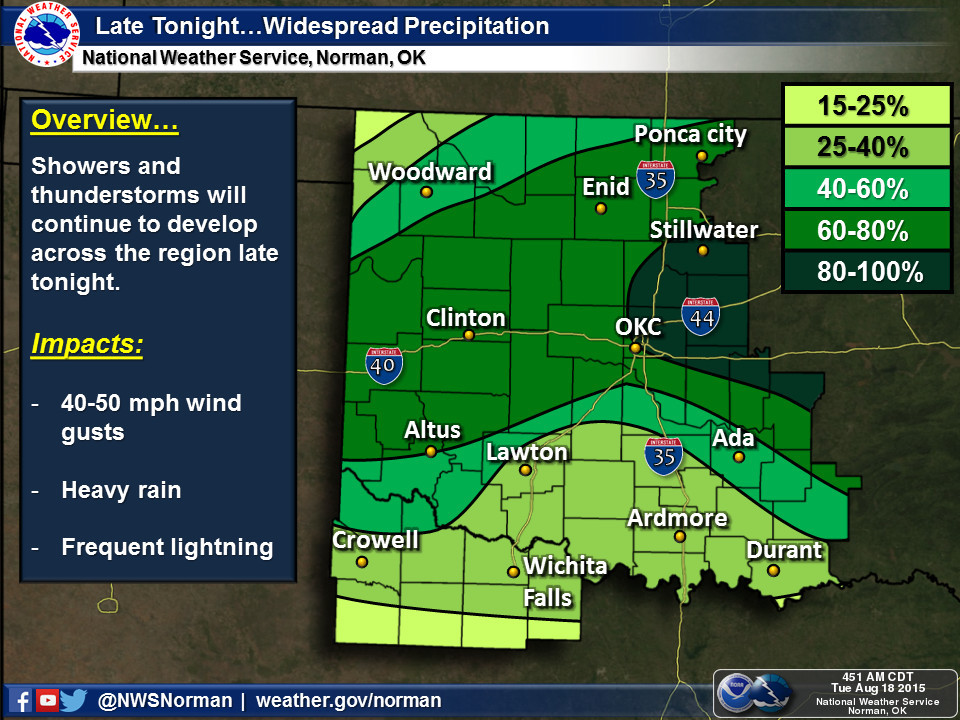
This moisture is sorely needed due to our flash drought situation currently
impacting southeastern Oklahoma (and spreading into the NE and SC).
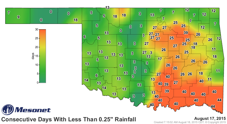
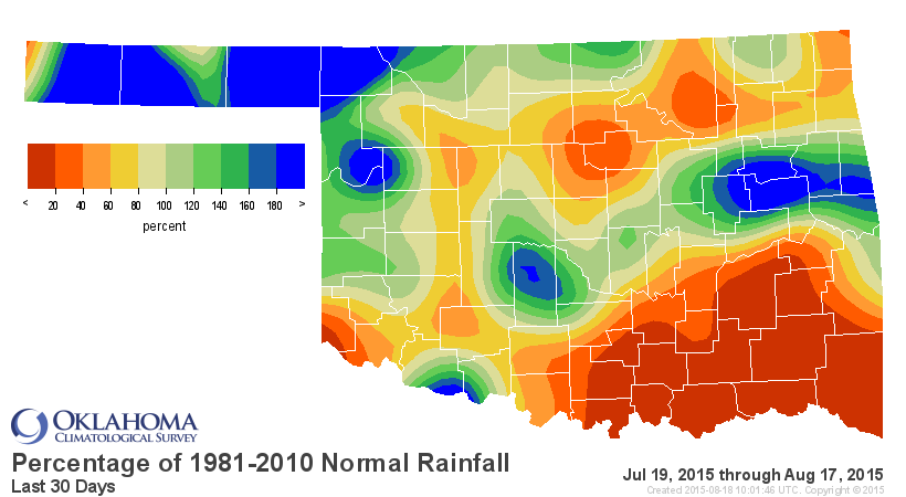
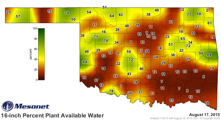
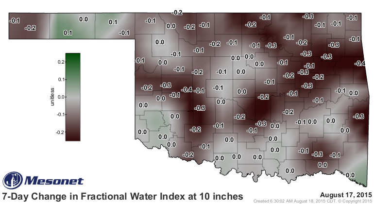
I don't think we're in a dire situation here. It's August. This is sorta what
we should expect. We got a bit bigger dose of that heat dome than we bargained
for just as the rain shut off for an extended period of time, creating deficits
of 1-3 inches in some parts. But again, it's August. And the rain is about
to begin, and hopefully not disappear for so long this time.
And Godzilla lurks...
Gary McManus
State Climatologist
Oklahoma Mesonet
Oklahoma Climatological Survey
(405) 325-2253
gmcmanus@mesonet.org
August 18 in Mesonet History
| Record | Value | Station | Year |
|---|---|---|---|
| Maximum Temperature | 112°F | GRA2 | 2023 |
| Minimum Temperature | 53°F | EVAX | 2016 |
| Maximum Rainfall | 9.00″ | FTCB | 2007 |
Mesonet records begin in 1994.
Search by Date
If you're a bit off, don't worry, because just like horseshoes, “almost” counts on the Ticker website!