Ticker for August 28, 2015
MESONET TICKER ... MESONET TICKER ... MESONET TICKER ... MESONET TICKER ...
August 28, 2015 August 28, 2015 August 28, 2015 August 28, 2015
Summer...it's baaaaaaccccccckkkkkk
So the entire Ticker staff leaves for a week and a case of fall breaks out, and
timed perfectly with our return, summer says "oooh, take me take me!!" So I'm not
saying you can blame us, but it is highly coincidental.
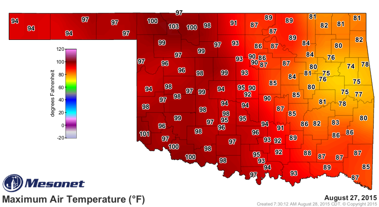
It was downright hot in western Oklahoma yesterday. Trust me (careful!), I wuz
there. And it was windy too, so we got the full hair drier (I SAID CAREFUL!)
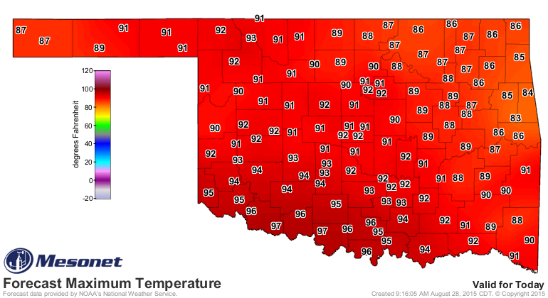
effect. And that looks like the pattern we're gonna see for the foreseeable
future. You can see those 70s in the east where they got some smattering of rain
and good clouds, and that's what we'll see today probably. Where there are showers
and some nice could cover, it won't be quite so bad. But still, summer is
apparently back. Now keep in mind that it won't be quite as bad as yesterday,
but seasonable for the latter part of summer.
These forecasts don't change much in between, so I'll show you today's and next
Tuesday's. You get the picture. No seriously, you get the picture...click!
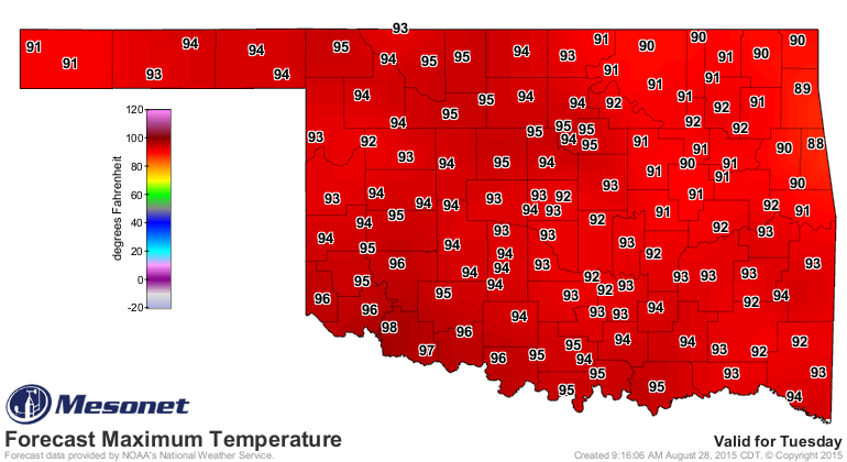
And by next Tuesday it will be September. Can you believe it? It seems like
just yesterday it was August 27. And from the looks of the rainfall forecast
between now and then
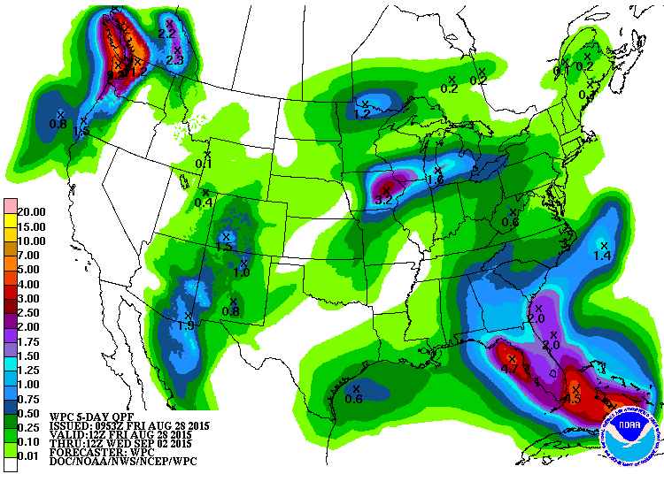
it does appear that August is going to end up fairly dry for most of the
state.
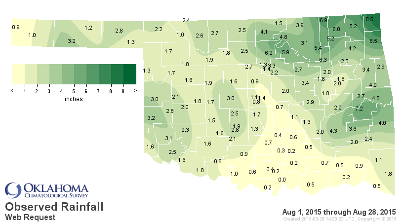
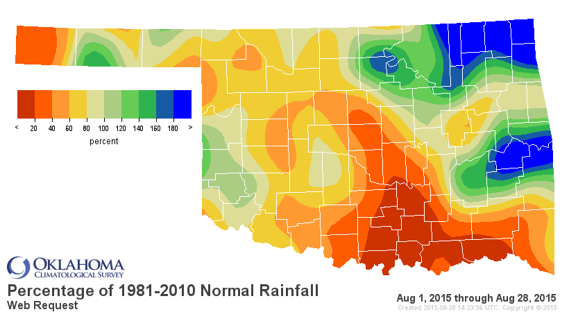
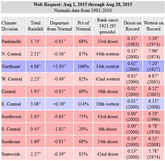
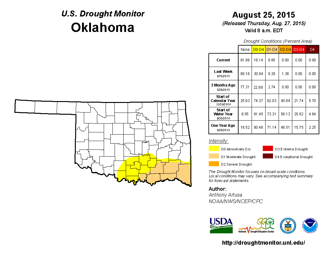
At least the NE corner of the state finally had some nice rains and killed the
burgeoning flash drought up that way. You can see that on the newest Drought
Monitor map. Now there was once again a glitch and the D2 from McCurtain County
was removed on accident, but I'll try and have it put back (if not expanded)
by next week's map in the event they don't have nice rains by next Tuesday. And
you can see flash drought beginning to take shape across SC Oklahoma as well with
that yellow color moving to the west, all the way to Jefferson County.
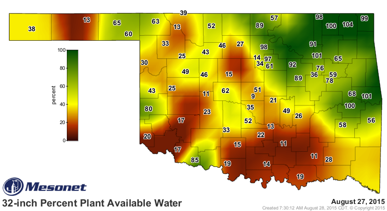
And that's a place that had 16,343 inches of rain in May. That might be a slight
overestimate, but still, that's what a nice, prolonged heat dome and lack of
rainfall can do. The Mesonet's 32-inch percent plant available water demonstrates
the problem quite nicely, with values down close to 10 percent of the theoretical
maximum.
Nothing to be alarmed about yet. This doesn't mean the El Nino is fizzling.
Although still not a guarantee, we don't expect much impact from El Nino during
the summer. That comes later in the fall and winter.
Gary McManus
State Climatologist
Oklahoma Mesonet
Oklahoma Climatological Survey
(405) 325-2253
gmcmanus@mesonet.org
August 28 in Mesonet History
| Record | Value | Station | Year |
|---|---|---|---|
| Maximum Temperature | 111°F | ALTU | 2011 |
| Minimum Temperature | 50°F | BOIS | 2004 |
| Maximum Rainfall | 4.73″ | VINI | 2025 |
Mesonet records begin in 1994.
Search by Date
If you're a bit off, don't worry, because just like horseshoes, “almost” counts on the Ticker website!