Ticker for August 13, 2015
MESONET TICKER ... MESONET TICKER ... MESONET TICKER ... MESONET TICKER ...
August 13, 2015 August 13, 2015 August 13, 2015 August 13, 2015
A VERY unwelcome visitor
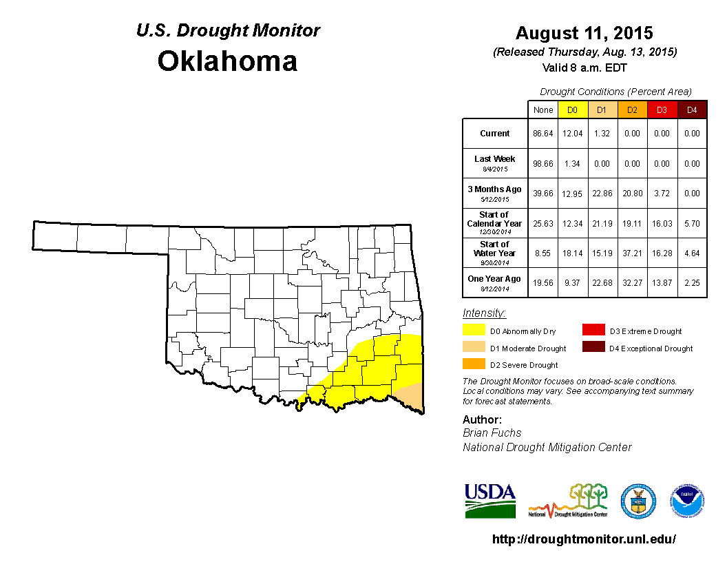
Well, we saw this coming last week, and sure enough, drought has crept back into
Oklahoma for the first time since May 26. Now it's not a lot at only 1.32% of the
state, in far southern McCurtain County, but we also saw those "abnormally dry"
conditions march right along with it to the tune of 12.04%.
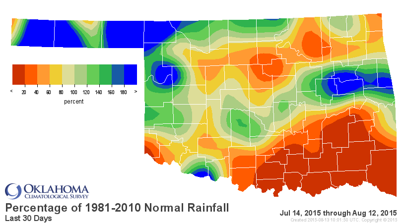
Southern McCurtain County is a no-brainer (I HEARD THAT!), given the rainfall
deficits over the last 30-60 days. Again, THE driest last 30 days across SE OK
since at least 1921.
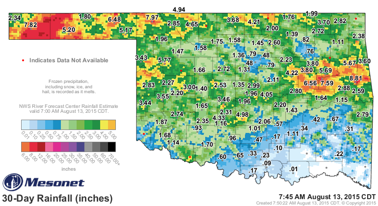
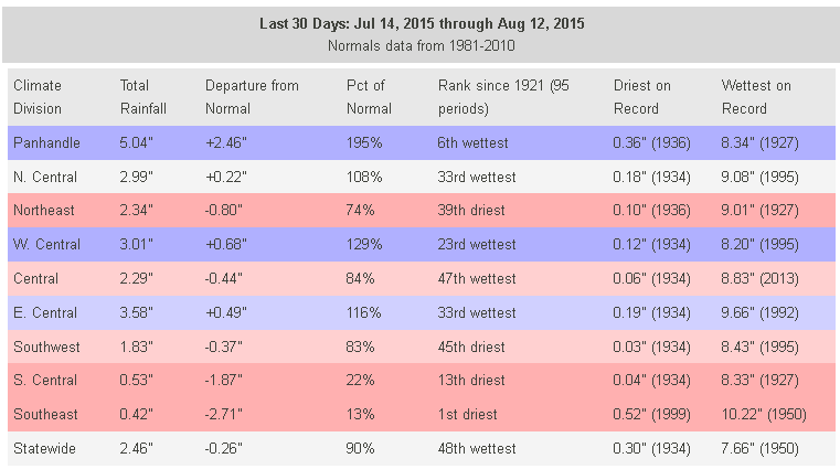
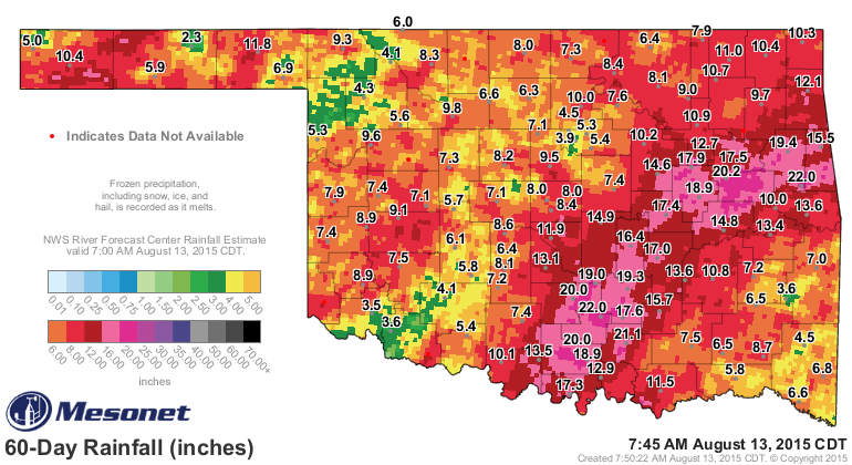
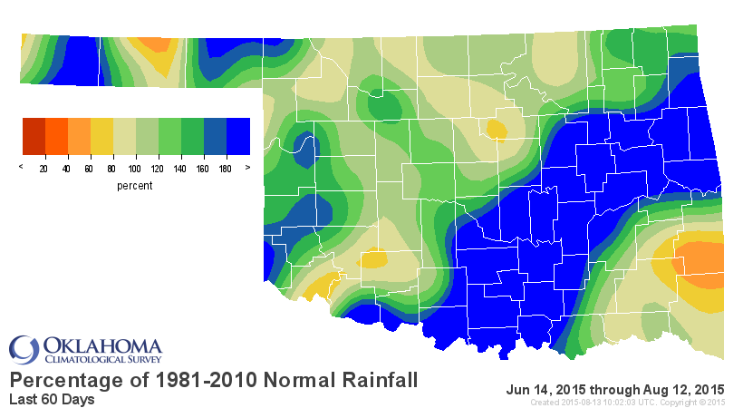
The Panhandle's sitting pretty, though. But you know when Boise City has had
7.8" of rain over the last 30 days and Hugo, Idabel and Broken Bow have had
zilch, something has gone kerflooey! I also became a bit concerned when those
counties a bit farther north kept pinging the air temp charts with triple digits.
Talihina has more days above 100 degrees at 14 than some of those western
stations. That's a sure sign of vegetative distress as the sun's energy goes
towards heating the ground instead of being absorbed by green cover or evaporating
soil moisture.
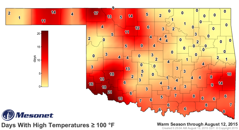
Those numbers get a bit inflated from SW through NC Oklahoma thanks to the bare
field left by wheat harvest, but there is SOME concern for SW OK right now as
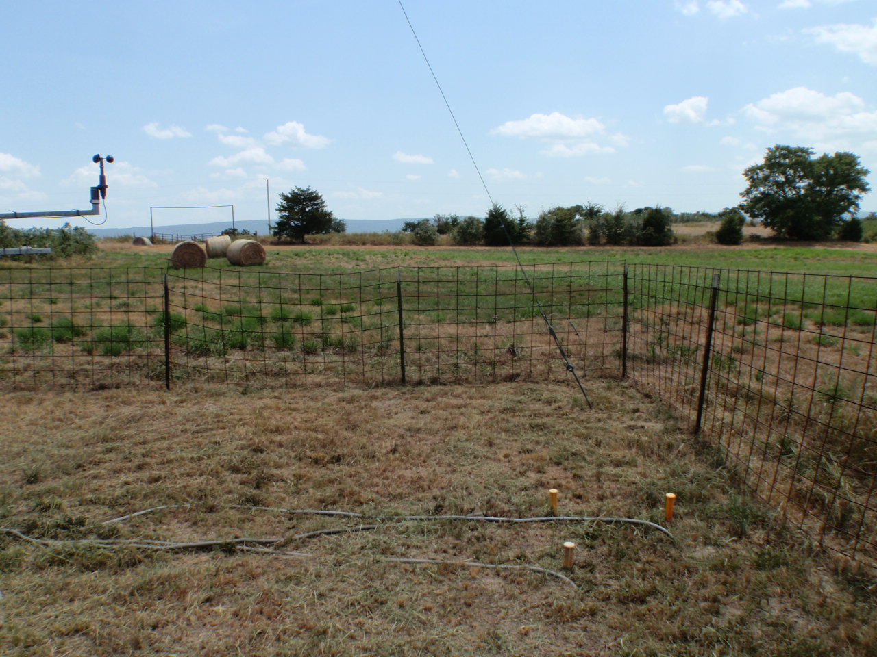
well. But all these maps and stats can be summed up by a single picture from
Talihina. This was taken by one of our Mesonet Technicians at the Talihina site.
Now you tell me if you think this looks "droughty," or at least abnormally
dry?
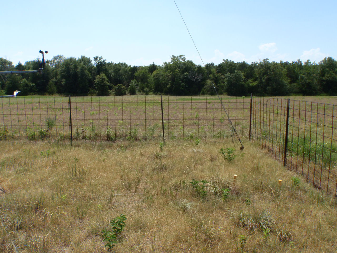
And how about nearby Cloudy (although for the last month or so, Not Cloudy).
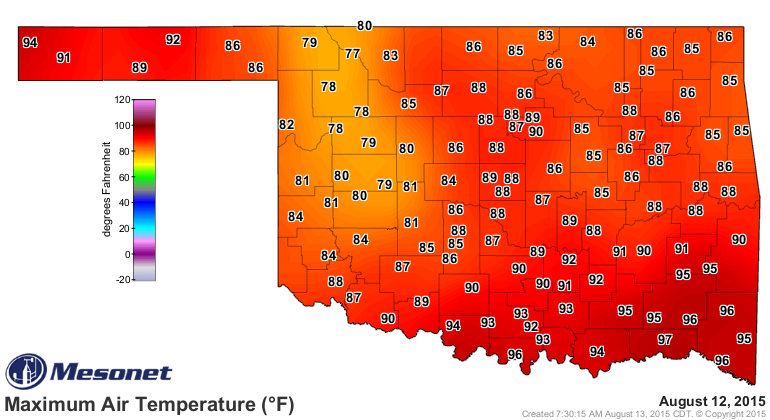
The cool down has helped, of course, but far SE OK is still showing a tendency
to heat up a good 5-10 degrees more than the rest of the state.
I'm afraid things look dry for the next 7 days at least, so no hope for relief
just yet.
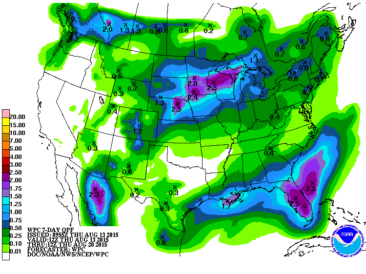
Maybe next week?
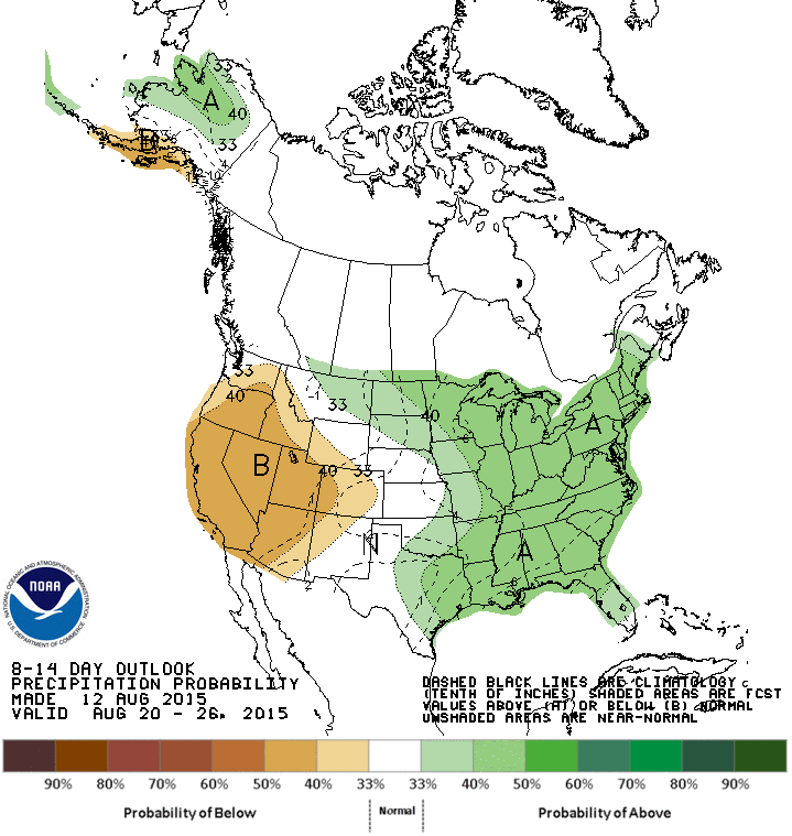
It was fun while it lasted. But things are looking drier and drier to the SE.
Trouble is there is no "Alfalfa Bill" Murray to send the National Guard out to
stop this menace from crossing the Red River.
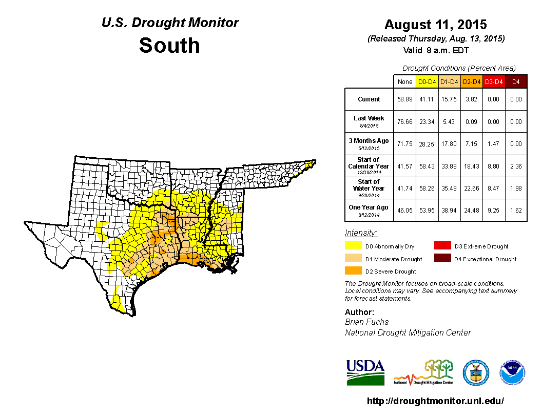
I suspect there are wet times ahead for this area, however. A little birdy
from the equatorial pacific told me so. No need to panic just yet.
Gary McManus
State Climatologist
Oklahoma Mesonet
Oklahoma Climatological Survey
(405) 325-2253
gmcmanus@mesonet.org
August 13 in Mesonet History
| Record | Value | Station | Year |
|---|---|---|---|
| Maximum Temperature | 110°F | GRA2 | 2023 |
| Minimum Temperature | 48°F | MIAM | 2004 |
| Maximum Rainfall | 5.89″ | SALL | 2017 |
Mesonet records begin in 1994.
Search by Date
If you're a bit off, don't worry, because just like horseshoes, “almost” counts on the Ticker website!