Ticker for August 11, 2015
MESONET TICKER ... MESONET TICKER ... MESONET TICKER ... MESONET TICKER ...
August 11, 2015 August 11, 2015 August 11, 2015 August 11, 2015
We'll take it!
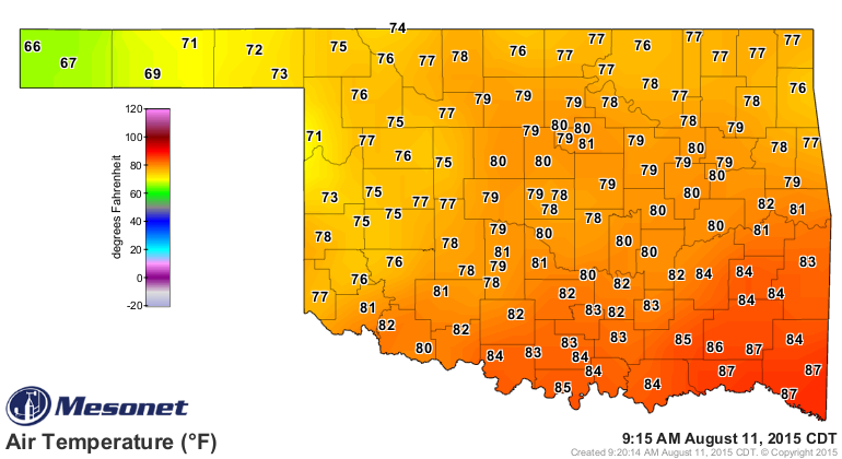
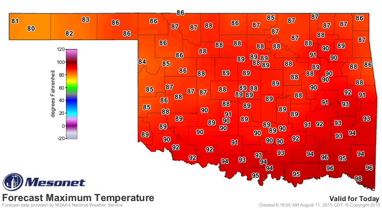
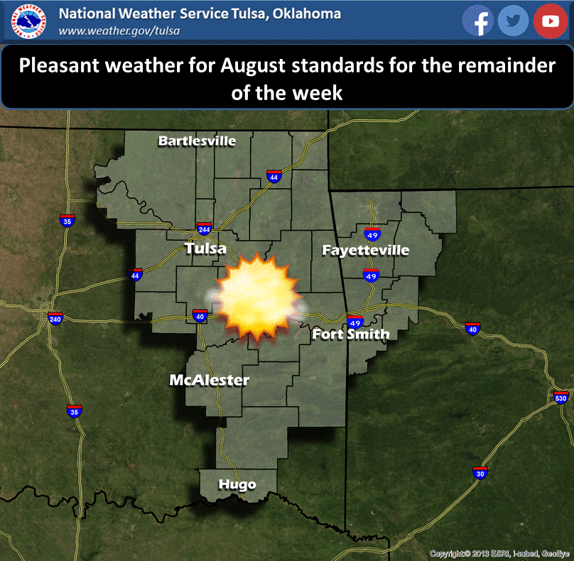
So THIS is what a cool front feels like, eh? Sometimes you have to go through
a heat index of 110 to remember what a temperature of 89 is like. So a nice
pleasant morning (for most of us) will yield to a rather pleasant August
afternoon and evening. Very blah, very nice.
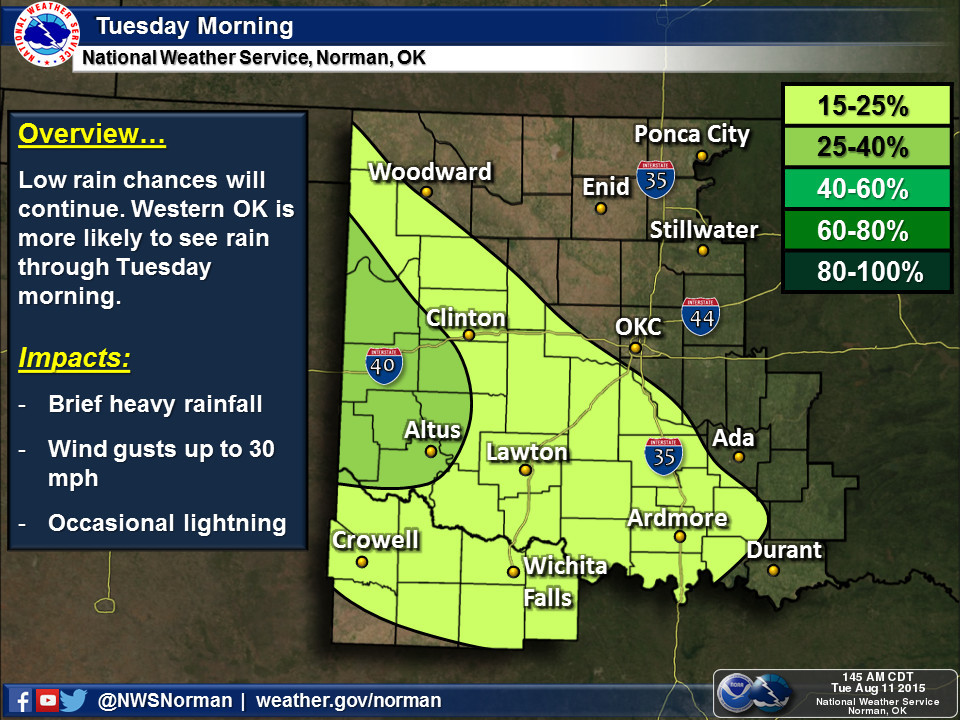
Sorry to those of you down south, but you can laugh at the northern folks come
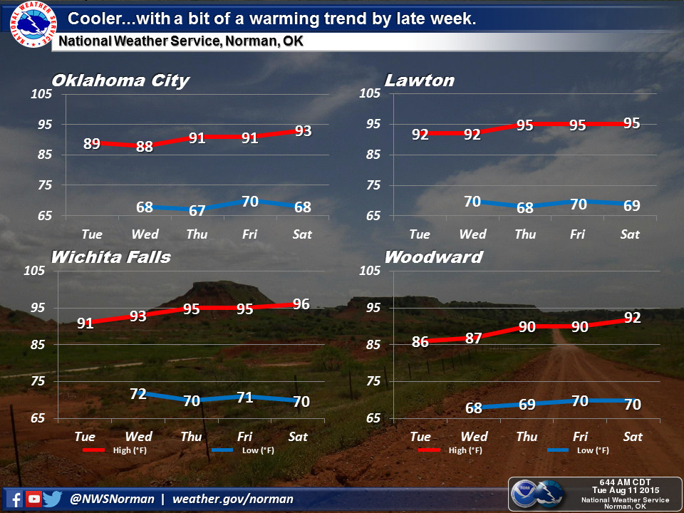
December. Maybe. But for now, a few showers in the west and then a slow warm up
back to August'ish weather.
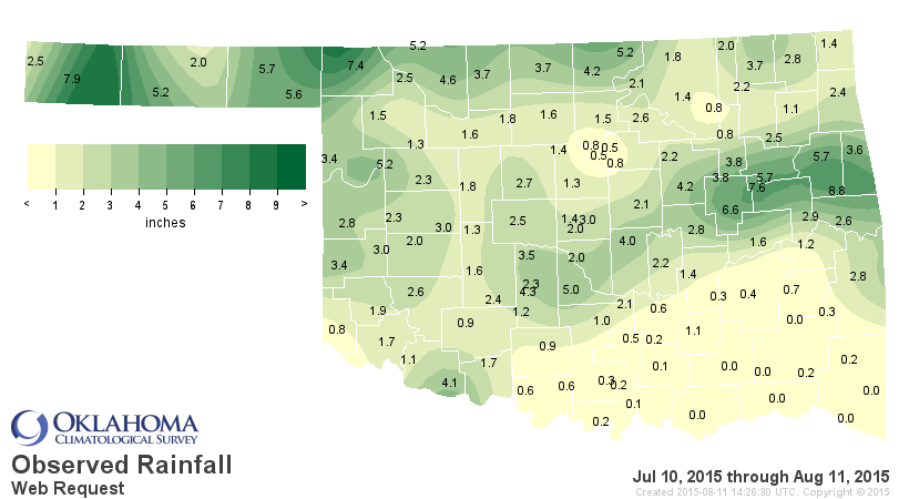
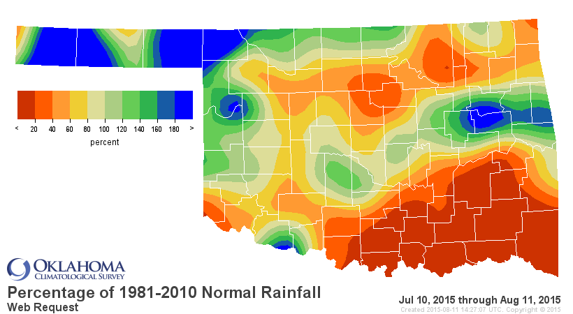
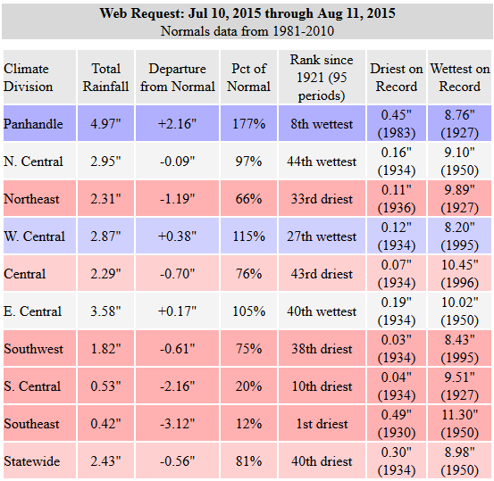
Things have changed drastically since mid-July, however. The rains of spring and
early summer have become more sporadic, and downright non-existent for parts of
the state. In fact, the July 10-August 11 period is the driest on record for
SE OK since at least 1921. Not good at all. The Panhandle, on the other hand,
is taking its wettest part of the year seriously with the 8th wettest such
period since 1921.
The temperature stats over that time frame show us that based on a statewide
average, we're above normal by about a degree, but we all know that it has FELT
hotter than that due to the humidity.
Will the oppressive conditions return? Tough to say...it's a long time until
fall. I guess the message now is enjoy the weather for the next few days. It
can (and probably will) get worse later.
Gary McManus
State Climatologist
Oklahoma Mesonet
Oklahoma Climatological Survey
(405) 325-2253
gmcmanus@mesonet.org
August 11 in Mesonet History
| Record | Value | Station | Year |
|---|---|---|---|
| Maximum Temperature | 112°F | ALTU | 2023 |
| Minimum Temperature | 52°F | NOWA | 2012 |
| Maximum Rainfall | 5.58″ | SHAW | 2008 |
Mesonet records begin in 1994.
Search by Date
If you're a bit off, don't worry, because just like horseshoes, “almost” counts on the Ticker website!