Ticker for August 6, 2015
MESONET TICKER ... MESONET TICKER ... MESONET TICKER ... MESONET TICKER ...
August 6, 2015 August 6, 2015 August 6, 2015 August 6, 2015
Nice little run you had there, Oklahoma

It's a creeping hazard. It's sneaky. It's like the Varmint Cong. You go three
weeks (THREE WEEKS!) with no color in the U.S. Drought Monitor map for
Oklahoma and then, out of nowhere...BAM!
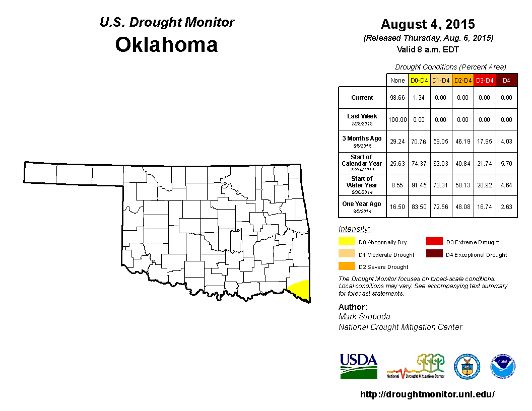
Yes, buried down in far SE OK is a small spot of yellow. So small it only covers
the extreme southern half of McCurtain County (or 1.34% of the state). The last
time we saw yellow on the map was July 7, but that was for a different reason.
Remember, the yellow, or D0-Abnormally Dry, designation is not drought, but a
signal that the affected area is either coming into our out of drought. Well, back
on July 7, it meant we were coming out of drought, and the following week the
entire state was clear. Now, we see the yellow for a different reason...the
southeastern corner of the state is slowly slipping back into dry conditions, as
is the entire ArkLaTex region.
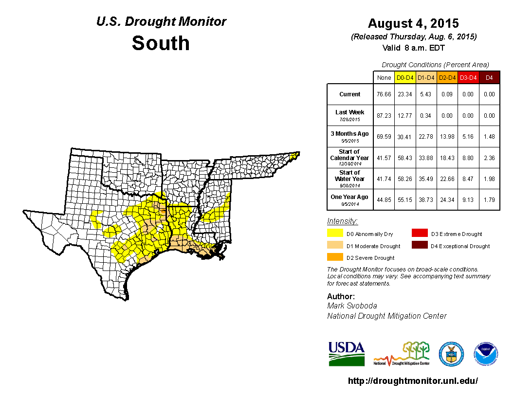
This is being propelled by rainfall deficits that began back in the last 30-60
days.
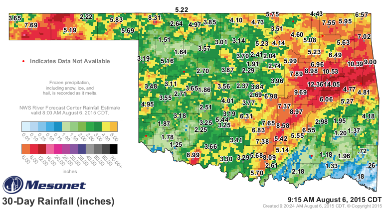
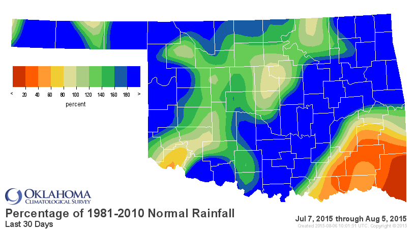
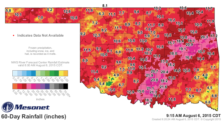
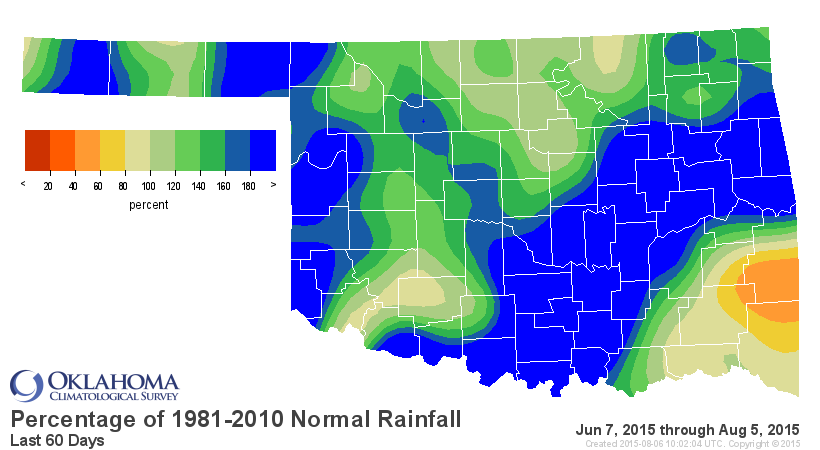
The last 30 days is especially telling. Only 0.18 inches of rain at Idabel over
that time, and only 0.26 inches at Broken Bow. Wow! And for the record, the
last 30 days for that whole Climate Division is the 19th driest since at least
1921 at 2 inches below normal.
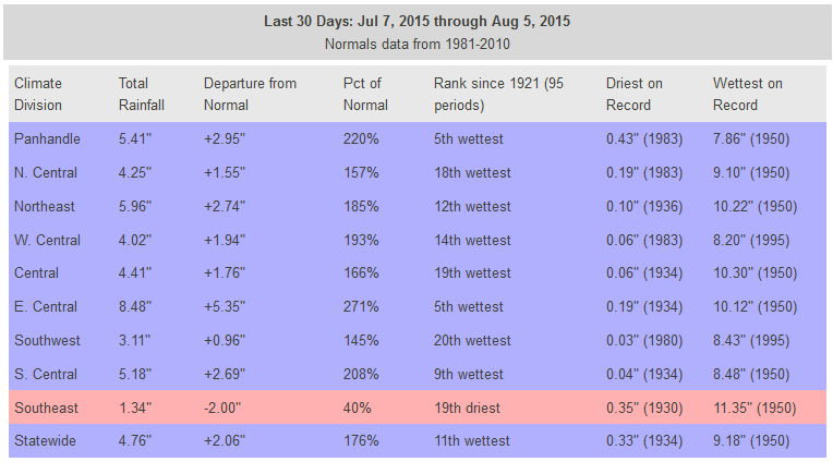
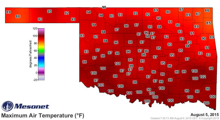
For Idabel and Broken Bow, however, it's well over 3 inches below normal. And
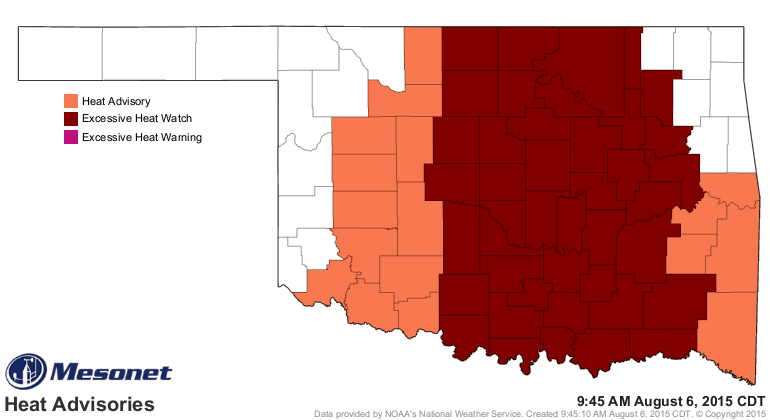
remember this is also a time during which the heat has soared with the meanderings
of that upper-level heat dome. That part of the state reached 100 degrees
yesterday, another very telling indicator of the dry conditions. Less of the
sun's energy is going towards evaporating soil moisture, or being absorbed by
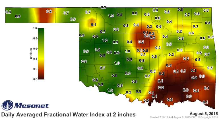
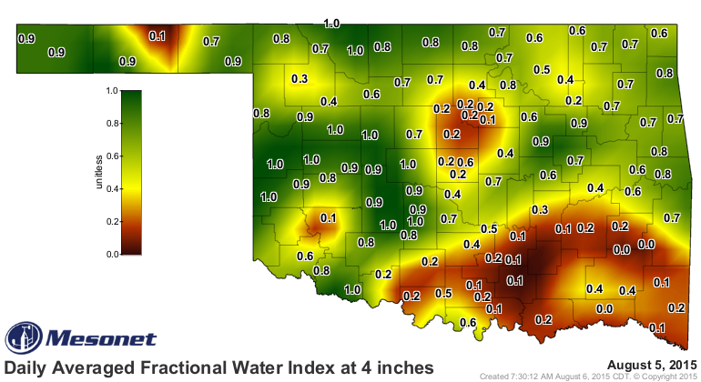
green vegetation, for instance...both cooling mechanisms. You can see that in the
Mesonet's soil moisture maps down to 2 and 4 inches.
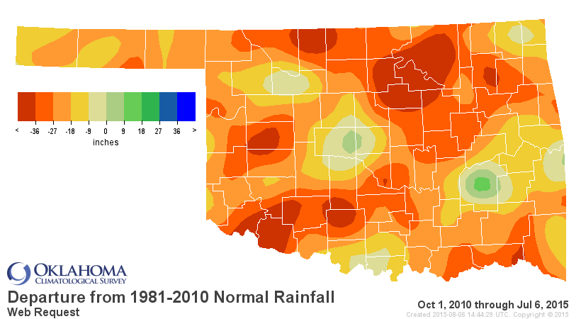
Judging from that map, we might need to keep our eye on the Payne County area.
They're also starting to dry out, and their area as a local minimum of rainfall
over the last 60 days is pretty obvious when you drill down into the county
level. I've highlighted a couple of other areas of concern as well. Nothing
to panic about yet, but if the heat dome stays over us for an extended period
of time, we will have to judge the impacts and determine is this just normal
August dryness, or are we getting into the D0 or D1 territory.

If we hadn't just come out of a 5 year drought, with deficits of 20-40 inches
over that time frame remaining, there probably wouldn't be much worry. But
given those previous deficits, the specter of Flash Drought sticks in the mind.
Rain chances and amounts are looking rather slim for now.
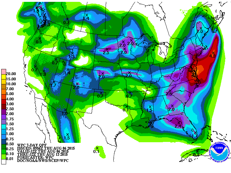
But the chances for heat stroke are looking good, if you like that sort of
thing. ZOUNDS!
Gary McManus
State Climatologist
Oklahoma Mesonet
Oklahoma Climatological Survey
(405) 325-2253
gmcmanus@mesonet.org
August 6 in Mesonet History
| Record | Value | Station | Year |
|---|---|---|---|
| Maximum Temperature | 112°F | OKMU | 2011 |
| Minimum Temperature | 54°F | BOIS | 1998 |
| Maximum Rainfall | 6.70 inches | HUGO | 2017 |
Mesonet records begin in 1994.
Search by Date
If you're a bit off, don't worry, because just like horseshoes, “almost” counts on the Ticker website!