Ticker for August 4, 2015
MESONET TICKER ... MESONET TICKER ... MESONET TICKER ... MESONET TICKER ...
August 4, 2015 August 4, 2015 August 4, 2015 August 4, 2015
Who'da thunk it?
It's August 4th, that must mean it's raining. I mean, it IS 2015 after all. The
latest radar picture tells the wet story.
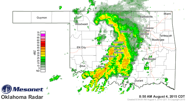
You can see a definitely curly-Q link up there to the northwest, especially when
viewing it on a loop (if you read this much later, you might not see much..push
the play button at the bottom of the picture for the loop).
http://www.mesonet.org/index.php/weather/radar/KTLX
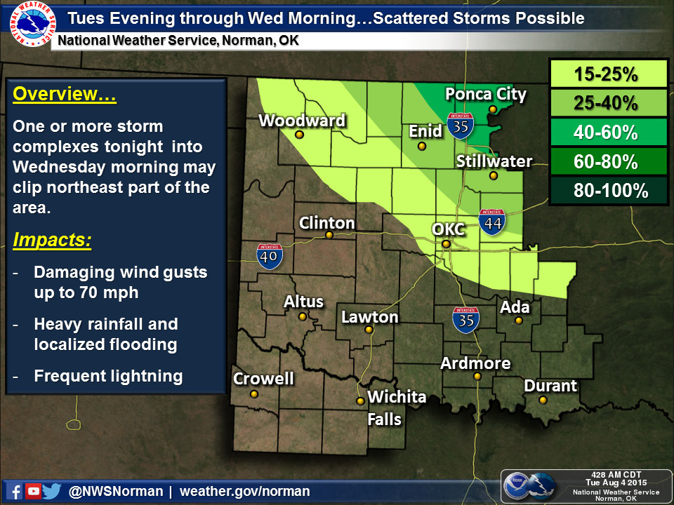
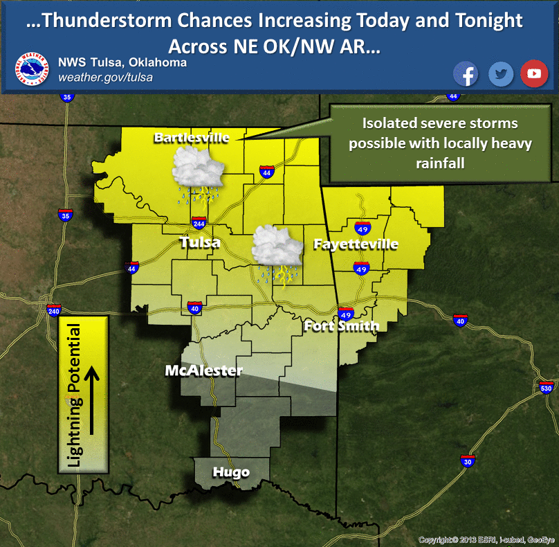
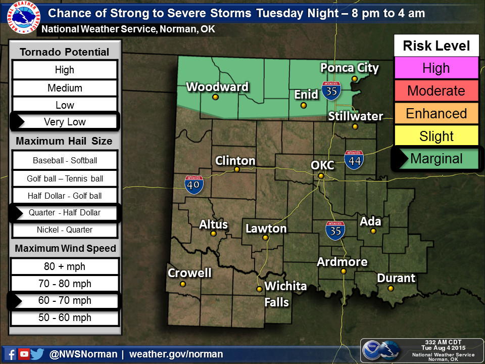
As that storm system moves off to the east, we should see another complex of
showers and storms form up in the High Plains and with the NW flow, expect that
activity to move to the SE into Oklahoma. There will be a chance of severe weather
with these storms, IF they do indeed make it into Oklahoma (which isn't a given).
That's all fine and dandy, but the dreaded heat dome is moving east back towards
Oklahoma and will camp over the Southern Plains for awhile. So the rain now is
nice, but it will all be turned to water vapor in the coming days and we will
once again see those heat index values soar into the dangerous category.
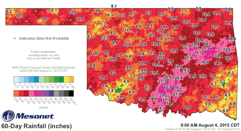
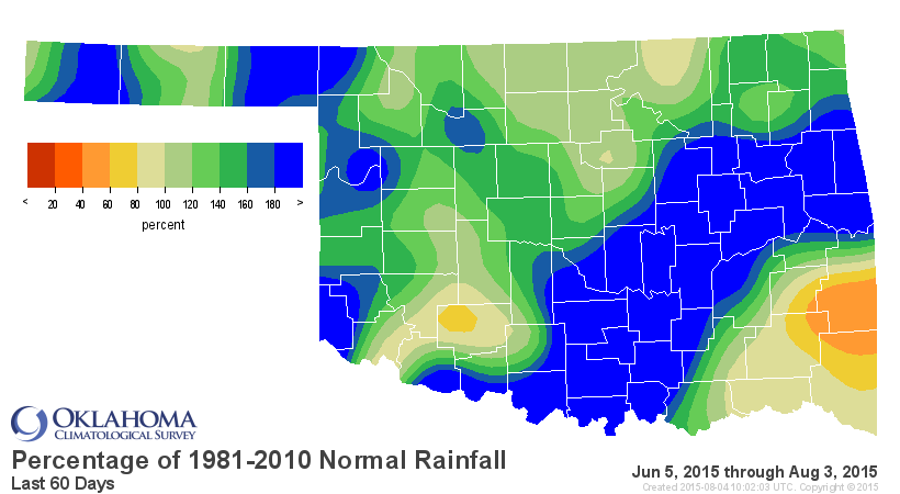
However, the August rainfall has been kind to Oklahoma thus far, especially those
parts of western Oklahoma and the Panhandle that needed a drink.
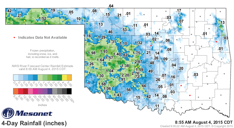
Look for that green to be covered some of eastern Oklahoma as well after
tomorrow.
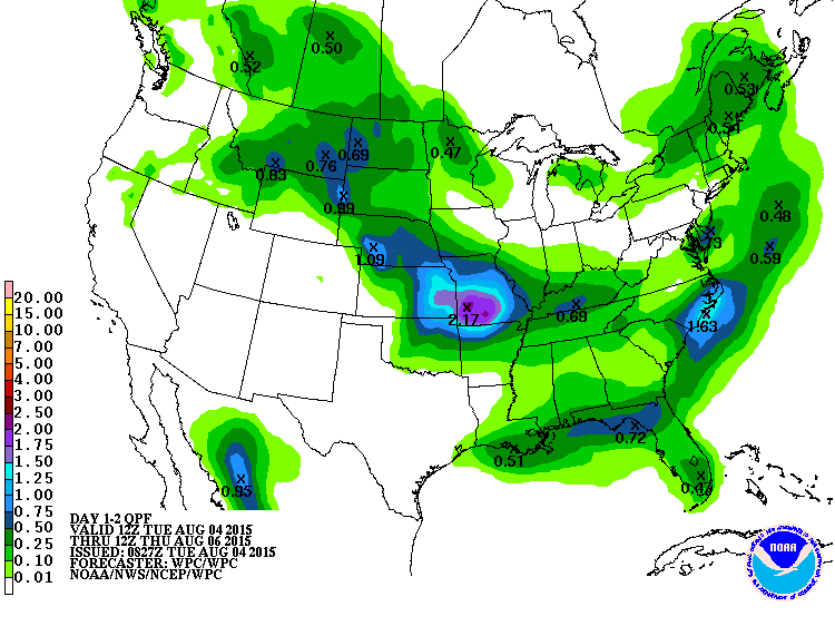
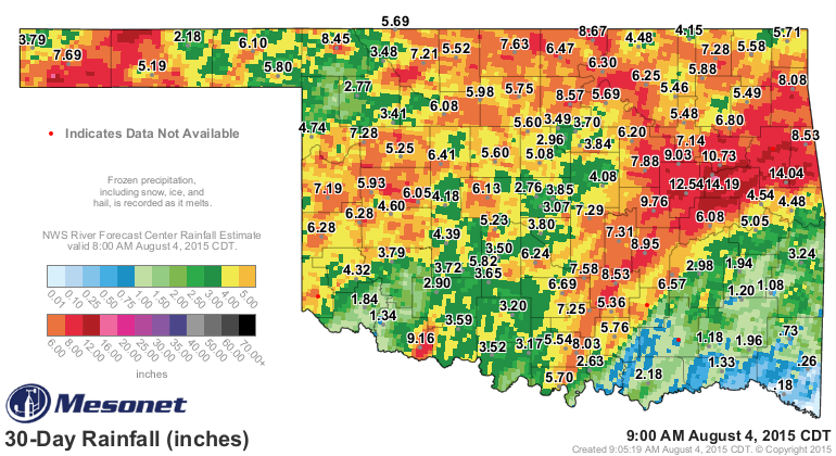
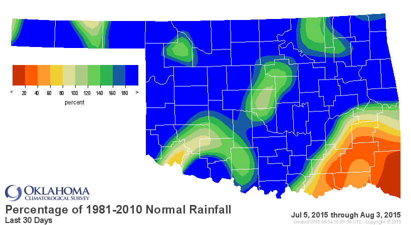
That still leaves SE OK in a bit of a hole (along with a small area of SW OK
as well).
Gary McManus
State Climatologist
Oklahoma Mesonet
Oklahoma Climatological Survey
(405) 325-2253
gmcmanus@mesonet.org
August 4 in Mesonet History
| Record | Value | Station | Year |
|---|---|---|---|
| Maximum Temperature | 112°F | KIN2 | 2012 |
| Minimum Temperature | 54°F | NOWA | 2020 |
| Maximum Rainfall | 2.29″ | JAYX | 1998 |
Mesonet records begin in 1994.
Search by Date
If you're a bit off, don't worry, because just like horseshoes, “almost” counts on the Ticker website!