Ticker for August 3, 2015
MESONET TICKER ... MESONET TICKER ... MESONET TICKER ... MESONET TICKER ...
August 3, 2015 August 3, 2015 August 3, 2015 August 3, 2015
Goodbye July, Hello August!
There's a bit of rain to be had still, which is always a blessing this time of
year. In fact, it's raining now across SW OK.
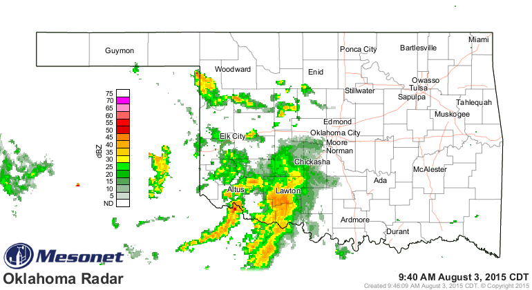
It doesn't appear that rain will spread too far to the east, but at least the
SW corner, so dry in July (keep reading!), has gotten some moisture. In fact,
Altus' total of 1.2 inches since midnight is about an inch more than what they
received in all of July (KEEP READING!).

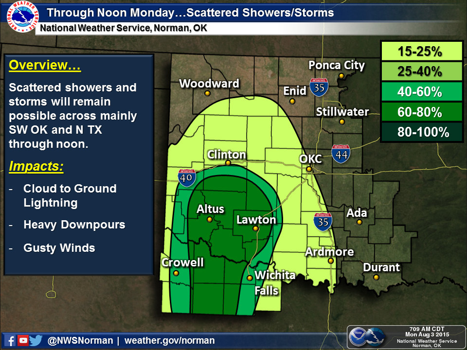
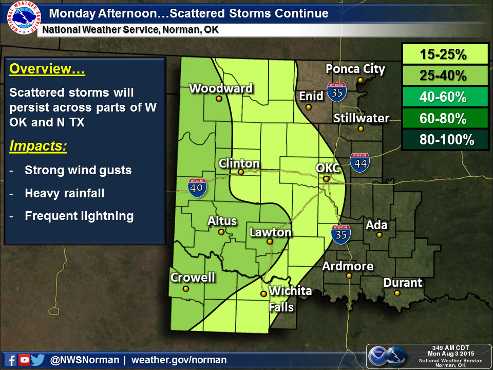
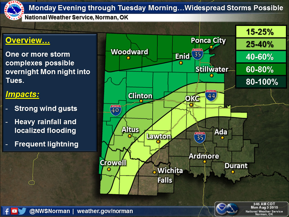
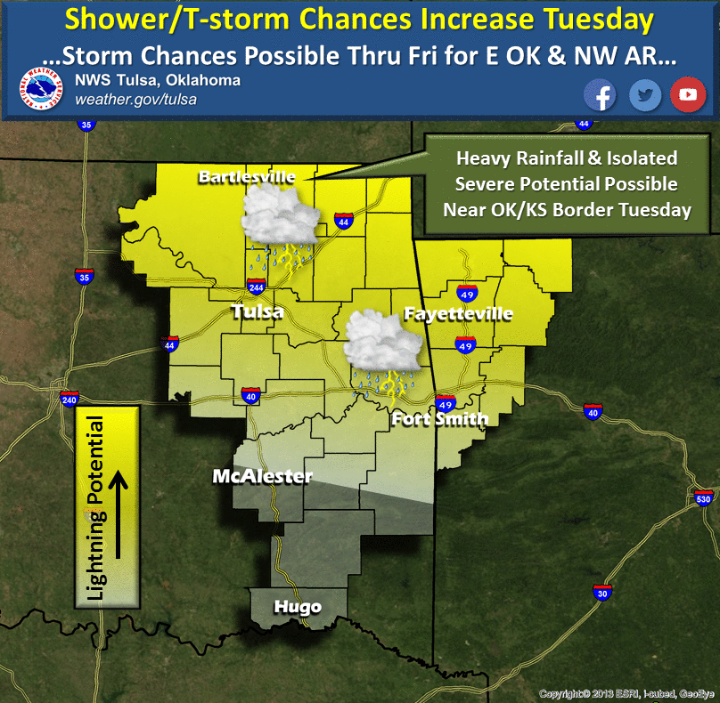
There will be another chance of rain farther east (except for the SE quarter)
in the state over the next couple of days.
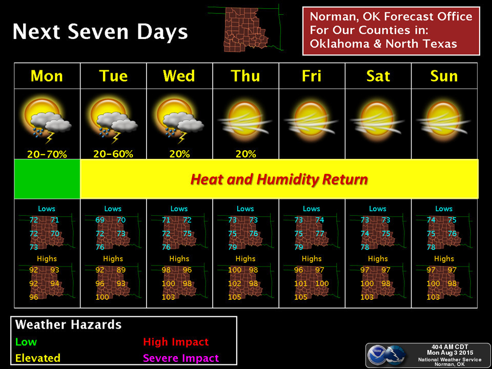
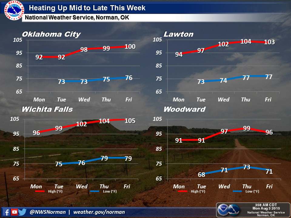
After that, keep the AC and fans on high, because Mother Nature is putting us
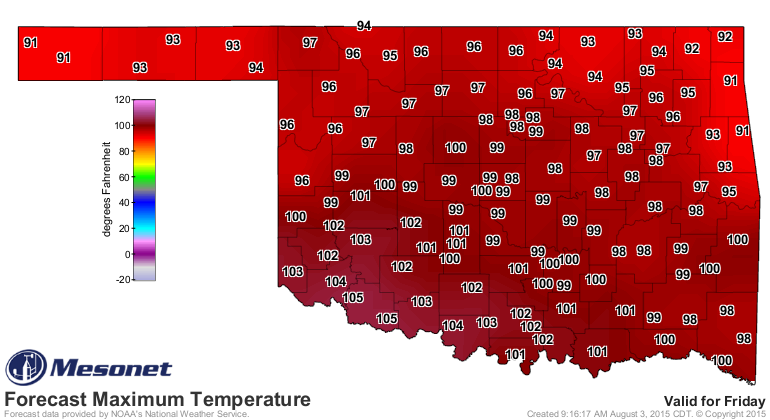
back in the Easy Bake Oven. According to the NWS Norman graphics, OKC might even
see its first triple digit temp of the year on Friday. WHEEEE!!
Have you not read enough about rain and heat, sometimes combined? Well, here's
something completely NOT different...the July summary.
----------------------------------------------------------------------------------
Heavy Rain Continues Into July
August 3, 2015
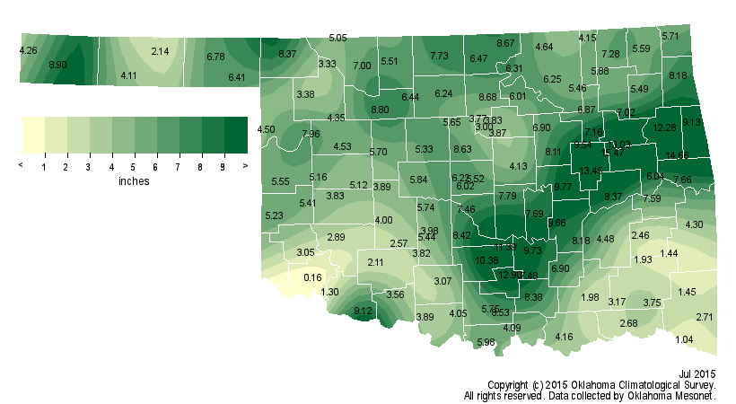
The heavy rains of spring continued right through the first week of July before
finally giving way to a more typical summertime pattern. Rainfall totals during
July were particularly excessive from south central through east central
Oklahoma, with widespread amounts of 10-15 inches through that area. According
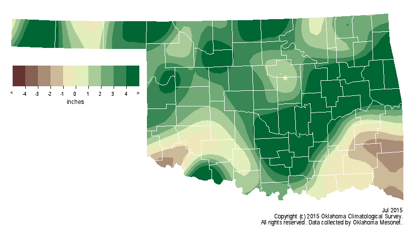
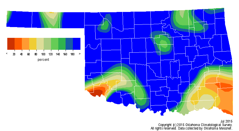
to preliminary data from the Oklahoma Mesonet, the statewide average for the
month was 5.89 inches, 3.01 inches above normal and the sixth wettest July
since records began in 1895. East central and south central sections of the
state were 6.44 inches and 4.04 inches above normal, respectively. Haskell led
the Mesonet with 15.05 inches during July, and seven other stations registered
double-digit rainfall amounts. The Altus and Tipton Mesonet sites finished with
less than an inch, the former receiving a paltry 0.16 inches. Idabel came in
with a total of just 1.04 inches, more than 2.5 inches below normal for that
location.
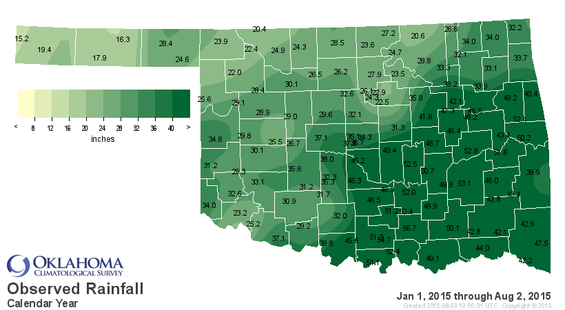
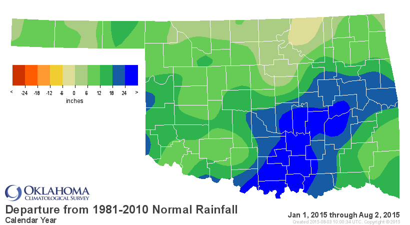
The 2015 calendar year is on pace to top 1957 as the wettest on record. The
moisture in July brought the January-July rainfall total up to a statewide
average of 34.73 inches, nearly 13 inches above normal and ranked as the
wettest first seven months of the year on record. That tops the previous record
holder's total of 34.17 inches set back in 1957, on its way to a record annual
total of 47.88 inches. The Mesonet site at Tishomingo led the state over that
period with 56.67 inches of precipitation. The annual average at Tishomingo is
44 inches. Many other stations across south central and east central Oklahoma
have already surpassed their annual average in just the first seven months
alone.
Although July's statewide average temperature was just a tad below normal at
81.4 degrees, the state still had plenty of hot, miserable weather. A large
area of high pressure camped over the state for much of the second half of the
month. That persistent summertime feature of the Southern Plains provided ample
sunshine and steered storms system up and around Oklahoma. Heat alerts were
fairly common during the second half of the month with heat index values of
105-115 across much of the state. Vinita captured both the number one and two
spot in the unbearable category with heat index readings of 118 degrees on the
24th and 116 degrees on the 19th. The 120 Mesonet stations registered a heat
index of at least 110 degrees 169 times during July. A heat index of at least
105 degrees was recorded 930 times. The highest actual air temperature during
the month was 108 degrees at Buffalo on the 13th. Arnett was held to a rain-
cooled 68 degrees for the lowest maximum temperature. The lowest minimum
temperature recorded was 52 degrees at three Panhandle stations on July 8. The
January-July statewide average of 59.4 degrees was near normal and ranked that
period as the 53rd warmest on record.
The U.S. Drought Monitor continued to show an Oklahoma devoid of drought,
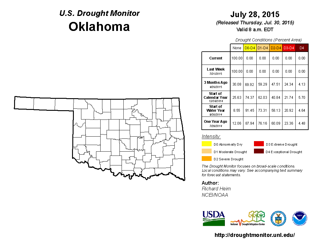
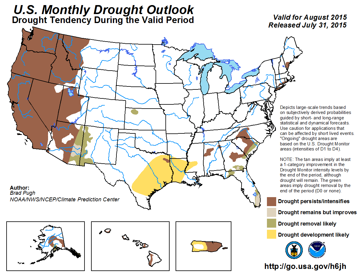
and the NWS' Climate Prediction Center's (CPC) Monthly drought outlook for
August predicted more of the same.
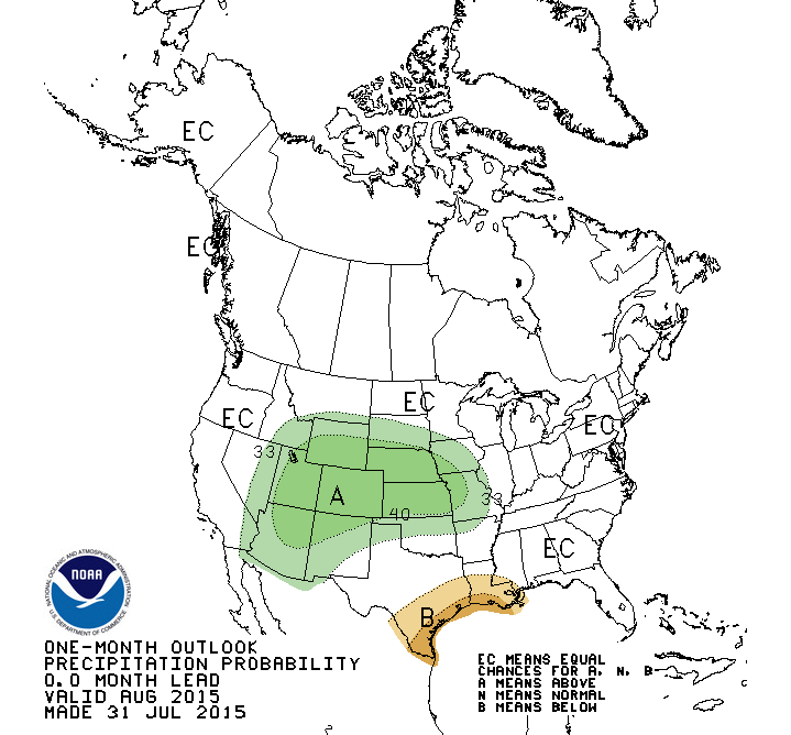
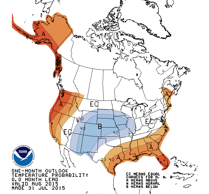
CPC's August outlooks called for increased odds of above normal precipitation
and below normal temperatures for the northern half of the state during August.
Gary McManus
State Climatologist
Oklahoma Mesonet
Oklahoma Climatological Survey
(405) 325-2253
gmcmanus@mesonet.org
August 3 in Mesonet History
| Record | Value | Station | Year |
|---|---|---|---|
| Maximum Temperature | 115°F | WILB | 2011 |
| Minimum Temperature | 53°F | CAMA | 2021 |
| Maximum Rainfall | 5.73″ | CHER | 1995 |
Mesonet records begin in 1994.
Search by Date
If you're a bit off, don't worry, because just like horseshoes, “almost” counts on the Ticker website!