Ticker for July 29, 2015
MESONET TICKER ... MESONET TICKER ... MESONET TICKER ... MESONET TICKER ...
July 29, 2015 July 29, 2015 July 29, 2015 July 29, 2015
Wait for it...
The slowest moving cold front in history has entered the NW corner of the state.
You can see it in the Mesonet wind fields and also the air temperature map. And
also the dewpoint and wet-bulb temperature maps. Heck, if you were in the
Panhandle, you could just go outside and feel it! Why are you not in the Panhandle
again? Well that's your fault.
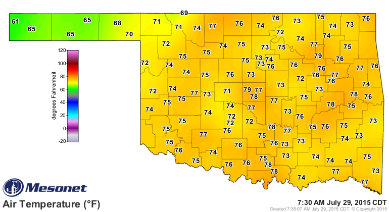
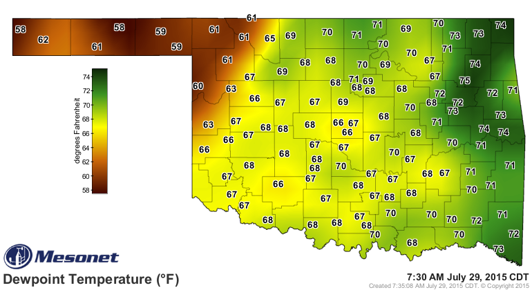
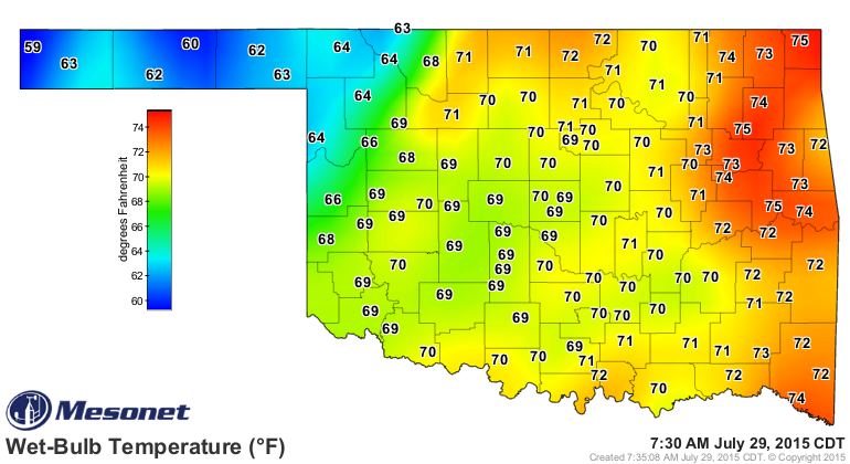
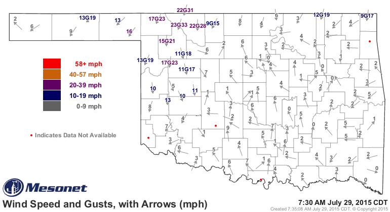
It's a slow moving sucker, much like myself, so you're gonna have to wait awhile
to see its impact as you go to the southeast. But eventually, you should be
rewarded with some cooler, drier weather, both of which will be greatly welcomed.
Let's call that day "Friday."
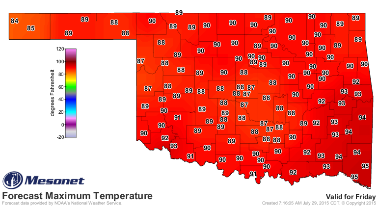
Those in the southeast are a bit out of luck, as that front will stall and sort
of mix out, but there are rain chances for the northern half of the state over
the next few days and then western OK thanks to its slow crawl to the south.
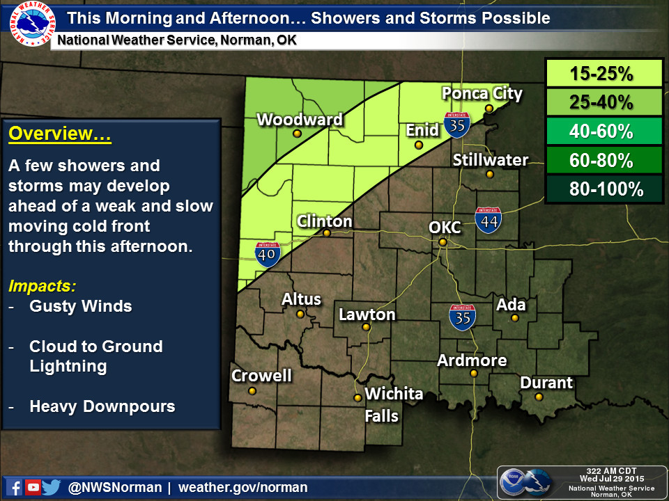
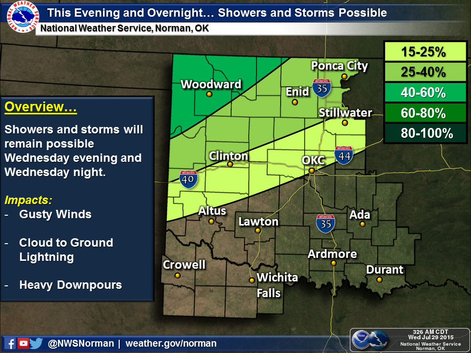
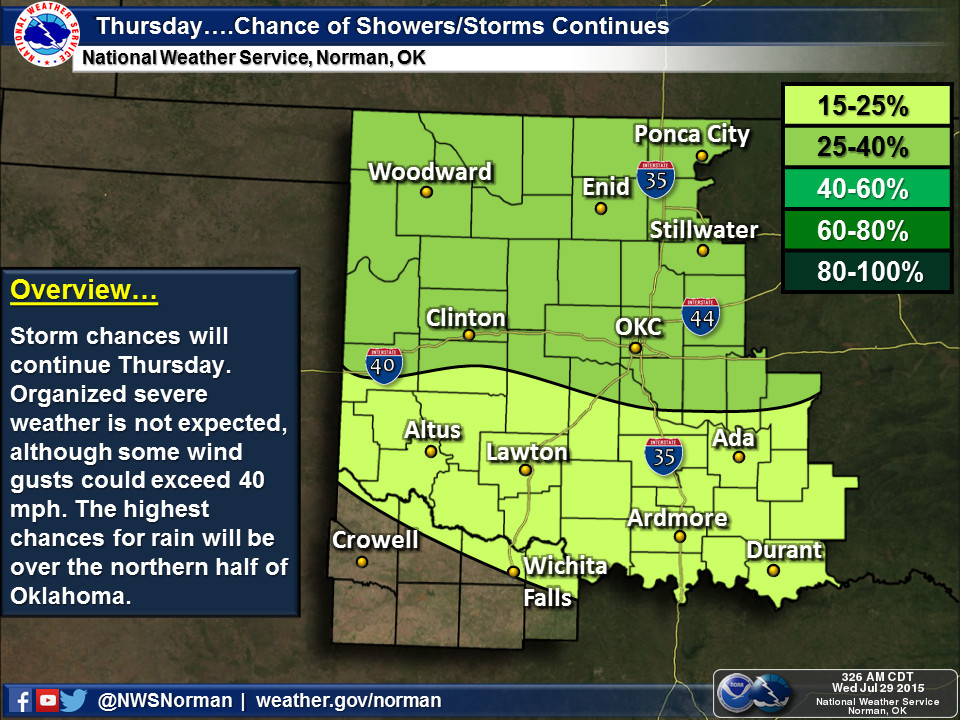
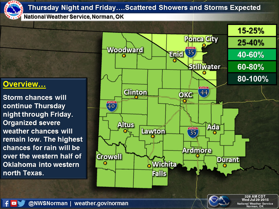
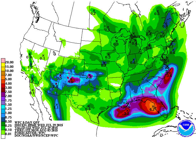
Some impressive totals for NW OK being forecast. If they actually happen,
wonderful. If not, at least you had a dream for a bit. And remember, what falls
this week will be turned to steam next week.
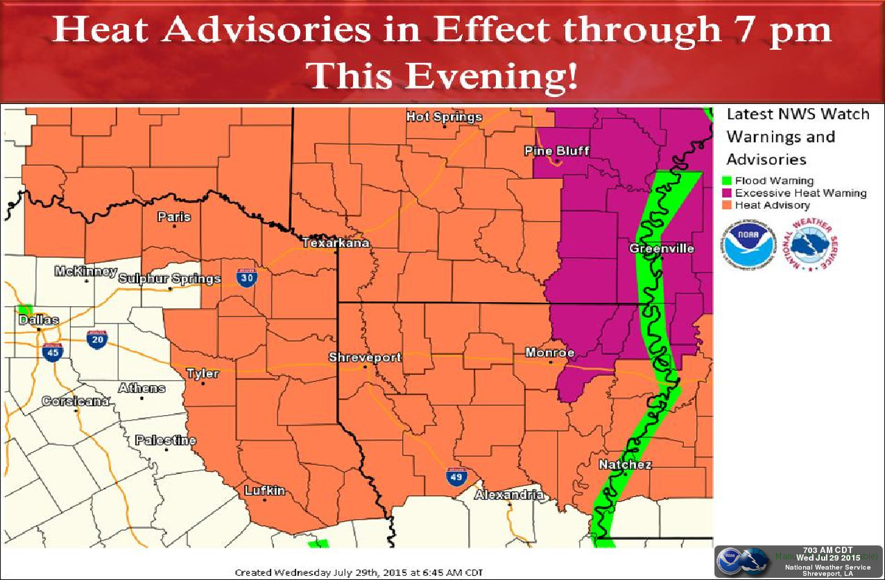
Until you see that front, however, prepare to bake. But at least it's a moist
heat??
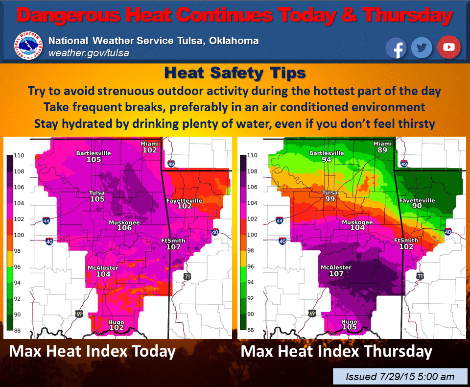
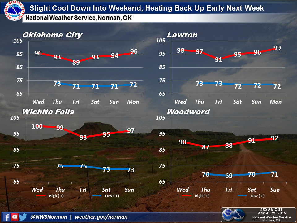
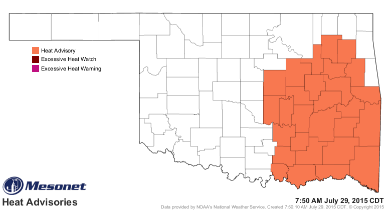
Now get thee to the Panhandle! Or wait where you are for a day or two. Whichever
you prefer.
Gary McManus
State Climatologist
Oklahoma Mesonet
Oklahoma Climatological Survey
(405) 325-2253
gmcmanus@mesonet.org
July 29 in Mesonet History
| Record | Value | Station | Year |
|---|---|---|---|
| Maximum Temperature | 110°F | INOL | 2012 |
| Minimum Temperature | 51°F | BEAV | 2005 |
| Maximum Rainfall | 4.67 inches | OKMU | 2020 |
Mesonet records begin in 1994.
Search by Date
If you're a bit off, don't worry, because just like horseshoes, “almost” counts on the Ticker website!