Ticker for July 24, 2015
MESONET TICKER ... MESONET TICKER ... MESONET TICKER ... MESONET TICKER ...
July 24, 2015 July 24, 2015 July 24, 2015 July 24, 2015
Wet heat, dry heat...you name it, we got it!
Disgusting, nasty, unrelentingly steamy, etc. etc. Not sure I want to think of
more adjectives to describe the weather we're having lately. How about a picture
(yayyyy, I can skip 1000 more words) instead?
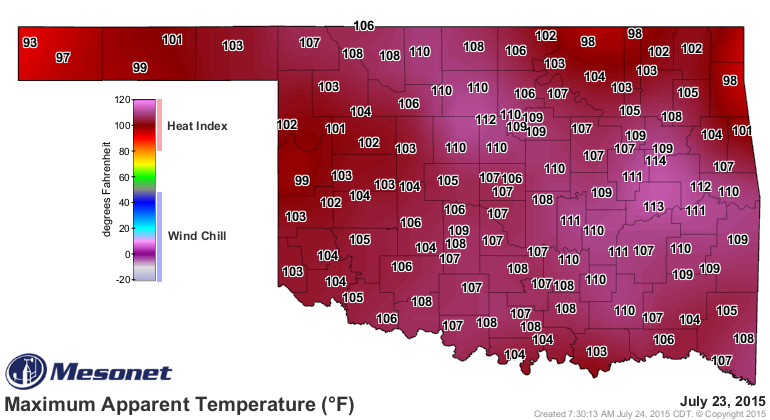
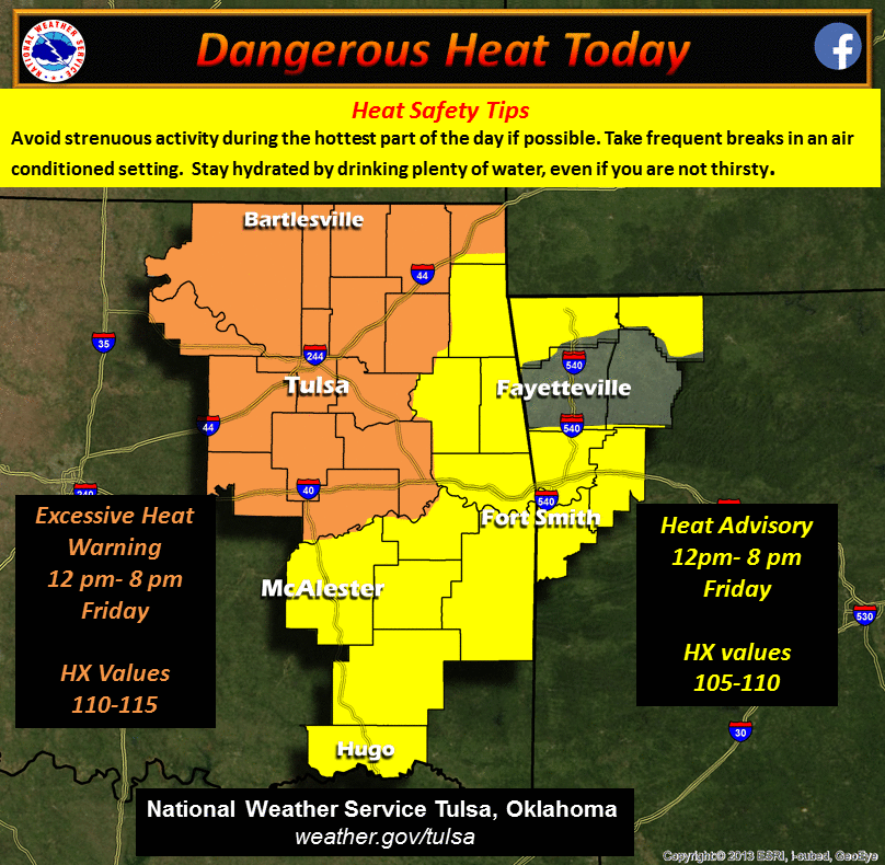
I know we've had higher heat index values this summer, but yesterday just looks
particularly nasty for some reason. That 113 at Eufaula is high, but the 107
at BUFFALO is more impressive, because it happened in BUFFALO. Sorry Eufaula, you
know I'm right. But we owe all of this to the continued rains that we've had, but
also a combination of the moisture-rich flow from the south off the Gulf of
Mexico, and the heat dome parked over the Southern Plains. Dewpoints have been
up in the mid-70s to low-80s. We had 12 Mesonet stations hit the magical 80
degree dewpoint mark yesterday with Webbers Falls leading the way at 83 degrees.
83 DEGREES! For comparison's sake, that's like a dewpoint of 82 degrees, then
add a degree. It doesn't happen too often. It's still a bit off from the highest
dewpoints seen on the Mesonet, but it is the highest since Clayton hit 84
degrees back on July 24, 2011.
BUFFALO still leads the Mesonet in days above 100 with 10.
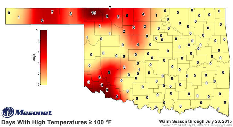
Poor Altus, Freedom and Tipton can only gaze from way way way back in the rear
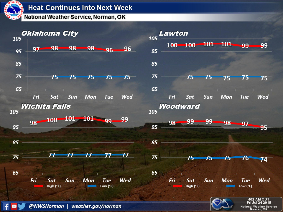
with 9 (okay, only down by 1, but you know, it's BUFFALO). Now expect this heat
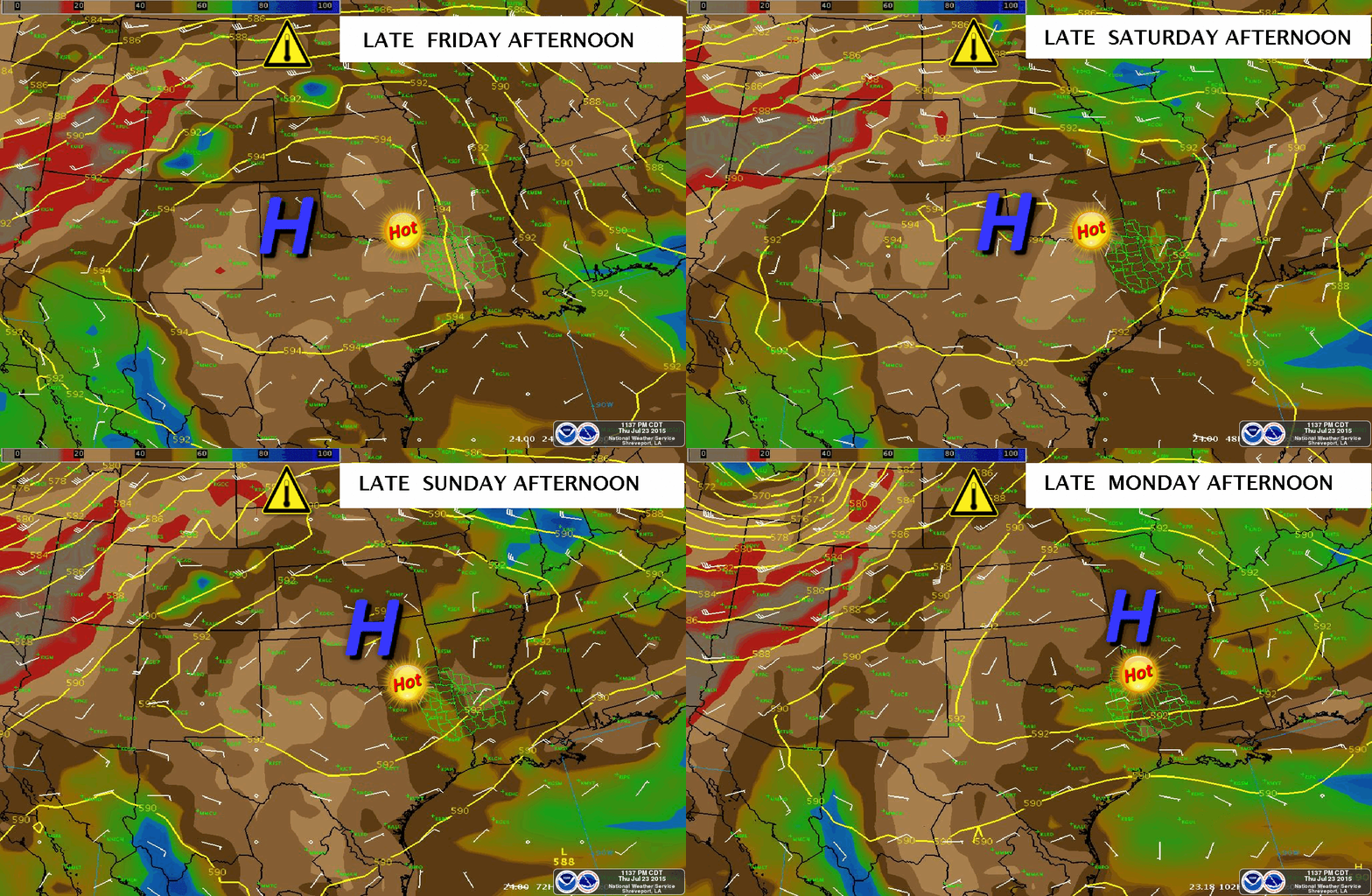
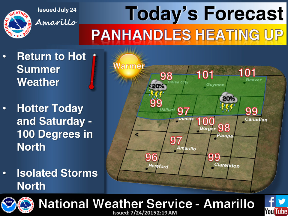
to continue through the weekend. By then, we might see that heat dome shift
just a tad to the east and cool us down a few degrees. The NWS office at
Shreveport has a nice little animated graphic showing that subtle shift, which
might allow a few showers and storms to plague us next week.
Don't expect much, however.
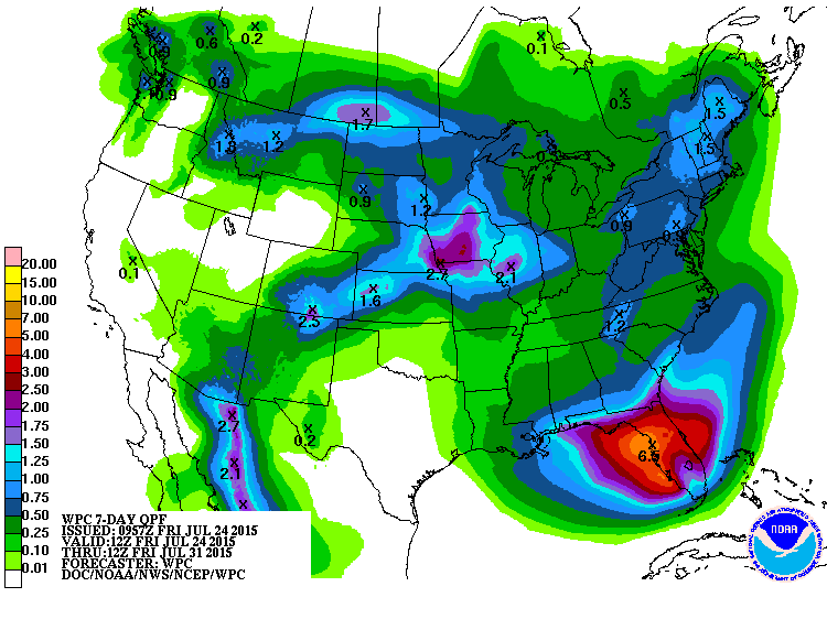
Except lots of heat.
I'm ready to evaporate all this moisture, cut off the Gulf, and get back to the
good old blast furnace style heat I grew up with out in BUFFALO.
Or Autumn, whichever comes first.
Gary McManus
State Climatologist
Oklahoma Mesonet
Oklahoma Climatological Survey
(405) 325-2253
gmcmanus@mesonet.org
July 24 in Mesonet History
| Record | Value | Station | Year |
|---|---|---|---|
| Maximum Temperature | 110°F | MARE | 2011 |
| Minimum Temperature | 48°F | CAMA | 2019 |
| Maximum Rainfall | 4.43″ | COOK | 2004 |
Mesonet records begin in 1994.
Search by Date
If you're a bit off, don't worry, because just like horseshoes, “almost” counts on the Ticker website!