Ticker for July 23, 2015
MESONET TICKER ... MESONET TICKER ... MESONET TICKER ... MESONET TICKER ...
July 23, 2015 July 23, 2015 July 23, 2015 July 23, 2015
Mother Nature, you big dummy!
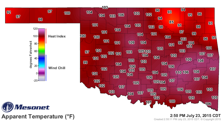
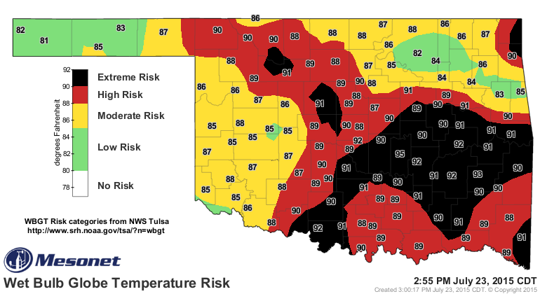
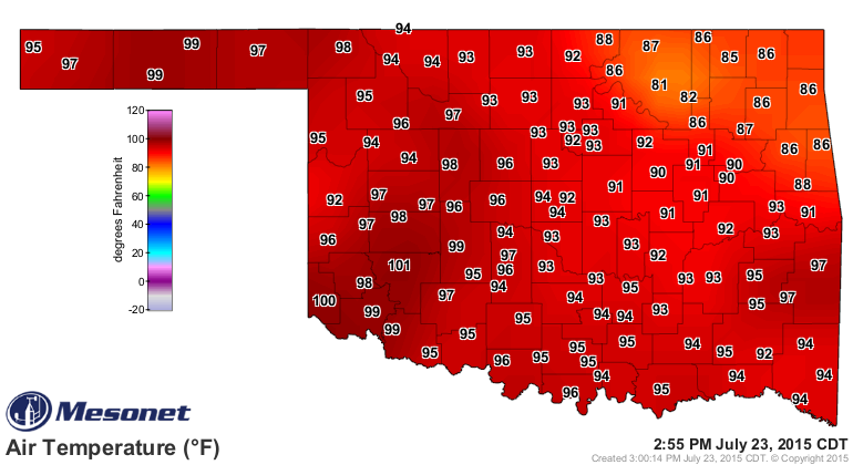
It's only 3pm and already we see all the dangerous heat related indices pinging
the tops of the charts across the state, from the heat index
to the wet temperature risky bulb globe (AKA the wet bulb globe temperature risk)
to just the plain old temps (which look nicer than they really are)
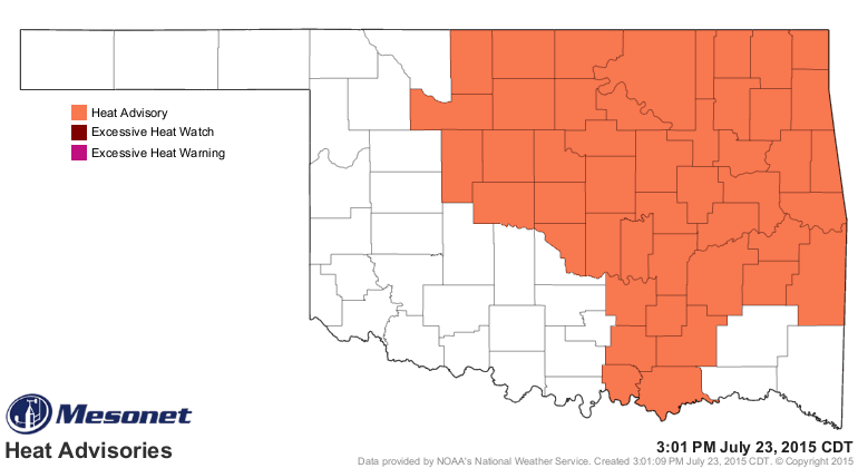
All of which are why we have a heat advisory in place for a large part of the
state through Friday.
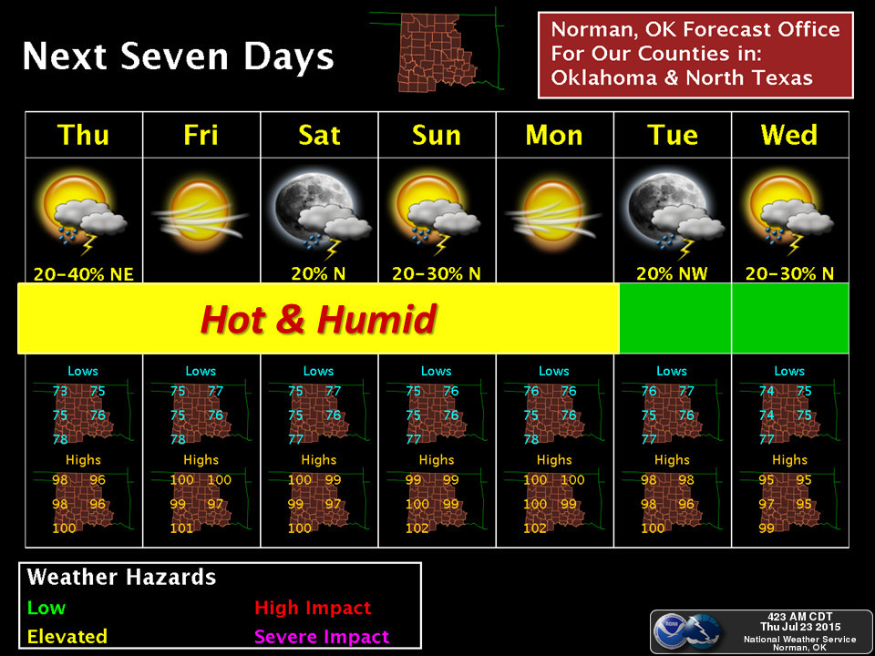
Don't expect much help soon...maybe early next week we'll get down to more
mild conditions (relatively).
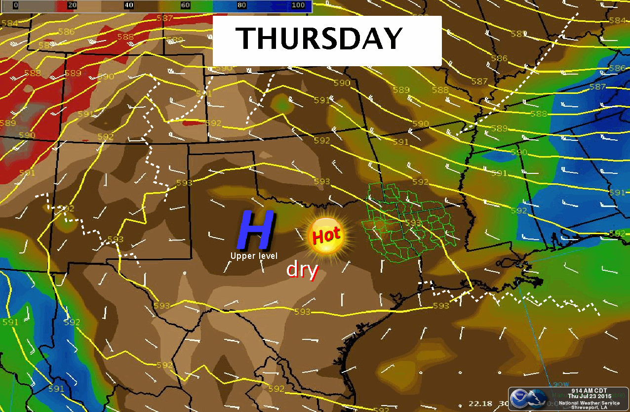
So grab yourself a cold one (ROOT beer) and relax under the calming but baking
action of the infamous Southern Plains Heat Dome
and await the grasshopper and beetle plagues to descend upon us!
https://www.youtube.com/watch?v=BRj_ZZ-GcCk&feature=youtu.be
Before you go all Pharaoh, however, remember that these radars have always
been able to pick up biological returns, such as birds, bugs, and even non-
biological oddities like cars traveling along the interstate.
Gary McManus
State Climatologist
Oklahoma Mesonet
Oklahoma Climatological Survey
(405) 325-2253
gmcmanus@mesonet.org
July 23 in Mesonet History
| Record | Value | Station | Year |
|---|---|---|---|
| Maximum Temperature | 109°F | CHER | 2001 |
| Minimum Temperature | 54°F | ELRE | 2019 |
| Maximum Rainfall | 4.28″ | TAHL | 2013 |
Mesonet records begin in 1994.
Search by Date
If you're a bit off, don't worry, because just like horseshoes, “almost” counts on the Ticker website!