Ticker for July 22, 2015
MESONET TICKER ... MESONET TICKER ... MESONET TICKER ... MESONET TICKER ...
July 22, 2015 July 22, 2015 July 22, 2015 July 22, 2015
Chasing 1957
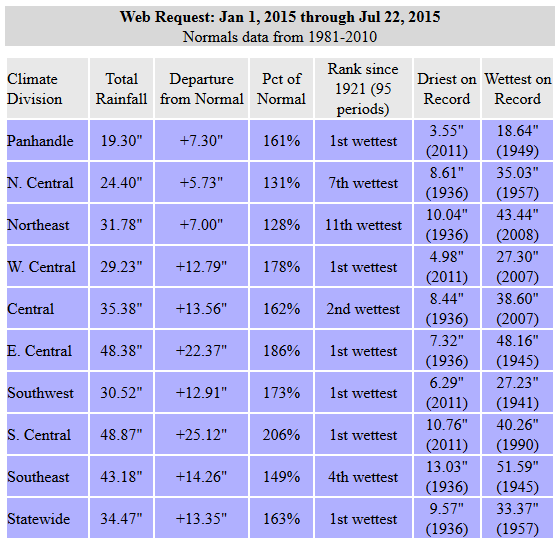
Here we go, July rainfall at a statewide average of 5.24 inches already ranks the
month (as a whole) as the 9th wettest since 1895, and as per usual...it's still
raining.
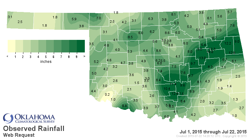
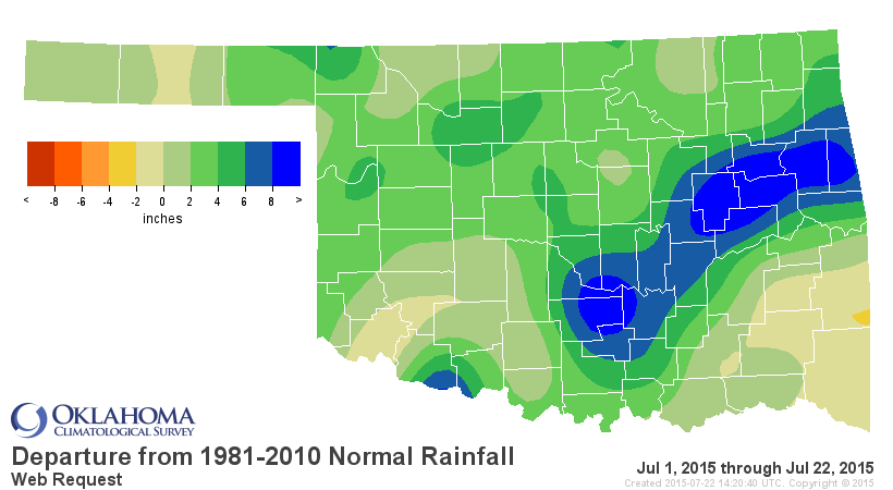
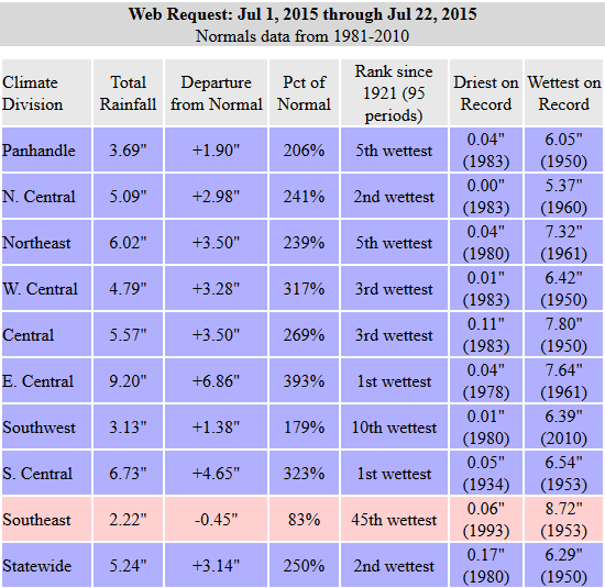
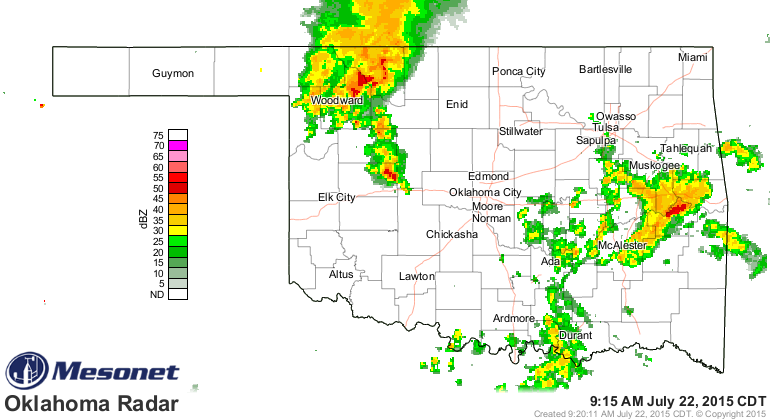
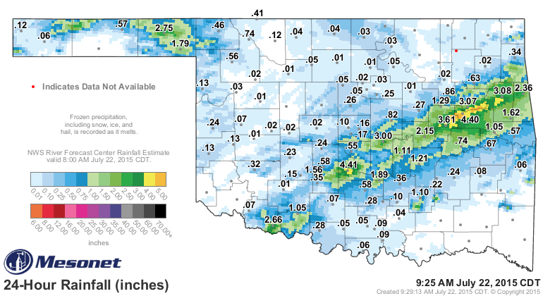
Notice also that it's the 2nd wettest July 1-22 since at least 1921, and the
wettest such period for EC and SC Oklahoma. Last night's storms missed SE OK where
the deficits are still minor at this point. But a good portion of the eastern
Panhandle and EC OK had some really nice summertime rains.
How about our horse race with 1957 to end up as the wettest year on record? Recall
that 1957 is the wettest year on record for Oklahoma with a statewide average of
47.88".
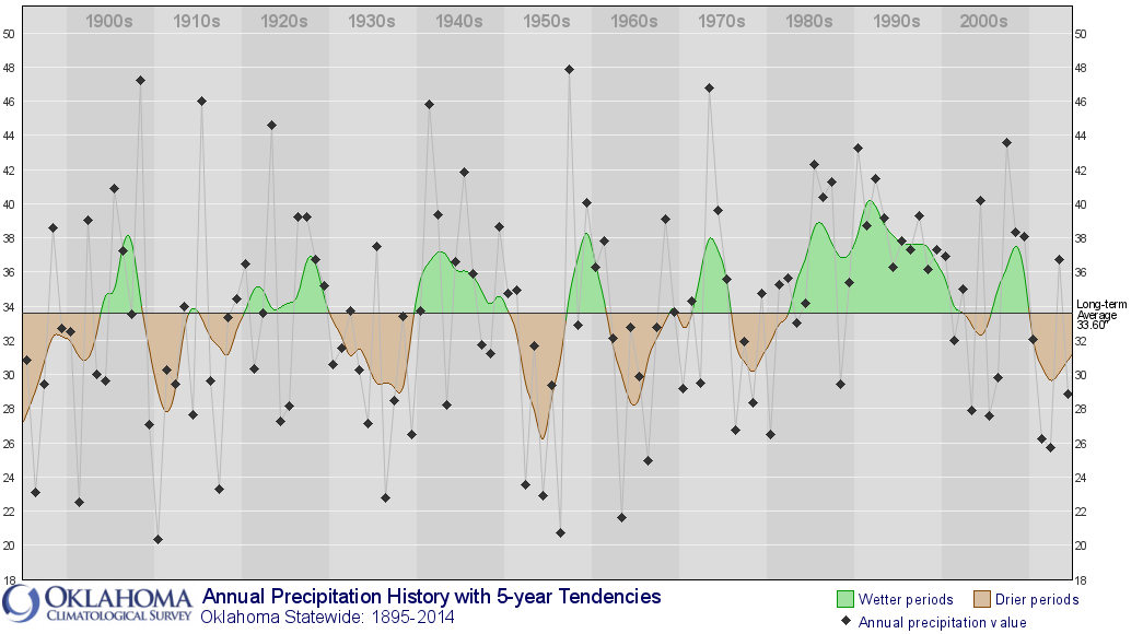
1957 ended up with a statewide average of 34.17" through July, and then
ended up with a rather ordinary 13.71" through the rest of the year. So 2015 has
now overtaken 1957's record-setting pace by a third of an inch or so (again,
with rain still falling and 9 days lest in the month).
By now I'm sure you've heard about the super-duper El Nino that appears to be
taking steroids and continuing to strengthen in the equatorial pacific. Here's
a pic of the comparison of temperature anomalies down that way this year as
compared with the other super-duper 'roided out El Nino from 1997.
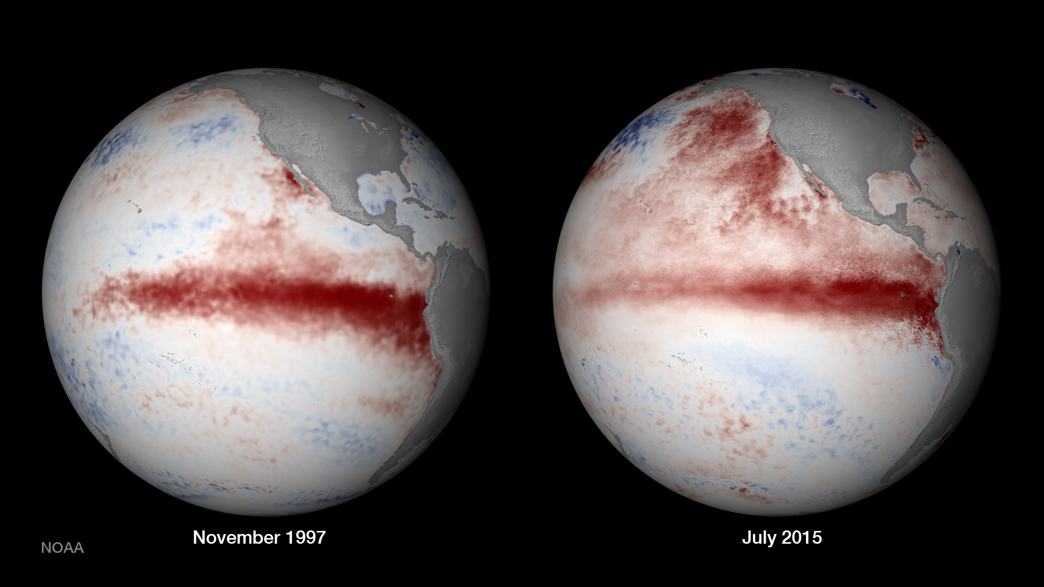
"Comparison of 1997 and 2015 Ocean Temperatures
The 1997-1998 El Ni?o was distinguished by record-breaking warm sea
surface temperature anomalies in the equatorial east-central Pacific
Ocean. So far in 2015, increasing equatorial warmth is developing
alongside a positive Pacific Decadal Oscillation, characterized by
persistently higher sea surface temperature anomalies of the
northeastern Pacific. This image from NOAA View shows sea surface
temperature anomalies from November 1997 and July 2015."
A couple of important points there...they are comparing November 1997 to July
2015, so not the same time of the year. November is more relevant since that's
when the impacts to our part of the world become more significant. AND, the
presence of a warm Pacific Decadal Oscillation (PDO) generally favors more
El Ninos over time, and also wetter conditions across our part of the world.
You can also see that big blob of warm water that has persisted off the southern
part of the West Coast of the U.S. that is thought to be at least partially
responsible for their drought conditions.
But to sum up, a strong El Nino through the fall and winter would FAVOR (BUT
NOT GUARANTEE) a wetter than normal fall-spring period, and would presumably
put us in the running to gun down 1957 as the wettest year on record. Still
5 months to go, a long time in the weather world.
But verrrryyyy interesting nevertheless!
Gary McManus
State Climatologist
Oklahoma Mesonet
Oklahoma Climatological Survey
(405) 325-2253
gmcmanus@mesonet.org
July 22 in Mesonet History
| Record | Value | Station | Year |
|---|---|---|---|
| Maximum Temperature | 112°F | GRA2 | 2018 |
| Minimum Temperature | 56°F | GOOD | 2006 |
| Maximum Rainfall | 2.75″ | BEAV | 2015 |
Mesonet records begin in 1994.
Search by Date
If you're a bit off, don't worry, because just like horseshoes, “almost” counts on the Ticker website!