Ticker for July 14, 2015
MESONET TICKER ... MESONET TICKER ... MESONET TICKER ... MESONET TICKER ...
July 14, 2015 July 14, 2015 July 14, 2015 July 14, 2015
Should have voted for Pedro!

And here all this time I thought Pedro won the election. The Oklahoma weather
says otherwise. I know all the outlooks and whatnot were saying we were going
to have a nice, cool July...but then it stopped raining. Here's a primer once
again for Oklahoma summers: when it rains, it tends to be milder (high temperatures
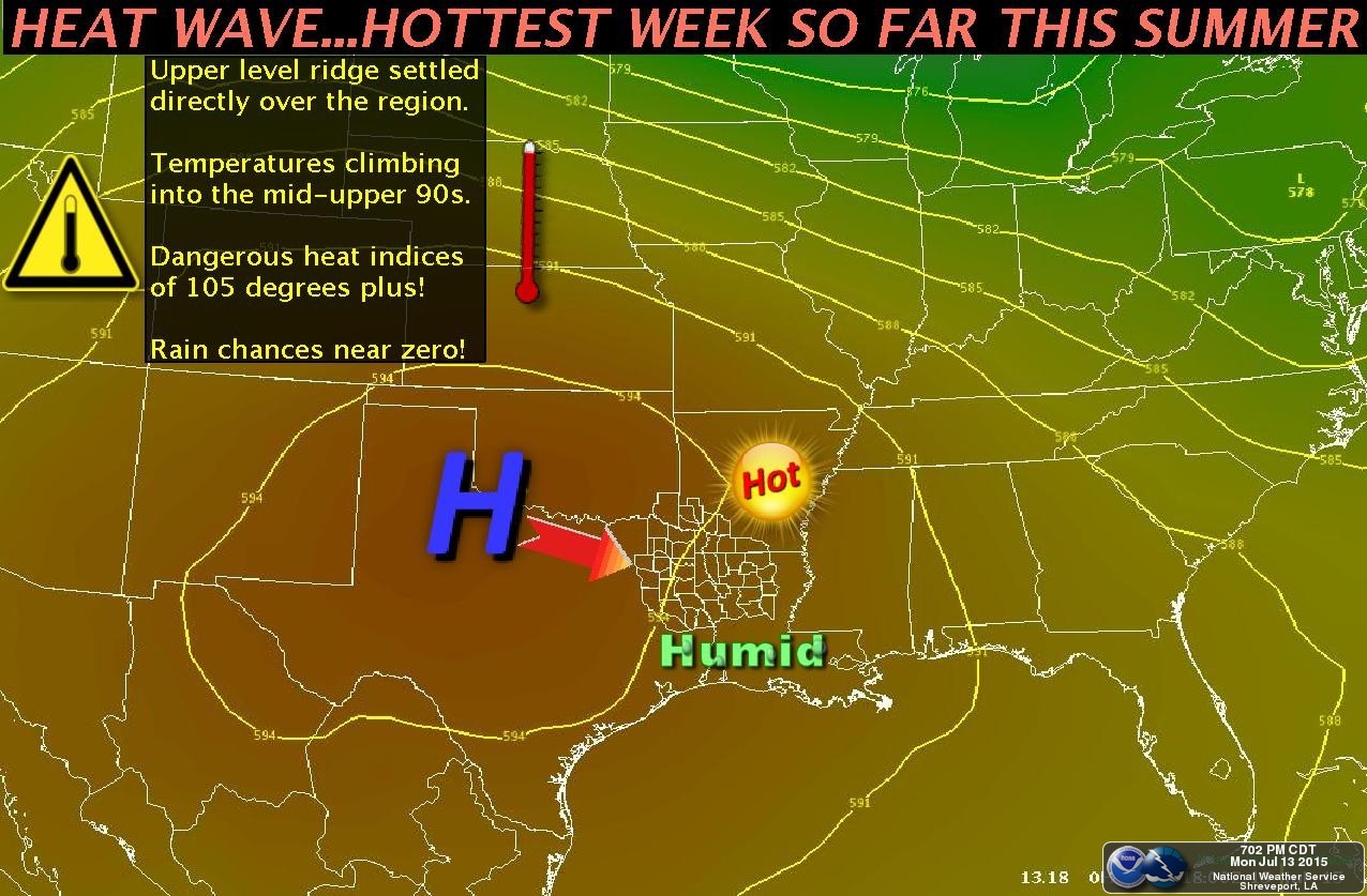
held in check a bit). When it doesn't rain, AND we get that heat dome sitting over
the Southern Plains, it's gonna get hot. And if that doesn't show on the air
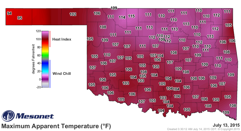
temperature maps, it will on the heat index version. Check out yesterday's high
temperatures as well as the maximum heat indices from across the state, via the
Oklahoma Mesonet.
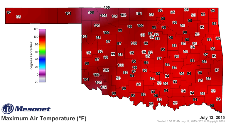
Nobody could top Buffalo's 108 degrees on the air temperature map, also the
highest temp of the summer thus far as recorded by the Mesonet AND one of the
highest readings we've seen in nearly 2 years. Waurika was the last station to
do it way back on Sept. 1, 2013.
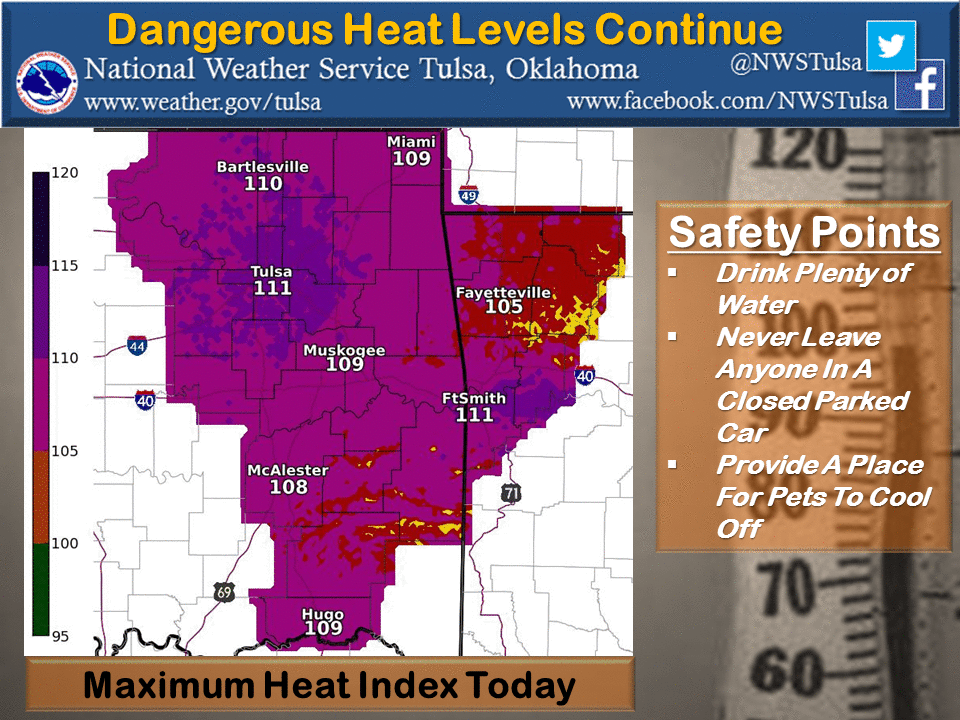
But Cherokee won the Miserable Award with a heat index of 115 degrees,
although as you can see, a lot of the state shared in their misery. Now that's
the first time we've seen a heat index that high in nearly THREE years, since
Nowata hit 115 degrees on August 4, 2014. Inola did the same a few days before
on August 1, 2012. If you'll remember, that last week of July and first week
of August back in 2012 at the height of the drought was one of the hottest
periods in state history.
So all that rain comes with a price when you combine the surface moisture and
a our seasonal heat dome. And don't forget we are getting moisture streaming
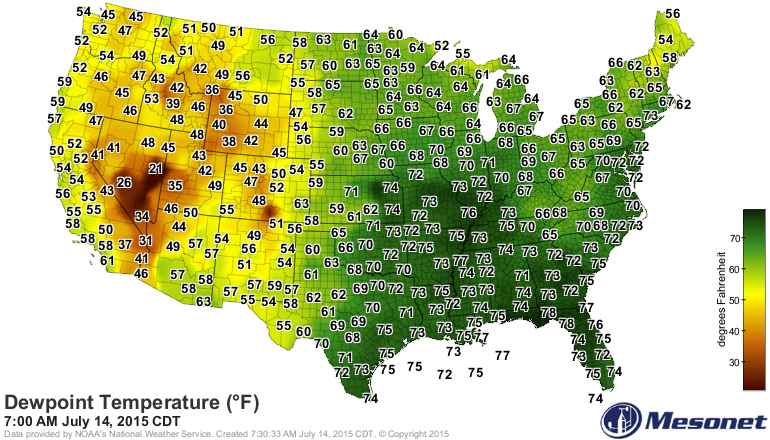
up from the Gulf of Mexico as well on some pretty decent southerly winds. Most
of the eastern half of the country is a hot, sticky mess as evidenced by the
U.S. dewpoint map.
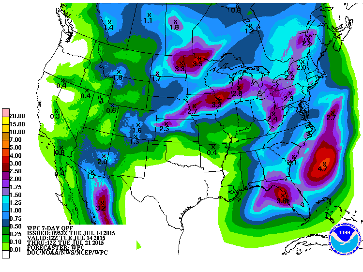
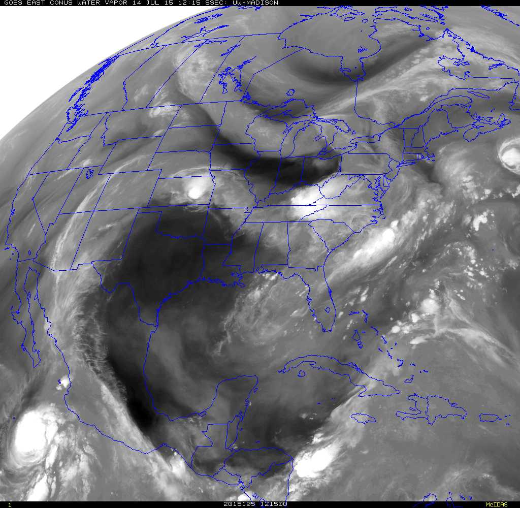
You can clearly see the signs of that heat dome in several forms, such as
the satellite images, and also the rainfall forecast maps. All the active wx is
being deflected up and over the Southern Plains.

I'm sorry to say, expect more of the same for the immediate future.
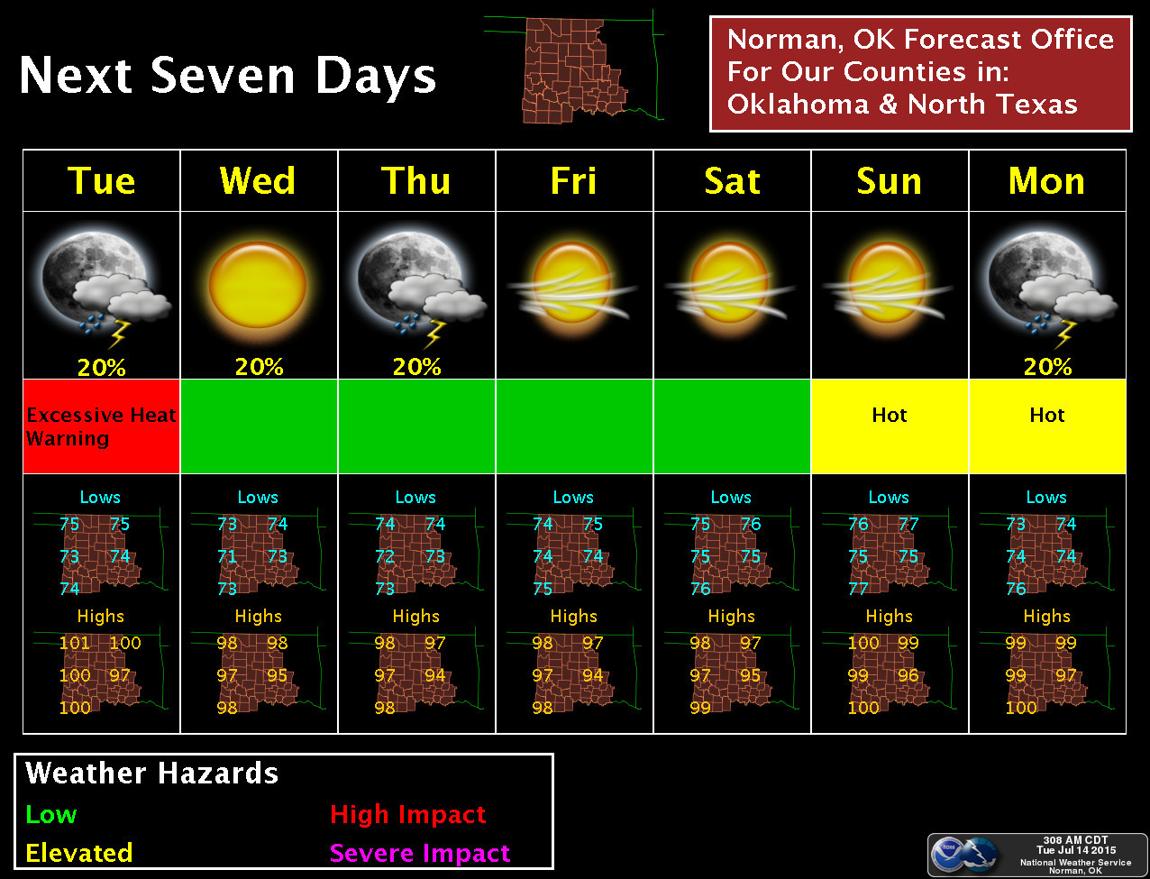
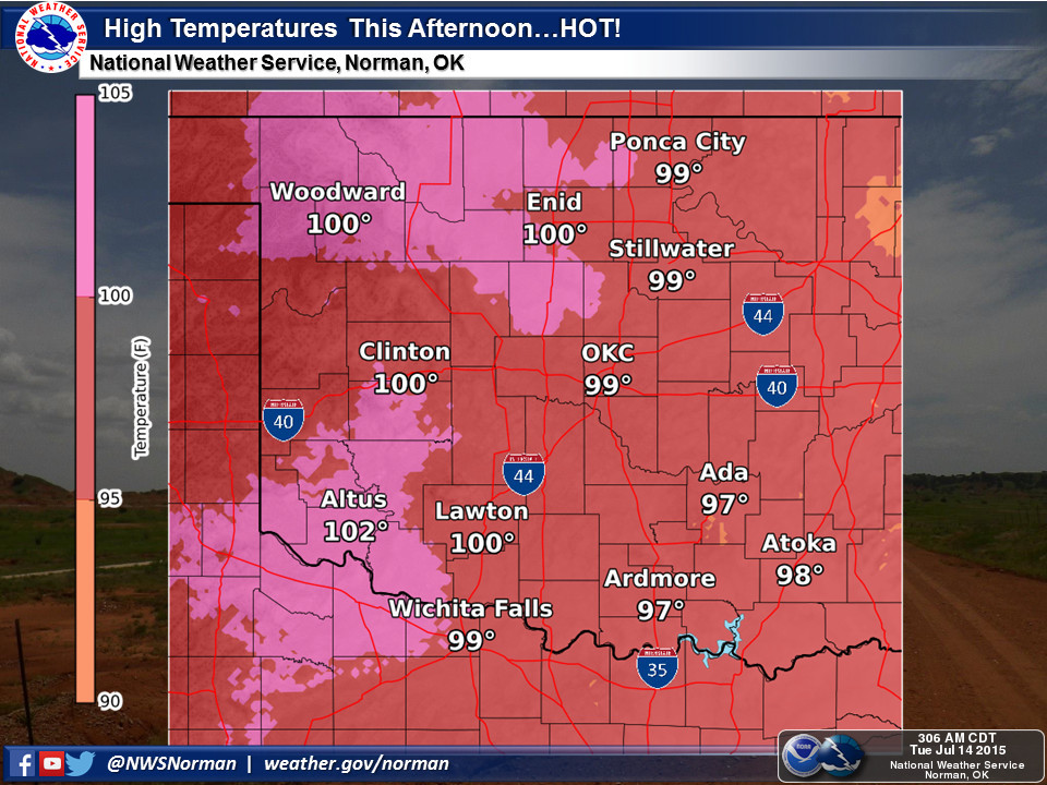
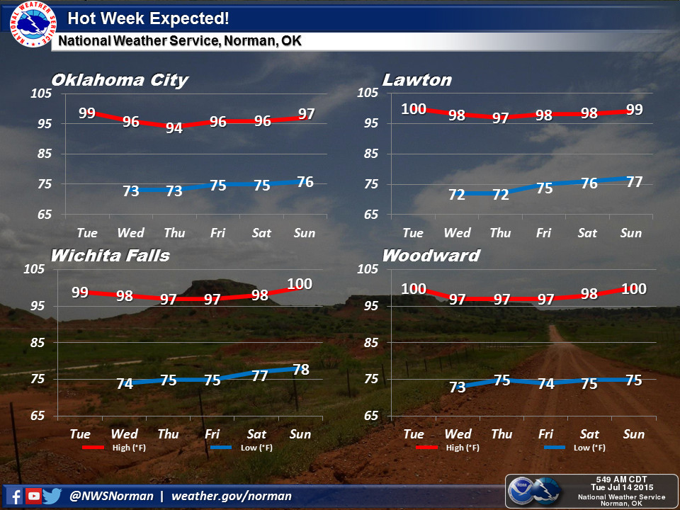
And all of our flood maps have been replaced with heat advisory maps.
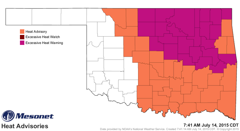
The heat advisory in orange means heat index values of 105-109 are expected
today, and the excessive heat warning in purple-ish means heat indices of
107-111. This is a very dangerous situation. There is actually another indicator
similar to the heat index that measures the danger of the heat to humans, known
as the "Wet Bulb Globe Temperature." This work was brought to the Mesonet
through the NWS Tulsa office, and like the heat index, it takes into account
the air temperature and the relative humidity, but it also adds in the impacts
of the sun and wind. Here is the official explanation as found on the Mesonet
website:
"The Wet Bulb Globe Temperature Risk map plots the current wet bulb
globe temperature (degrees F) at the standard height of 1.5m (5 feet)
along with its associated risk category. The wet bulb globe temperature
is an estimation of the impact of temperature, humidity, wind speed,
and solar radiation on humans. Its values are similar to a heat index;
however, the wet bulb globe temperature additionally accounts for
sunlight exposure and wind speed. The risk categories are based on
guidelines from the NWS Tulsa WFO. This map is updated every 5 minutes."
So a good wind will help cool your body by increasing the evaporation of sweat
from your skin (up to a point...a really hot wind counters this effect), and
if you're standing in the sun rather than shade, you're obviously gonna get
quite a bit more heat input. You can find the current Wet Bulb Globe Temperature
Risk maps here:
http://www.mesonet.org/index.php/weather/map/wet_bulb_globe_temperature_risk/air_temperature
Here's the rub...don't panic if it doesn't rain for awhile and we start to see
our lawns and other vegetation turn yeller or brown across the state. Before the
drought, that was actually a common occurrence as well during the summer. That
doesn't mean that the drought is roaring back. Now if it continues too long
with the dry weather and extreme heat, then we start to talk about a flash
drought situation. Otherwise, this is summer in Oklahoma, drought or not. It's
what you signed up for when you became an Okie.
Take heart...September is only a month and a half away.
Gary McManus
State Climatologist
Oklahoma Mesonet
Oklahoma Climatological Survey
(405) 325-2253
gmcmanus@mesonet.org
July 14 in Mesonet History
| Record | Value | Station | Year |
|---|---|---|---|
| Maximum Temperature | 113°F | HOLL | 2020 |
| Minimum Temperature | 54°F | EVAX | 2019 |
| Maximum Rainfall | 5.94″ | ANT2 | 2025 |
Mesonet records begin in 1994.
Search by Date
If you're a bit off, don't worry, because just like horseshoes, “almost” counts on the Ticker website!