Ticker for July 9, 2015
MESONET TICKER ... MESONET TICKER ... MESONET TICKER ... MESONET TICKER ...
July 9, 2015 July 9, 2015 July 9, 2015 July 9, 2015
Uhhhh, it's rained HOW much?
With big blobs of rain invading the state as we speak (and we all know just how
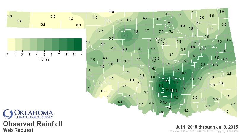
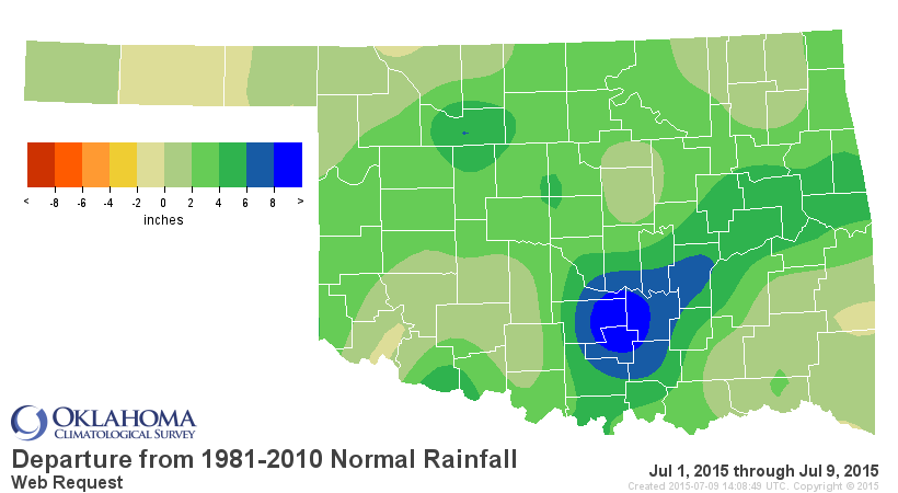
painful that can be), the rainfall totals for July continue to increase. As of
9:05am, the statewide average total was 3.60", about 2.7" above normal, and also
the wettest July 1-9 since at least 1921. 2010's 3.21" comes in second. The totals
are once again dominated by south central Oklahoma, of course (HEY LAKE TEXOMA...
HERE'S SOME MORE FOR YA!), but there is a good chunk of 2-6" in other areas as
well.
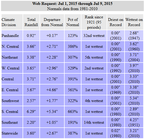
Heck, at 3.21" through the 9th, that already ranks this July as the 47th wettest
on record even if this is the end of the rain for the rest of the month. Add these
totals to the ginormous totals of April-June and you have the makings for a record-
breaking year. Again, as of 9:05am this morning, the statewide average for the
year thus far is 32.82", 12.87" above normal and just a hair (don't do it!) behind
1957's 32.91".
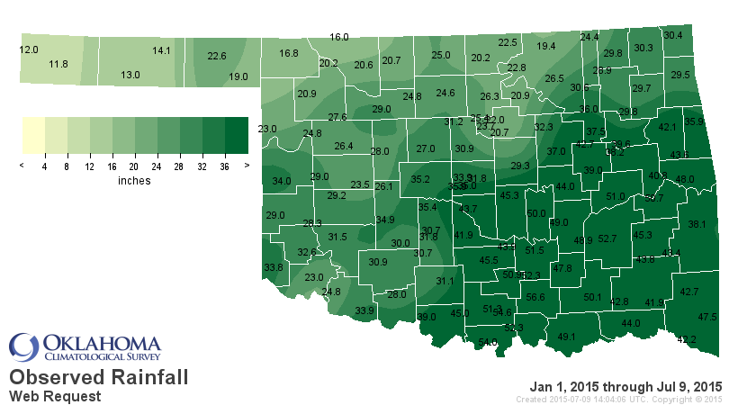
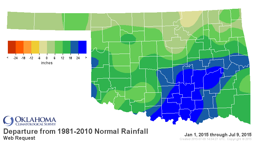
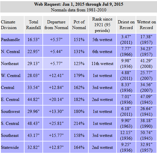
Once again, obviously dominated by SC OK's ridiculous 48.43" average, almost
26" above normal for the year thus far.
26" ABOVE NORMAL HALFWAY THROUGH THE YEAR!
Tishomingo leads all Mesonet sites with 56.63" for the year thus far, but 13
Mesonet sites are already over 50", and 38 are over 40". Here are those over
50" thus far (which might change as the day goes forward).
-***-
Tishomingo 56.63 Newport 51.25
Ardmore 54.63 Eufaula 50.98
Burneyville 53.99 Sulphur 50.87
McAlester 52.70 Stigler 50.67
Madill 52.30 Lane 50.09
Fittstown 52.28 Bowlegs 50.01
-****-
Tishomingo averages 45.50" per year, so they're already 11" and counting ahead
of their annual average. It's wettest year on record is 1957 at 69.40", a mere
13" away.
1957 is the wettest year on record for Oklahoma with a statewide average of
47.88".
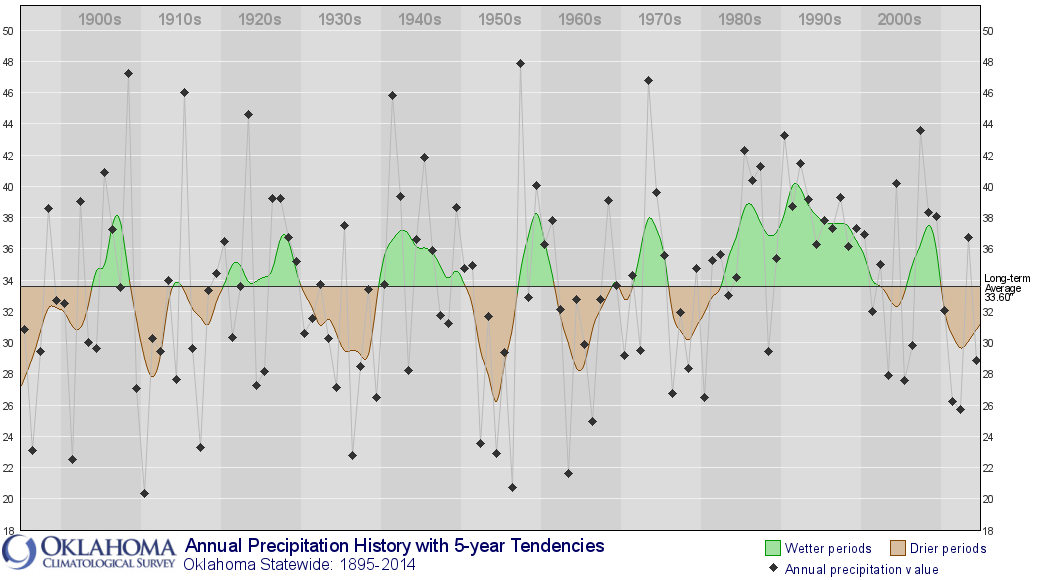
1957 ended up with a statewide average of 34.17" through July, and then
ended up with a rather ordinary 13.71" through the rest of the year. It's
impossible to say if 2015's pace can top that. Lots can happen between now
and Dec. 31, like another big tropical visit, or simply increased moisture
chances from the possible moderate-to-strong El Nino lurking in the equatorial
Pacific.
Oklahoma City's 39.49" through yesterday is EASILY tops on its list for a Jan. 1-
July 8 period, well ahead of 1908's 34.02".
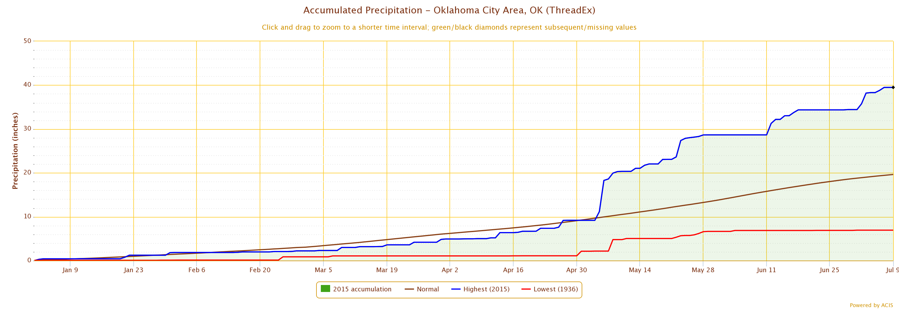
OKC's wettest year on record is 2007's 56.95 inches, still a ways to go for
that record to fall. OKC had 24.50" of moisture between July 9-Dec. 31 back in
2007, so a pretty tall order on that one.
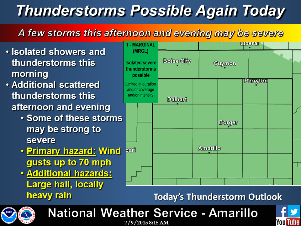
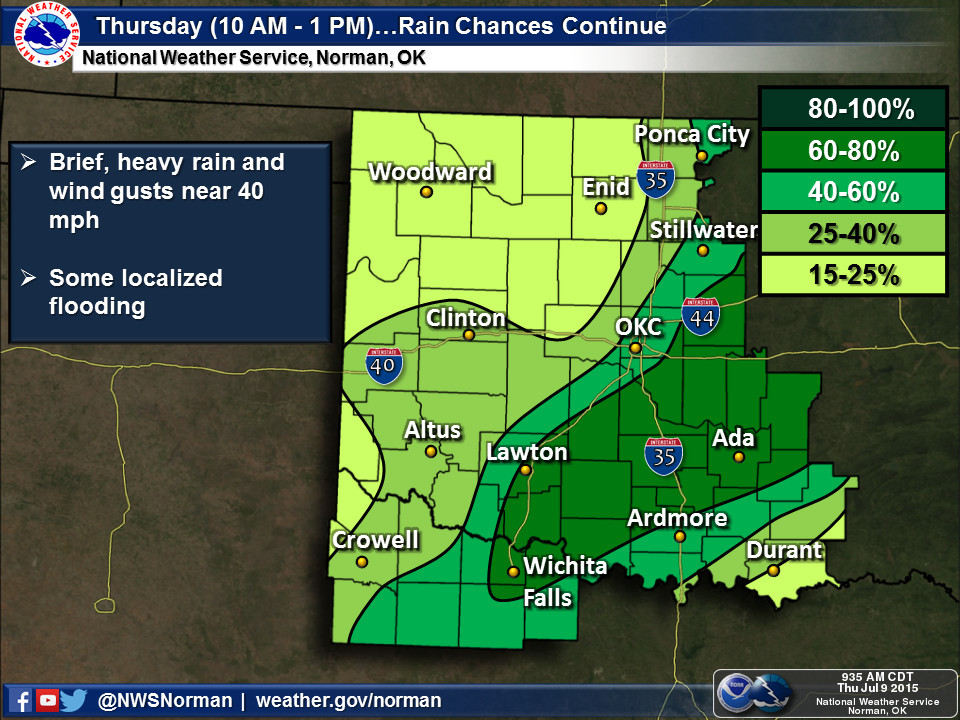
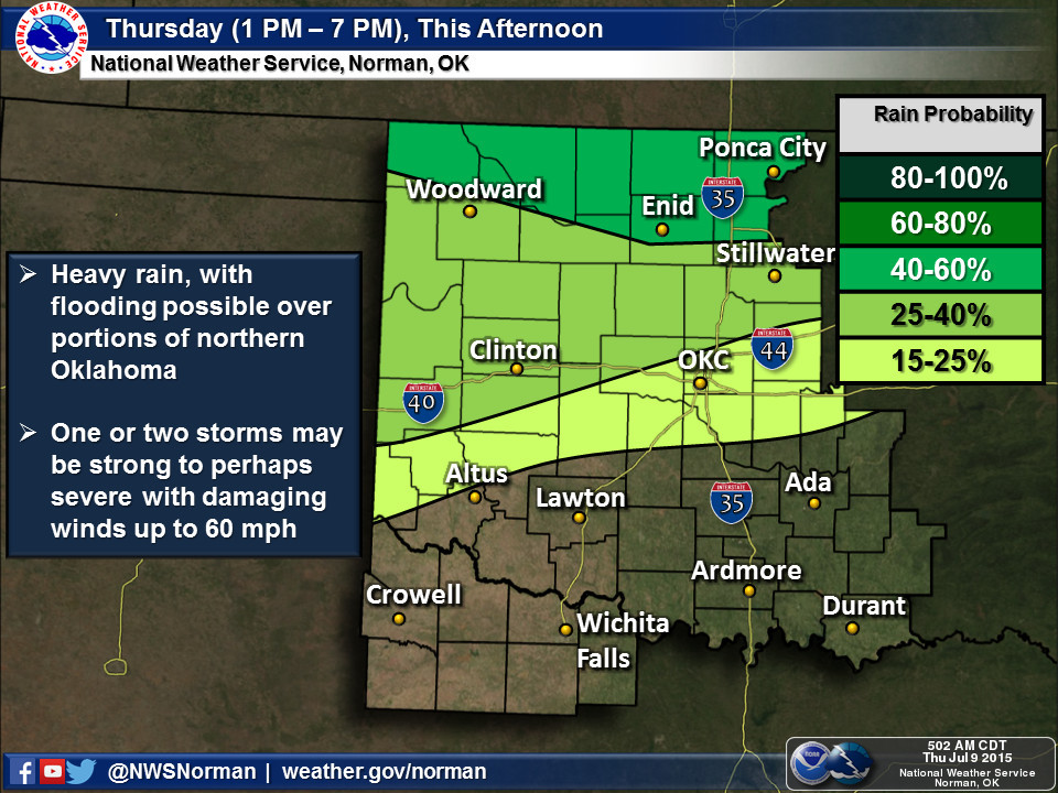
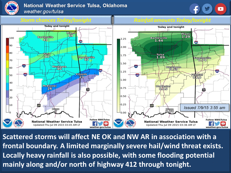
At any rate, we have a chance of big rains in the state for the rest of the
day and then we return to summer pretty quickly. I don't think too many will
complain if the rain goes away, but I'm sure most aren't looking forward to
that heat and sultry air.
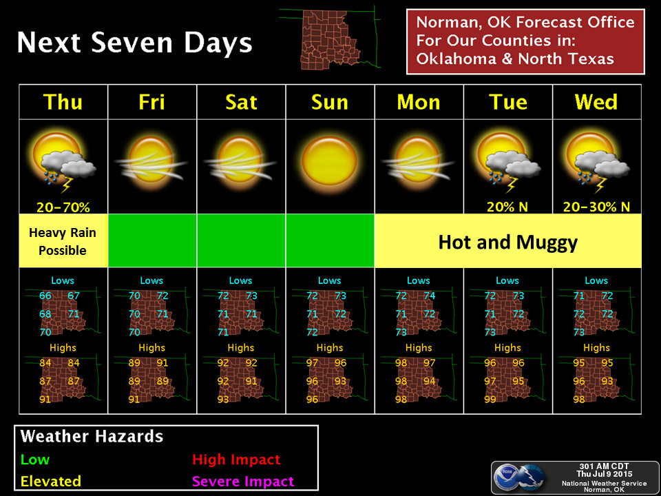
However, it is summer, and eventually it needs to act like it...get rid of some
of the soggy ground and allow folks to fish, swim, swelter, etc. But we're in
another horse race with 1957 for a pretty big title.
After the last few years, the Ticker ain't laying any odds. All bets are off.
Gary McManus
State Climatologist
Oklahoma Mesonet
Oklahoma Climatological Survey
(405) 325-2253
gmcmanus@mesonet.org
July 9 in Mesonet History
| Record | Value | Station | Year |
|---|---|---|---|
| Maximum Temperature | 115°F | BUFF | 2009 |
| Minimum Temperature | 55°F | KENT | 2015 |
| Maximum Rainfall | 3.91 inches | OKCE | 2014 |
Mesonet records begin in 1994.
Search by Date
If you're a bit off, don't worry, because just like horseshoes, “almost” counts on the Ticker website!