Ticker for July 7, 2015
MESONET TICKER ... MESONET TICKER ... MESONET TICKER ... MESONET TICKER ...
July 7, 2015 July 7, 2015 July 7, 2015 July 7, 2015
Well that was odd!
A massive wall of water came right up to central Oklahoma and went "KERSPLATTY!"
(scientific term, patent pending, The Ticker). But some folks got some really
nice (or not so nice, depending on your perspective) rainfall last night.
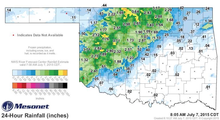
It's evident from that Mesonet graphic that most of NW OK saw a good soaking of
2-4 inches, with some higher amounts in localized areas. This was a part of the
state that actually needed a bit of moisture, despite the big rains of the last
90 days. A good part of that was concentrated across S OK, if you'll remember.
The rain is not over, however. First off, it's raining now.
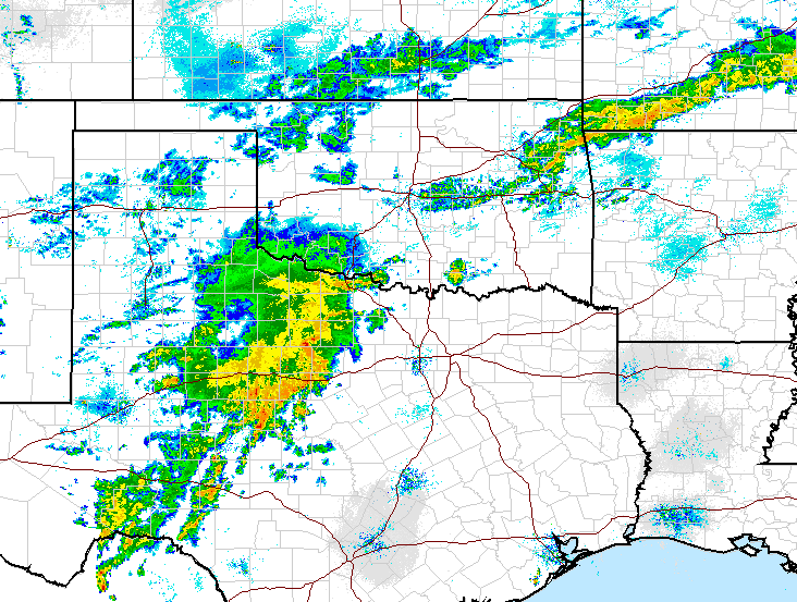
With more on the way.
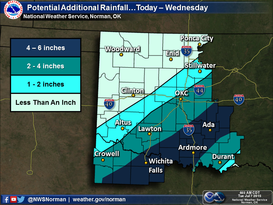
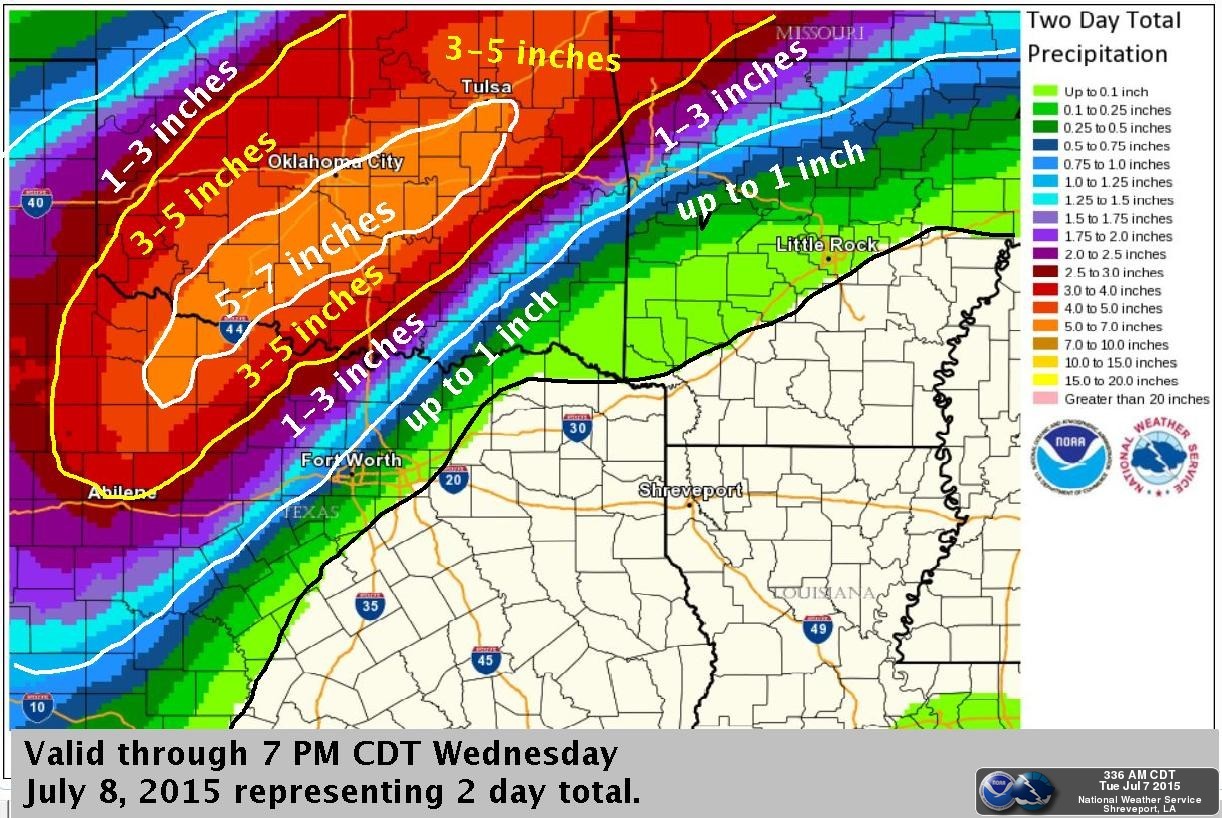
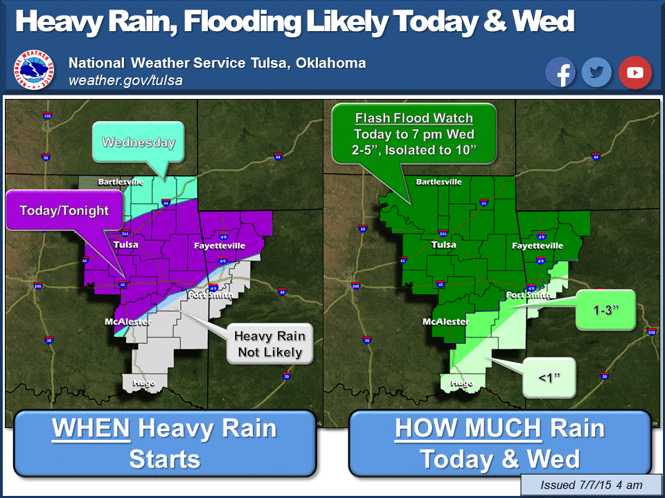
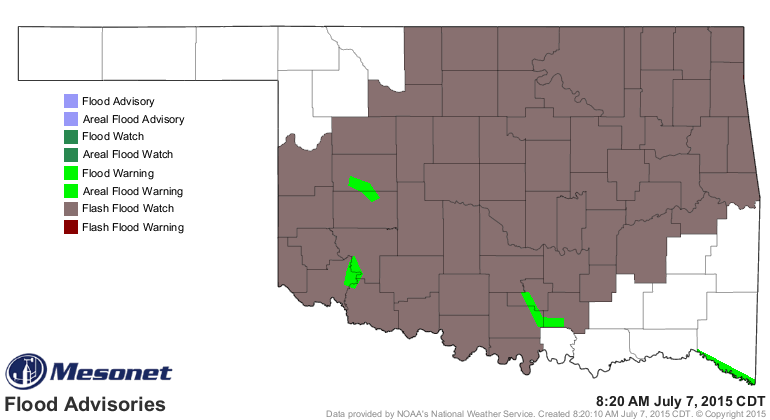
The NWS still has a large swath of Oklahoma under a flash flood watch, and thanks
to the drenching last night, there are a few flood warnings continuing this
morning.
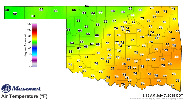
It would appear the far NW and SE will miss out on the heaviest rains, but
the I-44 corridor +/- a hundred miles or so could still get hammered. The
cold front that has slipped into the state has turned July to April in the NW.
Julil? Aply? How about just a really chilly July day.
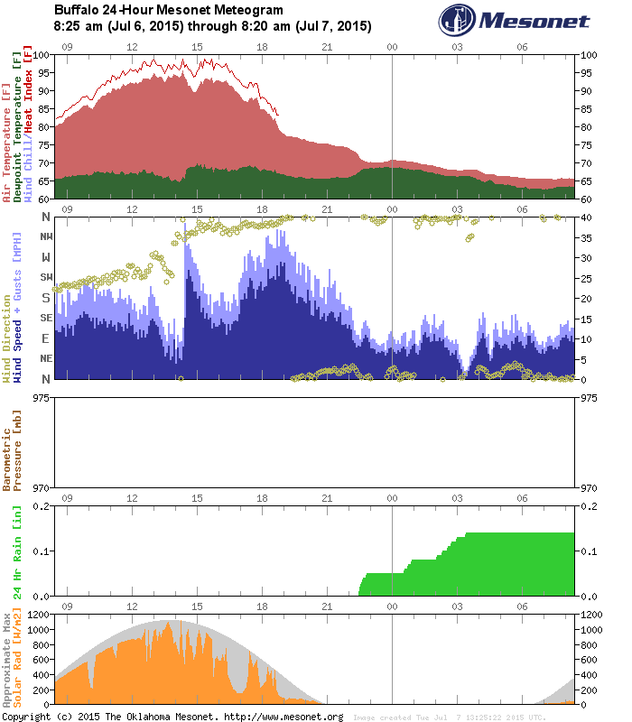
The front's passage is evident on the Mesonet's meteograms. Take Buffalo, for
instance (as if I'd use any other station!). Quite a change as the winds switch
from the S/SW to the N and temperatures go from mid-90s to mid-60s.
And apparently they ain't going much higher today.
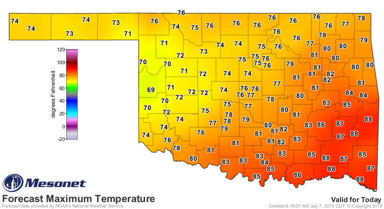
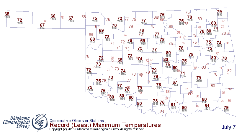
Some of those low maximum temperatures would be close to records for the day.
If you didn't get rain yet, and you're anywhere within 100 miles or so of I-44...
you probably will. And all that rain will be running through the rivers to
places like Lake Texoma, which has already gone over its spillway twice this
year (unprecedented) for the 4th and 5th time in its history.
Can it happen a third time this year?
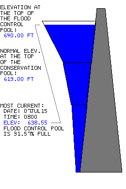
Texas wanted our water and boy are they getting a lakefull of it this year.
Gary McManus
State Climatologist
Oklahoma Mesonet
Oklahoma Climatological Survey
(405) 325-2253
gmcmanus@mesonet.org
July 7 in Mesonet History
| Record | Value | Station | Year |
|---|---|---|---|
| Maximum Temperature | 111°F | ALTU | 2011 |
| Minimum Temperature | 52°F | ANTL | 2006 |
| Maximum Rainfall | 5.20″ | KIN2 | 2024 |
Mesonet records begin in 1994.
Search by Date
If you're a bit off, don't worry, because just like horseshoes, “almost” counts on the Ticker website!