Ticker for July 6, 2015
MESONET TICKER ... MESONET TICKER ... MESONET TICKER ... MESONET TICKER ...
July 6, 2015 July 6, 2015 July 6, 2015 July 6, 2015
You only THOUGHT it was over

I'm sure you've enjoyed your vacation from the Ticker, whose weird, wild ramblings
often leave folks frightened and confused. But hey, I only report this crazy
stuff. Like more June-ish type rainfall pegged for July. By this time Wednesday,
I predict you'll once again be waving the white flag to Mother Nature, at least
in some parts of the state. Check out the rainfall forecast for the next several
days and you'll see why.
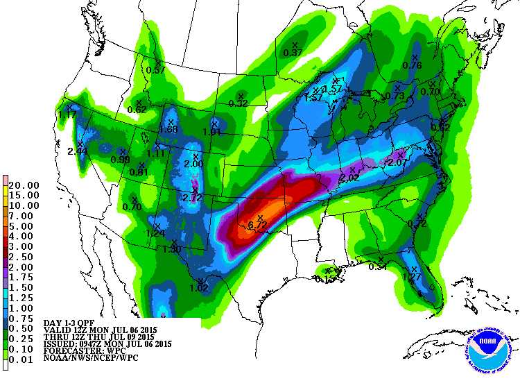
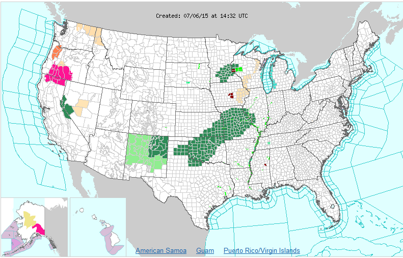
Do not adjust your set (or your eyeballs)...that is a 6.72-inch bullseye right
in the middle of Oklahoma. That has, given the wetness of the previous 3 months,
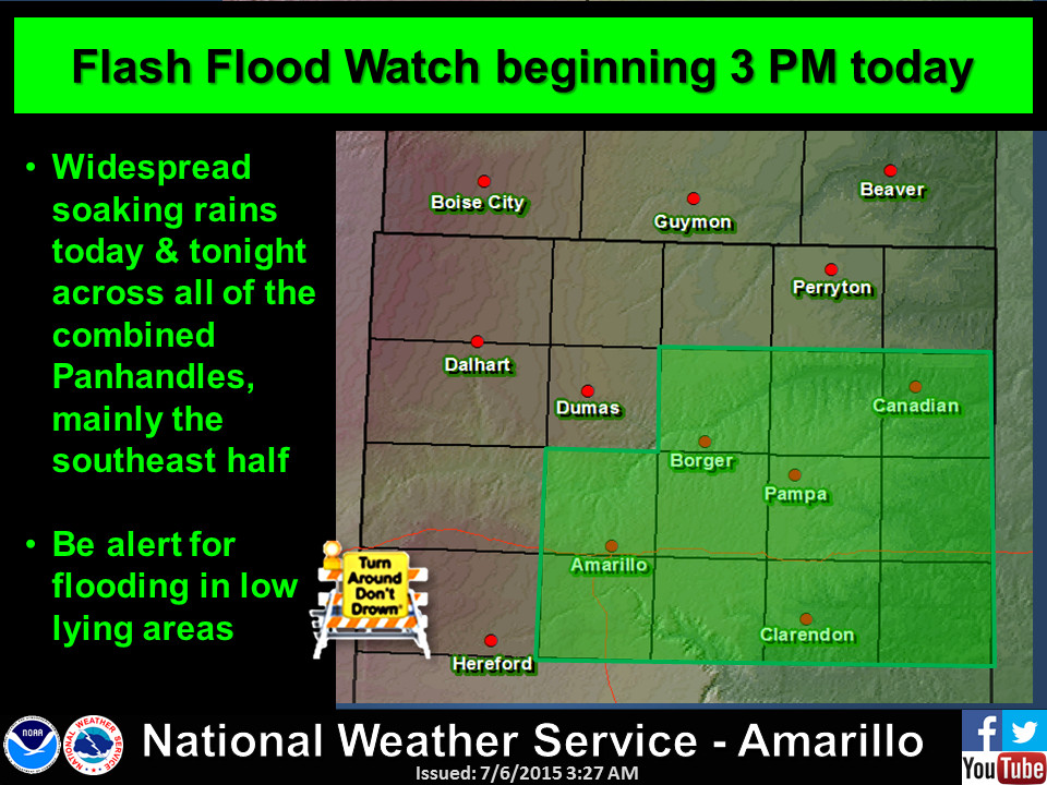
prompted a rather large flash flood watch area from the NWS from SW OK all the
way up through Missouri.
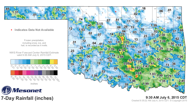
This will be on top of what we've received just in the past week or so, including
those downpours in north OK and southern Logan counties, Cleveland County, and
through Garvin/Murray county area.
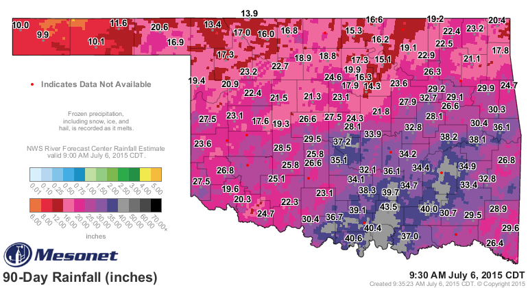
And lest we forget, the record-setting rains of April-June.
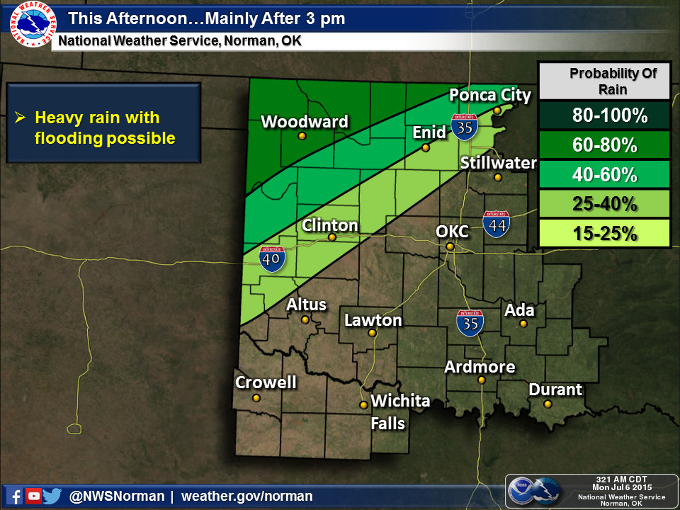
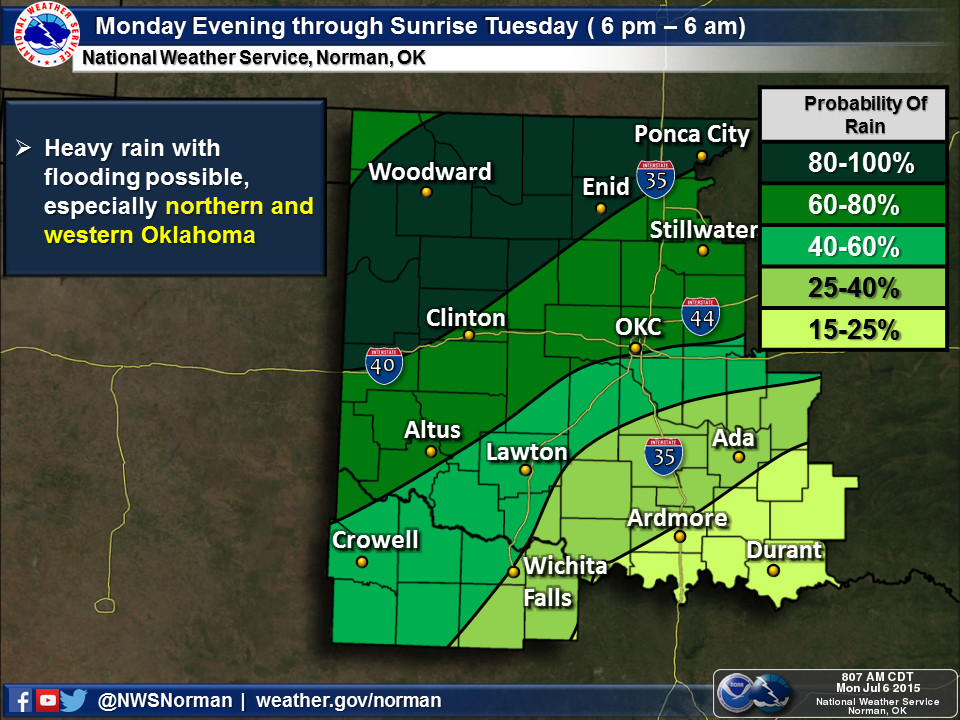
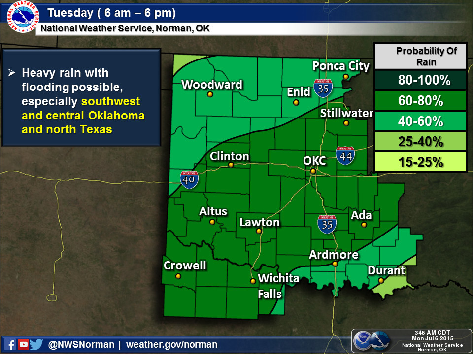
The rains should begin today out west and linger into Wednesday or Thursday,
as depicted in the graphicasts from the local NWS offices.
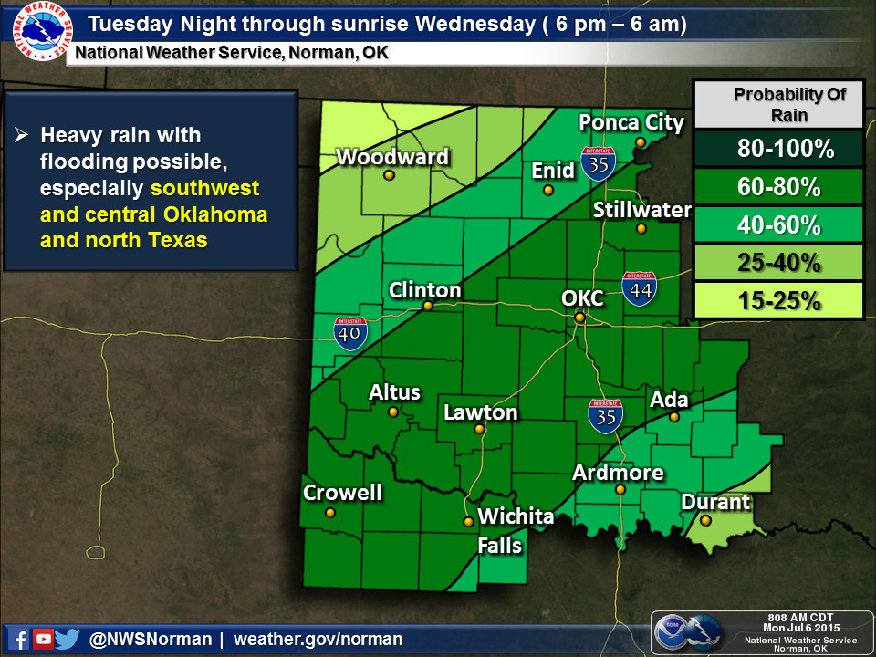
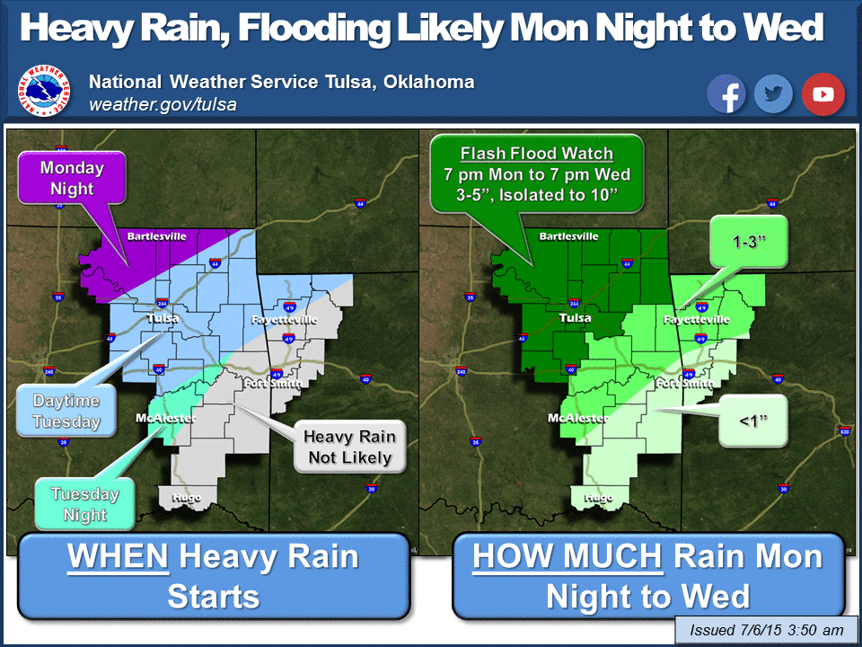
Do we need this rain? Not really. In fact, NO! But one by-product will be the
milder temperatures that all those clouds and moisture will produce. Yesterday
was downright nasty in some parts of the state with dewpoints nearing 80 degrees
and heat indices up into the mid-100s. It didn't hit 100 on the thermometer,
but if you add in that moisture it sure felt like it.
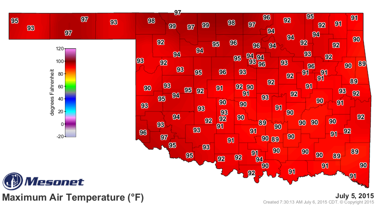
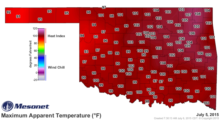
So Tuesday and Wednesday will be downright early spring-like in some parts of
the state.
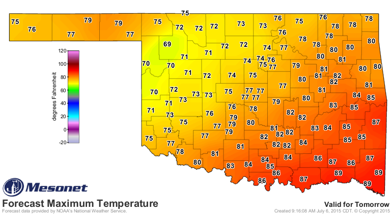
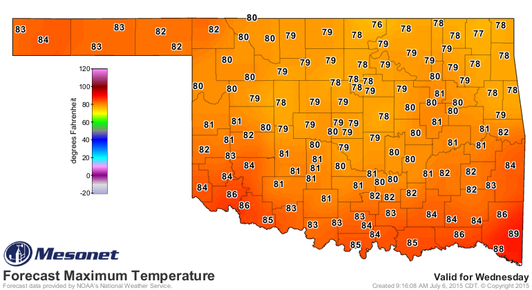
So while it is true that wet summers correlate quite strongly with mild summers
in the Southern Plains, don't you think we could spread out the rainfall a bit
more?
Get your galoshes ready!
Gary McManus
State Climatologist
Oklahoma Mesonet
Oklahoma Climatological Survey
(405) 325-2253
gmcmanus@mesonet.org
July 6 in Mesonet History
| Record | Value | Station | Year |
|---|---|---|---|
| Maximum Temperature | 108°F | GRA2 | 2011 |
| Minimum Temperature | 53°F | GOOD | 1997 |
| Maximum Rainfall | 3.57 inches | WATO | 2015 |
Mesonet records begin in 1994.
Search by Date
If you're a bit off, don't worry, because just like horseshoes, “almost” counts on the Ticker website!