Ticker for June 17, 2015
MESONET TICKER ... MESONET TICKER ... MESONET TICKER ... MESONET TICKER ...
June 17, 2015 June 17, 2015 June 17, 2015 June 17, 2015
Kill Bill. Please?
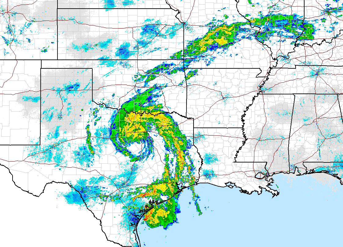
Gee thanks, Bill. And we didn't get you anything. Yes, the remnants of Tropical
Storm Bill, now a mere tropical depression, has entered the state, impacting
southern Oklahoma and soon the entire eastern half or so (give or take a county
across the western half). A very impressive display on the current radar map,
complete with a leftover rain-free eye-wall.
For a dramatic loop of the storm in full resolution, check this out. Wow!
http://radar.weather.gov/ridge/Conus/full_loop.php
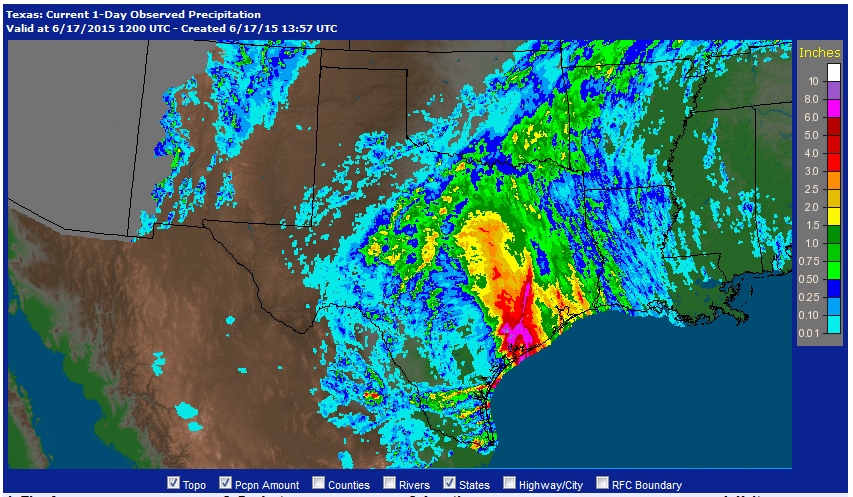
It's already dumped from 4-10+ inches of rain from the Gulf Coast up through
north Texas, bringing flooding and spreading havoc along the way.
And it's headed this way. The current track map has Bill moving straight north
into Oklahoma, then probably taking a quick turn to the northeast before
reaching I-40.
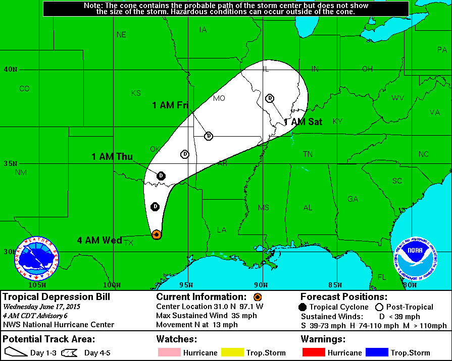
Even though there is still a bit of uncertainty, the forecast models are in
pretty good agreement on the track. And that track is of vital importance since
it determines who gets from 6-10+ inches of rainfall possibly, and those that
might get an inch or two. Here is the thinking from our local NWS offices at
this time.
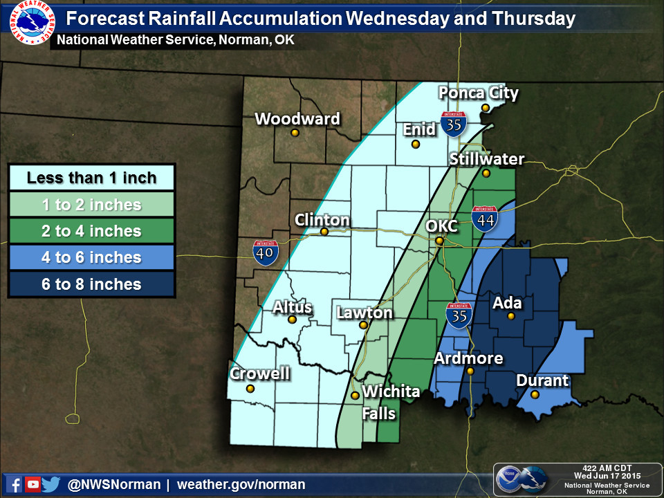
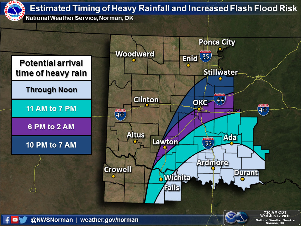
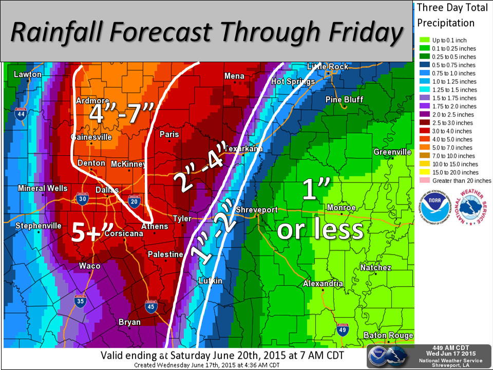
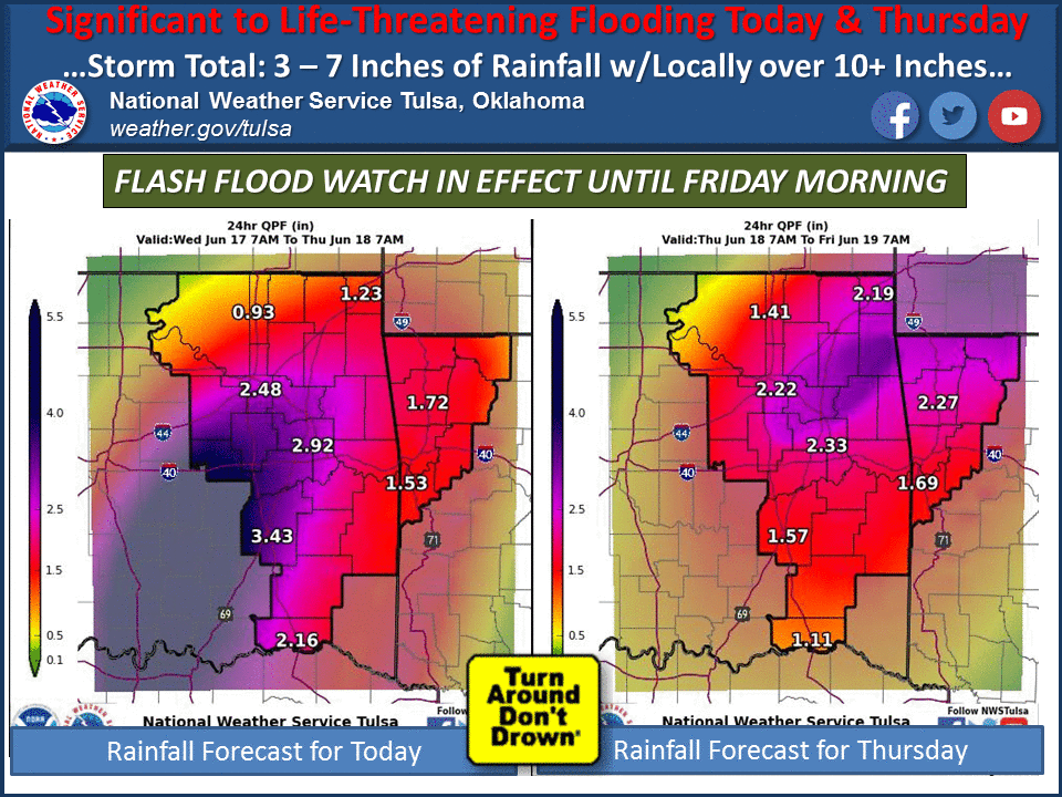
And the 3-day rainfall forecast from the WPC.
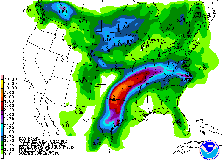
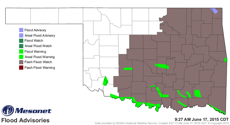
This obviously puts us in a tough spot with an already saturated state, full
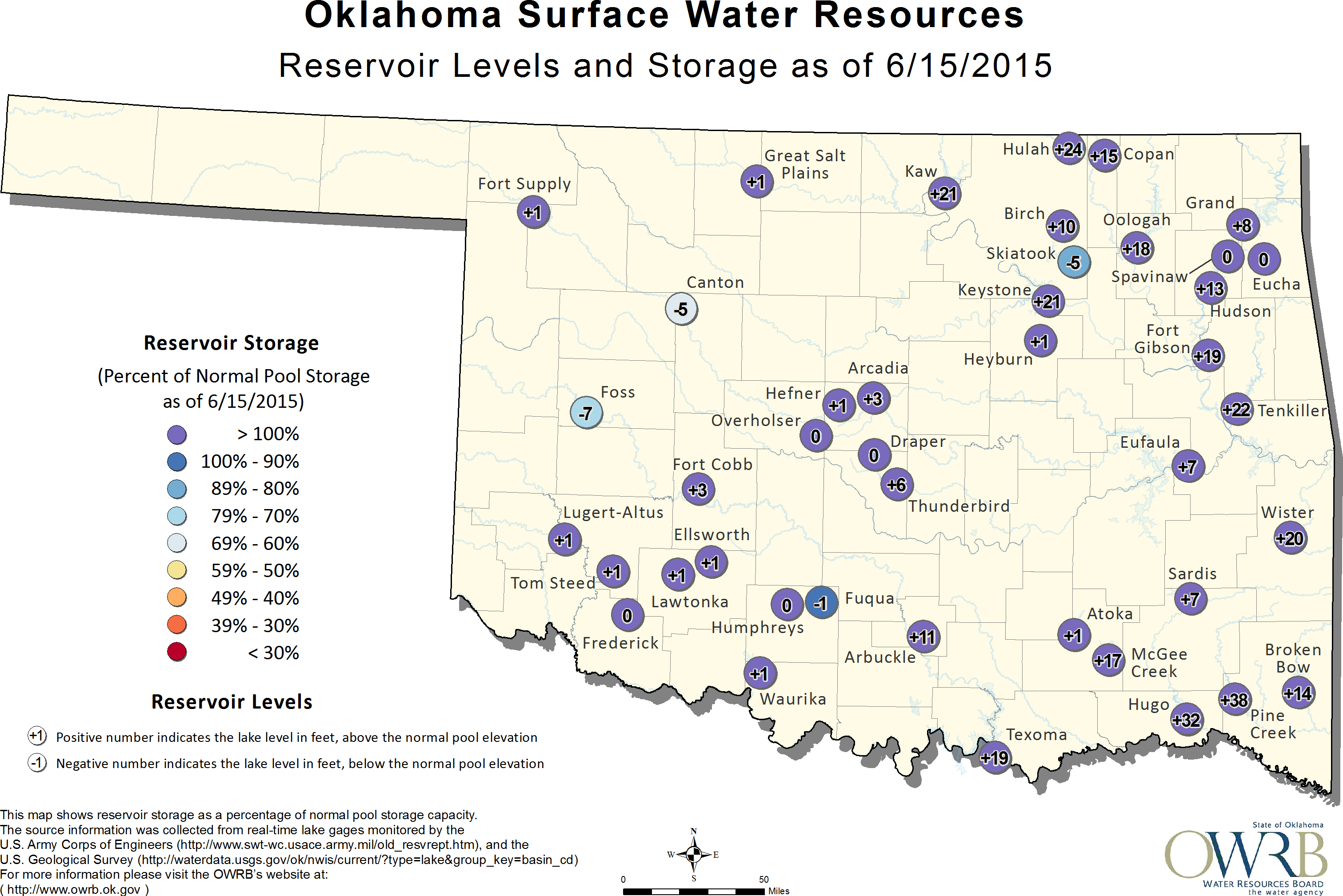
reservoirs, and flood warnings (and a great big watch area) already in place.
Texoma is already 19 feet above capacity, for crying out loud. And Hugo and
Pine Creek are 32 and 38 feet into flood stage, respectively.
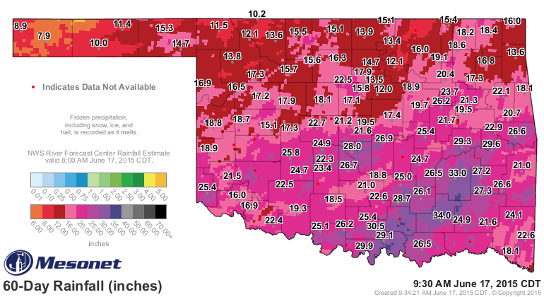
Note that places like Norman, which has received 28 inches of rain in the last
60 days, can't really hold much more.
For those wondering, the statewide average rainfall total thus far for Oklahoma
(as measured by the Mesonet) is 2.98 inches. That'd rank as the 42nd wettest
June on record (since 1895) if the month ended today.
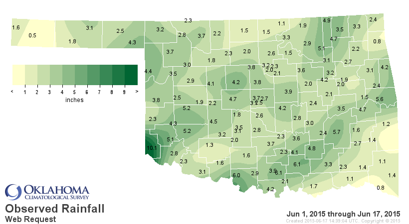
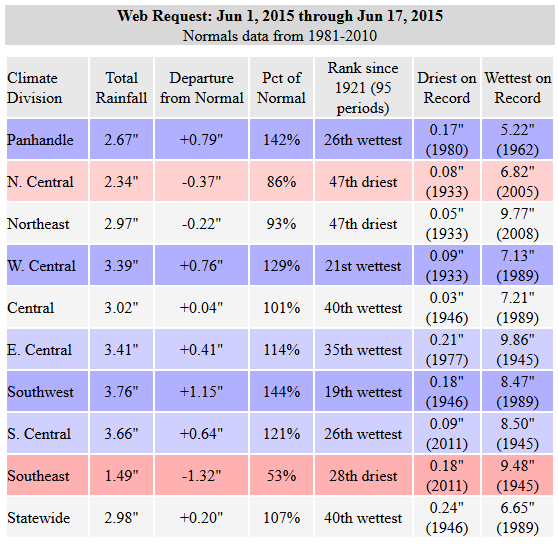
We have a long way to go to that top mark of 9.51 inches from June 2007. Given
that the western half of the state should remain fairly dry for awhile,
including through Bill's passage, I don't think we'll threaten that. But we will
be zooming up the ranks over the next couple of days.
Now for the most important part...there will be some wobble in Bill's track. It
will definitely curve to the NE after it enters Oklahoma, but any movement east
or west will determine that path of highest rainfall amounts. It's important to
keep abreast of all the latest forecasts from all the usual sources. The warning
and watch maps are going to get really ugly, so be sure and check the Mesonet
advisories page for a clear view of those.
http://www.mesonet.org/index.php/weather/category/advisories
And also for an up-to-the-minute (well, 5-minute) rainfall map.
http://www.mesonet.org/index.php/weather/category/rainfall
And for goodness sakes, "TURN AROUND, DON'T DROWN!"

Gary McManus
State Climatologist
Oklahoma Mesonet
Oklahoma Climatological Survey
(405) 325-2253
gmcmanus@mesonet.org
June 17 in Mesonet History
| Record | Value | Station | Year |
|---|---|---|---|
| Maximum Temperature | 114°F | GRA2 | 2011 |
| Minimum Temperature | 45°F | BEAV | 1999 |
| Maximum Rainfall | 10.49″ | NEWP | 2015 |
Mesonet records begin in 1994.
Search by Date
If you're a bit off, don't worry, because just like horseshoes, “almost” counts on the Ticker website!