Ticker for June 18, 2015
MESONET TICKER ... MESONET TICKER ... MESONET TICKER ... MESONET TICKER ...
June 18, 2015 June 18, 2015 June 18, 2015 June 18, 2015
Monstrous rain totals
You know, the scary thing is these rainfall totals don't even faze me after what
we saw in April and May.
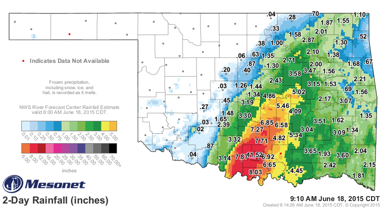
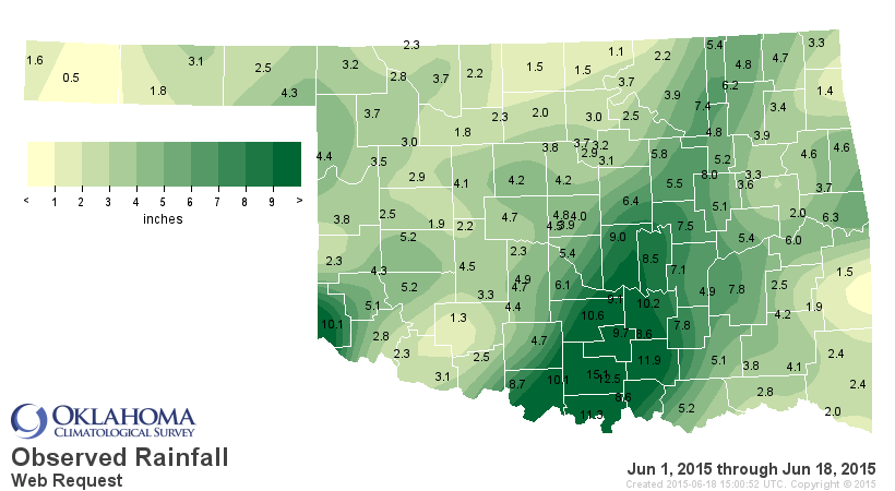
Newport, just to the NW of Ardmore, is the big winner (loser) in the moisture
totals with 11.52 inches as of 9:15am. That's the 2-day total. But there is a
LARGE swatch of 4-12 inches of radar-gauge indicated rainfall from south central
up through central Oklahoma. Like some devilish 1970s atmospheric child's toy,
Bill continues to sit across Oklahoma and spin. Wouldn't you just know that it
was going to slow down and become almost stationary over Oklahoma? SHOCKER! You
can see a loop here. Also notice a big line of storms approaching from the
NW as well. That's expected to die out as it plunges to the SE, but hey...just
sayin'.
http://radar.weather.gov/ridge/Conus/full_loop.php
Here is a video loop of pressure, winds, rainfall and radar as it enters
Oklahoma and does its spinning act through 9am this morning.
https://content.mesonet.org/ticker/archive/20150618/bill-loop.mp4
You can also find that video on the Mesonet Facebook page here...if you haven't
subscribed yet, go ahead and like our page.
https://www.facebook.com/mesonet
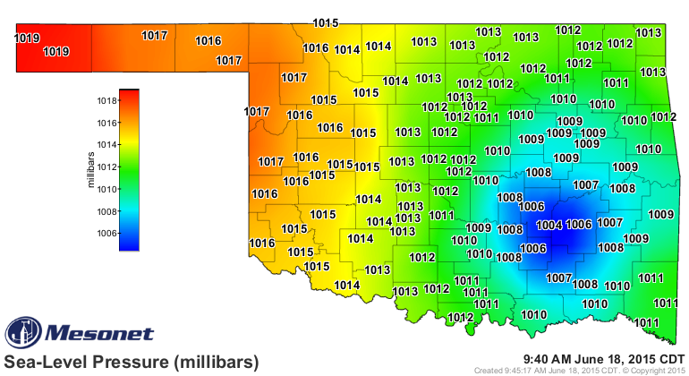
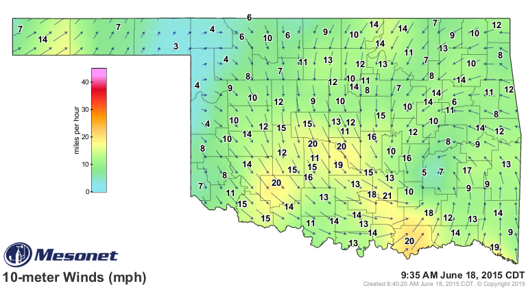
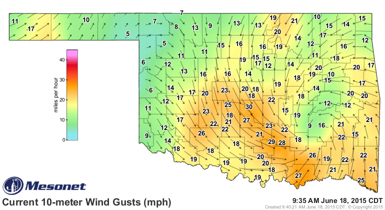
And the circulation is still showing up quite nicely in the still images of
the latest winds, wind gusts, and pressure maps.
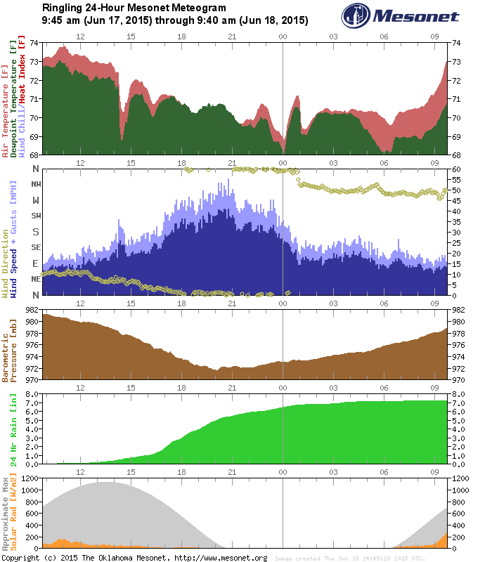
And if you want to see what a tropical storm'ish meteogram looks like, check out
this one for the last 24 hours in Ringling (the top graph is air temp and
dewpoint; the second graph is wind speed, wind gusts and wind direction; the
third is barometric pressure; the fourth is rainfall; and the fifth is solar
radiation). Pretty obvious as the pressure drops, the sustained winds (dark
blue) go to 40-45 mph, gusts up to 55 mph, and rain goes from zero to 7 inches
in half a day.
By the way, the NWS definition of a tropical storm is for a tropical system
with maximum sustained winds of 39-73 mph, for comparison's sake.
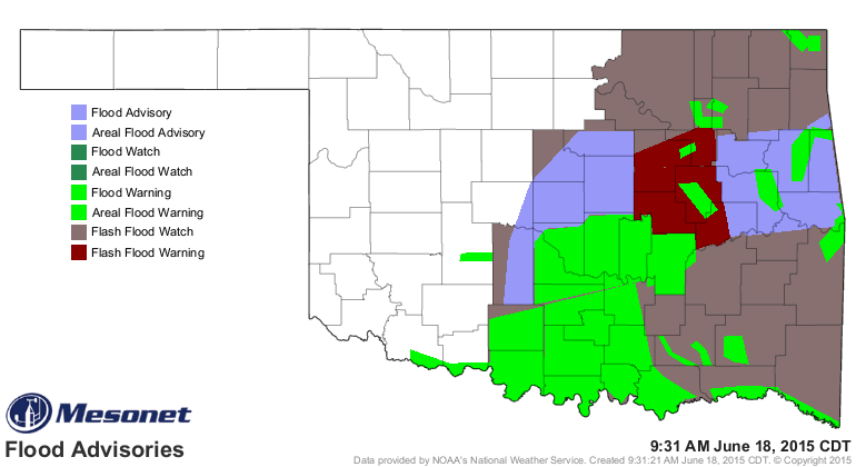
Obviously the eastern half of the state is littered with warnings and watches of
the flood variety, with massive river and flash flooding occurring across south
central up through NE OK. Oh yeah, and a rock slide on I-35 down near Turner
Falls resulting in a boulder falling on a car.
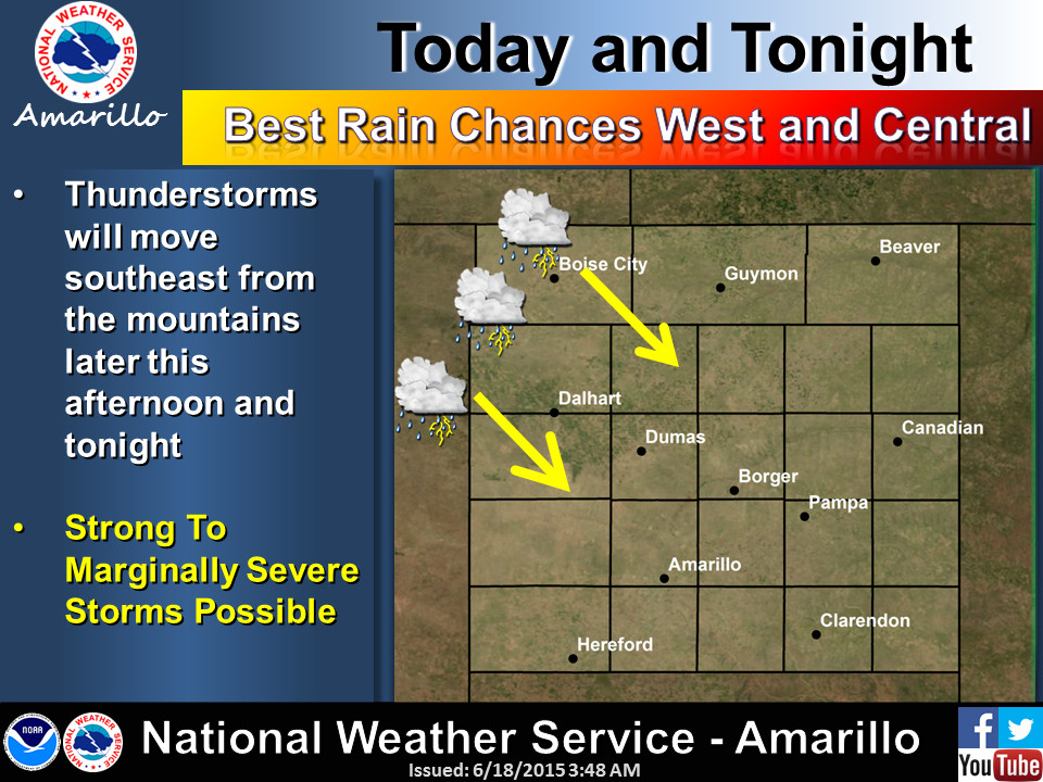
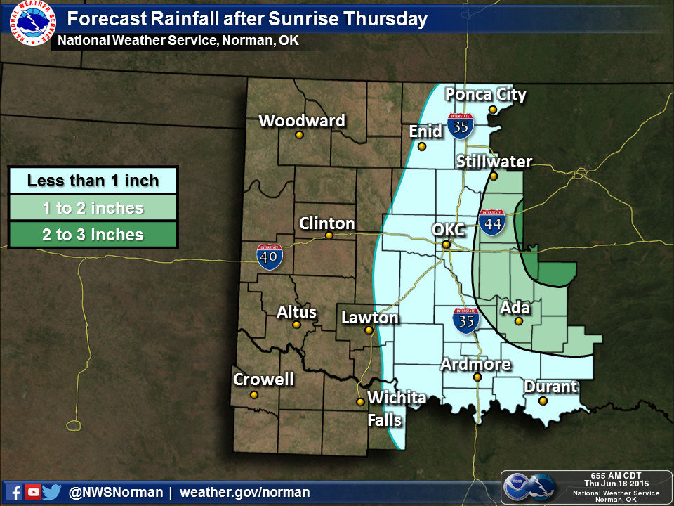
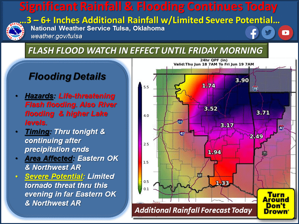
The attention now shifts to the NE as Bill moves that way, with more rainfall
and addition flooding expected. But the Panhandle could also see some turbulent
weather (not associated with Bill).
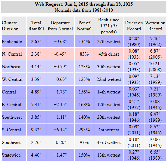
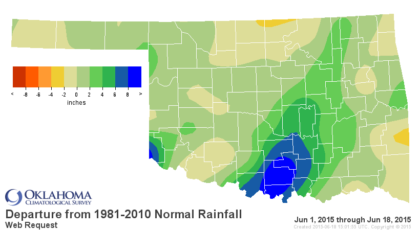
Oh by the way, the latest statewide average total for June thus far is up to
4.40", a surplus of 1.47" and ranked as the 13th wettest June 1-18 since at
least 1921. But that's a bit misleading since SC OK has had an average of 9.32"
(6.14" above normal, ranked as the wettest) while NC OK is still showing a
deficit of a half-inch.
Texas wanted our water pretty badly. Well, here it comes...again. Hope they're
ready on that side because Texoma is on its way back up again.
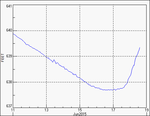
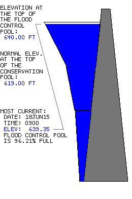
Arbuckle runneth over as well.

Glub glub.
Gary McManus
State Climatologist
Oklahoma Mesonet
Oklahoma Climatological Survey
(405) 325-2253
gmcmanus@mesonet.org
June 18 in Mesonet History
| Record | Value | Station | Year |
|---|---|---|---|
| Maximum Temperature | 110°F | GRA2 | 2011 |
| Minimum Temperature | 42°F | KENT | 1998 |
| Maximum Rainfall | 5.74 inches | HOOK | 2024 |
Mesonet records begin in 1994.
Search by Date
If you're a bit off, don't worry, because just like horseshoes, “almost” counts on the Ticker website!