Ticker for June 16, 2015
MESONET TICKER ... MESONET TICKER ... MESONET TICKER ... MESONET TICKER ...
June 16, 2015 June 16, 2015 June 16, 2015 June 16, 2015
Bill just got real
THIS is what is coming this way (note, this file is a bit large...20MB,download
it before playing if you're on an older computer).
https://content.mesonet.org/ticker/archive/20150616/TS-Bill-radar.loop.mov
The tropics are about to hit the fan and the southeastern half of the state is
gonna suffer for it. Already filled to the brim with surpluses from 6-20 inches
of rainfall over the last 90 days
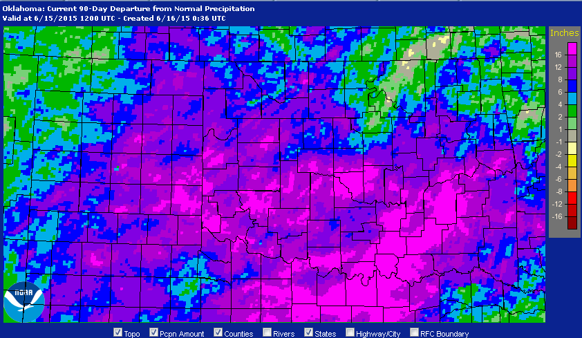
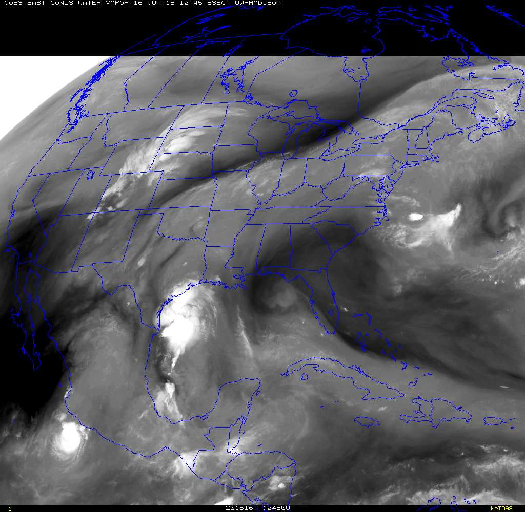
along comes Tropical Storm Bill to add his thoughts to the party. You can see
Bill in this water vapor satellite image approaching the Texas coast, and then
see the track map put forth by the National Hurricane Center of Bill's expected
track to the north and then the northeast.
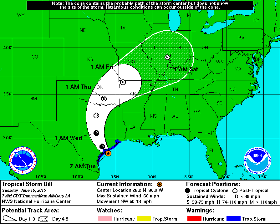
To see it as a tropical depression (the circled "D") as it travels over Oklahoma
is a bit alarming. That means we'll see some of the classic characteristics of a
tropical storm, such as rotating bands of convection, enough shear for tornadoes
in some parts of the storm, and steady, intense rainfall rates. And in those areas
where those spiral bands of the storm travel along and train for long periods of
time, rainfall totals will begin to become extreme. I would not be shocked at
all to see rainfall totals in some localized (I hope not more widespread) areas
to exceed 10 inches.
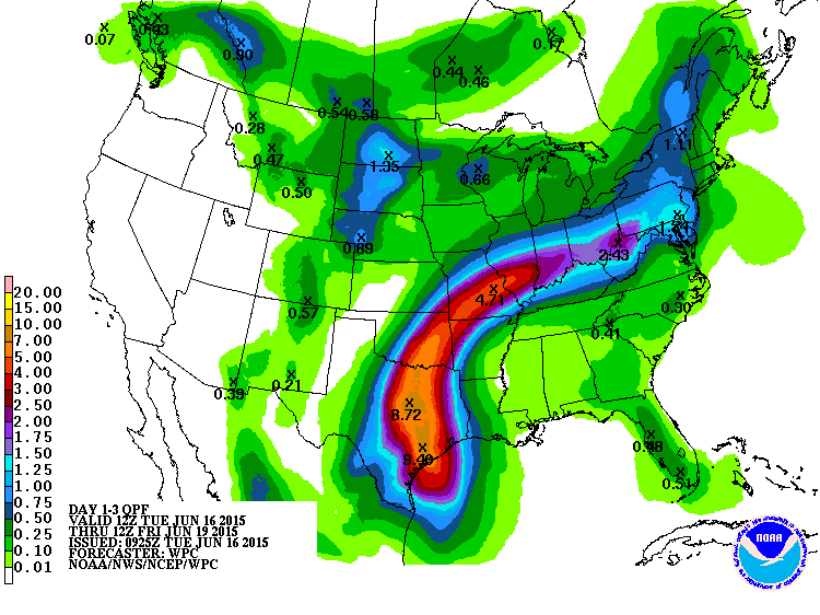
Here is the rainfall forecast for the storm, including what we're getting now
as the moisture from Bill and the Gulf streams north and interacts with a
stalled front over the state.
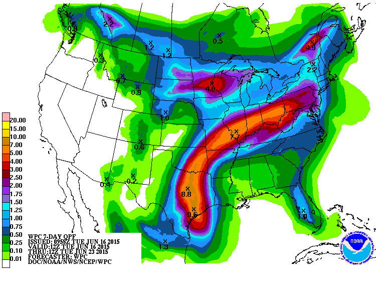
Again, most of that will fall over the next three days, and that's a lot of
water in a short period of time with nowhere to put it.
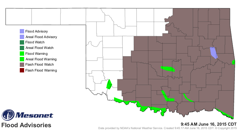
Already, much of the eastern two-thirds of the state is under a flash flood
watch in anticipation of Bill's arrival. Note that some areas are still under
flood warnings, so NOT a good starting point for Bill.
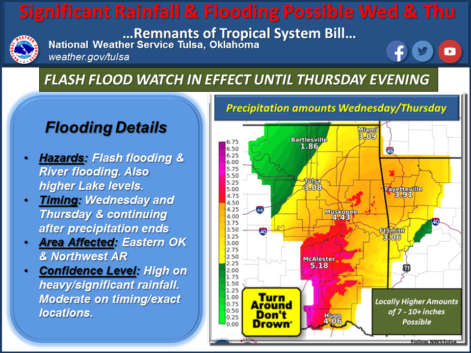
Here are the latest thoughts from the Tulsa NWS office regarding Bill and the
chances of calamitous flooding.
"Latest forecasts continue to bring the remains of tropical system
Bill through Texas and into parts of Eastern Oklahoma and Northwest
Arkansas during the Wednesday and Thursday time period. Heavy
rainfall amounts in the 3 to 7 inch range will be possible, with
locally higher amounts of 7 to 10 inches and greater. At this time
the axis of heaviest rainfall looks to be from Southeast Oklahoma
through East Central Oklahoma and into Northwest Arkansas. These
conditions will likely lead to significant flash flooding and also
main stem river flooding across the region. A flash flood watch
is in effect until Thursday evening for the region. Continue to
monitor latest updates and forecasts as timing and location details
continue to be refined over the next 24 to 36 hours."
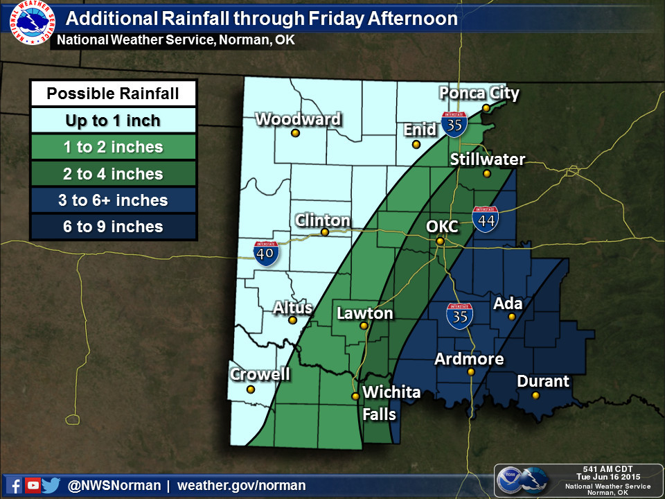
And Norman's rainfall estimates.
Things are going to get nasty, and given the loss of life we had from flooding
during May, this is as serious as any "Particularly Dangerous Situation" tornado
watch you might see.
The tricky part, it's a tropical system and it's just coming ashore. The forecast
track is iffy, and with that uncertainty there is also uncertainty with the
worst of the impacts. The east side of the center of the circulation will get
the worst of it as it moves across the state, so stay tuned to your favorite
NWS or media (preferably both) weather source for the most up to date forecasts.
Deaths from flash flooding are almost 100% preventable. Turn around, don't
drown.
Gary McManus
State Climatologist
Oklahoma Mesonet
Oklahoma Climatological Survey
(405) 325-2253
gmcmanus@mesonet.org
June 16 in Mesonet History
| Record | Value | Station | Year |
|---|---|---|---|
| Maximum Temperature | 108°F | ALTU | 2011 |
| Minimum Temperature | 45°F | KENT | 1998 |
| Maximum Rainfall | 3.93 inches | BLAC | 1997 |
Mesonet records begin in 1994.
Search by Date
If you're a bit off, don't worry, because just like horseshoes, “almost” counts on the Ticker website!