Ticker for June 15, 2015
MESONET TICKER ... MESONET TICKER ... MESONET TICKER ... MESONET TICKER ...
June 15, 2015 June 15, 2015 June 15, 2015 June 15, 2015
Oh sure, NOW we get a tropical system
After 5 years of drought, the 17th wettest April on record, the wettest May (and
wettest month of ANY month) on record, the wettest April-May combined on record,
and then directly after we just had a brush with the remnants of a pacific
hurricane blanco that helped give us some really nice moisture totals over the last
few days, including more than 10 inches down across far SW OK in Harmon County.
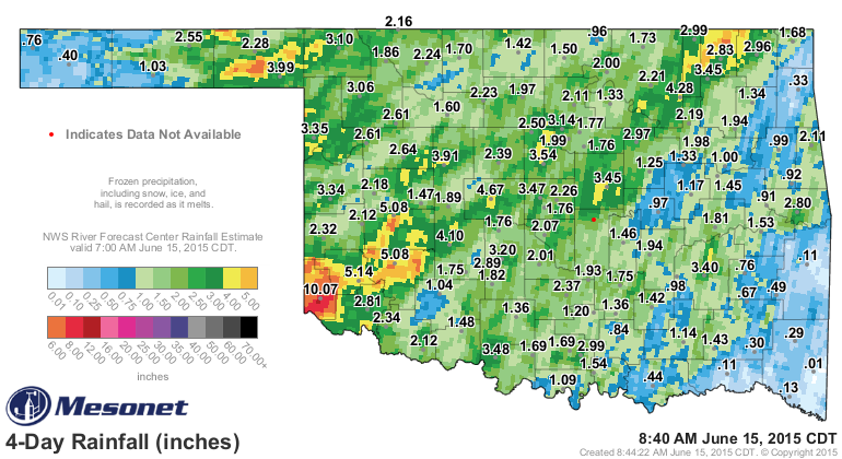
NOW we have to deal with the remnants of another tropical system forming down
near the Yucatan Peninsula, soon to be named "Bill?" It's expected track is
pretty obvious just from the 7-day rainfall forecast.
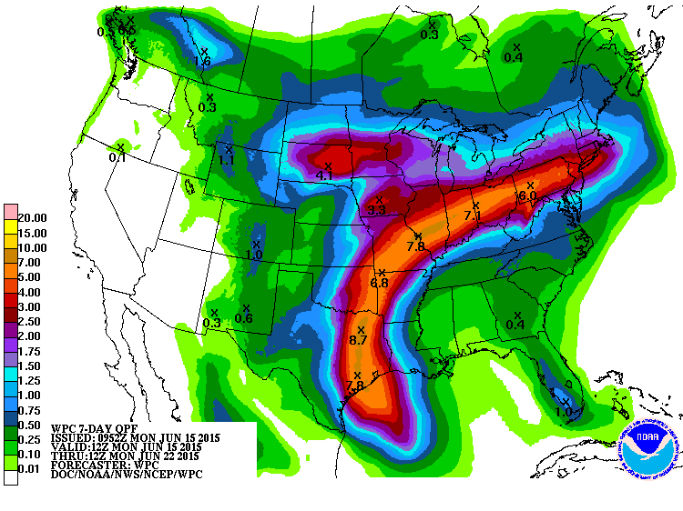
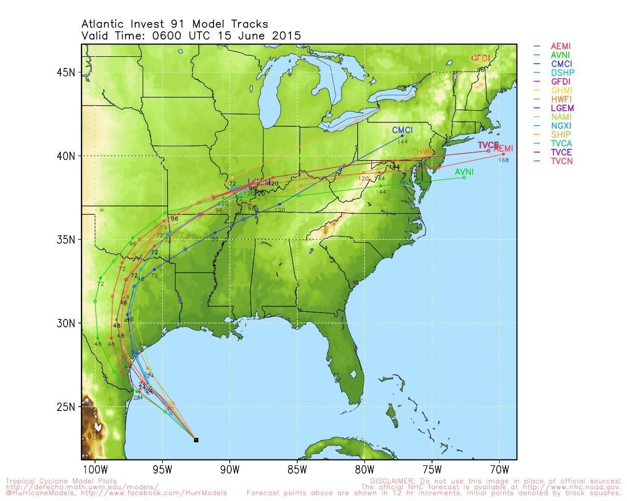
But you can see the center of the low pressure that will remain once it makes
landfall is expected to travel across SE OK and then up into the NE U.S.
But my question, in looking at the last 60 days worth of rainfall
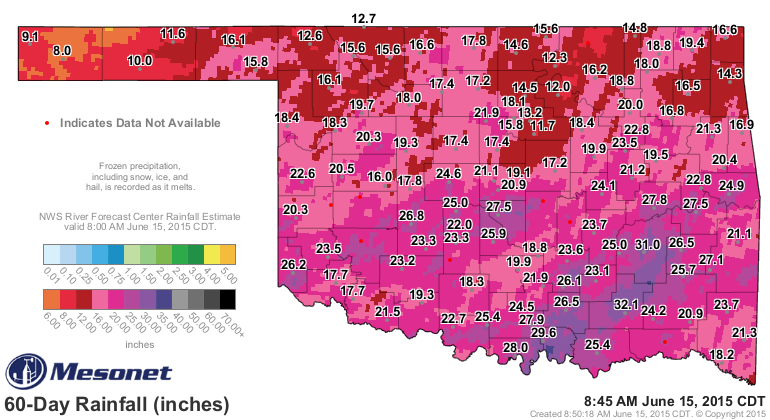
is...where the heck are we gonna put it? In the lakes? Well, maybe a couple or
three could handle some more water, but not across the eastern half of the
state save for Skiatook.
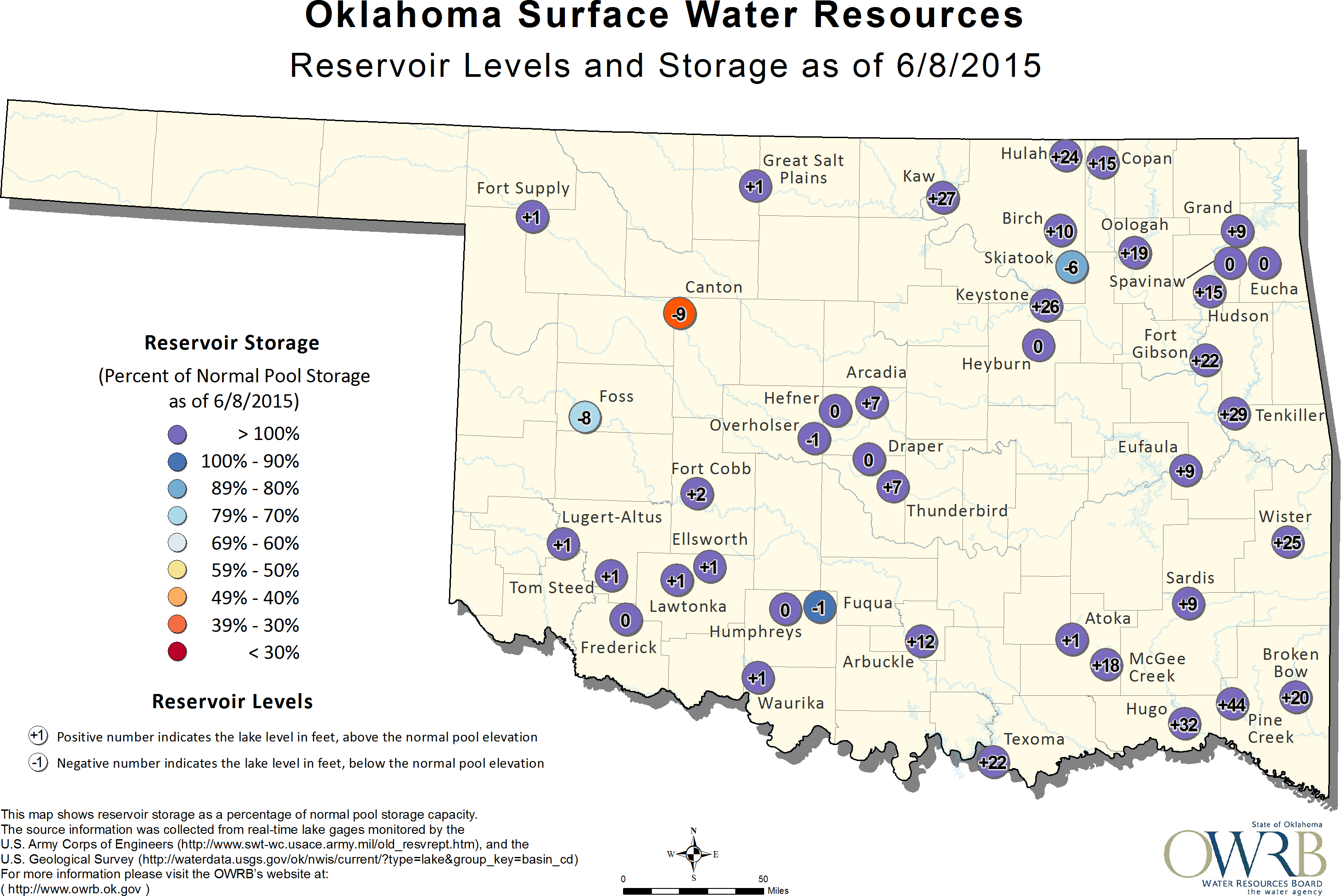
Note that this map is about a week old, and places like Canton Lake and Foss
are recovering quite nicely. Canton is really only 4-5 feet down at this point
and continues to rise with more releases and flow from the northwest.
Tropical remnants are really flaky, and its often difficult to tell exactly
where they're gonna go. On top of that, the gradients for the heavy rains vs.
the REALLY heavy rains can be quite sharp. But I'd say it's time for us to wave
the white flag to Mother Nature for eastern Oklahoma.
It's June 15th. Time for summer to be summer now.
Gary McManus
State Climatologist
Oklahoma Mesonet
Oklahoma Climatological Survey
(405) 325-2253
gmcmanus@mesonet.org
June 15 in Mesonet History
| Record | Value | Station | Year |
|---|---|---|---|
| Maximum Temperature | 104°F | ALTU | 2022 |
| Minimum Temperature | 42°F | KENT | 2001 |
| Maximum Rainfall | 5.22 inches | BYAR | 2007 |
Mesonet records begin in 1994.
Search by Date
If you're a bit off, don't worry, because just like horseshoes, “almost” counts on the Ticker website!