Ticker for June 11, 2015
MESONET TICKER ... MESONET TICKER ... MESONET TICKER ... MESONET TICKER ...
June 11, 2015 June 11, 2015 June 11, 2015 June 11, 2015
Read it and weep
June 10th, 2015...a date which will live, in anonymity. EXCEPT that it's also the
date that we saw our first triple-digit temps on the Mesonet.
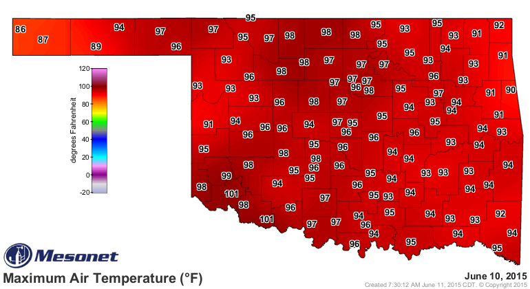
Those readings of 101 degrees at Altus and Grandfield were the first 100s recorded
by the Mesonet since Burneyville and Waurika reached 100 degrees way back on
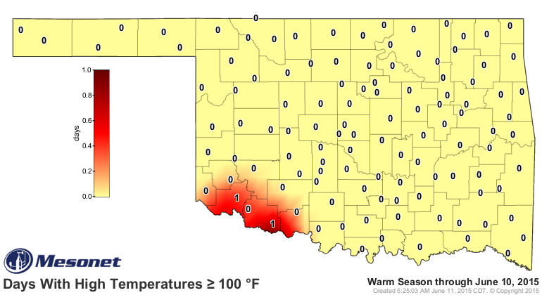
Sept. 10, 2014. It also gives us a chance to present the Mesonet's days at or
above 100 map. YIPEE!!
Heck, we'll even show you the consecutive days with highs at or above 100.
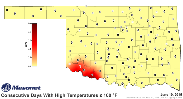
That might be it for awhile. Maybe somebody will reach 100 again today, but
the forecast highs are a bit lower today.
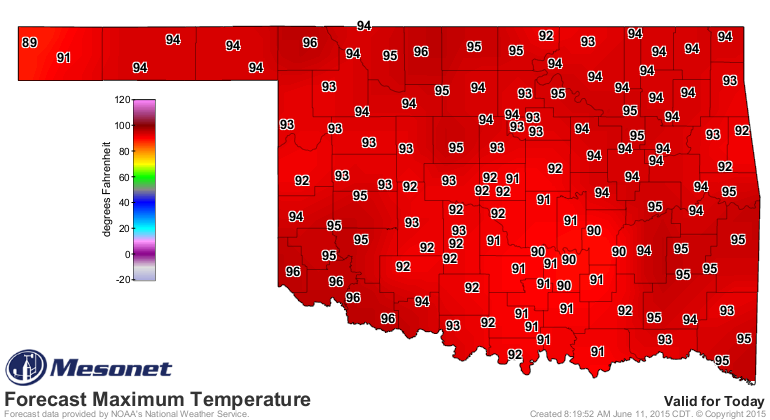
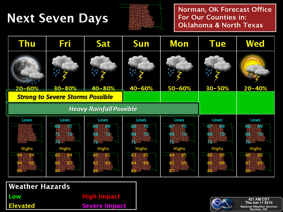
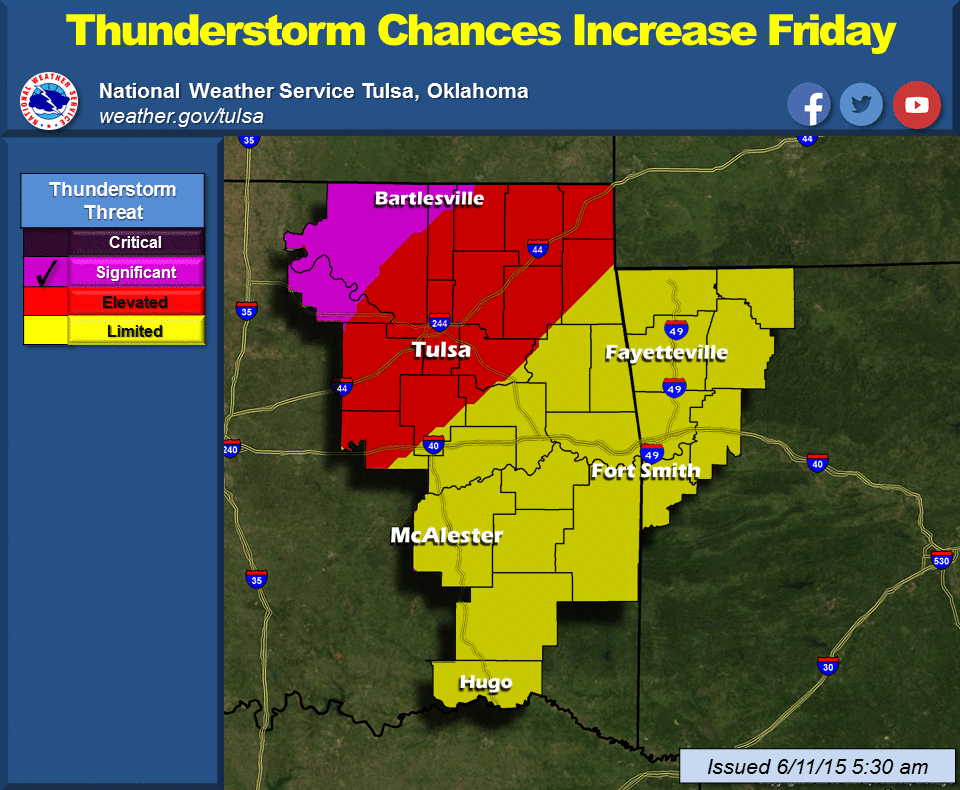
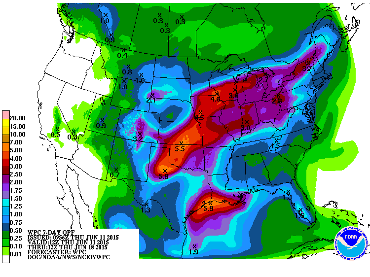
And then we enter into another rainy pattern with a very slow-moving upper-level
storm approaching from the west that should give us rain chances in various parts
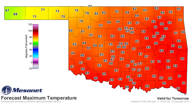
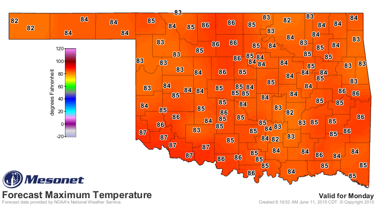
of the state well into next week. So the highs will be coming down to more
seasonable levels, if not lower. Here are the forecast highs for Friday and
Monday, for instance.
As for those rain chances, it's beginning to look a lot like May. This will put
a damper (or damp-er) on the wheat harvest for a bit.
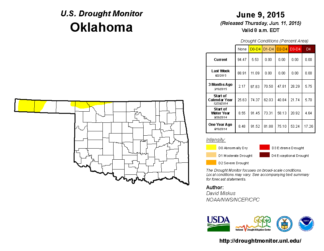
Oh yeah, here's the new U.S. Drought (or non-Drought) Monitor map. A bit more
shrinkage of D0 (the Abnormally Dry category, which again is NOT a drought
category) up in NW OK thanks to some timely rains. Take a good look...I suspect
those D0 areas will be gone next week.
Gary McManus
State Climatologist
Oklahoma Mesonet
Oklahoma Climatological Survey
(405) 325-2253
gmcmanus@mesonet.org
June 11 in Mesonet History
| Record | Value | Station | Year |
|---|---|---|---|
| Maximum Temperature | 108°F | ALTU | 2022 |
| Minimum Temperature | 44°F | KENT | 2004 |
| Maximum Rainfall | 6.05 inches | COPA | 2007 |
Mesonet records begin in 1994.
Search by Date
If you're a bit off, don't worry, because just like horseshoes, “almost” counts on the Ticker website!