Ticker for April 22, 2015
MESONET TICKER ... MESONET TICKER ... MESONET TICKER ... MESONET TICKER ...
April 22, 2015 April 22, 2015 April 22, 2015 April 22, 2015
More. Severe. Weather.

When will it stop. This is spring, we're supposed to have a raging drought going
on across the state right now. Oh wait, that was last year. We're currently on our
18th bout with severe weather in the last 14 days. Yes, I exaggerate, but that's
what it seems like. And we have more severe weather on tap for the next several
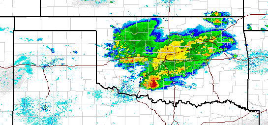
days with particular interest on Friday. Here's the current radar map, which shows
some strong to severe storms scooting across the state as we type and read.
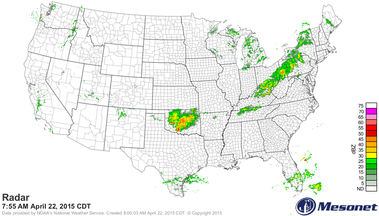
Kudos to Mother Nature for placing virtually the only rain west of the
Misisisisiisisipi (let's see...humpback humpback i, crooked letter...oh never mind,
you know I'm trying to spell Mississippi) directly on top of Oklahoma.
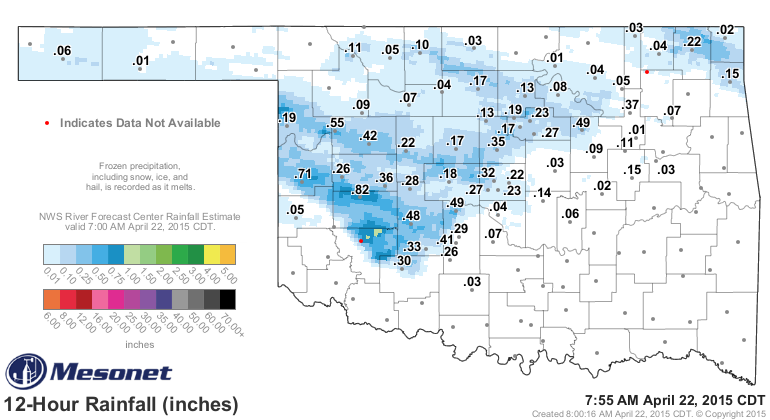
The rain has brought us some decent rain once again overnight and this morning.
As per usual, every little bit helps.
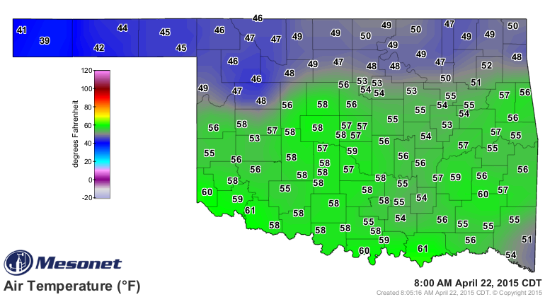
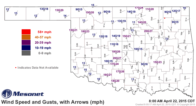
The storms are going up as a storm system moves overhead and a cold front is
pushing through the state from the north. The front shows up pretty clearly on
the Mesonet temperature map, and not so clearly on the wind map.
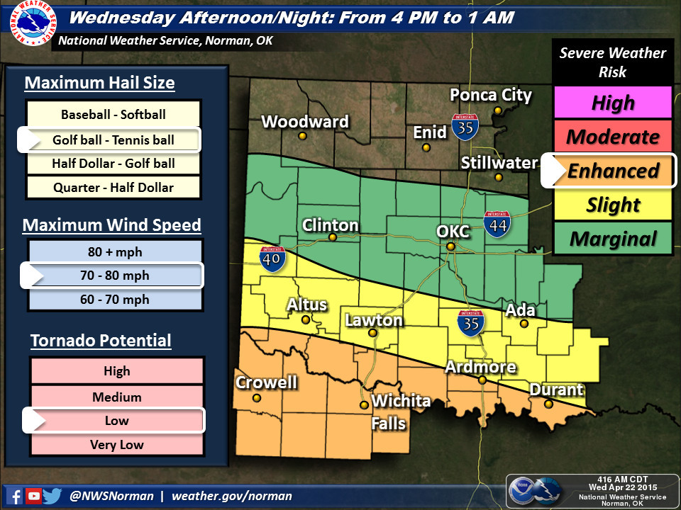
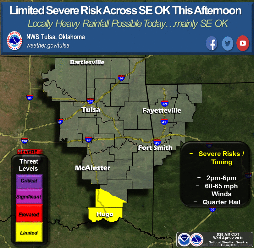
The severe weather threat will continue today, mostly across southern Oklahoma
as the front sags to the south. The tornado potential is low for today, again
across southern Oklahoma, but the chances for other severe weather types will
be there as well (winds, hail, etc.). Lesser chances tomorrow, but the chances
for significant severe weather, including tornadoes, appears to be on the rise
for Friday. Still two days out, so you should be keeping abreast of the weather
not only for today and tomorrow, but especially as Friday draws near and the
forecasters start to better pinpoint where that risk will be.
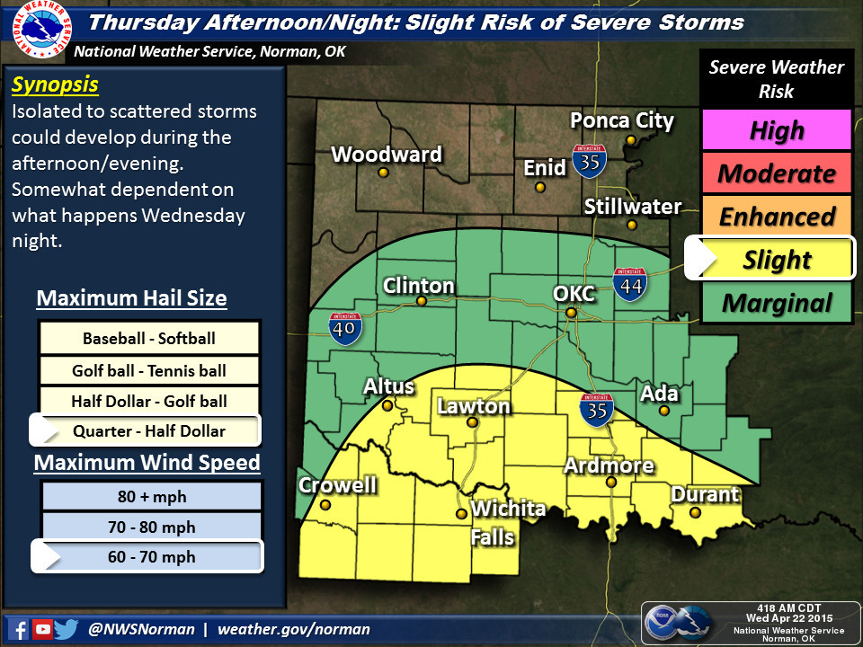
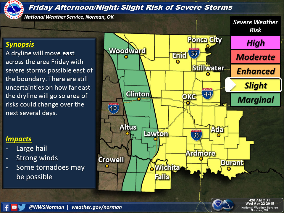
Lots of mentions of "fast-moving supercells" and whatnot for Friday, but again,
that forecast can and will change as that day draws near. From our friends at
the NWS Norman office:
"FRIDAY...SEVERE POTENTIAL AGAIN REMAINS VERY UNCERTAIN ESPECIALLY
WITH THE ADVANCEMENT OF A DRYLINE AND AMOUNT OF INSTABILITY AND
AVAILABLE MOISTURE. VERY STRONG MID/UPPER WINDS WOULD SUPPORT
FAST MOVING SUPERCELLS...MAINLY EAST OF I-35 DURING THE AFTERNOON
INTO EARLY EVENING. HOWEVER...MODELS MAY BE OVERDOING THE AMOUNT
OF LOW LEVEL MOISTURE AND INSTABILITY DUE TO CONVECTION OCCURRING
ACROSS THE AREA DURING THE MORNING HOURS. MORNING STORMS WOULD
HAVE SOME POTENTIAL FOR LARGE HAIL. AFTERNOON AND EVENING STORMS
COULD BE SIGNIFICANT WITH GIANT HAIL AND TORNADOES IF THEY OCCUR.
REGARDLESS...WILL CLOSELY MONITOR."
Well there's no need to shout! But as they say, they will closely monitor, and
you in turn should closely monitor the information from your favorite NWS and/or
media source as well. With two days to go, your plans and preparations for
possible severe weather on Friday should have been made in March, of course,
but if not, go ahead and START NOW!
Oh, and by the way, you asked for a drought miracle, I give you April 2015.
Yippie kay yay, Mother Nature.
Gary McManus
State Climatologist
Oklahoma Mesonet
Oklahoma Climatological Survey
(405) 325-2253
gmcmanus@mesonet.org
April 22 in Mesonet History
| Record | Value | Station | Year |
|---|---|---|---|
| Maximum Temperature | 98°F | WALT | 2011 |
| Minimum Temperature | 25°F | EVAX | 2021 |
| Maximum Rainfall | 6.48 inches | MCAL | 1996 |
Mesonet records begin in 1994.
Search by Date
If you're a bit off, don't worry, because just like horseshoes, “almost” counts on the Ticker website!