Ticker for April 21, 2015
MESONET TICKER ... MESONET TICKER ... MESONET TICKER ... MESONET TICKER ...
April 21, 2015 April 21, 2015 April 21, 2015 April 21, 2015
Cheyenne, we don't have a problem?
A quick (nah, go ahead and take your time) look at the Mesonet rainfall map over
the last 30 days is pretty revealing. It paints a great big red bullseye on Roger
Mills County and the Cheyenne Mesonet site at 8.71 inches.
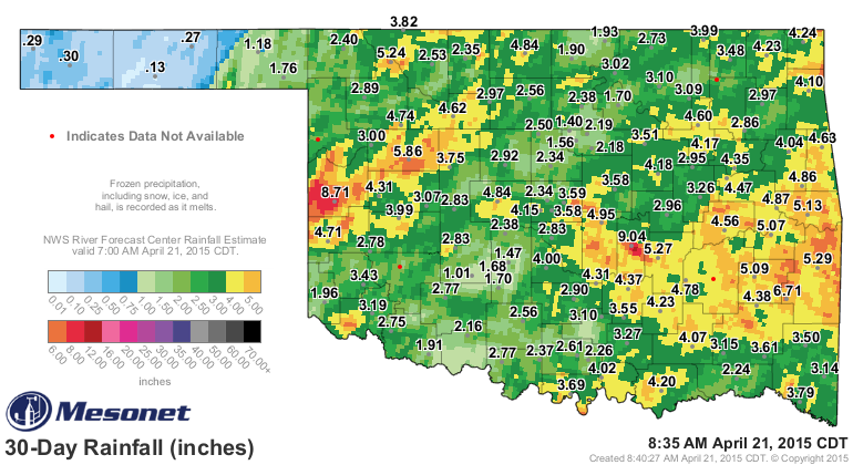
That's not quite as much as the 9.04 inches to the east at Bowlegs, but almost
all of the big rains across west central Oklahoma came in the last two weeks.
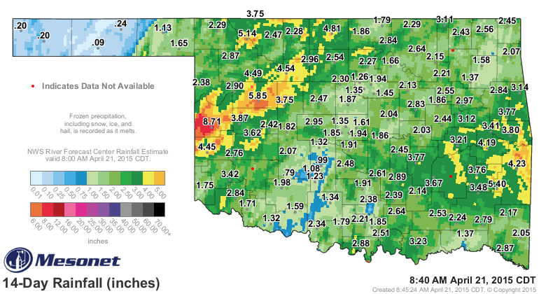
In fact, that 8.69 inches of rain that fell at Cheyenne in the 12 days between
April 8-19 was more than Cheyenne had received in the previous 214 days. Records
show the Cheyenne Mesonet site recorded 8.47 inches from Sept. 6, 2014, through
April 7, 2015.
That's a lot of rain in a little bit of time for the Washita to handle. But the
good news is that it created lots of runoff and so I'm betting all those shallow
farm ponds are either full or darned near it, if not overflowing outright. As
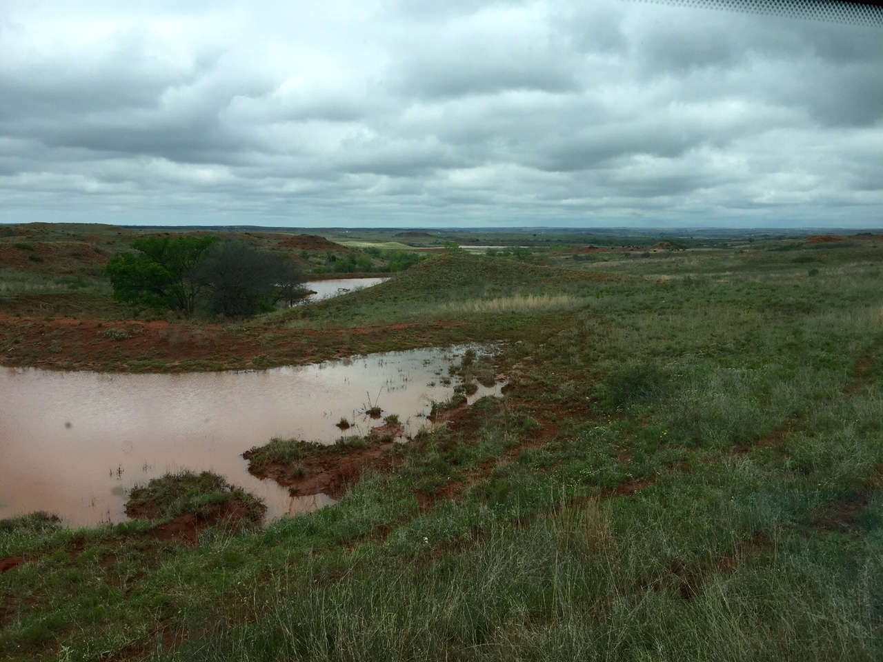
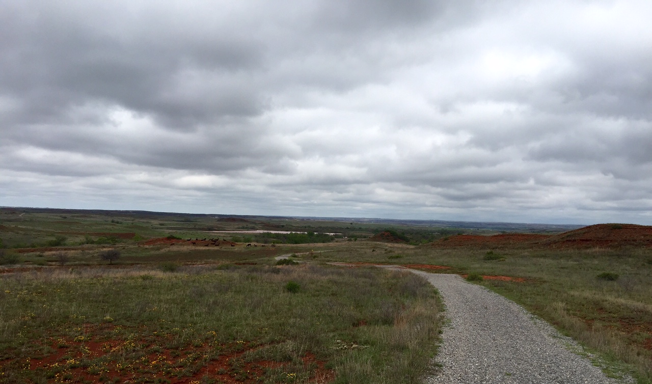
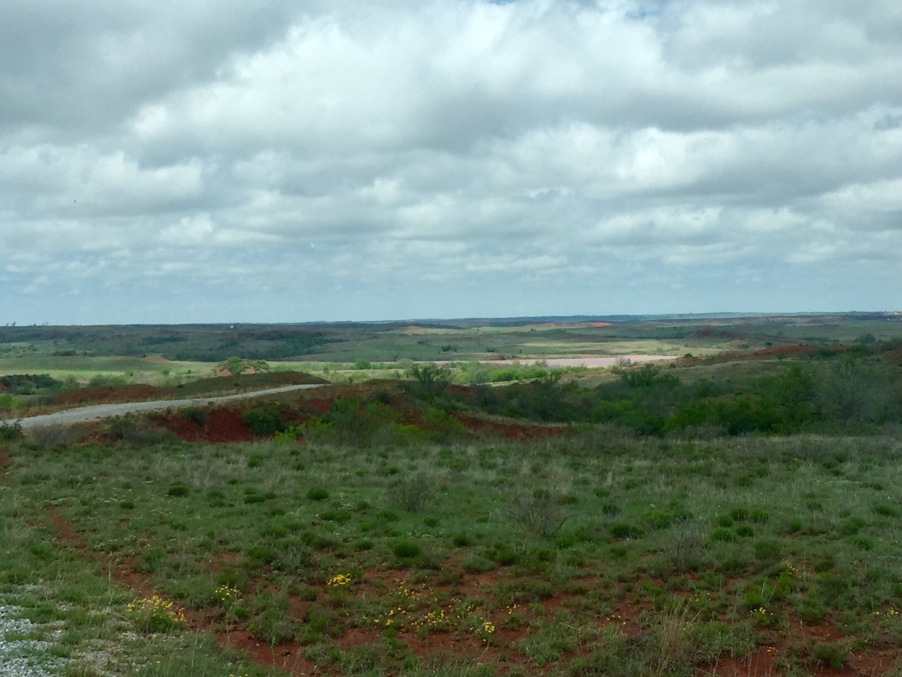
an example, here are a few photos sent to me by a Cheyenne area rancher of one
of the many small flood control lakes out that way, with his description.
"This is the McColgin Lake, a UWCD upstream flood control structure
on Brokenleg Creek. About a 40ac lake. Bone dry last week, now
completely full."
We also need to remember all that rain in such a short period of time WILL do
wonders for things like farm ponds and small lakes, but not necessarily for the
soil. A lot of that country out that way has lost a lot of its natural cover
due to the drought that still pounds away from 4+ years ago, as discussed in
this piece by Oklahoma Farm Report's Ron Hays:
"Over six inches of rain from April 12-17 has challenged the
region?s drought damaged soil. According to the US Geological
Survey (USGS), one inch of rain is equal to about 27,154 gallons
of water per acre. Extremely dry soil is highly erodible and
absorbs water much slower than healthy soil."
You can find this report and many other Agricultural-related stories at Ron's
website here, and even sign up for his daily e-mail reports.
http://oklahomafarmreport.com/index.php
The benefits aren't confined to Roger Mills and the Washita, however. Several
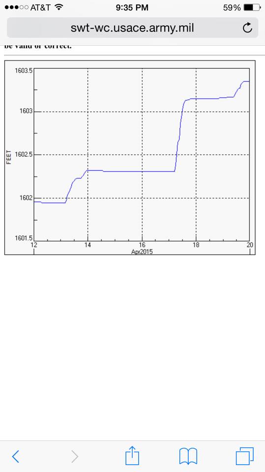
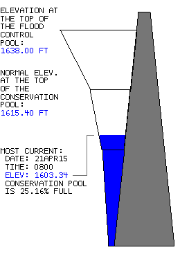
western Oklahoma lakes made some nice gains with the moisture. Canton Lake is up
more than a foot in the last couple of weeks with the rains that fell on it, and
also in its watershed. It's still woefully low at about 25% of capacity.
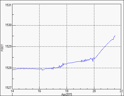
With all the rains around Altus and also up into the adjoining Texas Panhandle,
even Altus-Lugert is up nearly a couple of feet over the last few days. All
the way up to 12% of capacity. WOO-HOO!!
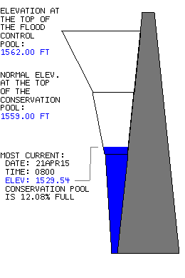
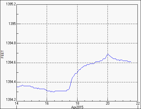
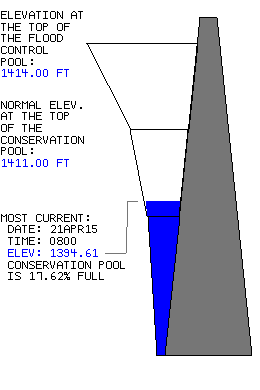
That's an irrigation reservoir, however. The actual drinking supply reservoir for
Altus and some other communities, Tom Steed Lake, saw minimal gains with the
recent rains, holding low and steady at 17.6% of capacity.
For Oklahoma City, Hefner has also made some gains, rising about a half foot
since a week ago, but still sits around 12 feet below normal. We'll see how
long it continues to rise as water runs down the North Canadian from the
northwest into Lake Hefner and Lake Overholser (about 7 feet down itself).
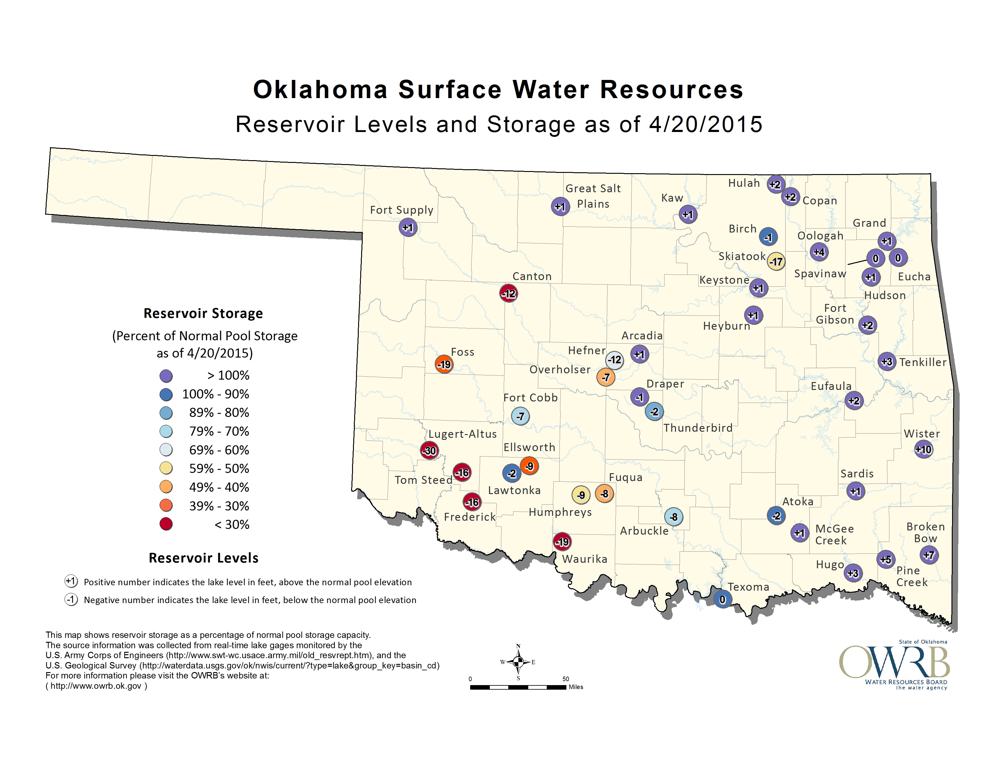
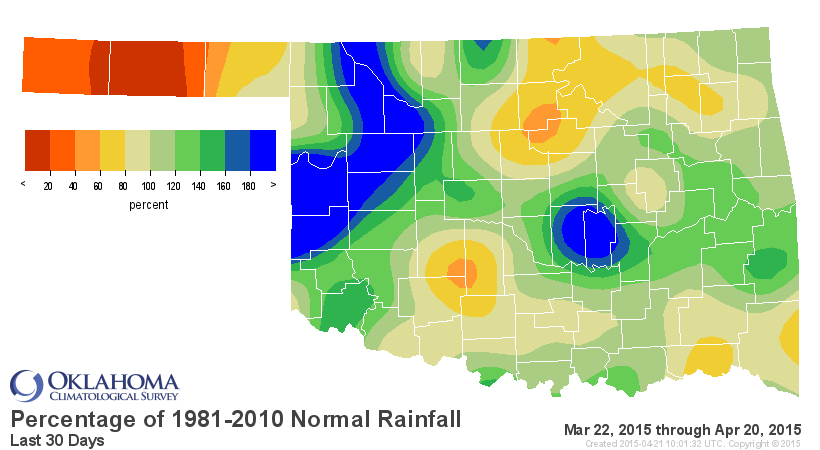
That map helps keep things in perspective, I think. There have been gains over
the last 30 days, some drought impacts lessened in many areas, but all those
red dots across western Oklahoma represent LONG TERM drought impacts, and it
will take more than a nice April to eradicate drought. The percent of normal
rainfall map for the last 30 days has lots more greens and blues on it that
reds and yellows, at least. But look at the poor Panhandle.
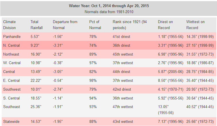
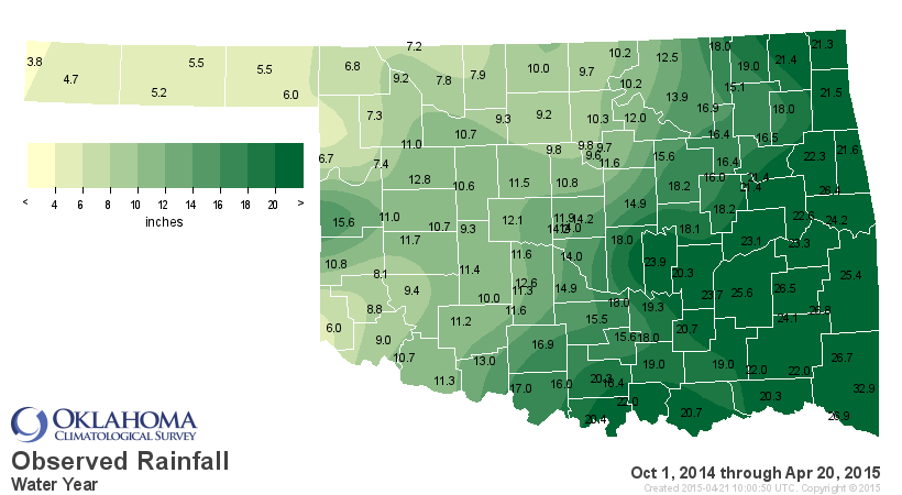
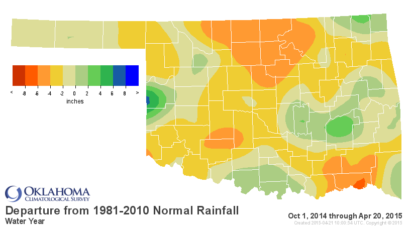
But go back to the start of the water year and things don't look quite so rosy,
especially for north central Oklahoma, suffering its 36th driest Oct 1-Apr 20
since at least 1921, more than 3 inches below normal.
On second thought, Cheyenne, you MIGHT still have a problem. Same for you Goodwell,
Hooker, Medford, Blackwell, Woodward, Altus, etc. etc.
Gary McManus
State Climatologist
Oklahoma Mesonet
Oklahoma Climatological Survey
(405) 325-2253
gmcmanus@mesonet.org
April 21 in Mesonet History
| Record | Value | Station | Year |
|---|---|---|---|
| Maximum Temperature | 98°F | HOLL | 2022 |
| Minimum Temperature | 22°F | KENT | 2021 |
| Maximum Rainfall | 4.95″ | CHAN | 2017 |
Mesonet records begin in 1994.
Search by Date
If you're a bit off, don't worry, because just like horseshoes, “almost” counts on the Ticker website!