Ticker for April 9, 2015
MESONET TICKER ... MESONET TICKER ... MESONET TICKER ... MESONET TICKER ...
April 9, 2015 April 9, 2015 April 9, 2015 April 9, 2015
Bust city, the good and the bad
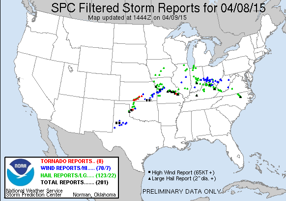
Well, Mother Nature was more boastful than bluster yesterday as Oklahoma dodged
the proverbial bullet last night with a more benign severe weather event. Lots
of worry about tornadoes up north and a little worry of them farther south
never really materialized into much. As far as I can tell, there was at least
one but maybe a couple of weak tornadoes across far western Oklahoma. The best
bet was the one that touched down near Hammon in Custer County. There were a slew
of twisters right across the border in southern Kansas, however (hence the bullet
= dodged verbiage).
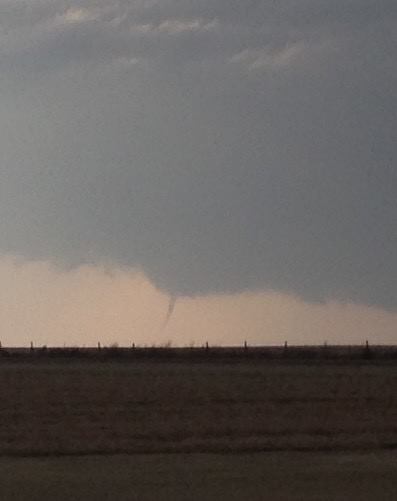
In fact, here's a pic looking north from the May Ranch Mesonet site (taken by
my cousin Angie) of one of the tornadoes that dropped in southern KS.
Other than that, there were a few instances of pretty large hail out west,
including 3-inch diameter hail near Cheyenne and Hammon, and other scattered large
hail reports. Winds of 65-75 mph were also reported with the storms out west. Not
a whole lot up north at all. Dryline magic works its wonders yet again!
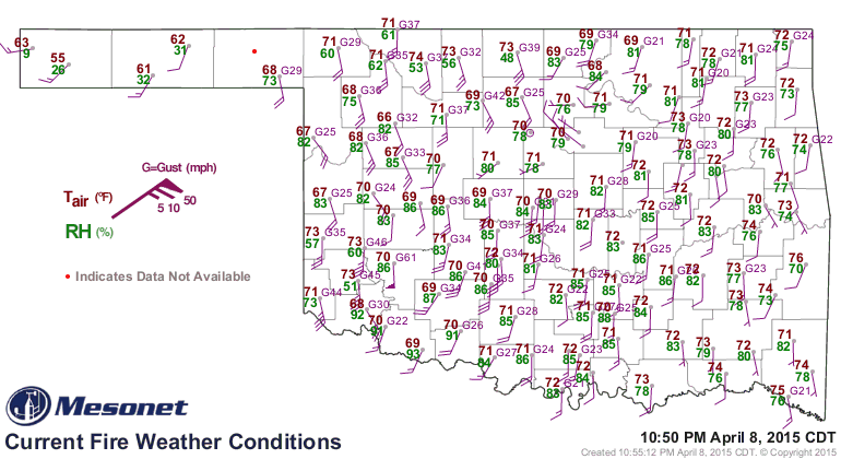
The Hobart and El Reno Mesonet sites registered severe wind gusts for quite some
time last night...not from storms passing over the site but from outflow from
those storms to their south. Once those storms crashed, all that wind came
rushing down and knocked the fire out of Hobart and El Reno (and other parts of
central Oklahoma). Here is a map of conditions at 10:50pm last night. Notice
pennant at Hobart down southwest, That signifies a 5-minute windspeed average of
at least 50 mph! The gust at that time shows 61 mph. But that's easy as pie
for western Oklahoma. Show them 70 mph and they'll be impressed!
So that was a good bust, at least for most. The other bust was the rainfall that
was supposed to come with those storms. We weren't expecting a lot across western
and southern Oklahoma, so that isn't a shock. We were expecting more up north
where it is badly needed with larger areal storm coverage. The Mesonet rainfall
map tells the sad tale, however. You needed to be in the crosshairs of one of
those big storms to get the best rainfall.
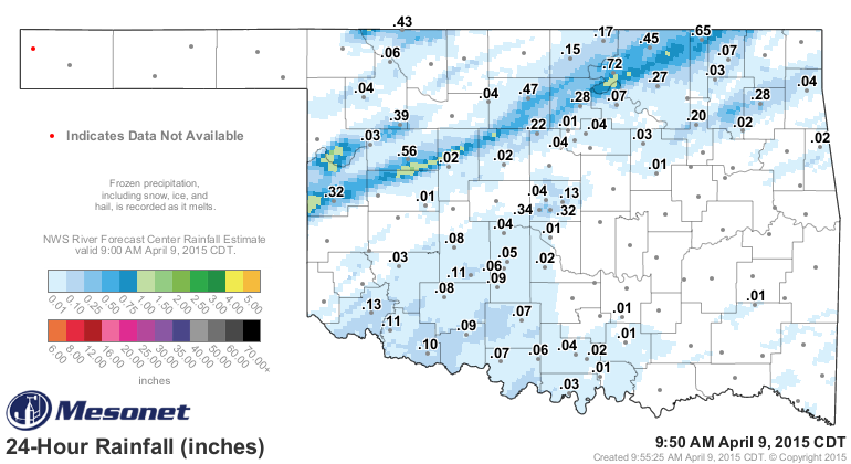
Over an inch it appears with those storms in Roger Mills and southern Ellis
counties, so great for those folks (unfortunate that it came with a tornado and
3-inch hail!). And you can see how that storm streaked to the NE and dropped
from 0.5-1.0 inches of rain in a pretty narrow swath. Other than that...meh!
That was pretty important because drought continues to intensify in parts of
the state after the hot, windy weather out west (and up north, to a lesser
degree). The latest U.S. Drought Monitor map bears that out.
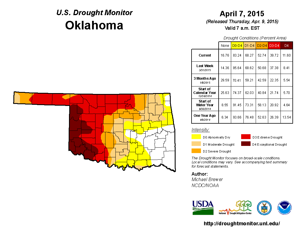
We now have 40% of the state (mostly across W OK) covered by D3-D4 drought, the
two worst categories. And the amount of D4 is now up to 11.6% from 5.54% just
3 months ago.
Luckily, we have more chances for rain in the coming 7 days, leaving us with
this lovely 7-day rainfall map.
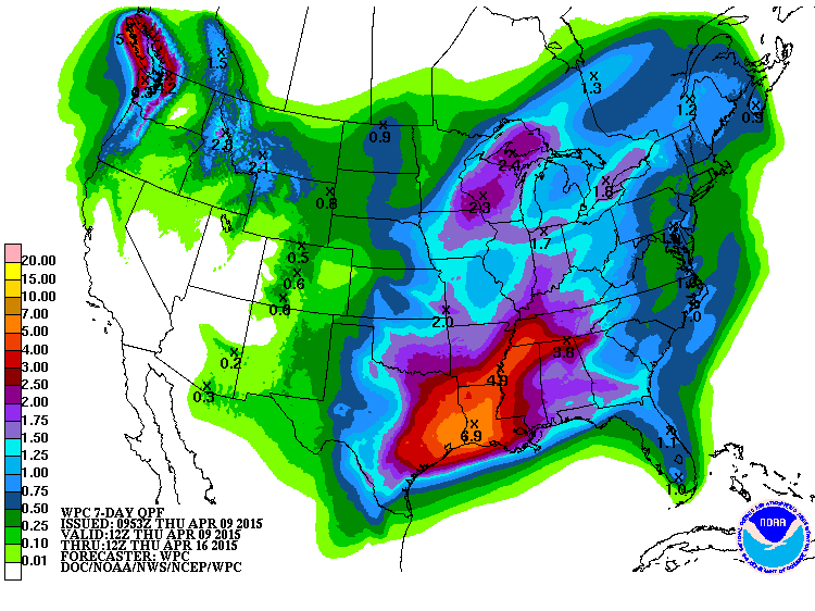
That shows from 1-3 inches across most of Oklahoma with the rain chances, which
would be fantastic, especially out west and up north.
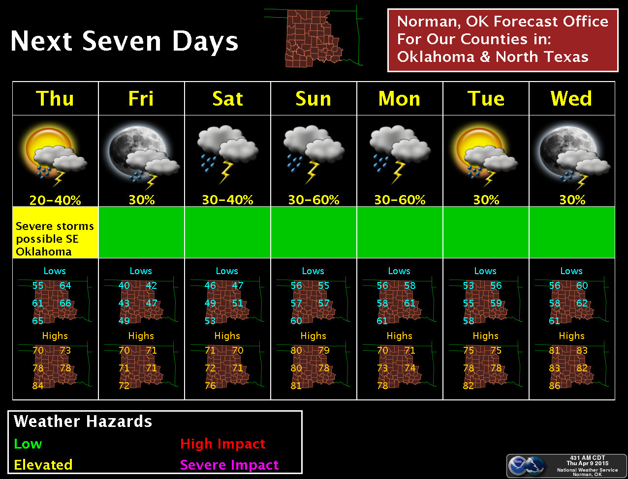
Looks like Sunday and Monday are the big days, but chances exist throughout the
next 7 days. No really cold air showing up either, which is great news for
the green thumb types. There is still a chance for severe weather today across
eastern Oklahoma, as shown by the local NWS offices.
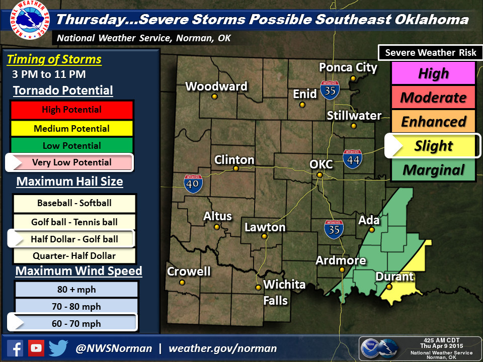
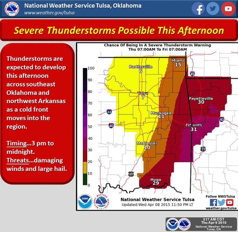
It's all over but the shouting now for most of us, and for eastern Oklahoma
later today. Until this weekend, then we get to do it all over again. Bring on
the rain!
Gary McManus
State Climatologist
Oklahoma Mesonet
Oklahoma Climatological Survey
(405) 325-2253
gmcmanus@mesonet.org
April 9 in Mesonet History
| Record | Value | Station | Year |
|---|---|---|---|
| Maximum Temperature | 100°F | HOLL | 2011 |
| Minimum Temperature | 18°F | KENT | 2013 |
| Maximum Rainfall | 4.69″ | GUTH | 2008 |
Mesonet records begin in 1994.
Search by Date
If you're a bit off, don't worry, because just like horseshoes, “almost” counts on the Ticker website!