Ticker for April 8, 2015
MESONET TICKER ... MESONET TICKER ... MESONET TICKER ... MESONET TICKER ...
April 8, 2015 April 8, 2015 April 8, 2015 April 8, 2015
There COULD be tornadoes in Oklahoma today
Might as well address the 800lb gorilla right off the bat. That's called "not
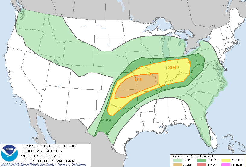
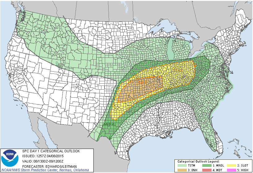
burying the lead." Here's what we know from the Storm Prediction Center. As of
now, there is an "enhanced" risk of severe weather from west central Oklahoma
up to the northeast all the way into Mizzou and Illinois. Farther to the south
and west, the risk is being deemed "slight." Here is a view of the convective
outlook map from SPC with coutnies on and off.
Here's a bit of a primer from the Kansas City NWS office explaining the risk maps.
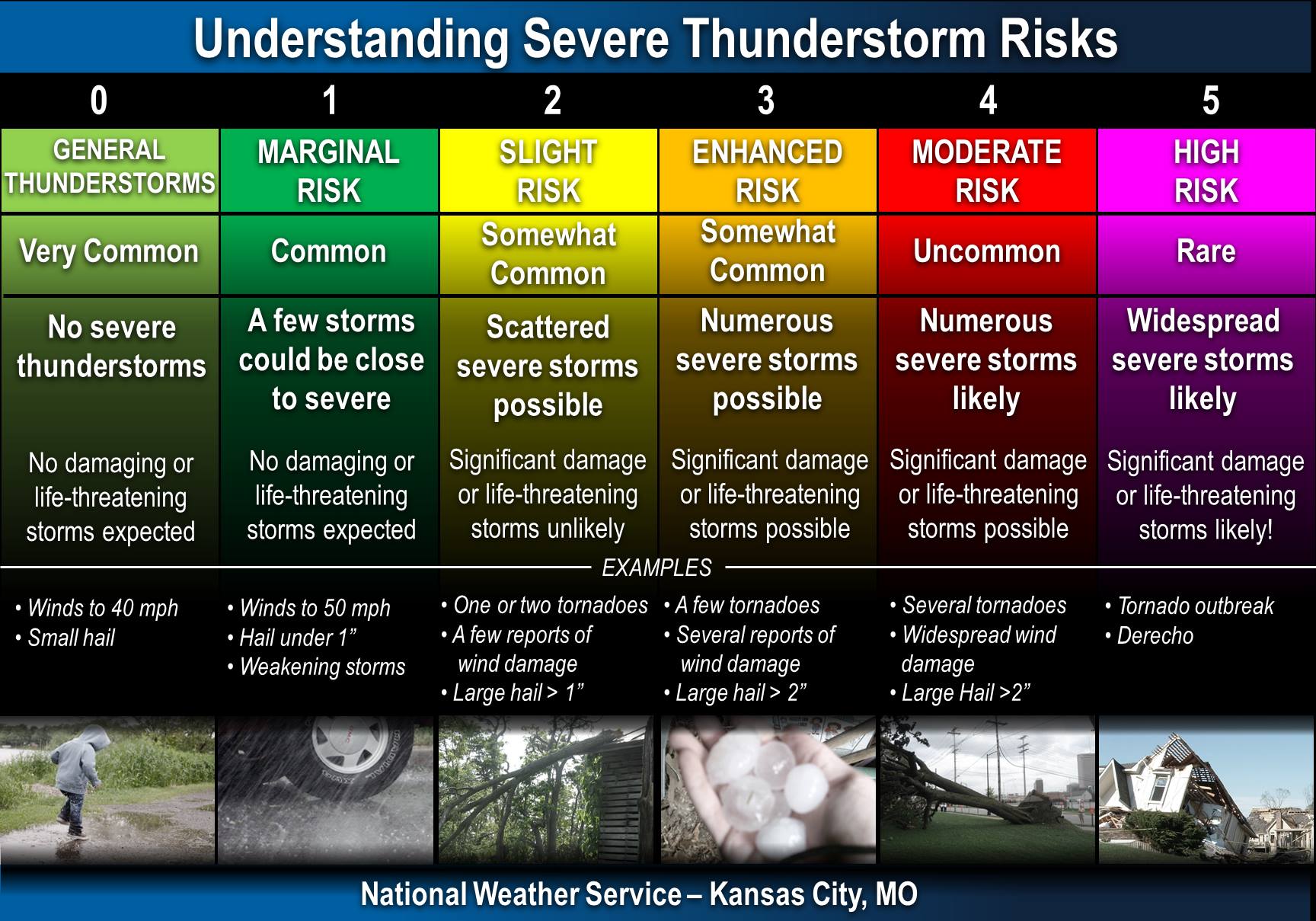
So the difference between the "slight" and "enhanced" risk area is subtle, but
important. And wording from SPC this morning indicated that some parts of the
Plains might get upgraded to "Moderate" risk, which ups the ante even more,
although there are some uncertainties (areal coverage of storms, low level
moisture availability) that might keep that from happening.
The risk that gets the most attention is for tornadoes, but that tornado has to
come from a pretty darned severe storm to begin with. Given that there WILL be
a tornado risk today, we have to assume the other big baddies will be there with
any storm that fires...hail and severe winds in addition to lightning. Here
are the probability maps for those risks, as SPC sees them now. Remember, this
can AND PROBABLY WILL change throughout the day as conditions evolve.
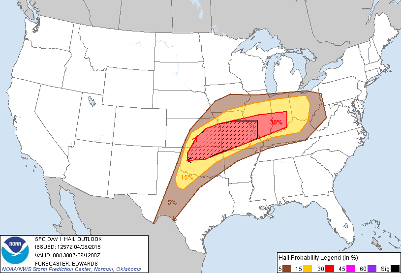
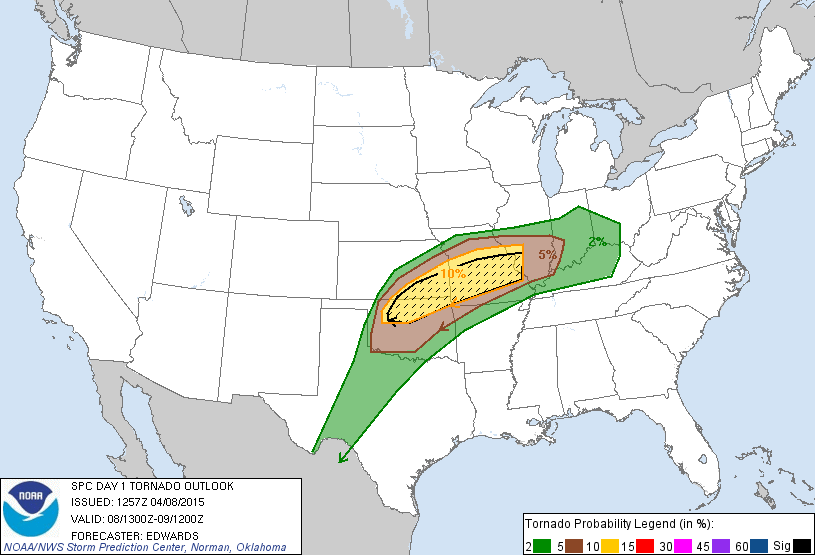
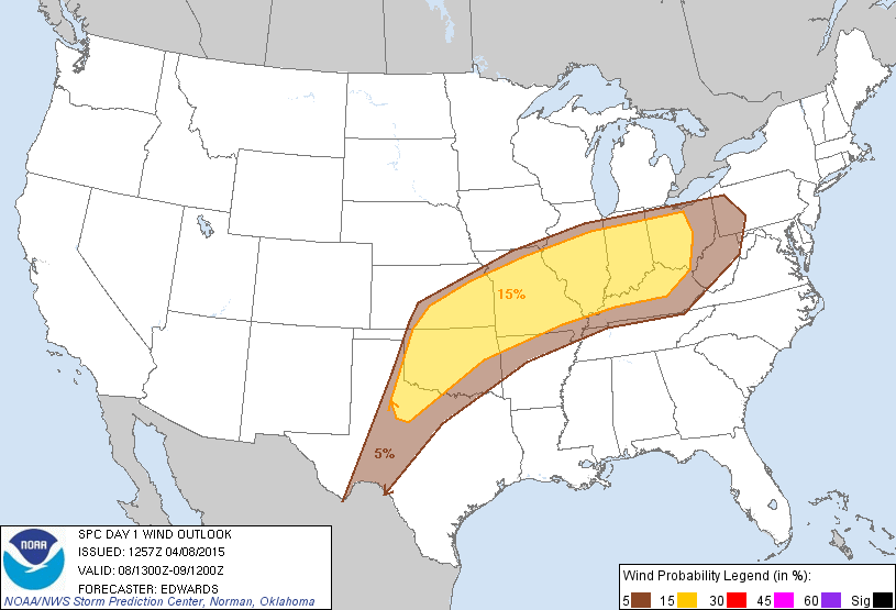
So big hail 2 inches in diameter or larger is a particular risk across northern
OK, and the same goes for strong tornadoes. The hatched areas designate where
conditions are the most favorable for those risks. Remember that the March 25
tornadoes across central Oklahoma developed in a slight risk category, so don't
try and pinpoint your location on those risk maps and make discrete boundaries
into complacency. The boundaries between "enhanced" and "slight" (and "marginal")
risk are intended to be fuzzy.
The best advice, as always, is to have a plan in place and keep abreast of the
situation from your favorite (and hopefully multiple) NWS and media sources. As
of now, this does appear to be an "after 4pm" type of event, but that could
change as the situation evolves.
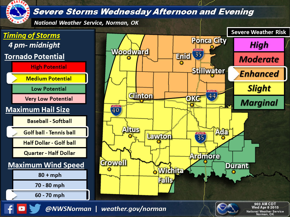
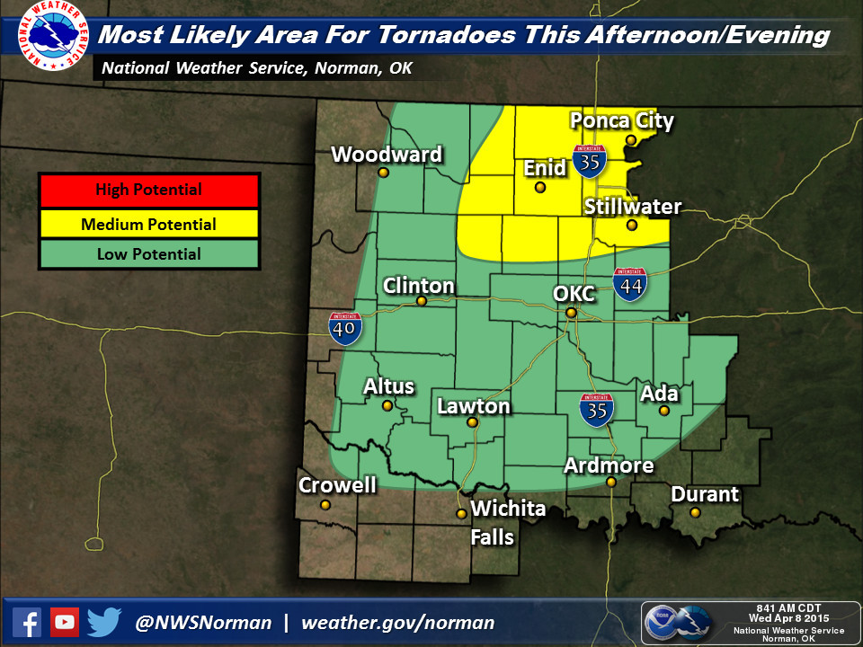
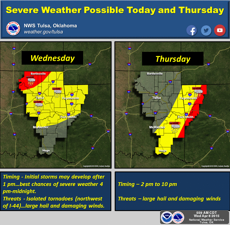
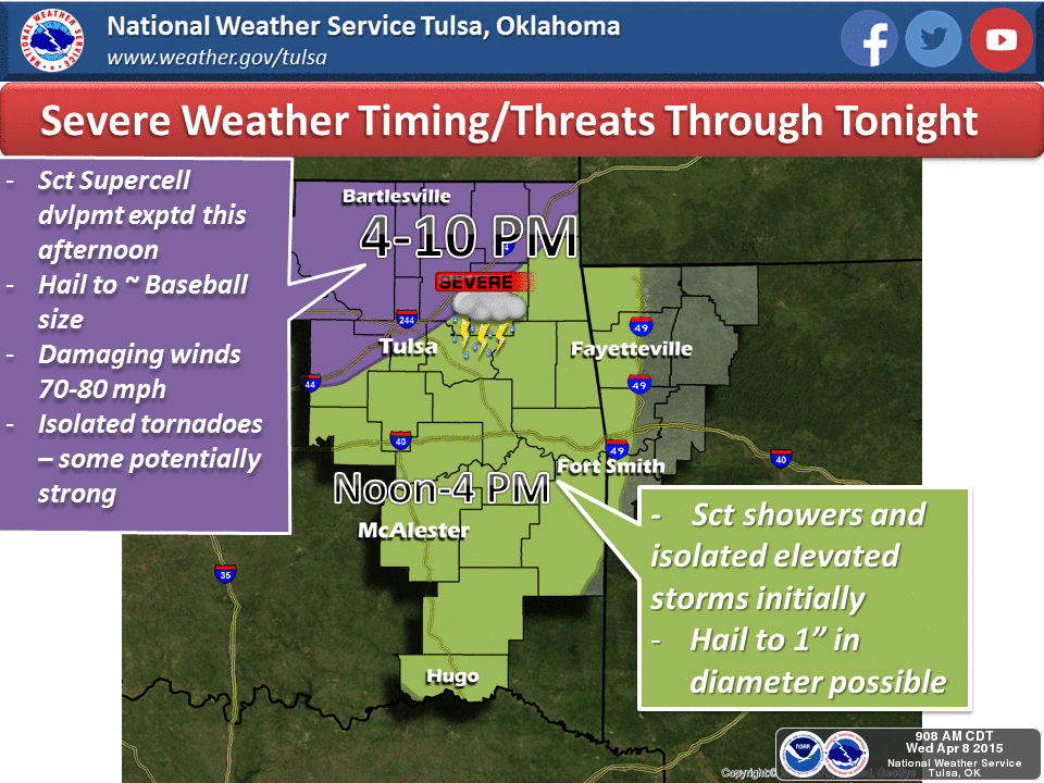
Okay, after all that BLAH BLAH BLAH, here are some graphics from the NWS offices
that explain it much better than I can.
I know that a lot of folks are worried. But this is a typical springtime storm
system for Oklahoma. We've been here before, we've done this. Just stay tuned,
stay aware of the weather, and take the proper safety precautions for whatever
situation you are in. Don't wait until storms are upon you to try and figure
out what to do.
Do it now.
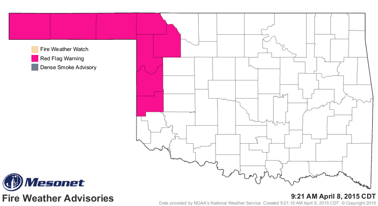
And remember there is extreme fire danger out west behind the dryline where
winds are howling, the air is dessicated and the vegetation is ripe for burning!
Gary McManus
State Climatologist
Oklahoma Mesonet
Oklahoma Climatological Survey
(405) 325-2253
gmcmanus@mesonet.org
April 8 in Mesonet History
| Record | Value | Station | Year |
|---|---|---|---|
| Maximum Temperature | 96°F | MANG | 2020 |
| Minimum Temperature | 17°F | JAYX | 2007 |
| Maximum Rainfall | 3.22″ | BIXB | 2008 |
Mesonet records begin in 1994.
Search by Date
If you're a bit off, don't worry, because just like horseshoes, “almost” counts on the Ticker website!