Ticker for April 2, 2015
MESONET TICKER ... MESONET TICKER ... MESONET TICKER ... MESONET TICKER ...
April 2, 2015 April 2, 2015 April 2, 2015 April 2, 2015
Yes, drought is still here
There hasn't been THAT much rain over the last week, unless you live in Bowlegs.
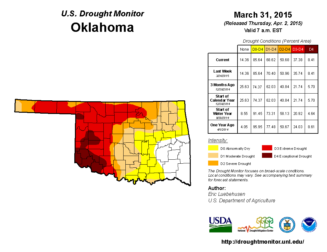
And most of the rain that fell this week did not figure into the new U.S. Drought
Monitor map. Remember, it cuts off at 7am on Tuesday, lest the national author
be frantically working 24 hours a day to make changes right up until the end. Here
is the rainfall map from the last 7 days AND the Drought Monitor map from this
morning which shows a bit of relief in the SE and intensification in the
Panhandle.
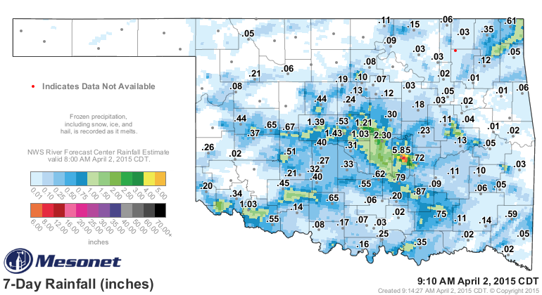
That's not to say the blues and greens on that map are not welcome, it's just we
need more of those yellows and oranges. And like my legs, there is simply wayyyy
too much white on there. Looking back from the beginning of the year, you can
definitely pick out the trouble areas.
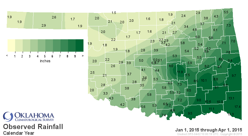
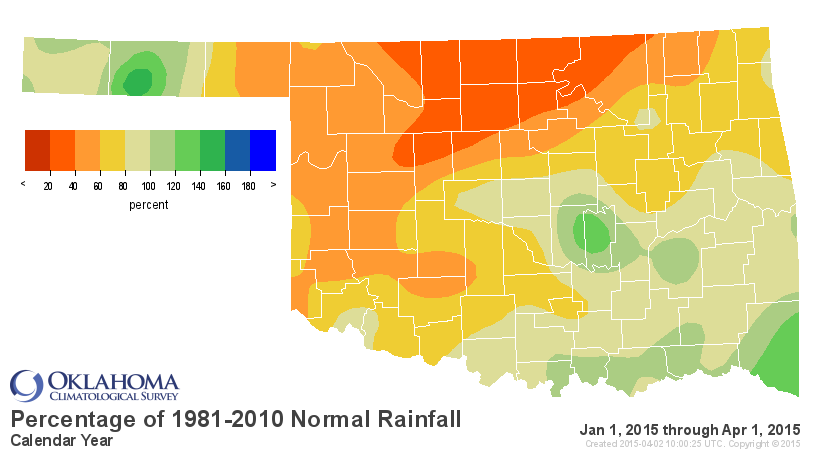
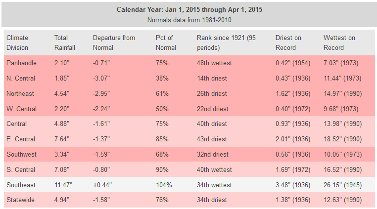
North central Oklahoma and its wheat crop is starting to suffer from what I
have heard. Even those places in the Panhandle that were looking decent up until
a week ago have been hit hard by the wind and heat. We've had highs in the 80s
and 90s at times since mid-March, for crying out loud. That's more than 20
degrees above normal. In fact, since March 16, we've only seen 13 Mesonet
stations reach 32 degrees or below, all in the NW, and at the most for 7 hours
through those 18 days.
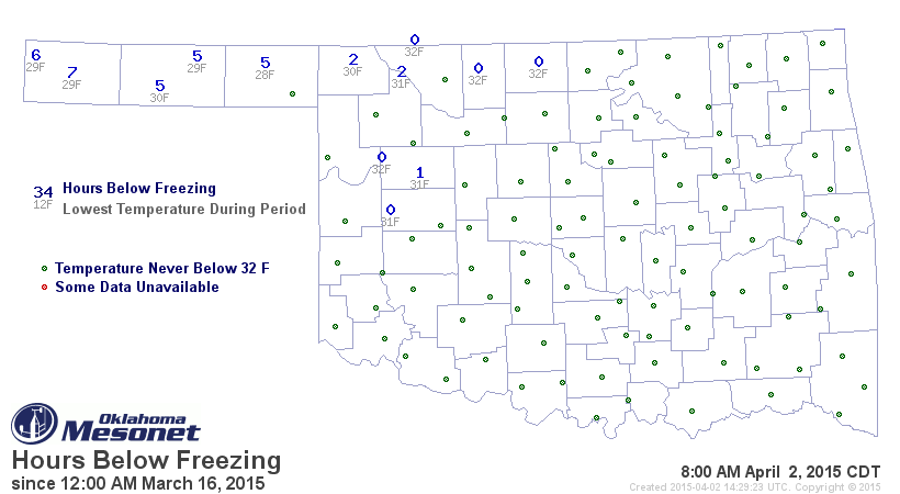
What's that mean? It means that the vegetation across the state, the ENTIRE
state, is awake and thirsty. Wheat, canola, weeds, bermuda grass, trees, etc.
The wheat was already showing signs of stress a week ago, and we've had a hot,
windy week since then.
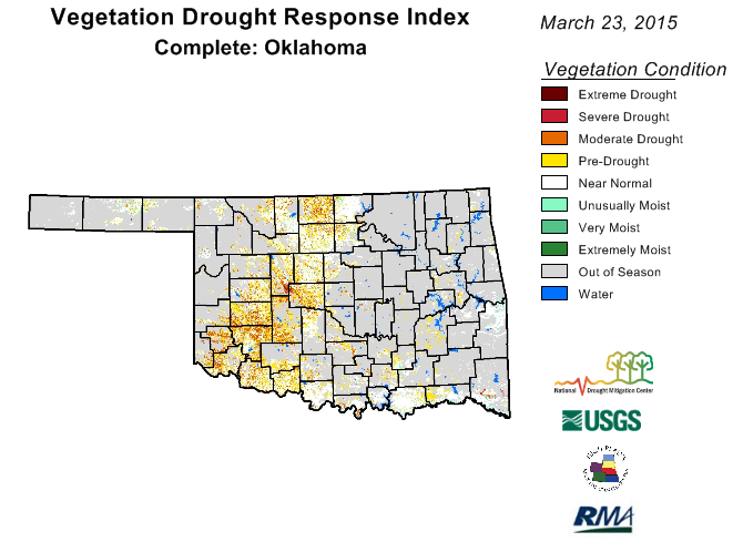
What's it mean? It means we need rain. We need spring to be spring and then
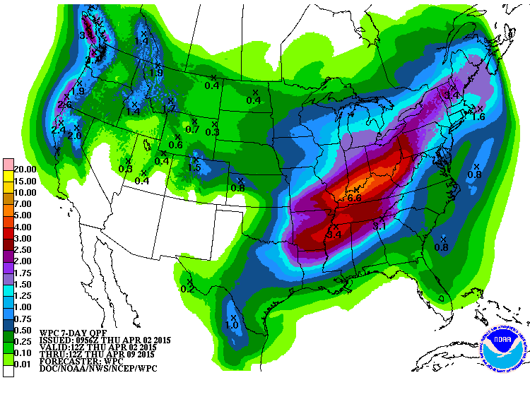
some. The next 7 days...what do they show, at least according to the Weather
Prediction Center? Eastern Oklahoma, okay! Western Oklahoma...meh.
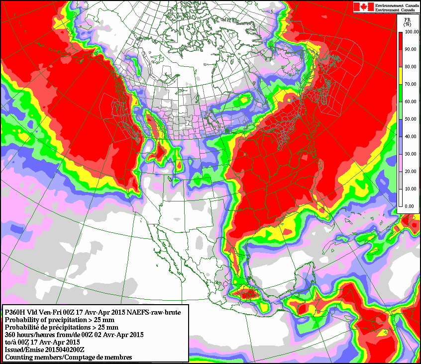
Chances of accumulating at least an inch of rain over the next two weeks across
eastern Oklahoma, according to the Canadian forecasts? OKAY! Western Oklahoma...
not so much.
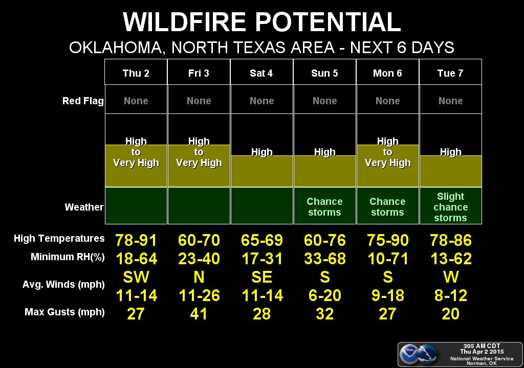
Chance of fire danger, as our dormant vegetation that needs water to green up
stays on the yeller side? Elevated.
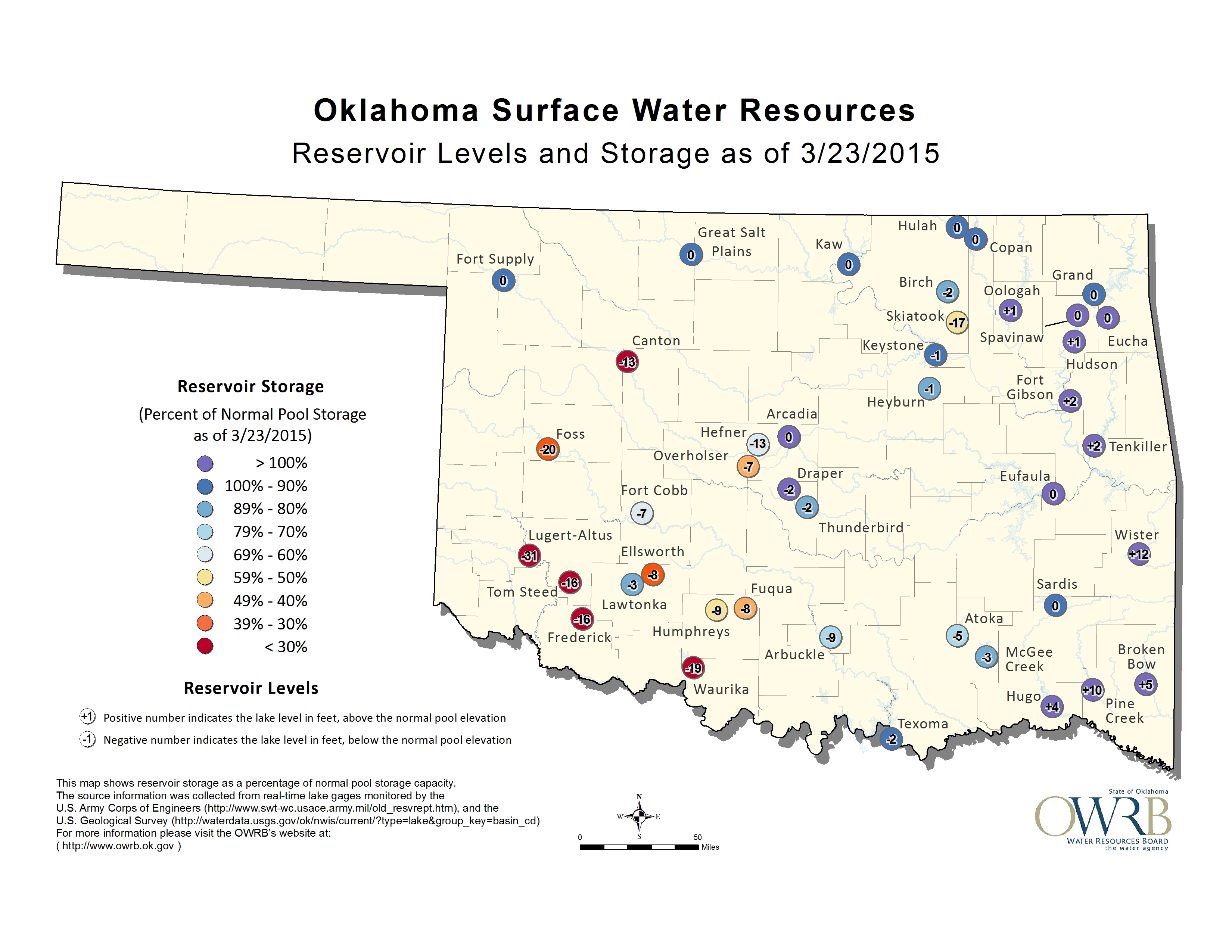
Lakes across the western half of the state, in addition to Skiatook up in Osage
County? Yikes! And this was a week ago.
There are signs in some long-range forecast models that the second half of April
will be on the wet side. Still a fantasy-cast at this point. Heck, next week
could turn damp for the entire state. It's spring. It's happened before. But
it needs to be sooner rather than later.
Gary McManus
State Climatologist
Oklahoma Mesonet
Oklahoma Climatological Survey
(405) 325-2253
gmcmanus@mesonet.org
April 2 in Mesonet History
| Record | Value | Station | Year |
|---|---|---|---|
| Maximum Temperature | 92°F | BUFF | 2003 |
| Minimum Temperature | 21°F | EVAX | 2018 |
| Maximum Rainfall | 3.46″ | TALI | 2013 |
Mesonet records begin in 1994.
Search by Date
If you're a bit off, don't worry, because just like horseshoes, “almost” counts on the Ticker website!