Ticker for March 25, 2015
MESONET TICKER ... MESONET TICKER ... MESONET TICKER ... MESONET TICKER ...
March 25, 2015 March 25, 2015 March 25, 2015 March 25, 2015
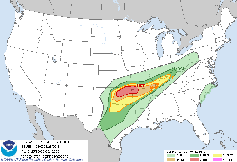
All hail the moderate risk
Before we get started, let me just say that the threat of tornadoes, while not
zero, is still fairly low today for Oklahoma. As you'll see in a minute, the big
risk for today's severe weather event will be large hail. At least as the experts
at the NWS' Storm Prediction Center (SPC) see it now. They have upgraded today's
risk to moderate for central through NE OK.
The specific threat maps from SPC will show what I said earlier...this looks to
be a hail threat at this time.
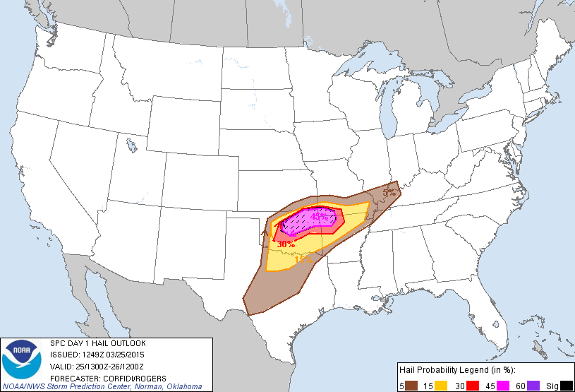
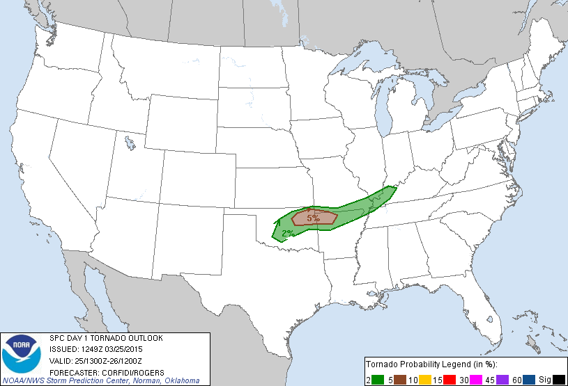

That's not to say there will not be tornadoes associated with the storms today,
especially early on. And there will obviously be the threat of large hail and
severe winds. Basically, what Oklahomans are used to with a "normal" severe weather
setup in springtime.
Last night's storms laid down some decent rains across far eastern Oklahoma,
although it was highly localized, and in an area that was not too drought
stressed to begin with.

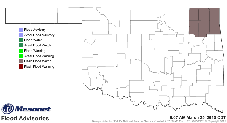
Today's event still has the markings of a squall line with possible heavy rain
across NE down into central Oklahoma.
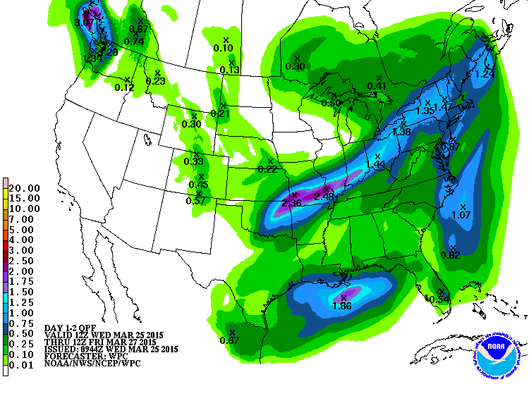
Enough so that a flash flood watch has been issued for NE OK.
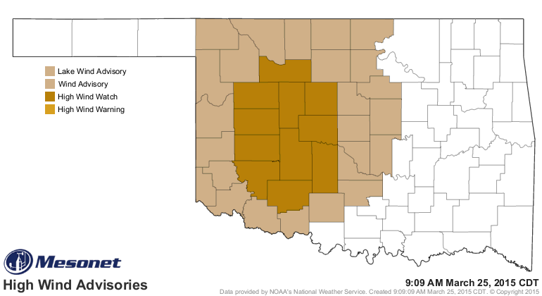
There is also a high wind watch/warning out for the western half of the state
for this afternoon through tomorrow morning. Non-thunderstorm gusts could reach
as high as 60 mph in this area.
Speaking of watches and warnings, be on the lookout for those of the severe
weather variety to be appearing later today. If your weather map starts to get
overrun with different colors and whatnot, you can always see them all separated
out on the Mesonet weather advisories page.
http://www.mesonet.org/index.php/weather/category/advisories
So the advice is to remain calm, but weather aware, and keep in touch with your
favorite source for severe weather warnings. It's spring, it's Oklahoma, it's
expected.
Gary McManus
State Climatologist
Oklahoma Mesonet
Oklahoma Climatological Survey
(405) 325-2253
gmcmanus@mesonet.org
March 25 in Mesonet History
| Record | Value | Station | Year |
|---|---|---|---|
| Maximum Temperature | 93°F | WOOD | 1998 |
| Minimum Temperature | 15°F | BOIS | 2013 |
| Maximum Rainfall | 2.92″ | VALL | 2024 |
Mesonet records begin in 1994.
Search by Date
If you're a bit off, don't worry, because just like horseshoes, “almost” counts on the Ticker website!