Ticker for March 26, 2015
MESONET TICKER ... MESONET TICKER ... MESONET TICKER ... MESONET TICKER ...
March 26, 2015     March 26, 2015     March 26, 2015     March 26, 2015


I like tornado droughts better

Well so much for the big "March tornado drought" in the news lately, and
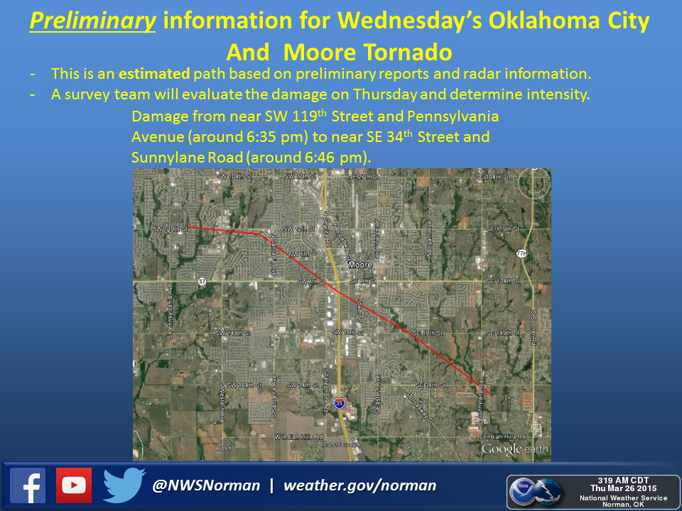
of course Moore would have to be one of the towns hit to end that drought. Here's
a preliminary information graphic from the Norman NWS office about the tornado
that ripped the roof off of Southgate-Rippetoe Elementary near NW 5th Street in
central Moore.


Apparently there were at least 20 injuries with this storm and structural damage
from SW 119th between Penn and May in SW OKC through east Moore.

The worst news comes from the Tulsa area as one resident was killed and damage
forced the closing of the Tulsa and Sand Springs school districts.

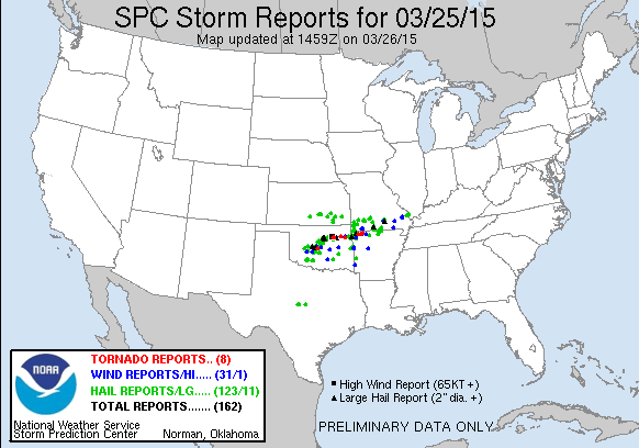
There were several tornadoes, lots of large hail and severe wind reports with
this system. Here's the map from the Storm Prediction Center of the locations
of each of those PRELIMINARY reports.


Hail to the size of softballs was reported near Chandler Park in Tulsa and wind
gusts of at least 80 mph were reported near Westport in Pawnee County.

Most information is still so preliminary I hesitate to report too much with
the fear it could change rapidly.

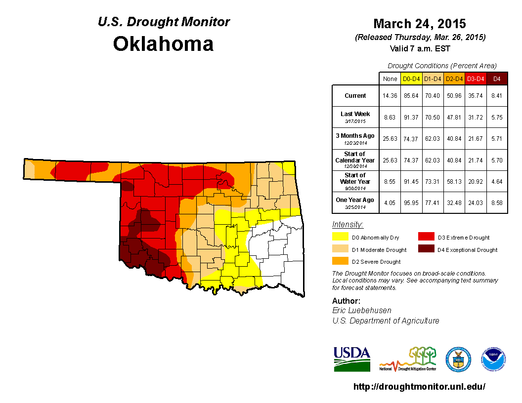
One thing NOT changing rapidly would be the OTHER drought. The U.S. Drought
Monitor map released this morning shows that extreme-to-exceptional drought
is making a comeback across western and north central Oklahoma, now covering
36% of the state, up from 32% last week and 23% three months ago.


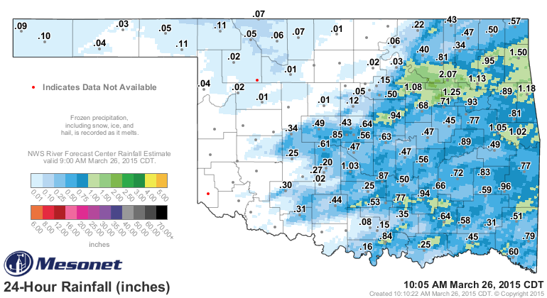
If there is one consolation to Oklahoma's severe weather, including last night's
ridiculousness, it's that it comes with much-needed rain. The best totals fell
across the eastern half of the state.


Unfortunately, if you match up all the reds and maroons on the Drought Monitor
map with the rainfall, most of that area came up on the short end of the stick.
They also missed out on all the severe weather, but that's has always been the
gamble with springtime convective precipitation in Oklahoma.

Here's hoping the former drought begins anew and the latter begins to fade
away.

Gary McManus
State Climatologist
Oklahoma Mesonet
Oklahoma Climatological Survey
(405) 325-2253
gmcmanus@mesonet.org
March 26 in Mesonet History
| Record | Value | Station | Year |
|---|---|---|---|
| Maximum Temperature | 100°F | HOLL | 2020 |
| Minimum Temperature | 11°F | BOIS | 2024 |
| Maximum Rainfall | 2.35″ | BYAR | 2018 |
Mesonet records begin in 1994.
Search by Date
If you're a bit off, don't worry, because just like horseshoes, “almost” counts on the Ticker website!