Ticker for March 23, 2015
MESONET TICKER ... MESONET TICKER ... MESONET TICKER ... MESONET TICKER ...
March 23, 2015 March 23, 2015 March 23, 2015 March 23, 2015
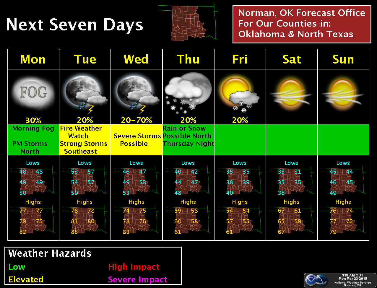
Rain, storms, fire and snow, oh my!
Crazy weather, no? No. It's called "March." I see all those possibilities on the
7-day planner graphic from the Norman NWS office.
Before we get carried away, however, this is not a widespread/significant looking
scenario for any of those events.
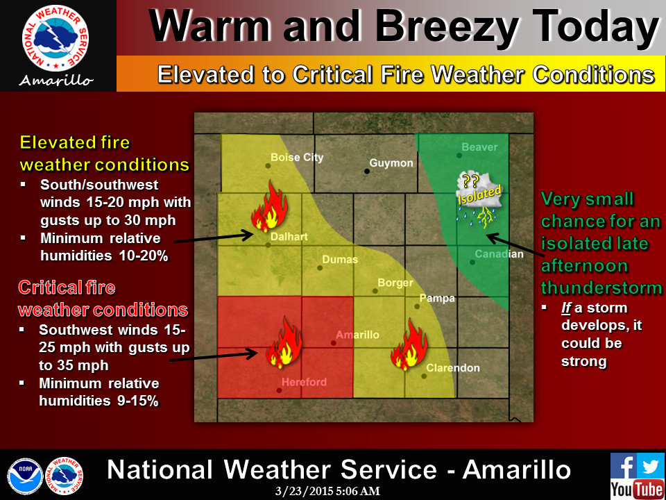
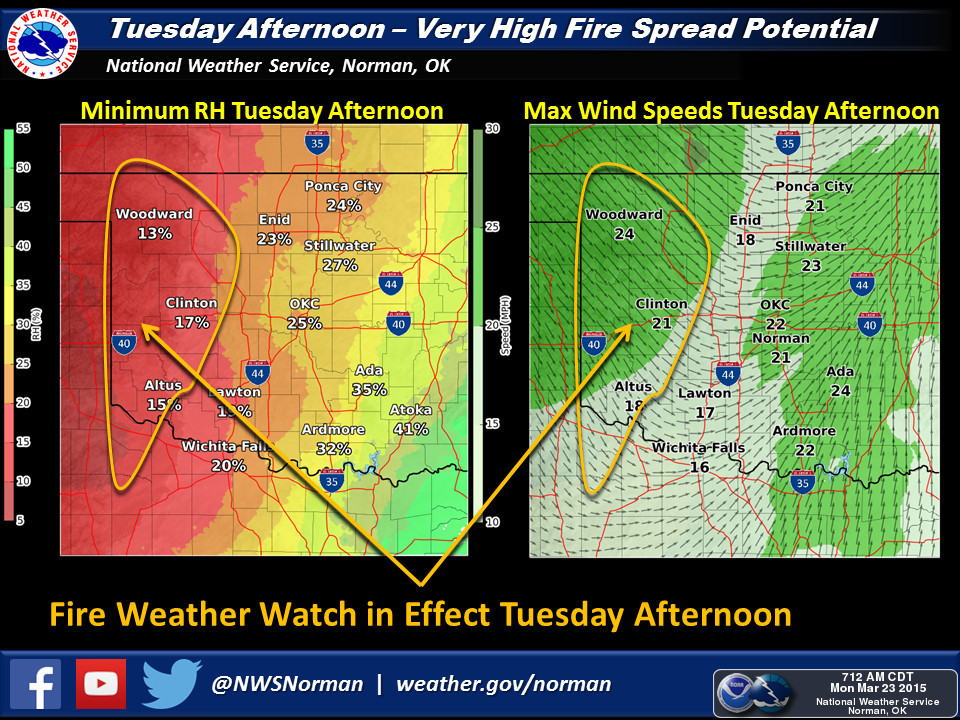
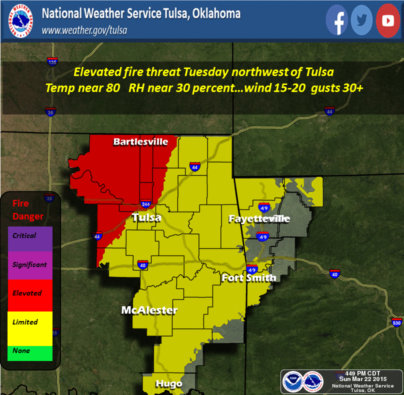
Let's start with the threat of wildfires, since that's the biggie for today
and tomorrow (and Wednesday for a bit as well).
Then we come to the chance of rain and storms starting tonight through Friday,
with Wednesday being the "big" day as of now. There is a slight chance of severe
storms on Wednesday, with large hail and strong winds being the primary threat.
However, it is spring and it is Oklahoma, so stay weather aware regardless.
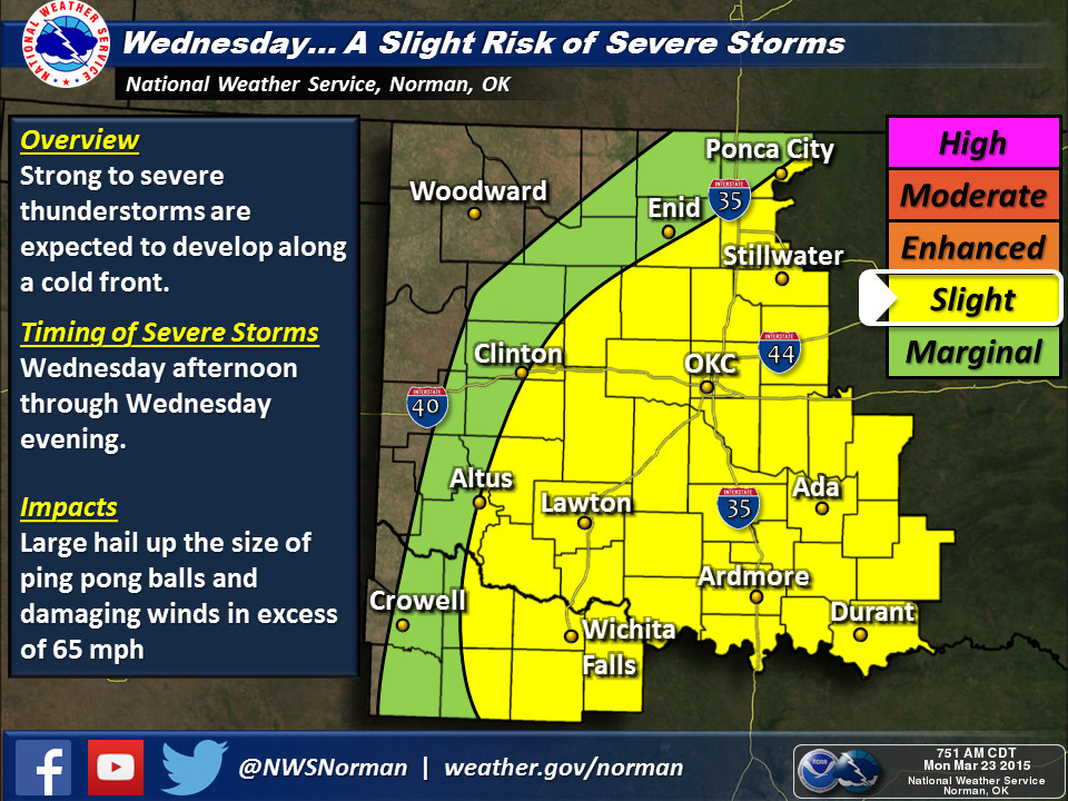
Obviously that svr threat will extend across all of the eastern 2/3rds of the
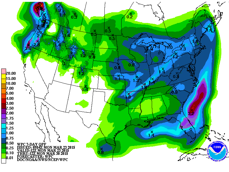
state, as will the highest rain chances. For the 2,713th rainfall forecast map
in a row, western Oklahoma appears to get the short end of the rain gauge for
the coming storm system. I'll throw the 7-day forecast map up there to encompass
the chances throughout the week. Sorry western Oklahoma, you'll be windy, dusty
and worried about fires. Definitely not good news for the agricultural folks
out west.
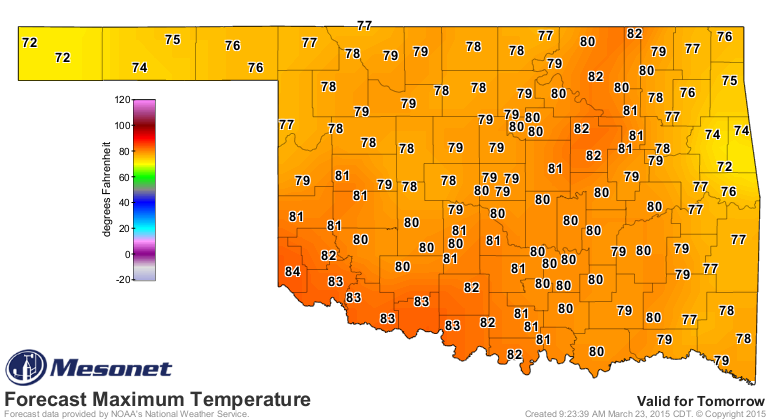
It will be warm today and even warmer tomorrow with highs in the 70s and 80s.
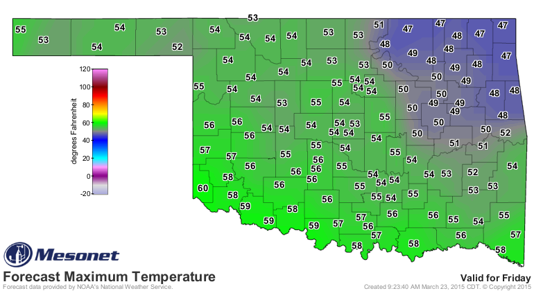
The front on Wednesday will cool things down for a few days, but a warm up
appears to be in the works for later in the weekend after a chilly Friday.
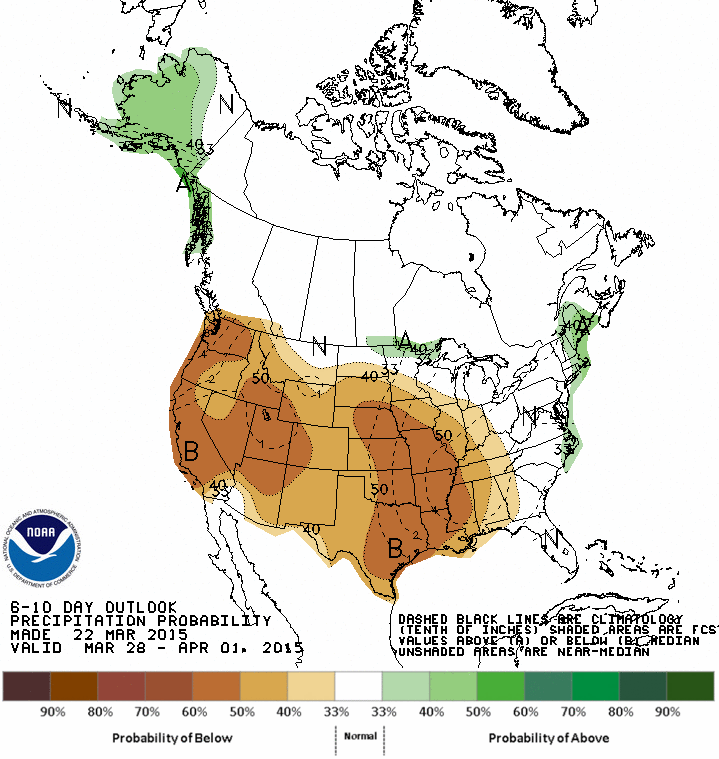
Looks a bit on the dry side after this week, but hopefully this scenario of
increased odds of below normal precip will break down and we can go back to
a good rainy pattern.
Gary McManus
State Climatologist
Oklahoma Mesonet
Oklahoma Climatological Survey
(405) 325-2253
gmcmanus@mesonet.org
March 23 in Mesonet History
| Record | Value | Station | Year |
|---|---|---|---|
| Maximum Temperature | 95°F | BEAV | 2018 |
| Minimum Temperature | 17°F | BOIS | 2013 |
| Maximum Rainfall | 3.91″ | INOL | 2023 |
Mesonet records begin in 1994.
Search by Date
If you're a bit off, don't worry, because just like horseshoes, “almost” counts on the Ticker website!