Ticker for March 19, 2015
MESONET TICKER ... MESONET TICKER ... MESONET TICKER ... MESONET TICKER ...
March 19, 2015 March 19, 2015 March 19, 2015 March 19, 2015
I was wrong before I was right?
Yes, quoteth me, from my latht Tickereth:
"The rains should start late tomorrow night and then last for a few days, with
Wednesday being the real drencher."
And a look at the Mesonet rainfall maps from that period (with additional totals
adding up this morning):
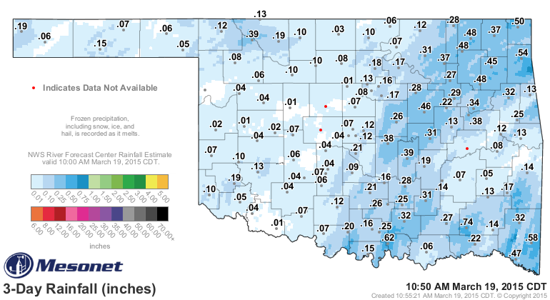
What...you don't consider 0.03 inches at Medford a "drenching?" Well, compared to
0.00 inches it is! Okay, I'm really reaching there. I will start sending
subscription refund checks after I finish the Ticker. However, as noted
previously, it is raining NOW.
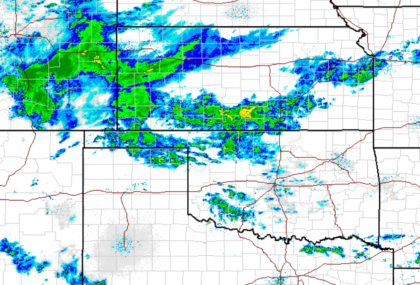
See, THIS is the Wednesday I was talking about. Not yesterday Wednesday, but today
Wednesday. The rain *should* increase later today and into tonight, with some
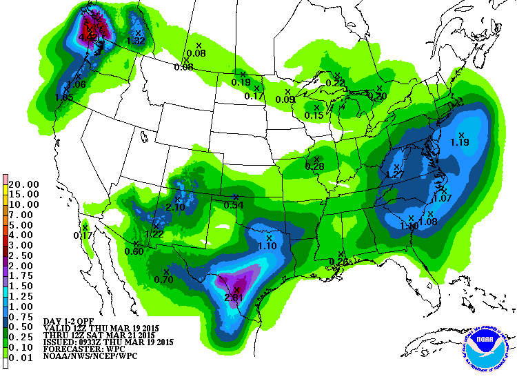
heavier storms *possibly* occurring in southern OK. Here are the rainfall
forecasts (I DIDN'T DO THESE!) for the next couple of days.
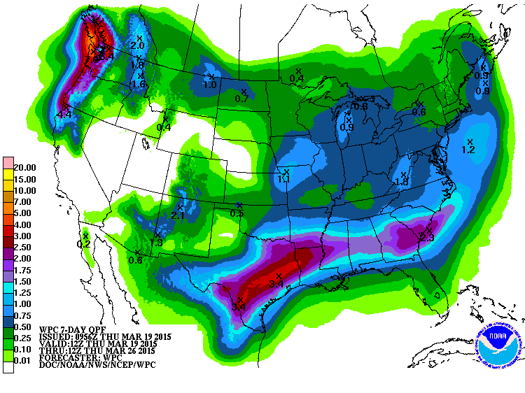
And then with additional rain chances throughout the next week or so, we get
a 7-day rain forecast that looks a bit nice, at least for SE OK.
Now that 0.03 inches at Medford needs to multiply rapidly, as the latest Drought
Monitor map shows. That D3 "extreme" drought continues to head east in north
central Oklahoma.
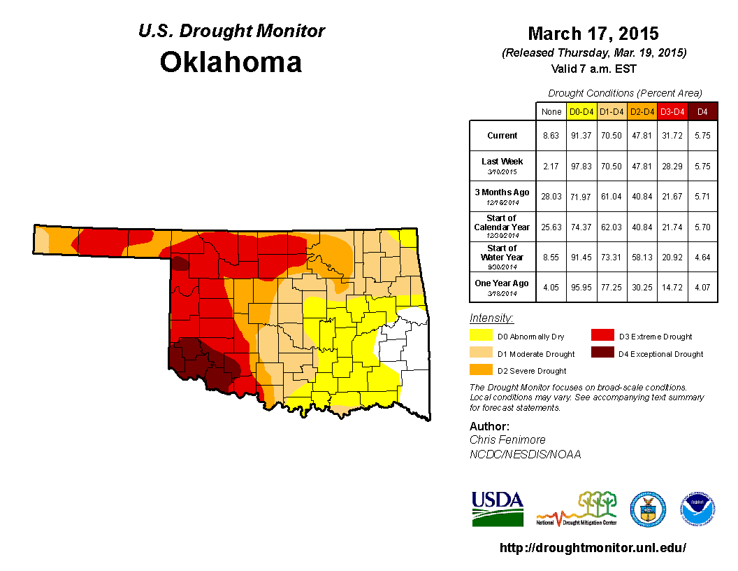
We now have 32 percent of the state in extreme-exceptional drought, the worst
two categories, an increase of 10 percent from just three months ago. Somewhat
significant since most of that period was in the cool season, when drought just
doesn't spread as rapidly. Now we enter the spring rainy season, and sure
enough, it's raining. But we need that REAL spring rainy season. Building
off of what we would normally expect, CPC predicts at least some drought relief
and even removal across much of western Oklahoma.
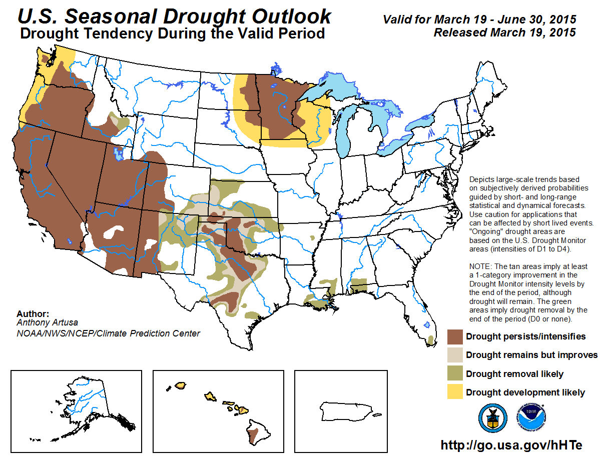
The areas in brown, however, can still expect drought to persist or even
intensify through June. These are the areas where the soil moisture profile
is the worst, and the hydrologic impacts are still quite severe in this area.
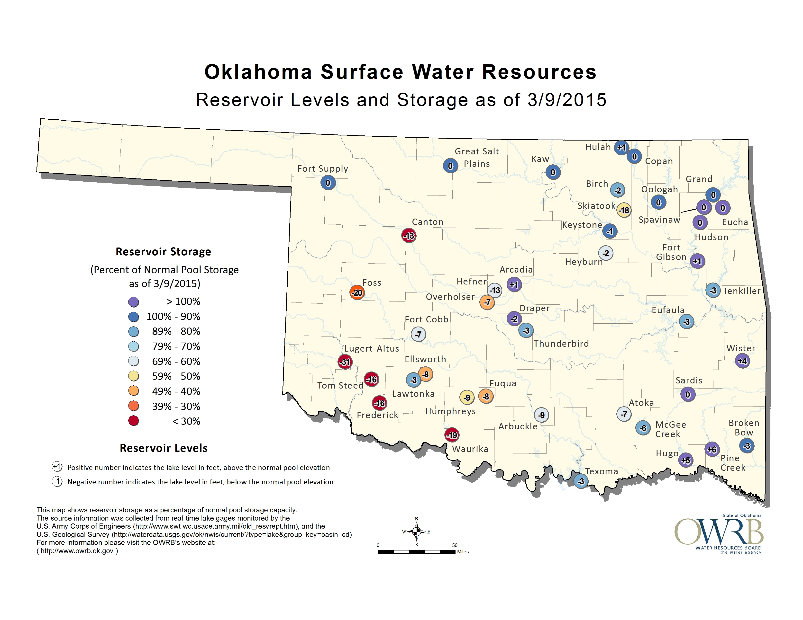
I've said this for nearly 5 years now, and I'll say it again...should we have
the type of drought in western Oklahoma persist (or intensify) through June,
and let it get a taste of July and August, watch out. It won't be pretty.
My final plea is, yes, this rain event has been a dud thus far. However, two
key points:
1. It (at least the multi-day event) ain't over yet.
B. It's still only March.
We have plenty of time for spring to go all "spring" on us and relieve drought.
It's Oklahoma, stranger things have AND WILL happen.
Gary McManus
State Climatologist
Oklahoma Mesonet
Oklahoma Climatological Survey
(405) 325-2253
gmcmanus@mesonet.org
March 19 in Mesonet History
| Record | Value | Station | Year |
|---|---|---|---|
| Maximum Temperature | 97°F | BEAV | 2017 |
| Minimum Temperature | 5°F | EVAX | 2023 |
| Maximum Rainfall | 4.46″ | PRYO | 2012 |
Mesonet records begin in 1994.
Search by Date
If you're a bit off, don't worry, because just like horseshoes, “almost” counts on the Ticker website!